


Traben-Trarbach, Germany
Traben-Trarbach is a town of 6,018 people in Rheinland-Pfalz, Germany.
Why visit Traben-Trarbach
Townapedia lists 86 museums and landmarks, 7 parks and trails, 263 places to eat, 110 places to stay and 22 attractions in and around town.
Highlights include Mont Royal, Zylinderhaus, Buddha-Museum and Moselbad.
Weather in Traben-Trarbach
Forecast from MET Norway (CC BY 4.0). Full forecast
About Traben-Trarbach
Traben-Trarbach (German pronunciation: [ˌtʁaːbn̩ ˈtʁaːɐ̯bax]) on the Middle Moselle is a town in the Bernkastel-Wittlich district in Rhineland-Palatinate, Germany. It is the seat of the like-named Verbandsgemeinde and a state-recognized climatic spa (Luftkurort). The city is located in the Valley of Dawn.
From the Wikipedia article Traben-Trarbach (this version), under CC BY-SA 4.0.
Travel tips from other travellers: Traben-Trarbach on Wikivoyage (CC BY-SA 4.0).
Things to do22


10 more on the map.
Museums and landmarks86

Zylinderhaus
Museum · 4.8 km
2 Adolf-Kolping-Straße, Bernkastel-Kues
Tu-Sa 10:00-18:00, Su,PH 10:00-17:00; Mo off

Buddha-Museum
Museum
12 Wolfer Weg, Traben-Trarbach
Tu-Su,PH 10:00-18:00 open "letzter Einlass 17:00 Uhr"; Mo off; PH...


Verbandsgemeindeverwaltung Traben-Trarbach
Monument and historic site
3 Am Markt, Traben-Trarbach
Mo-Fr 08:00-12:00, Mo 14:00-16:00, Th 14:00-18:00; Sa,Su,PH off


Graach Gate
Museum · 4.7 km
Town gate of the German town of Bernkastel-Kues



74 more on the map.
Parks, trails and playgrounds7



Restaurants and cafes263
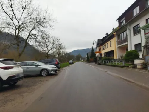
Graacher Tor
Restaurant · Regional · 4.8 km
3 Graacher Straße, Bernkastel-Kues
Mo,Tu,Fr 17:30-20:30; Sa,Su 12:00-14:00,17:30-20:30; We,Th off

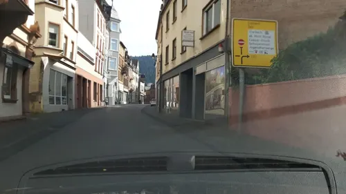
Alte Zunftscheune
Restaurant · Regional
15 Neue Rathausstraße, Traben-Trarbach
Tu-Su 17:00+, Su 11:30-15:00; Mo off

Alter Moselbahnhof
Restaurant · German · 4.8 km
19 Gestade, Bernkastel-Kues
10:30-22:30; Fr,Sa 10:30-23:00

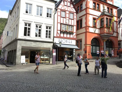
Da Salvatore
Restaurant · Italian · 4.9 km
3 Markt, Bernkastel-Kues
Mo,Tu 11:30-14:45,17:30-22:30; Th-Su 11:30-14:30,17:30-22:30
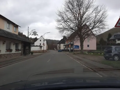
Hotel Dampfmühle
Restaurant · Regional · 3.9 km
80 Am Steffensberg, Enkirch
Th-Tu 11:30-14:00,17:30-21:00; We off


251 more on the map.
History
As early as 830, the Aachener Hof (estate) had a documentary mention. Emperor Louis the Pious, Charlemagne's son, donated Traben with all its rights and privileges, and its appurtenances, namely Litzig, Rißbach, Irmenach and Beuren, to the minster at Aachen (Aachen Foundation of Mary), where German kings were crowned.
In the 17th century, the town was part of what was then known as Rhenish Franconia, a strategic area fought over by France and the Holy Roman Empire. Seized by France in the 1683–1684 War of the Reunions, Traben was the location for the new fortress of Mont-Royal, constructed by Vauban, the leading military engineer of the period. The main ramparts were 30 metres (98 ft) high and 3 km (1.9 mi) long, with space for 12,000 troops; despite the enormous cost, it was demolished when the French withdrew following the 1697 Treaty of Ryswick and only the lower foundations are visible today.
All today's Stadtteile – with the exception of a part of Kautenbach – belonged to the Hintere (English: rear, back, i.e. hinterland; Upper) County of Sponheim, whose main centre was Trarbach. After the comital family of Sponheim died out, the inheriting landholders formed the County into a Palatine-Badish condominium and had their residences elsewhere in the county, namely in Birkenfeld and Kastellaun. Trarbach was also the seat of a Palatine oberamt, the Oberamt Trarbach.
From the History section of Traben-Trarbach on Wikipedia, under CC BY-SA 4.0.
Where to stay110
Churches and places of worship20
Evangelische Kirche
Church · Protestant · 4.1 km
2 Zweibachstraße, Traben-Trarbach
Heilig-Geist Kirche
Church · Catholic · 5.0 km
47 Burgstraße, Bernkastel-Kues
Sankt Maria Himmelfahrt
Church · Roman Catholic · 4.1 km
18 Graacher Straße, Traben-Trarbach
Shopping38
Gas and EV charging7
Schools, colleges and libraries12
Healthcare4
Gesundheitszentrum Mittelmosel
Clinic and pharmacy · 0.6 km
58 Am Bahnhof, Traben-Trarbach
Map of Traben-Trarbach
250 places. The map loads OpenStreetMap tiles when you open it.
Getting there and nearby towns
Hahn Airport (HHN) is the nearest airport with scheduled flights listed in OpenStreetMap, 10 km away.
- Zell 10 km northeast, about 10 min by car
- Wittlich 16 km west, about 16 min by car
- Morbach 16 km south, about 16 min by car
- Idar-Oberstein 30 km southeast, about 30 min by car
- Trier 40 km southwest, about 40 min by car
- Nohfelden 41 km south, about 41 min by car
- Mayen 43 km north, about 43 min by car
- Bitburg 42 km west, about 42 min by car
- Boppard 46 km northeast, about 46 min by car
- Konz 48 km southwest, about 48 min by car
Drive times are estimates from straight-line distance, not routes.
Local news
Headlines from INDB.
Reviews, tips and questions
Loading what members have shared...
Sources and licences
- GeoNames (CC BY 4.0): population, coordinates, regions and time zone
- Mapillary (see each image): photos
- OpenStreetMap contributors (ODbL 1.0): places, airports, map data
- Wikidata (CC0 1.0): elevation, founding date, time zone, website, landmarks and historic places
- Wikimedia Commons (see each image): photos
- Wikipedia (CC BY-SA 4.0): overview and history text
Photo credits
- Aerial image of the Moselle in Traben-Trarbach (view from the south), Carsten Steger, CC BY-SA 4.0
- 56841 Traben-Trarbach, Germany - panoramio (61), Ben Bender, CC BY-SA 3.0
- 56841 Traben-Trarbach, Germany - panoramio (52), Ben Bender, CC BY-SA 3.0
- 56841 Traben-Trarbach, Germany - panoramio (59), Ben Bender, CC BY-SA 3.0
- Traben-Trarbach BW 2019-06-23 15-39-03, Berthold Werner, CC BY-SA 4.0
- Traben-Trarbach BW 2019-06-23 15-34-21, Berthold Werner, CC BY-SA 4.0
- 56841 Traben-Trarbach, Germany - panoramio (45), Ben Bender, CC BY-SA 3.0
- Traben-Trarbach - Altes Rathaus, Südseite - panoramio, giggel, CC BY 3.0
- Traben-Trarbach - Hotel Moselschlößchen, Neue Rathausstraße - panoramio, giggel, CC BY 3.0
- Traben-Trarbach BW 2019-06-23 15-36-25, Berthold Werner, CC BY-SA 4.0
- Traben-Trarbach - Dr.-Spies-Brunnen - panoramio, giggel, CC BY 3.0
- Traben-Trarbach BW 2019-06-23 15-36-38, Berthold Werner, CC BY-SA 4.0
- Traben-Trarbach - Ruine Grevenburg auf der Trarbacher Seite - panoramio, Edgar El, CC BY 3.0
- 56841 Traben-Trarbach, Germany - panoramio (50), Ben Bender, CC BY-SA 3.0
- Traben-Trarbach - Altes Rathaus, Bahnstr. 22 - panoramio, giggel, CC BY 3.0
- 56841 Traben-Trarbach, Germany - panoramio (49), Ben Bender, CC BY-SA 3.0
- Traben-Trarbach - panoramio (3), Halina Frederiksen, CC BY 3.0
- Traben-Trarbach BW 2012-05-20 17-13-41, Berthold Werner, CC BY-SA 3.0
- Traben-Trarbach - Turm der ev. Kirche - panoramio, Edgar El, CC BY 3.0
- Panorama Traben-Trarbach 01, Helmlechner, CC0
- Traben-Trarbach - Hotel - Restaurant Vier Loewen - panoramio, giggel, CC BY 3.0
- 56841 Traben-Trarbach, Germany - panoramio (54), Ben Bender, CC BY-SA 3.0
- Traben-Trarbach BW 2012-05-20 17-11-59, Berthold Werner, CC BY-SA 3.0
- Nice rock stone building (Postoffice) at Traben-Trarbach - panoramio, Henk Monster, CC BY 3.0
- 56841 Traben-Trarbach, Germany - panoramio (48), Ben Bender, CC BY-SA 3.0
- Traben-Trarbach BW 2012-05-20 17-00-38, Berthold Werner, CC BY-SA 3.0
- Traben-Trarbach, Kommandantenhaus BW 2019-06-23 15-29-45 stitch, Berthold Werner, CC BY-SA 4.0
- Traben-Trarbach - Poststraße - panoramio, giggel, CC BY 3.0
- Traben-Trarbach BW 2012-05-20 17-09-26, Berthold Werner, CC BY-SA 3.0
- Traben-Trarbach BW 2012-05-20 17-09-26 stitch, Berthold Werner, CC BY-SA 3.0
- Traben-Trarbach BW 2012-05-20 17-09-44, Berthold Werner, CC BY-SA 3.0
- Traben-Trarbach - Pfarrkirche St. Nikolaus im Ortsteil Trarbach - panoramio, Edgar El, CC BY 3.0
- Traben-Trarbach - ev. Kirche - panoramio (1), giggel, CC BY 3.0
- 56841 Traben-Trarbach, Germany - panoramio (46), Ben Bender, CC BY-SA 3.0
- Graacher Tor, BBKurt, CC BY 3.0
- Grevenburg in Traben-Trarbach, Ra'ike (see also: de:Benutzer:Ra'ike ), CC BY-SA 3.0
- Traben-Trarbach Brückentor BW 2019-06-23 14-59-09, Berthold Werner, CC BY-SA 4.0
- Nikolaus-von-Kues-Gymnasium, User:Professor Einstein, CC BY-SA 3.0 de
- Kesselstadt Chapel in Kröv, Römert, CC BY-SA 4.0
- Mittelmoselmuseum Traben-Trarbach, Norbert Hagemann, CC BY-SA 3.0
- 0 5028 Bernkastel-Kues (St. Nikolaus-Hospital), W. Bulach, CC BY-SA 4.0
- Starkenburg-Ruine, Peter Tritthart, CC BY 3.0
- MKn Staffelter Hof, Martin Kraft, CC BY-SA 3.0 de
- EvangelischeKircheKautenbachAussen1, Dagmar Quiring, Evangelischer Kirchenkreis Trier, CC BY-SA 4.0
- Bernkastel-Kues St. Michael 2016, Uwe Barghaan, CC BY-SA 3.0
- Enkirch - die kath. Pfarrkirche St. Franziskus war früher eine Wallfahrts- und Klosterkirche - panoramio, Edgar El, CC BY 3.0
- Bernkastel-Heiliggeistkirche-Langhaus, Dkvtig, CC BY-SA 4.0
- Traben, Evangelische Kirche, Rolf Kranz, CC BY-SA 4.0
- Traben-Trarbach BW 2012-05-20 16-56-03, Berthold Werner, CC BY-SA 3.0
- Aeltesteweinstube, Stefan Krebs, CC BY-SA 4.0
- Abschnittswall Kroever Burgberg Skizze, JS Lonscet, CC BY-SA 4.0
- ABUS locks, Zylinderhaus pic1, Alf van Beem, Public domain
- Traben-Trarbach - Buddha Museum - panoramio, giggel, CC BY 3.0
- Street-level photo, changchun1, CC BY-SA 4.0
- Street-level photo, Lowiekse, CC BY-SA 4.0
- Street-level photo, Lowiekse, CC BY-SA 4.0
- Street-level photo, Lowiekse, CC BY-SA 4.0
- Street-level photo, changchun1, CC BY-SA 4.0
- Street-level photo, mp4321, CC BY-SA 4.0
- Street-level photo, Lowiekse, CC BY-SA 4.0
- Street-level photo, Lowiekse, CC BY-SA 4.0
- Street-level photo, Lowiekse, CC BY-SA 4.0
- Street-level photo, Lowiekse, CC BY-SA 4.0
- Street-level photo, deleted_user, CC BY-SA 4.0
- Street-level photo, Lowiekse, CC BY-SA 4.0
- Street-level photo, Lowiekse, CC BY-SA 4.0
- Street-level photo, zors1843, CC BY-SA 4.0
- Street-level photo, Lowiekse, CC BY-SA 4.0
- Street-level photo, deleted_user, CC BY-SA 4.0
- Street-level photo, Lowiekse, CC BY-SA 4.0


Page built November 9, 2026. Spotted a mistake? Tell us or suggest a place.