


Why visit Welver
Townapedia lists 74 museums and landmarks, 43 parks and trails, 50 places to eat, 9 places to stay and 8 attractions in and around town.
Highlights include Haus Hohenover, Jürgen Vedder, Haus Nehlen and Glaselefant.
Weather in Welver
Forecast from MET Norway (CC BY 4.0). Full forecast
About Welver
Welver (German pronunciation: [ˈvɛlvɐ]) is a municipality in the district of Soest, in North Rhine-Westphalia, Germany.
From the Wikipedia article Welver (this version), under CC BY-SA 4.0.
Things to do8

Mosterei Gerhards
Farm and orchard · 4.5 km
1 Klosterstraße, Welver
Oevel's Milchtankstelle
Farm and orchard · 6.7 km
Milchtankstelle und Automat für Grillfleisch usw.
66 Lindweg, Soest


Museums and landmarks74

Haus Nehlen
Monument and historic site · 4.3 km
1 Haus Nehlen, Welver


Burg Vellinghausen
Monument and historic site · 5.5 km
1 Burg Vellinghausen, Welver

Haus Heidemühlen
Monument and historic site · 6.9 km
Gebiet, wo früher Haus Heidemühlen stand

Ehem. Burg Heidemühle
Monument and historic site · 6.8 km
Ehem. Burg und Mühle Heidemühle (niederdeutsch Heidemole) auf einer Lippeinsel - Zerstört 1346 und wiederaufgebaut - auch ein Schauplatz...


62 more on the map.
Parks, trails and playgrounds43




31 more on the map.
Restaurants and cafes50
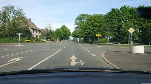
Das Fischlokal
Restaurant · Fish, Seafood · 7.6 km
36 Westönner Bundesstraße, Werl
We-Sa 17:00-22:30; Su,PH 11:30-14:30,16:30-22:00
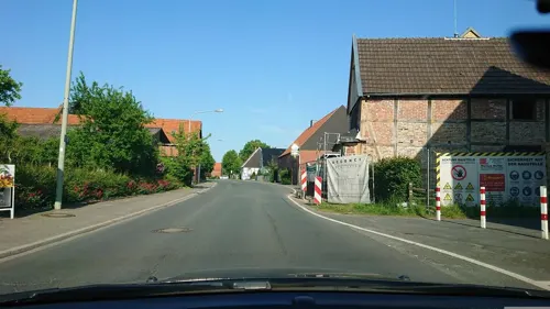
Gasthof Witteborg
Restaurant · German · 2.9 km
25 Hellweg, Welver
Tu 17:00-20:00; We-Sa 17:00+; Su 11:30+; Mo off

Haus Splietker
Restaurant · Regional · 4.1 km
36 In Süddinker, Hamm
Jan-Mar: Th,Fr 17:00+; Sa,Su 11:00+; Mo-We off; Apr: Mo,Tu,Th,Fr...
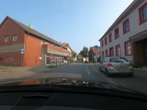
Bäckerei Erdmann
Bakery · 7.7 km
4 Reginenstraße, Hamm
Mo-Fr 05:30-12:30,14:30-18:30; Sa 06:00-12:00; Su 07:00-11:00

Hammona Braumanufaktur GbR
Brewery and winery · 7.7 km
33 Heinrich-Welken-Straße, Hamm
Mo-Fr 08:00-12:00,13:00-16:00



38 more on the map.
History
The town was once known as Villinghausen or Vellinghausen. The Seven Years' War Battle of Villinghausen was fought nearby.
From the History section of Welver on Wikipedia, under CC BY-SA 4.0.
Where to stay9
Churches and places of worship27
Maria Magdalena
Church · Roman Catholic · 4.0 km
20 Kapellenstraße, Werl
Pfarrkirche St. Bernhard
Church · Roman Catholic · 0.8 km
13 Klosterhof, Welver
Pfarrkirche St. Cäcilia
Church · Roman Catholic · 7.3 km
26 Westönner Kirchstraße, Werl
St. Regina
Church · Roman Catholic · 7.6 km
Sankt-Reginen-Platz, Hamm
Shopping9
Gas and EV charging8
Theodor Rubart Mineralöle und Schmierstoffe GmbH & Co.
Gas station · 7.6 km
24 Hammer Straße, Werl
Schools, colleges and libraries12
Healthcare4
Map of Welver
244 places. The map loads OpenStreetMap tiles when you open it.
Getting there and nearby towns
Dortmund Airport (DTM) is the nearest airport with scheduled flights listed in OpenStreetMap, 27 km away.
- Werl 8 km southwest, about 8 min by car
- Soest 11 km southeast, about 11 min by car
- Hamm 12 km northwest, about 12 min by car
- Bönen 14 km west, about 14 min by car
- Bad Sassendorf 14 km east, about 14 min by car
- Wickede 15 km southwest, about 15 min by car
- Beckum 16 km north, about 16 min by car
- Ahlen 17 km north, about 17 min by car
- Möhnesee 17 km southeast, about 17 min by car
- Unna 21 km southwest, about 21 min by car
Drive times are estimates from straight-line distance, not routes.
Local news
Headlines from INDB.
Reviews, tips and questions
Loading what members have shared...
Sources and licences
- GeoNames (CC BY 4.0): population, coordinates, regions and time zone
- Mapillary (see each image): photos
- OpenStreetMap contributors (ODbL 1.0): places, airports, map data
- Wikidata (CC0 1.0): elevation, founding date, time zone, website, landmarks and historic places
- Wikimedia Commons (see each image): photos
- Wikipedia (CC BY-SA 4.0): overview and history text
Photo credits
- Bücherschrank in Welver - panoramio, qwesy qwesy, CC BY 3.0
- Bahnhof, 2, Welver, Landkreis Soest, GeorgDerReisende, CC BY-SA 4.0
- Bahnhof, 1, Welver, Landkreis Soest, GeorgDerReisende, CC BY-SA 4.0
- Welver-Kirchwelver - Dorf 01, Dat doris, CC BY 4.0
- Welver-Kirchwelver - Dorf 02, Dat doris, CC BY 4.0
- Bushaltestelle Rathaus-Sparkasse, 1, Welver, Landkreis Soest, GeorgDerReisende, CC BY-SA 4.0
- Welver - panoramio, qwesy qwesy, CC BY 3.0
- Welver-Kirchwelver - Ehrenmal, Dat doris, CC BY 4.0
- Welver-Kirchwelver - Antonius Heiligenhaus 02, Dat doris, CC BY 4.0
- Welver-Kirchwelver - Antonius Heiligenhaus 01, Dat doris, CC BY 4.0
- Am Markt, 2, Welver, Landkreis Soest, GeorgDerReisende, CC BY-SA 4.0
- Am Markt, 1, Welver, Landkreis Soest, GeorgDerReisende, CC BY-SA 4.0
- Am Markt 13, 1, Welver, Landkreis Soest, GeorgDerReisende, CC BY-SA 4.0
- Am Markt, 4, Welver, Landkreis Soest, GeorgDerReisende, CC BY-SA 4.0
- Stolperstein Philipp Ostwald, 1, Am Markt 13, Welver, Landkreis Soest, GeorgDerReisende, CC BY-SA 4.0
- Stolperstein Henriette Ostwald, 1, Am Markt 13, Welver, Landkreis Soest, GeorgDerReisende, CC BY-SA 4.0
- Stolpersteinlage, 2, Am Markt 13, Welver, Landkreis Soest, GeorgDerReisende, CC BY-SA 4.0
- Stolpersteinlage, 1, Am Markt 13, Welver, Landkreis Soest, GeorgDerReisende, CC BY-SA 4.0
- Rathaus, 1, Welver, Landkreis Soest, GeorgDerReisende, CC BY-SA 4.0
- Bushaltestelle Bahnhof, 2, Welver, Landkreis Soest, GeorgDerReisende, CC BY-SA 4.0
- Bushaltestelle Rathaus, 2, Welver, Landkreis Soest, GeorgDerReisende, CC BY-SA 4.0
- Am Markt 11, 1, Welver, Landkreis Soest, GeorgDerReisende, CC BY-SA 4.0
- Bahnhof, 5, Welver, Landkreis Soest, GeorgDerReisende, CC BY-SA 4.0
- Welver-Kirchwelver - Dorfstraße 2, Dat doris, CC BY 4.0
- Bahnhof, 6, Welver, Landkreis Soest, GeorgDerReisende, CC BY-SA 4.0
- Bahnhof, 3, Welver, Landkreis Soest, GeorgDerReisende, CC BY-SA 4.0
- Bushaltestelle Bahnhof, 1, Welver, Landkreis Soest, GeorgDerReisende, CC BY-SA 4.0
- Bahnhofstraße 1, 1, Welver, Landkreis Soest, GeorgDerReisende, CC BY-SA 4.0
- Am Markt, 3, Welver, Landkreis Soest, GeorgDerReisende, CC BY-SA 4.0
- Bushaltestelle Rathaus, 1, Welver, Landkreis Soest, GeorgDerReisende, CC BY-SA 4.0
- Bahnhof, 4, Welver, Landkreis Soest, GeorgDerReisende, CC BY-SA 4.0
- Bahnhofstraße, 1, Welver, Landkreis Soest, GeorgDerReisende, CC BY-SA 4.0
- Klostercafé Kulinarius in Welver - panoramio, qwesy qwesy, CC BY 3.0
- Klostercafé Kulinarius in Welver - panoramio (1), qwesy qwesy, CC BY 3.0
- Welver-Kirchwelver - St. Albanus und Cyriakus, Dat doris, CC BY 4.0
- Welver-Kirchwelver - Friedhofsmauer St. Albanus und Cyriakus, Dat doris, CC BY 4.0
- Schwefe, Turm von St. Severin, Stephan Hense, CC BY-SA 3.0
- Burg Vellinghausen, Begede, CC BY-SA 3.0
- St. Albanus und Cyriakus (Welver) (13), Chris06, CC BY-SA 4.0
- Borgeln Kirche1, AlterWolf49, CC BY-SA 3.0
- Alte Salzstraße 6 (Hamm), Gliwi, CC BY-SA 3.0
- Werl, Forum der Völker, Missionsmuseum, Malchen53, CC BY-SA 3.0
- Welver, Berwicke, Haus Nehlen -- 2014 -- 8771 -- Ausschnitt, Dietmar Rabich, CC BY-SA 4.0
- St. Cäcilia-Kirche, Werl-Westönnen, Dominik Schäfer, CC BY-SA 3.0 de
- KAPELLE ST. MARIA-MAGDALENA in Niederbergstraße Ortsteil von Werl im Kreis Soest, Matthias Böhm, CC BY-SA 3.0
- Westönnen - Haus Lohe, Ath, CC0
- Werl Pauluskirche FFSN-241, Michael Kramer, CC BY-SA 3.0
- St. Antonius Stocklarn, Kühlungsborn, CC BY-SA 3.0
- Ev. Pfarrkirche St. Othmar Dinker (4), Uwe Dinker, CC BY-SA 3.0
- Hamm, Rhynern, Katholische Kirche St, Regina, Ansicht von der Seite in Richtung Turm, Malchen53, CC BY-SA 3.0
- Welver, Nateln, Haus Nateln -- 2014 -- 8775 -- Ausschnitt, Dietmar Rabich, CC BY-SA 4.0
- Katholische Pfarrkirche St. Antonius von Padua Nordseite, Nailik2020, CC BY-SA 4.0
- Schwefe - NSG Salzbrink - 01, Ath, CC0
- Dinker - NSG Ahse bei Dinker - 08, Ath, CC0
- Welver - NSG Ahsewiesen (VO) - 01, Ath, CC0
- Ahsewiesen-lippetal-soester-boerde-schwanengesang, PICNIC Foto Soest, CC BY-SA 4.0
- Hattrop - NSG Ehemalige Klärteiche bei Hattrop - 02, Ath, CC0
- St. Bernhard (Welver) 2, Chris06, CC BY-SA 4.0
- Der Glaselefant - panoramio, Foto Fitti, CC BY-SA 3.0
- Street-level photo, analuisa, CC BY-SA 4.0
- Street-level photo, analuisa, CC BY-SA 4.0
- Street-level photo, saschahaberkorn, CC BY-SA 4.0
- Street-level photo, nrailuj, CC BY-SA 4.0
- Street-level photo, nrailuj, CC BY-SA 4.0
- Street-level photo, saschahaberkorn, CC BY-SA 4.0
- Street-level photo, nrailuj, CC BY-SA 4.0
- Street-level photo, saschahaberkorn, CC BY-SA 4.0
- Street-level photo, saschahaberkorn, CC BY-SA 4.0
- Street-level photo, saschahaberkorn, CC BY-SA 4.0


Page built November 9, 2026. Spotted a mistake? Tell us or suggest a place.