


Why visit Beckum
Townapedia lists 62 museums and landmarks, 36 parks and trails, 102 places to eat, 5 places to stay and 13 attractions in and around town.
Highlights include Stadttheater Filou, Höxberg, Spannbetonbrücke and Galeriegrab von Beckum-Dalmer.
Weather in Beckum
Forecast from MET Norway (CC BY 4.0). Full forecast
About Beckum
Beckum (German pronunciation: [ˈbɛkʊm] ; Westphalian: Biäkem) is a town in the northern part of North Rhine-Westphalia, Germany. It is about 20 km (12 miles) north-east of Hamm and 35 km (22 miles) south-east of Münster. It gives its name to the nearby Beckum Hills.
From the Wikipedia article Beckum, Germany (this version), under CC BY-SA 4.0.
Photos of Beckum


Things to do13




1 more on the map.
Museums and landmarks62

Spannbetonbrücke
Monument and historic site · 4.7 km
Erste deutsche Spannbetonbrücke



Wallburg Havixbrock
Monument and historic site · 5.0 km
Frühmitteralterliche Fluchtburg des 9. Jahrhunderts

50 more on the map.
Parks, trails and playgrounds36




24 more on the map.
Restaurants and cafes102
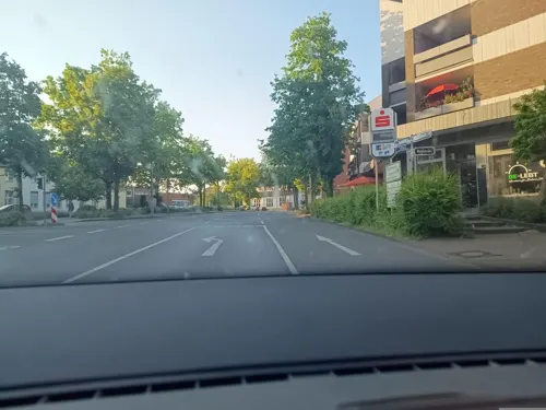
bei Kliewe im Westfälischen Hof
Restaurant · Burger, German, Italian, Regional
33 Weststraße, Beckum
Tu-Sa 11:30-14:00,16:30-23:30
Hotel Restaurant Alt Vellern
Restaurant · Regional · 4.0 km
21 Dorfstraße, Beckum
Mo-Fr 11:30-14:30; Sa-Th 17:30+
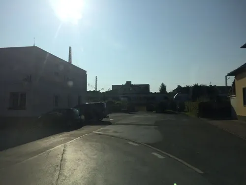
Restaurant Safi
Restaurant · Italian, Pizza · 5.4 km
7 Wiesenstraße, Beckum
Mo-Fr 11:00-14:00,17:00-22:00; Sa 15:00-24:00; Su 15:00-22:00
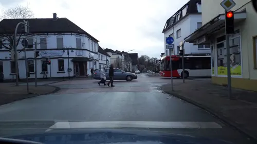
Buon Gusto
Restaurant · Italian · 5.1 km
33 Hauptstraße, Beckum
Tu-Fr 11:30-14:00,17:30-21:30; Sa 17:30-21:30; PH,Su 17:00-21:00; Mo off
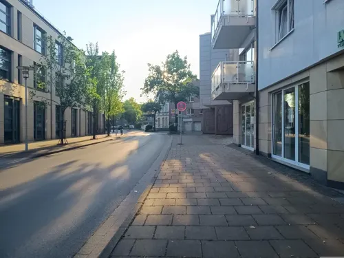
Pulverschoppen
Restaurant · Italian
7 Weststraße, Beckum
Mo 17:30+; Tu off; We-Fr 17:30+; Sa,Su,PH 11:30-14:30,17:30+
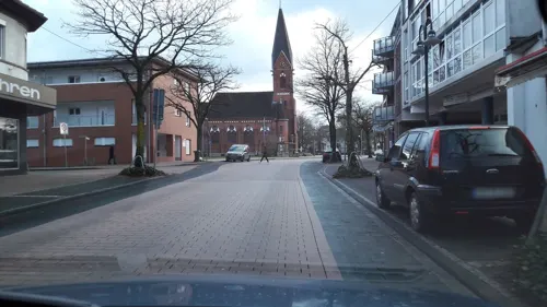
Chinesische Mauer
Restaurant · Chinese · 5.0 km
38 Hauptstraße, Beckum
Mo-Su,PH 11:30-15:00,17:30-22:30; Tu 11:30-15:00
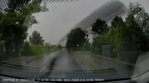


Bäckerei Dördelmann
Bakery · 1.0 km
34 Mühlenweg, Beckum
Mo-Fr 05:30-12:30, 14:15-18:00, Sa 05:30-12:30, Su 07:30-10:30
Brauhaus "Stiefel Jürgens"
Restaurant · Regional
Älteste Baruerei Westfalens von 1680
6 Hühlstraße, Beckum

90 more on the map.
History
Several Neolithic stone cists are the earliest traces of humans in the area around the three brooks, Kollenbach, Lippbach and Siechenbach. Because of these three brooks, the town was eventually named Bekehem or later Beckum, meaning "home upon the brooks".
In 1224, Beckum was granted its town charter, and it quickly grew in wealth as merchants and craftsmen set up businesses in the town. The town quickly expanded to an area of over 22 km2 (8.5 sq miles). However wars, riots and the Black Death in the following centuries left their mark on the town.
After the Thirty Years' War, legislation removed several rights from cities and towns, and as a result many cities and towns in Münsterland became heavily economically and religiously dependent upon the Bishop of Münster.
The town's long period of economic stagnation slowly came to an end in the 19th century. From 1803 to 1806 Beckum was under Prussian rule and from 1806 to 1816 under French rule. In 1816 Beckum became the district town of Beckum district.
In the second half of the 19th century, chalk and cement industries developed quickly, and in 1827 the first cement plant opened in Beckum. Eventually the town became one of the most important and largest cement production areas in the world.
Read more of the history
After the end of the First World War, inflation brought Beckum's economic growth to a halt. In 1933, the Nazi regime ended democracy in the Beckum town parliament - as everywhere in Germany. During the Second World War, Beckum was fortunate and Allied bombings destroyed only small areas of the town.
In the difficult post-war era, the townspeople developed Beckum into a modern industrial town. In 1974, the North Rhine-Westphalian state government reorganized the boundaries of several districts and towns. As of 1 January 1975, the Beckum and Warendorf districts merged into one, and Warendorf remained district town of the whole area.
From the History section of Beckum, Germany on Wikipedia, under CC BY-SA 4.0.
More about Beckum
Geography
Beckum is situated in the southeast corner of the agriculturally orientated Münsterland. Due to Münsterland's varied landscape of fields, pastures, hedgerows and small forests, it is often compared to a park.
A range of low hills, the Beckum Hills, almost completely surrounds Beckum in the south and east. The three brooks Kollenbach, Lippbach and Siechenbach rise in these hills and flow through the town. They are so symbolic of the area that they appear on the town's coat of arms as three silver wavy lines on a red background. The brooks converge near the town centre and form the River Werse, which flows past Ahlen and Münster to the River Ems.
Although Beckum is located in Münsterland, the nearest large city is not Münster but Hamm, which is 20 km (12 miles) away. Ahlen, Beckum's neighbour 11 km (7 miles) to the west, is the largest town in Warendorf District.
Autobahn 2, which runs from Berlin to the Ruhr area, passes to the north of Beckum. The two federal highways, B61 from Bielefeld to Hamm and B475 from Warendorf to Soest, intersect near the town centre. To the north of the town, B58 connects Ahlen to the B475.
Economy
The industry in Beckum is influenced by machine engineering, the cement industry and its suppliers. However, commerce and service industries have also become a strong area of Beckum's economy.
Möllers, Blumenbecker, and Beumer count as some of the largest machine engineering companies. CEMEX and Phoenix both have cement plants located in Beckum. Polysius and Christian Pfeiffer are two suppliers of cement manufacturing systems.
From the Wikipedia article Beckum, Germany, under CC BY-SA 4.0.
Notable people from Beckum
 Uri AvneryIsraeli politician, journalist and author (1923-2018)Photo: Moshe Pridan, Public domain
 Marian MichalczikGerman handball playerPhoto: Frau N. Zimmer = Walter Mier, CC BY-SA 4.0
 Inka MartíSpanish writer, editor and photographerPhoto: Xabier, CC BY-SA 4.0
 Walter KernGerman politician (CDU), MdL (1954–2025)Photo: Martin Rulsch , Wikimedia Commons, CC BY-SA 4.0
 Michael WiemannGerman footballerPhoto: Northside, CC BY-SA 3.0
- Rolf AldagGerman cyclist
- Udo HorsmannGerman footballer
- Philipp KühnGerman footballer
- Nils-Ole BookGerman footballer
- Franz-Josef SteffensGerman actor and voice actor (1923–2006)
- Winfried VahlandGerman businessman
- Jörg HalubekGerman conductor, organist and music educator
Born in Beckum, according to Wikidata (CC0). Each name links to its Wikipedia article.
Where to stay5
Churches and places of worship9
Propsteikirche Sankt Stephanus
Church · Roman Catholic
1 Kirchplatz, Beckum
St.-Ludgerus-Kapelle
Church · Roman Catholic · 5.0 km
46 Herzfelder Straße, Beckum
Shopping27
Gas and EV charging11
Schools, colleges and libraries18
Friedrich-von-Bodelschwingh-Schule
School · 5.1 km
2-4 Rektor-Wilger-Straße, Beckum
Healthcare9
Map of Beckum
250 places. The map loads OpenStreetMap tiles when you open it.
Getting there and nearby towns
Dortmund Airport (DTM) is the nearest airport with scheduled flights listed in OpenStreetMap, 40 km away.
- Ennigerloh 9 km north, about 9 min by car
- Ahlen 10 km west, about 10 min by car
- Oelde 11 km northeast, about 11 min by car
- Wadersloh 15 km east, about 15 min by car
- Welver 16 km south, about 16 min by car
- Hamm 17 km southwest, about 17 min by car
- Sendenhorst 17 km northwest, about 17 min by car
- Soest 21 km south, about 21 min by car
- Rheda-Wiedenbrück 21 km northeast, about 21 min by car
- Warendorf 22 km north, about 22 min by car
Drive times are estimates from straight-line distance, not routes.
Towns near Beckum


Keep exploring
Local news
Headlines from INDB.
Reviews, tips and questions
Loading what members have shared...
Sources and licences
- GeoNames (CC BY 4.0): population, coordinates, regions and time zone
- Mapillary (see each image): photos
- OpenStreetMap contributors (ODbL 1.0): places, airports, map data
- Wikidata (CC0 1.0): elevation, founding date, time zone, website
- Wikimedia Commons (see each image): photos
- Wikipedia (CC BY-SA 4.0): overview and history text
Photo credits
- Rathaus Beckum01, Markus Schweiss, CC BY-SA 3.0
- Beckum, Haus Nordstraße 12, Dguendel, CC BY 4.0
- Beckum, Haus Nordstraße 13, Dguendel, CC BY 4.0
- Beckum, Haus Nordstraße 20, Dguendel, CC BY 4.0
- Beckum, Haus Nordstraße 4, Erker, Dguendel, CC BY 4.0
- Beckum, Hühlstraße, Blick zur Christuskirche, Dguendel, CC BY 4.0
- Beckum, Haus Markt 4, Blick zum Turm der Kirche St. Stephanus, Dguendel, CC BY 4.0
- Linnenstraße, Beckum - panoramio, qwesy qwesy, CC BY 3.0
- Beckum, Haus Weststraße 3, Dguendel, CC BY 4.0
- Beckum, das Rathaus, Dguendel, CC BY 4.0
- Beckum, Haus Markt 11, Dguendel, CC BY 4.0
- Beckum, Haus Markt 7, Dguendel, CC BY 4.0
- Altes Rathaus, Beckum - panoramio, qwesy qwesy, CC BY 3.0
- Beckum, die Apotheke am Markt, Dguendel, CC BY 4.0
- Beckum, die Häuser Markt 9, 10 und 11, Dguendel, CC BY 4.0
- Marktplatz und Altes Rathaus in Beckum - panoramio, qwesy qwesy, CC BY 3.0
- Beckum, die Häuser Linnenstraße 1 und 3, Dguendel, CC BY 4.0
- Beckum, Haus Oststraße 7, Dguendel, CC BY 4.0
- Beckum, Haus Nordstraße 30, Dguendel, CC BY 4.0
- Beckum, Haus Nordstraße 1, Dguendel, CC BY 4.0
- Beckum, Haus Nordstraße 27, Dguendel, CC BY 4.0
- Gaststätte Pulverschoppen Hagedorn in Beckum (Hagedorn erstmals 1690 erwähnt, Gebäude von 1936) - panoramio, qwesy qwesy, CC BY 3.0
- Beckum, Haus Oststraße 7, Erker, Dguendel, CC BY 4.0
- Beckum, Karnevalsdenkmal, Dguendel, CC BY 4.0
- Beckum, Haus Kirchplatz 10, Dguendel, CC BY 4.0
- Beckum, die Kirche St. Stephanus, Tür, Dguendel, CC BY 4.0
- Beckum, die Statue "Steinkühler" von Heinrich Gerhard Bücker, Dguendel, CC BY 4.0
- Beckum, die Kirche St. Stephanus, Gedanktafel für Baron Wilhelm Emmanuel von Ketteler, Dguendel, CC BY 4.0
- Beckum, die Kirche St. Stephanus, Gedanktafel für Johann Bernhard Brinkmann, Dguendel, CC BY 4.0
- Beckum, die Kirche St. Stephanus, Bleiglasfenster-07, Dguendel, CC BY 4.0
- Beckum, die Kirche St. Stephanus, Bleiglasfenster-01, Dguendel, CC BY 4.0
- Beckum, die Kirche St. Stephanus, Bleiglasfenster-04, Dguendel, CC BY 4.0
- Beckum, die Kirche St. Stephanus, Chor, Dguendel, CC BY 4.0
- Beckum, die Kirche St. Stephanus, Heinrich Fleige, Kreuzwegstation XIII, Dguendel, CC BY 4.0
- Beckum, die Kirche St. Stephanus, Pieter de Grebber, die Taufe Christi, Dguendel, CC BY 4.0
- Beckum, die Kirche St. Stephanus, Innenansicht, Dguendel, CC BY 4.0
- Beckum, die Kirche St. Stephanus, Bleiglasfenster-03, Dguendel, CC BY 4.0
- Beckum, die Kirche St. Stephanus, Bleiglasfenster-02, Dguendel, CC BY 4.0
- Beckum, die Kirche St. Stephanus, Statue, Dguendel, CC BY 4.0
- Überführung Weg Hesseler von Süden 01, Elke Wetzig, CC BY-SA 3.0
- Soestwarte höxberg, Kryptonit, Public domain
- Beckum (St. Stephanus) 2005 10 19 West, JWBE, Public domain
- AMG-Beckum, Laszlo Schürbüscher, CC BY 3.0
- Neubeckum, Christuskirche -- 2014 -- 8690 -- Ausschnitt, Dietmar Rabich, CC BY-SA 4.0
- Marienkapelle (Beckum) Außenansicht, FraJo57, CC BY-SA 3.0
- Beckum-lippweg-197390, Pim van Tend, CC BY-SA 4.0
- Unterberg - St. Ludgerus - 1, Ath, CC0
- Beckum - Siechenhauskapelle, Kryptonit, CC BY-SA 4.0
- St. Pankratius Kirche Vellern, Kryptonit, CC BY-SA 4.0
- Aktivpark Phönix Beckum, Kryptonit, CC0
- Stolperstein Josef Stein in Beckum.nnw, NordNordWest, CC BY-SA 3.0 de
- Stolperstein Thea Blumenthal in Beckum.nnw, NordNordWest, CC BY-SA 3.0 de
- 20140601 130544 NSG Steinbruch Vellern, Beckum (DSC02243), Günter Seggebäing, Coesfeld, CC BY-SA 3.0
- Beckum II, Megalithfan, CC BY-SA 4.0
- 20140601 131040 Soestwarte, Beckum (DSC02265), Günter Seggebäing, Coesfeld, CC BY-SA 3.0
- Street-level photo, zuse, CC BY-SA 4.0
- Street-level photo, nrailuj, CC BY-SA 4.0
- Street-level photo, elgolfo, CC BY-SA 4.0
- Street-level photo, derlipper, CC BY-SA 4.0
- Street-level photo, mac_do, CC BY-SA 4.0
- Street-level photo, nrailuj, CC BY-SA 4.0
- Street-level photo, alucardo, CC BY-SA 4.0
- Street-level photo, zuse, CC BY-SA 4.0
- Street-level photo, poxonline, CC BY-SA 4.0
- Street-level photo, nrailuj, CC BY-SA 4.0
- Street-level photo, alucardo, CC BY-SA 4.0
- Street-level photo, nrailuj, CC BY-SA 4.0
- Street-level photo, noel, CC BY-SA 4.0
- Street-level photo, alucardo, CC BY-SA 4.0
- Street-level photo, nrailuj, CC BY-SA 4.0
- Street-level photo, alucardo, CC BY-SA 4.0


Page built November 9, 2026. Spotted a mistake? Tell us or suggest a place.