


Möhnesee, Germany
Möhnesee is a town of 11,559 people in North Rhine-Westphalia, Germany.
Why visit Möhnesee
Townapedia lists 136 museums and landmarks, 61 parks and trails, 163 places to eat, 32 places to stay and 26 attractions in and around town.
Highlights include Universum Soest, Hamelsberg, Brunsteinkapelle and Burghofmuseum.
Weather in Möhnesee
Forecast from MET Norway (CC BY 4.0). Full forecast
About Möhnesee
Möhnesee (German pronunciation: [ˈmøːnəˌzeː]) is a municipality in the district of Soest, in North Rhine-Westphalia, Germany.
From the Wikipedia article Möhnesee (this version), under CC BY-SA 4.0.
Things to do26

Universum Soest
Cinema and theater · 7.7 km
44 Grandweg, Soest
"Täglich immer 20-30 Minuten vor der ersten Vorstellung"



14 more on the map.
Museums and landmarks136


Burghofmuseum
Museum · 7.8 km
22 Burghofstraße, Soest
Tu-Sa 10:00-12:00,15:00-17:00; Su 11:00-13:00

Landschaftsinformationszentrum
Museum · 5.9 km
2 Brüningser Straße, Möhnesee
Tu-Fr 10:00-17:00; Sa,Su,PH 14:00-18:00

Bismarckturm Delecke
Monument and historic site · 2.8 km
May-Oct: Su 10:00-12:30; May-Oct: PH 10:00-12:30; May-Oct: SH We 10:00

Haus zum Spiegel
Monument and historic site · 8.0 km
13 Jakobistraße, Soest

Kunstmuseum Wilhelm-Morgner-Haus
Museum · 8.1 km
1 Thomästraße, Soest
Tu,We,Fr 13:00-17:00; Th 13:00-19:00; Sa,Su 11:00-17:00


Jagdschloss Sankt Meinolf
Monument and historic site · 3.5 km
1 Wilhelmsruh, Möhnesee

Osthofentor
Monument and historic site · 8.3 km
72 Osthofenstraße, Soest

Rittergut Völlinghausen
Monument and historic site · 5.0 km
35 Syringer Straße, Möhnesee

Villa Plange
Monument and historic site · 8.0 km
20 Sigefridwall, Soest
von Dolffscher Hof
Monument and historic site · 8.3 km
Der ehemalige Patrizierhof steht auf einem weitläufigen Wohnplatz. Die Anlage besteht aus dem Wohnhaus, einem Gartenhaus und einer...
29 Nöttenstraße, Soest
124 more on the map.
Parks, trails and playgrounds61

Aqua Fun Spaßbad
Sports field and stadium · 8.6 km
35 Ardeyweg, Soest
Mo-Th 06:00-21:00; Fr 06:00-22:00; Sa 09:00-22:00; Su 09:00-21:00



Mittellauf des Stemmwegsiepens mit angrenzender Buchenwaldinsel
Hiking and trails · 8.4 km



49 more on the map.
Restaurants and cafes163

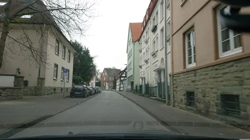
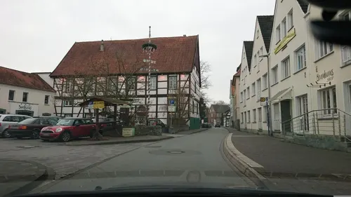
Brauhaus Zwiebel
Restaurant · German · 7.8 km
24 Ulricherstraße, Soest
Su-Th 11:30-21:00+; Fr,Sa 11:00-22:00+

Im Osterkamp
Restaurant · German · 8.4 km
10 Walburgerstraße, Soest
Mo-Th 11:00-15:00,17:00-23:00; Tu off; Fr 11:00-15:00,17:00-24:00;...
Restaurant FachWerk
Restaurant · Regional, International · 8.2 km
5 Am Seel, Soest
Tu-Fr 17:00-24:00; Sa,Su 12:00-14:00,17:00-24:00

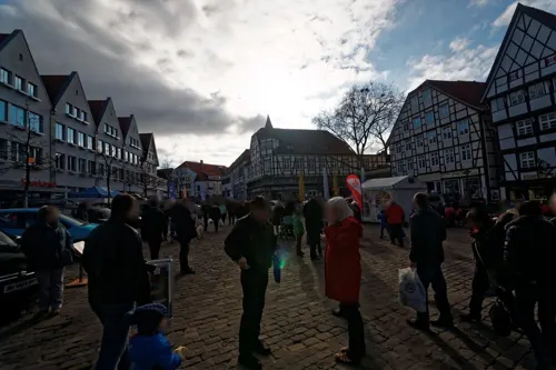
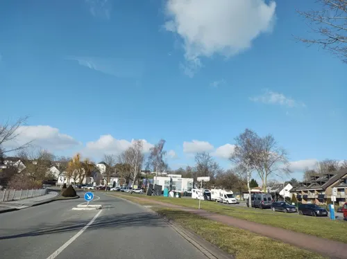
Geronimo
Restaurant · Burger, American · 3.2 km
17 Linkstraße, Möhnesee
Mo-Fr 17:00-23:00; Sa,Su,PH 10:00-23:00
Ghebah
Restaurant · Indian · 6.3 km
1 Herzog-Adolf-Weg, Soest
Mo-Sa 11:00-14:00, 17:00-21:45, Su 11:00-21:00
Harry
Restaurant · Regional · 8.3 km
71 Kölner Ring, Soest
Tu-Fr 11:00-14:30,17:00-21:00; Sa 12:00-14:30,17:00-21:00; PH,Su...


151 more on the map.
History
On the night of the 16/17 May 1943, the Dam which contains the Mohnesee was breached in an attack by Avro Lancaster Bombers of 617 Squadron of the British Royal Air Force, the "Dambusters".
From the History section of Möhnesee on Wikipedia, under CC BY-SA 4.0.
Where to stay32
Churches and places of worship42
Nikolai-Kapelle
Church · Roman Catholic · 8.1 km
7 Thomästraße, Soest
Sankt Patrokli-Dom
Church · Roman Catholic · 8.1 km
11 Rathausstraße, Soest
Shopping44
Gas and EV charging20
Schools, colleges and libraries30
Healthcare15
Map of Möhnesee
250 places. The map loads OpenStreetMap tiles when you open it.
Getting there and nearby towns
Airport Paderborn/Lippstadt (PAD) is the nearest airport with scheduled flights listed in OpenStreetMap, 36 km away.
- Soest 9 km north, about 9 min by car
- Bad Sassendorf 10 km north, about 10 min by car
- Arnsberg 13 km south, about 13 min by car
- Warstein 16 km east, about 16 min by car
- Werl 16 km west, about 16 min by car
- Anröchte 16 km northeast, about 16 min by car
- Wickede 19 km west, about 19 min by car
- Meschede 20 km southeast, about 20 min by car
- Erwitte 19 km northeast, about 19 min by car
- Rüthen 21 km east, about 21 min by car
Drive times are estimates from straight-line distance, not routes.
Local news
Headlines from INDB.
Reviews, tips and questions
Loading what members have shared...
Sources and licences
- GeoNames (CC BY 4.0): population, coordinates, regions and time zone
- Mapillary (see each image): photos
- OpenStreetMap contributors (ODbL 1.0): places, airports, map data
- Wikidata (CC0 1.0): elevation, founding date, time zone, website, landmarks and historic places
- Wikimedia Commons (see each image): photos
- Wikipedia (CC BY-SA 4.0): overview and history text
Photo credits
- Rathaus der Gemeinde Möhnesee in Körbecke, ludger1961, CC BY-SA 3.0
- Möhnesee-Berlingsen Deponie FFSN-3823, Petra Klawikowski, CC BY-SA 3.0
- Möhnesee - panoramio (1), qwesy qwesy, CC BY 3.0
- Möhnesee-Wippringsen FFSN-1684, Petra Klawikowski, CC BY-SA 3.0
- Möhnesee-Wippringsen FFSN-1680, Petra Klawikowski, CC BY-SA 3.0
- Mö-Körbecke Möhneseeinfo, Dat doris, CC BY 4.0
- Alt-St.Thomae Mai 2008 6, Benutzer Stephan Hense, CC BY-SA 3.0
- Archigymnasium Soest, Sebastian Kirsch, Segroove, CC BY-SA 3.0
- Bismarckturm (Möhnesee-Delecke), Franz von Ampen, CC BY-SA 3.0
- Brunsteinkapelle., Kühlungsborn, CC BY-SA 3.0
- BurghofMuseumSoest Mai 2008 1, Stephan Hense, CC BY-SA 3.0
- Möhnesee-Günne LIZ (1), Malchen53, CC BY-SA 3.0
- Soest-090816-9960-Kirche, Mbdortmund, GFDL 1.2
- Delecke-DrueggelterKapelle1-Asio, Asio otus, CC BY-SA 3.0
- 20140601 131813 St. Maria zur Wiese, Soest (DSC02285), Günter Seggebäing, Coesfeld, CC BY-SA 3.0
- Franzkapellesoest gesamtansicht, Juchhoff, CC0
- Soest Hansa-Realschule FFSN-1652, Petra Klawikowski, CC BY-SA 3.0
- Soest Aldegrever-Gymnasium FFSN-1549, Petra Klawikowski, CC BY-SA 3.0
- Museum Wilhelm Morgner mit dem Raum Schroth hell geschnitten©Gero Sliwa KLEIN, Fotograf Gero Sliwa, © Stiftung Konzeptuelle Kunst, CC BY-SA 3.0 de
- Pilgrimhaus, K.bierkaemper, CC BY-SA 3.0
- Jagdschloss Sankt Meinolf an der Straße Wilhelmsruh im Ortsteil Stockum der Gemeinde Möhnesee im Kreis Soest in Nordrhein-Westfalen 1, Matthias Böhm, CC BY-SA 3.0 de
- Nikolaikapelle Soest, outer view, K.bierkaemper, CC BY-SA 3.0
- Osthofentor, Parmigianino, CC BY-SA 3.0
- Paulikirche soest, Schonekind, Public domain
- Lemmberg 2023, Jörg Braukmann, CC BY-SA 4.0
- A 207 Bruno Paul Villa Plange (34), Stephan Hense, CC BY-SA 4.0
- Arnsberger Wald-13.10.10-1, Ökologix, CC BY-SA 3.0
- Möhnesee Hevedamm FFSN-3884, Petra Klawikowski, CC BY-SA 3.0
- Möhnesee Standortübungsplatz bei Büecke FFSN-1488, Petra Klawikowski, CC BY-SA 3.0
- Soest-Severinstr10-1-Bubo, Bubo, CC BY-SA 3.0
- Bruno Paul Villa Sternberg Mai 2008 1, Stephan Hense, CC BY-SA 3.0
- 0260 Informationstafel auf dem Möhneseeturm - Naturschutzgebiet Arnsberger Wald, Kersti, CC BY-SA 4.0
- NSG HSK-043 Breitenbruch-Neuhaus-13.10.10, Ökologix, CC BY-SA 3.0
- NSG Hevearm und Hevesee, Martin Lindner, CC BY-SA 4.0
- Möhnesee - NSG Standortübungsplatz bei Büecke - 02, Ath, CC0
- Naturschutzgebiet Steinbruch Lohner Klei 4, Falkmart, CC BY-SA 4.0
- Soest st petri, Unknown author, CC BY-SA 3.0
- Soest st patrokli dom vorderseite, Unknown author, CC BY-SA 3.0
- Soest, Evangelische Pfarrkirche Sankt Maria zur Wiese (Wiesenkirche) fm340908, Bildarchiv Foto Marburg Foto: Hege, Walter, CC BY-SA 4.0
- Stadbefestigung, Osthofentor Soest 20220608 0014, Tilman2007, CC BY-SA 4.0
- St. Johannes der Täufer, Neuengeseke, Dominik Schäfer, CC BY-SA 3.0 de
- St. Matthiaskirche 1, K.bierkaemper, CC BY-SA 3.0
- Haus zum Spiegel, 1, Soest, Landkreis Soest, GeorgDerReisende, CC BY-SA 4.0
- Heinrich Lübke Haus Zufahrtsschild, Garver, CC BY-SA 4.0
- Street-level photo, analuisa, CC BY-SA 4.0
- Street-level photo, analuisa, CC BY-SA 4.0
- Street-level photo, saschahaberkorn, CC BY-SA 4.0
- Street-level photo, thetornado76, CC BY-SA 4.0
- Street-level photo, analuisa, CC BY-SA 4.0
- Street-level photo, analuisa, CC BY-SA 4.0
- Street-level photo, txllxt, CC BY-SA 4.0
- Street-level photo, lord92, CC BY-SA 4.0
- Street-level photo, nrailuj, CC BY-SA 4.0
- Street-level photo, thetornado76, CC BY-SA 4.0
- Street-level photo, nicolaus1977, CC BY-SA 4.0
- Street-level photo, analuisa, CC BY-SA 4.0
- Street-level photo, hotteliene, CC BY-SA 4.0
- Street-level photo, saschahaberkorn, CC BY-SA 4.0
- Street-level photo, analuisa, CC BY-SA 4.0
- Street-level photo, pharris0n, CC BY-SA 4.0
- Street-level photo, nicolaus1977, CC BY-SA 4.0
- Street-level photo, nrailuj, CC BY-SA 4.0
- Street-level photo, nrailuj, CC BY-SA 4.0
- Street-level photo, hotteliene, CC BY-SA 4.0


Page built November 8, 2026. Spotted a mistake? Tell us or suggest a place.