


Why visit Aberaeron
Townapedia lists 2 museums and landmarks, 5 parks and trails, 24 places to eat, 9 places to stay and 2 attractions in and around town.
Highlights include Pont Aberarth and Gallery Gwyn.
Weather in Aberaeron
Forecast from MET Norway (CC BY 4.0). Full forecast
About Aberaeron
Aberaeron (Welsh pronunciation: [abɛˈrei̯rɔn]), previously anglicised as Aberayron, is a seaside town and community in Ceredigion, Wales. Located on the coast between Aberystwyth and Cardigan, its resident population was 1,274 in the 2021 census.
From the Wikipedia article Aberaeron (this version), under CC BY-SA 4.0.
Travel tips from other travellers: Aberaeron on Wikivoyage (CC BY-SA 4.0).
Photos of Aberaeron

Things to do2

Museums and landmarks2


Parks, trails and playgrounds5



Restaurants and cafes24

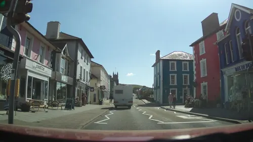
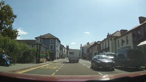
Big Bite
Restaurant · Burger, Coffee Shop, Ice Cream, Fish And Chips
Mo-Su 09:00-20:30




12 more on the map.
History
In 1800, there was no significant coastal settlement here. The present town was planned and developed from 1805 by the Rev. Alban Thomas Jones Gwynne. He built a harbour which operated as a port and supported a shipbuilding industry in the 19th century. A group of workmen's houses and a school were built on the harbour's north side, but these were reclaimed by the sea. Steam ships continued to visit the harbour until the 1920s but, in later years, it evolved into a small half-tide harbour for recreational craft. The estuary is also crossed by a wooden pedestrian bridge.
Crafts were an important part of village life in the 19th century. Information recorded in trade directories shows that in 1830, although it was not yet fully developed as a port, in Aberaeron there were one woollen manufacturer, one bootmaker, one baker, one corn miller, one blacksmith, one blacksmith and shovel maker, two shipwrights, one carpenter and one hatmaker.
In the late 1890s, a hand-powered cable car, the Aeron Express, was built to ferry workers across the harbour when the bridge was demolished by floods. The structure was recreated in 1988 as a tourist attraction that ran until the end of summer 1994, when it was closed under health and safety regulations.
Read more of the history
The architecture of Aberaeron is unusual for this part of rural Wales, being constructed around a principal square, Alban Square, of Regency style buildings grouped around the harbour. This was the work of Edward Haycock Sr., an architect from Shrewsbury. His designs also included the former Aberaeron Town Hall, which was completed in 1846 and became County Hall, Aberaeron in 1910. Some of the architecture was of sufficient interest to feature on British postage stamps.
Aberaeron Golf Club was founded in 1923. It continued until the Second World War, when the course was turned over to agriculture to aid the war effort. Post-war attempts to reinstate the club failed.
From the History section of Aberaeron on Wikipedia, under CC BY-SA 4.0.
More about Aberaeron
Education
The town and surrounding areas are served by Ysgol Gyfun Aberaeron, a bilingual secondary comprehensive school. Although there is no provision for higher education in the town, three university towns are within easy travelling range: Aberystwyth (13 mi (21 km) away), and the Lampeter (16 mi (26 km)) and Carmarthen (33 mi (53 km)) sites of the University of Wales Trinity Saint David.
From the Wikipedia article Aberaeron, under CC BY-SA 4.0.
Notable people from Aberaeron
 Josh TarlingBritish cyclistPhoto: Nicola, CC BY-SA 4.0
 John Aeron ThomasBritish politician (1850-1935)Photo: Cartŵn gan WT o ffotograff gan H A Chapman, Public domain
- Ron DaviesBritish photographer (1921-2013)
- Caryl LewisWelsh author
- Cynan JonesWelsh writer (1975-)
- Jenkin Alban DaviesWelsh rugby union player (1885–1976)
- David Lewis JonesWelsh historian and Librarian of the House of Lords
- Cooke DaviesCanadian politician
Born in Aberaeron, according to Wikidata (CC0). Each name links to its Wikipedia article.
Where to stay9
Churches and places of worship8
Shopping8
Gas and EV charging1
Schools, colleges and libraries4
Healthcare4
Map of Aberaeron
67 places. The map loads OpenStreetMap tiles when you open it.
Getting there and nearby towns
Haverfordwest Airport (HAW) is the nearest airport with scheduled flights listed in OpenStreetMap, 41 miles away.
- Lampeter 12 mi southeast, about 19 min by car
- Llanilar 13 mi northeast, about 20 min by car
- Aberystwyth 14 mi northeast, about 23 min by car
- Llandysul 14 mi south, about 23 min by car
- Tregaron 14 mi east, about 22 min by car
- Aberporth 14 mi southwest, about 23 min by car
- Llangeler 16 mi south, about 25 min by car
- Newcastle Emlyn 17 mi southwest, about 27 min by car
- Bow Street 17 mi northeast, about 27 min by car
- Cardigan 20 mi southwest, about 33 min by car
Drive times are estimates from straight-line distance, not routes.
Towns near Aberaeron


Keep exploring
Local news
Headlines from INDB.
Reviews, tips and questions
Loading what members have shared...
Sources and licences
- GeoNames (CC BY 4.0): population, coordinates, regions and time zone
- Mapillary (see each image): photos
- OpenStreetMap contributors (ODbL 1.0): places, airports, map data
- Wikidata (CC0 1.0): elevation, founding date, time zone, website, landmarks and historic places
- Wikimedia Commons (see each image): photos
- Wikipedia (CC BY-SA 4.0): overview and history text
Photo credits
- Aberaeron, Ceredigion, Cymru (Wales) - Gorllewin Cymru Forol - SAC Special Areas of Conservation 82, Llywelyn2000, CC BY-SA 4.0
- Aberaeron - panoramio (14), Tanya Dedyukhina, CC BY 3.0
- TrawsCymru T5 bus at Aberaeron (18990505322), Ed Webster, CC BY 2.0
- Aberaeron - panoramio (16), Tanya Dedyukhina, CC BY 3.0
- Aberaeron, Ceredigion, Cymru (Wales) - Gorllewin Cymru Forol - SAC Special Areas of Conservation 130, Llywelyn2000, CC BY-SA 4.0
- Aberaeron, Ceredigion, Cymru (Wales) - Gorllewin Cymru Forol - SAC Special Areas of Conservation 62, Llywelyn2000, CC BY-SA 4.0
- Aberaeron, Ceredigion, Cymru (Wales) - Gorllewin Cymru Forol - SAC Special Areas of Conservation 144, Llywelyn2000, CC BY-SA 4.0
- Aberaeron, Ceredigion, Cymru (Wales) - Gorllewin Cymru Forol - SAC Special Areas of Conservation 68, Llywelyn2000, CC BY-SA 4.0
- Aberaeron, Ceredigion, Cymru (Wales) - Gorllewin Cymru Forol - SAC Special Areas of Conservation 02, Llywelyn2000, CC BY-SA 4.0
- Aberaeron, Ceredigion, Cymru (Wales) - Gorllewin Cymru Forol - SAC Special Areas of Conservation 11, Llywelyn2000, CC BY-SA 4.0
- Aberaeron, Ceredigion, Cymru (Wales) - Gorllewin Cymru Forol - SAC Special Areas of Conservation 149, Llywelyn2000, CC BY-SA 4.0
- Aberaeron, Ceredigion, Cymru (Wales) - Gorllewin Cymru Forol - SAC Special Areas of Conservation 15, Llywelyn2000, CC BY-SA 4.0
- Aberaeron, Ceredigion, Cymru (Wales) - Gorllewin Cymru Forol - SAC Special Areas of Conservation 118, Llywelyn2000, CC BY-SA 4.0
- Aberaeron, Ceredigion, Cymru (Wales) - Gorllewin Cymru Forol - SAC Special Areas of Conservation 39, Llywelyn2000, CC BY-SA 4.0
- Aberaeron, Ceredigion, Cymru (Wales) - Gorllewin Cymru Forol - SAC Special Areas of Conservation 19, Llywelyn2000, CC BY-SA 4.0
- Aberaeron, Ceredigion, Cymru (Wales) - Gorllewin Cymru Forol - SAC Special Areas of Conservation 142, Llywelyn2000, CC BY-SA 4.0
- Aberaeron, Ceredigion, Cymru (Wales) - Gorllewin Cymru Forol - SAC Special Areas of Conservation 48, Llywelyn2000, CC BY-SA 4.0
- Aberaeron, Ceredigion, Cymru (Wales) - Gorllewin Cymru Forol - SAC Special Areas of Conservation 110, Llywelyn2000, CC BY-SA 4.0
- Aberaeron, Ceredigion, Cymru (Wales) - Gorllewin Cymru Forol - SAC Special Areas of Conservation 143, Llywelyn2000, CC BY-SA 4.0
- Aberaeron, Ceredigion, Cymru (Wales) - Gorllewin Cymru Forol - SAC Special Areas of Conservation 98, Llywelyn2000, CC BY-SA 4.0
- Aberaeron, Ceredigion, Cymru (Wales) - Gorllewin Cymru Forol - SAC Special Areas of Conservation 49, Llywelyn2000, CC BY-SA 4.0
- Aberaeron, Ceredigion, Cymru (Wales) - Gorllewin Cymru Forol - SAC Special Areas of Conservation 32, Llywelyn2000, CC BY-SA 4.0
- Aberaeron, Ceredigion, Cymru (Wales) - Gorllewin Cymru Forol - SAC Special Areas of Conservation 60, Llywelyn2000, CC BY-SA 4.0
- Aberaeron, Ceredigion, Cymru (Wales) - Gorllewin Cymru Forol - SAC Special Areas of Conservation 151, Llywelyn2000, CC BY-SA 4.0
- Aberaeron, Ceredigion, Cymru (Wales) - Gorllewin Cymru Forol - SAC Special Areas of Conservation 42, Llywelyn2000, CC BY-SA 4.0
- Aberaeron, Ceredigion, Cymru (Wales) - Gorllewin Cymru Forol - SAC Special Areas of Conservation 89, Llywelyn2000, CC BY-SA 4.0
- Aberaeron, Ceredigion, Cymru (Wales) - Gorllewin Cymru Forol - SAC Special Areas of Conservation 146, Llywelyn2000, CC BY-SA 4.0
- Aberaeron, Ceredigion, Cymru (Wales) - Gorllewin Cymru Forol - SAC Special Areas of Conservation 119, Llywelyn2000, CC BY-SA 4.0
- Aberaeron, Ceredigion, Cymru (Wales) - Gorllewin Cymru Forol - SAC Special Areas of Conservation 75, Llywelyn2000, CC BY-SA 4.0
- Aberaeron, Ceredigion, Cymru (Wales) - Gorllewin Cymru Forol - SAC Special Areas of Conservation 50, Llywelyn2000, CC BY-SA 4.0
- Aberaeron, Ceredigion, Cymru (Wales) - Gorllewin Cymru Forol - SAC Special Areas of Conservation 79, Llywelyn2000, CC BY-SA 4.0
- Aberaeron, Ceredigion, Cymru (Wales) - Gorllewin Cymru Forol - SAC Special Areas of Conservation 132, Llywelyn2000, CC BY-SA 4.0
- Aberaeron, Ceredigion, Cymru (Wales) - Gorllewin Cymru Forol - SAC Special Areas of Conservation 116, Llywelyn2000, CC BY-SA 4.0
- Aberaeron, Ceredigion, Cymru (Wales) - Gorllewin Cymru Forol - SAC Special Areas of Conservation 136, Llywelyn2000, CC BY-SA 4.0
- Aberaeron, Ceredigion, Cymru (Wales) - Gorllewin Cymru Forol - SAC Special Areas of Conservation 96, Llywelyn2000, CC BY-SA 4.0
- No.22 Market Street (Castle Hotel), Jason.nlw, CC BY-SA 3.0
- No.10 Market Street, Jason.nlw, CC BY-SA 3.0
- Prince of Wales (pub), Jason.nlw, CC BY-SA 3.0
- Tabernacl Chapel (2), Jason.nlw, CC BY-SA 3.0
- Peniel Welsh Independent Chapel (2), GeraintTudur2, CC BY-SA 3.0
- The Cellar, PKwicipics, CC BY-SA 3.0
- Holy Trinity Parish Church, Aberaeron, Cymru, Wales 01, Llywelyn2000, CC BY-SA 4.0
- Gallery Gwyn Aberaeron, Sionk, CC BY 4.0
- Street-level photo, southglos, CC BY-SA 4.0
- Street-level photo, southglos, CC BY-SA 4.0
- Street-level photo, southglos, CC BY-SA 4.0
- Street-level photo, toho, CC BY-SA 4.0
- Street-level photo, southglos, CC BY-SA 4.0
- Street-level photo, southglos, CC BY-SA 4.0
- Street-level photo, southglos, CC BY-SA 4.0
- Street-level photo, southglos, CC BY-SA 4.0
- Street-level photo, southglos, CC BY-SA 4.0
- Street-level photo, toho, CC BY-SA 4.0
- Street-level photo, southglos, CC BY-SA 4.0
- Street-level photo, southglos, CC BY-SA 4.0
- Street-level photo, southglos, CC BY-SA 4.0
- Street-level photo, southglos, CC BY-SA 4.0


Page built November 10, 2026. Spotted a mistake? Tell us or suggest a place.