


Why visit Llandysul
Townapedia lists 18 museums and landmarks, 5 parks and trails, 13 places to eat, 3 places to stay and 1 attraction in and around town.
Highlights include West Wales Museum of Childhood and National Wool Museum.
Weather in Llandysul
Forecast from MET Norway (CC BY 4.0). Full forecast
About Llandysul
Llandysul, also spelt Llandyssul, is a town and community in the county of Ceredigion, Wales. As a community it consists of the townships of Capel Dewi, Horeb, Pontsian, Pren-gwyn, Tregroes, Rhydowen and the town of Llandysul itself. Llandysul lies in south Ceredigion in the valley of the River Teifi and is visited for its fishing and canoeing. The community had a population of 2732, as of 2011.
From the Wikipedia article Llandysul (this version), under CC BY-SA 4.0.
Travel tips from other travellers: Llandysul on Wikivoyage (CC BY-SA 4.0).
Photos of Llandysul


Things to do1

Museums and landmarks18

West Wales Museum of Childhood
Museum · 3.2 mi
Toy museum in Carmarthenshire, Wales
Mo,Tu,Th-Su 10:00-18:00

National Wool Museum
Museum · 4.0 mi
Museum of the woollen industry in Dre-fach Felindre, Wales, United Kingdom
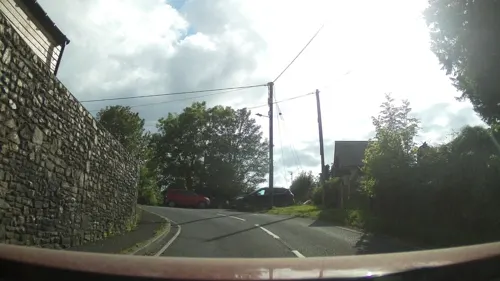
Ulcagnus Stone
Monument and historic site · 2.4 mi
Inscribed stone (Ulcagnus Stone) and cross-incised gravestone, both mortared into the floor next to the internal face of the E wall of...

Capel Eidalwyr
Museum · Roman Catholic · 3.8 mi
Former Prisoner of War dormitory, converted into a Roman Catholic chapel by the prisoners.

6 more on the map.
Parks, trails and playgrounds5

Penwern Saron Golf Course
Golf course · 3.4 mi
Penwern, Saron


Restaurants and cafes13
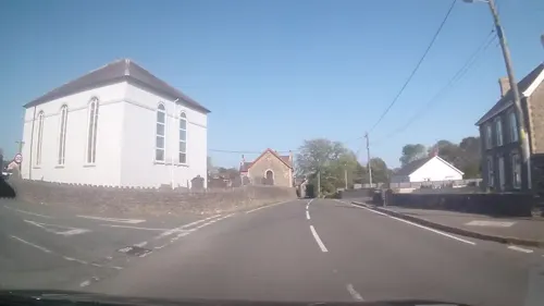


Tafarn John Y Gwas
Bar and pub · 4.2 mi
Mo-Fr 16:00-22:00; Sa-Su 12:00-22:00

The Red Lion
Bar and pub · 4.0 mi
Mo-Th 16:00-23:00; Fr 16:00-01:30; Sa 14:00-01:30; Su 12:00-22:00
1 more on the map.
History
Pencoedfoel is an Iron Age hillfort one mile northeast of Llandysul. An oval banked and ditched enclosure with double ramparts, about 160 by 128 metres (525 by 420 ft), is defined by degraded banks and scarps on the summit of an isolated hill. Two halves of a bronze collar were found near here, possibly dating to the late 1st century BC or early 1st century AD.
The oldest building in the town is the church which dates from the 13th century. It as built on the site of the original church from the 6th century. Saint Tysul was the grandson of Ceredig ap Cunedda (hence the name Ceredigion) and a cousin of St David. Fairs and markets were established by the Kings of England and the Edwardian marcher lords who captured these lands from the native rulers between the 12th and 14th centuries. Owain Glyndŵr is associated with the town. The men of Llandysul supported him in battle in 1400 and afterwards his lands around Llandysul were confiscated by Henry IV.
In 1644, during the English Civil War, the Royalist army was defending Ceredigion against the Parliamentary army. One of the three arches of the bridge at Llandysul was pulled down by the Royalists to prevent the Parliamentarians crossing into Ceredigion. The bridge was later rebuilt with a single arch.
Read more of the history
The Teifi Valley around Llandysul was the home of the Welsh woollen industry. Many sheep were reared locally and there were plenty of fast-flowing streams to power machinery so many woollen mills were established in the area in the 19th century. There was also a flannel shirt factory in the town at that time. The mills had nearly all been closed by the end of the 20th century as cheaper textiles became available from the Far East.
The Gomer Press (Welsh: Gwasg Gomer) was founded by John David Lewis (1859–1914). He started by selling books from a corner of his father's grocery store before establishing the press in 1892. It is now a thriving printing company and the largest publishing house in Wales and moved to new premises just outside the town in 2004. It publishes titles for both adults and children, in English and in Welsh. The present managing director, Jonathan Lewis, is the great-grandson of the founder.
From the History section of Llandysul on Wikipedia, under CC BY-SA 4.0.
More about Llandysul
Economy
There is little industry in Llandysul today. The woollen mills are closed and used for other purposes; one housed a confectionery distribution business which is now defunct, and the building currently lies empty. There was a fortnightly livestock market until 2008 when the site became part of the new Llandysul bypass. Tourism draws people into West Wales but Llandysul largely misses out from this source of income as it has no specific tourist attractions.
Llandysul was a railway station on the Newcastle Emlyn branch, opened in 1864 and closed to passengers in 1952.
Telynau Teifi Harps was a community business set up with help from Ceredigion County Council and the European Union in 2004 by harp-maker Allan Shiers. It was the only harp-making business in Wales, a country with a traditional association with the instrument. Celtic and folk harps were made here and the entire manufacturing process took place on the site. The business closed in 2022, with its empty building making national news in 2024 as the unexpected base of an illegal cannabis farm containing plants worth a reported £2 million. Shortly after the operation was shut down by the police, the building caught fire twice, causing major damage to the former primary school.
Arts and culture
The Memorial Park is a recreation area in a loop of the River Teifi. There is a children's playground, a tennis club, a bowling club and sports pitches. Llandysul Cricket Club and Llandysul Football Club play here. The cricket club fields two sides in the South Wales Cricket Association (Division One and Division Six) and has a thriving youth section. The football club likewise fields two teams in Division One and Two of the Ceredigion League and were league champions in 2016–17 as well as winners of the J. Emrys Morgan Cup.
Tysul Hall was built in 1955 as a memorial to the men lost in two world wars. It can seat 400 people and events and meetings are held there.
Llandysul has a post office, two chemists, a range of other shops, a church, several chapels and a leisure centre with swimming pool. The last of four major banks in Llandysul closed in 2017.
Llandysul Angling Association owns the rights to over 30 miles of fishing on the River Teifi which is a river noted for its salmon, sea trout and trout.
Llandysul Paddlers is a nonprofit making association which works with young people from the community and across the whole of the UK. They deliver sessions on kayaking, whitewater rafting and canoeing; away from the water they deliver sessions about climbing and mountain biking and help local schools in their delivery of the DofE scheme.
Education
There were two schools in the town; Ysgol Dyffryn Teifi, a bilingual comprehensive school with over 500 pupils, and Ysgol Gynradd Llandysul, a bilingual primary school. Both were closed in 2016 due to the opening of a new super school Ysgol Bro Teifi.
Llandysul Paddlers also works as an education centre delivering sessions to young people and adults and has a number of full-time trained teachers working for them.
From the Wikipedia article Llandysul, under CC BY-SA 4.0.
Notable people from Llandysul
 Iolo Ceredig JonesWelsh chess player (1947–2021)Photo: Oergell, CC BY-SA 3.0
 Abel DaviesWelsh rugby union playerPhoto: Herald of Wales and Monmouthshire Recorder, Public domain
- Christmas EvansWelsh minister (1766–1838)
- Fflur DafyddWelsh novelist, academic and musician
- David Bevan JonesBritish minister
- John DaviesWelsh footballer
- John Park DaviesWelsh Unitarian minister (1879-1937)
- John DaviesWelsh bibliographer and genealogist (1860-1939)
- Hywel DaviesWelsh broadcaster
Born in Llandysul, according to Wikidata (CC0). Each name links to its Wikipedia article.
Where to stay3
Churches and places of worship19
Shopping6
Gas and EV charging2
Schools, colleges and libraries5
Healthcare1
Map of Llandysul
73 places. The map loads OpenStreetMap tiles when you open it.
Getting there and nearby towns
Haverfordwest Airport (HAW) is the nearest airport with scheduled flights listed in OpenStreetMap, 31 miles away.
- Llangeler 3 mi west, about 5 min by car
- Newcastle Emlyn 7 mi west, about 11 min by car
- Carmarthen 13 mi south, about 21 min by car
- Saint Clears 17 mi southwest, about 28 min by car
- Pontyberem 19 mi south, about 31 min by car
- Whitland 20 mi southwest, about 32 min by car
- Tregaron 20 mi northeast, about 32 min by car
- Ammanford 22 mi southeast, about 35 min by car
- Llanelli 26 mi south, about 41 min by car
- Aberystwyth 28 mi north, about 44 min by car
Drive times are estimates from straight-line distance, not routes.
Towns near Llandysul


Keep exploring
Local news
Headlines from INDB.
Reviews, tips and questions
Loading what members have shared...
Sources and licences
- GeoNames (CC BY 4.0): population, coordinates, regions and time zone
- Mapillary (see each image): photos
- OpenStreetMap contributors (ODbL 1.0): places, airports, map data
- Wikidata (CC0 1.0): elevation, founding date, time zone, website, landmarks and historic places
- Wikimedia Commons (see each image): photos
- Wikipedia (CC BY-SA 4.0): overview and history text
Photo credits
- Llandysul, Breckenheimer, Public domain
- Richmond House Llandysul, Sionk, CC BY-SA 4.0
- No 5 Barley Mow Llandysul, Sionk, CC BY-SA 4.0
- Spar Supermarket Llandysul, Sionk, CC BY-SA 4.0
- Allied Pharmacy Llandysul, Sionk, CC BY-SA 4.0
- Llandysul-panorama, Marion Phillips, CC BY-SA 2.0
- Meddygfa Teifi Llandysul, Sionk, CC BY-SA 4.0
- Gorsaf Heddlu Llandysul, Sionk, CC BY-SA 4.0
- Kings Arms Llandysul, Sionk, CC BY-SA 4.0
- Old Vicarage Llandysul, Sionk, CC BY-SA 4.0
- Lych Gate Llandysul, Sionk, CC BY-SA 4.0
- High Street Llandysul (2), Sionk, CC BY-SA 4.0
- Teifi Units Llandysul, Sionk, CC BY-SA 4.0
- High Street Llandysul (1), Sionk, CC BY-SA 4.0
- St Tysul Church Llandysul, Sionk, CC BY-SA 4.0
- Lilac house on Church Street Llandysul, Sionk, CC BY-SA 4.0
- Teddyanddollincar, SELF, CC BY-SA 3.0
- Welsh National Wool Museum, David Gearing, CC BY-SA 2.0
- Church Of St Michael (2), Morfuddnia, CC BY-SA 3.0
- Carmel Welsh Independent Chapel (5), GeraintTudur2, CC BY-SA 3.0
- Gwyddgrug Welsh Independent Chapel, Morfuddnia, CC BY-SA 3.0
- Street-level photo, trigpoint, CC BY-SA 4.0
- Street-level photo, southglos, CC BY-SA 4.0
- Street-level photo, trigpoint, CC BY-SA 4.0
- Street-level photo, southglos, CC BY-SA 4.0
- Street-level photo, southglos, CC BY-SA 4.0
- Street-level photo, toho, CC BY-SA 4.0
- Street-level photo, southglos, CC BY-SA 4.0


Page built November 10, 2026. Spotted a mistake? Tell us or suggest a place.