


Newcastle Emlyn, United Kingdom
Newcastle Emlyn is a town of 1,883 people in Wales, United Kingdom.
Why visit Newcastle Emlyn
Townapedia lists 7 museums and landmarks, 5 parks and trails, 21 places to eat, 2 places to stay and 5 attractions in and around town.
Highlights include Cenarth Bridge, Cenarth Falls, Newcastle Emlyn Castle and National Wool Museum.
Weather in Newcastle Emlyn
Forecast from MET Norway (CC BY 4.0). Full forecast
About Newcastle Emlyn
Newcastle Emlyn (Welsh: Castellnewydd Emlyn) is a town and community on the River Teifi, in West Wales. The community is wholly in Carmarthenshire, but the built up area also includes Adpar north of the Teifi, which is in Ceredigion. Adpar was formerly called Trefhedyn and was historically a borough in its own right. Newcastle Emlyn grew around its castle, which dates from the 13th century.
From the Wikipedia article Newcastle Emlyn (this version), under CC BY-SA 4.0.
Travel tips from other travellers: Newcastle Emlyn on Wikivoyage (CC BY-SA 4.0).
Things to do5


Cenarth Falls
Waterfall · 2.5 mi
Waterfall on the boundary of Ceredigion and Carmarthenshire, Wales, UK

Museums and landmarks7

Newcastle Emlyn Castle
Monument and historic site
Castle in Newcastle Emlyn, Carmarthenshire, Wales, UK

National Wool Museum
Museum · 3.0 mi
Museum of the woollen industry in Dre-fach Felindre, Wales, United Kingdom


Newcastle Emlyn Power Station
Monument and historic site
Water powered corn mill converted into a power station by Mr R.J. Parkington in 1908 by installing two Gilkes turbines to drive two d.c....
Parks, trails and playgrounds5

Gerddi Plonovez Porzay
Park · 0.4 mi
Garden commemorating twinning of Newcastle Emlyn with Plonévez-Porzay in France.
Restaurants and cafes21
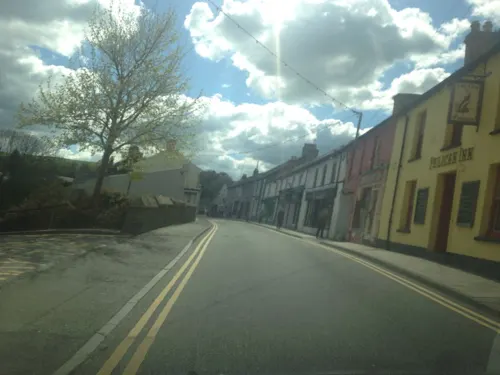
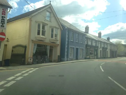
Nahar Indian Cuisine
Restaurant · Indian, Bangladeshi
Sgwâr y Farchnad, Newcastle Emlyn
Mo-Th 17:00-22:30; Fr-Sa 17:00-23:00; Su 17:00-22:30
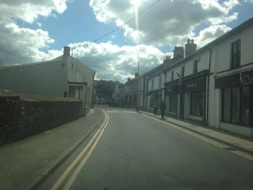
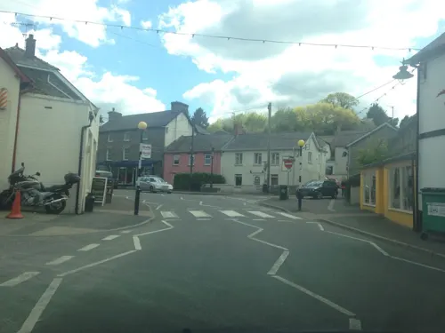
Plough Hotel
Bar and pub
Emlyn Square, Newcastle Emlyn
Mo-Th 12:00-23:00; Fr 10:00-00:00; Sa-Su 12:00-23:00
The Three Compasses
Bar and pub
Sycamore Street, Newcastle Emlyn
Mo-Tu 10:00-00:00; We 12:00-00:00; Th 10:00-00:00; Fr 10:00-01:00;...
Y Bistro
Restaurant
Bridge Street, Newcastle Emlyn
Mo-Tu 18:00-21:00; We-Sa 10:00-15:00,18:00-21:00; Su...
ButterfliesTea Room
Cafe · Cake
Emlyn Square, Newcastle Emlyn
Mo-Sa 11:00-17:00
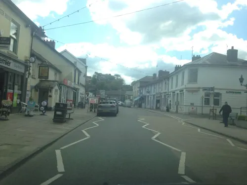
Teifi Chips @ Caffi Emlyn
Cafe · Fish And Chips
11 Sycamore Street, Newcastle Emlyn
Mo 16:00-20:30; Tu 11:00-20:30; We-Sa 11:30-22:00
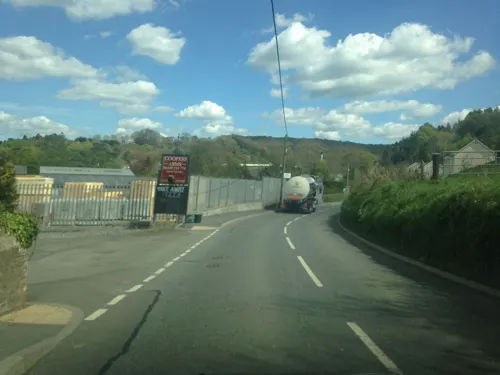
The Coopers Arms
Bar and pub · 0.4 mi
Station Road, Newcastle Emlyn
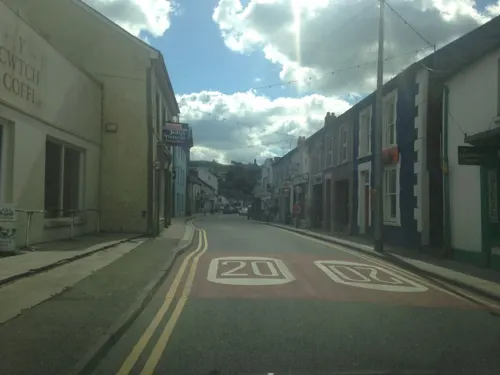
Y Cwtch Coffi
Cafe · Cake
Sycamore Street, Newcastle Emlyn
Mo-Sa 08:30-16:00
9 more on the map.
History
The town takes its name from the cantref of Emlyn, an administrative district in medieval Dyfed.
Newcastle Emlyn Castle, was first mentioned in Brut y Tywysogion in 1215, when it was seized by Llewelyn the Great (Welsh: Llywelyn Fawr). It was captured by the Welsh during the revolt of 1287–1288 and also by Owain Glyndŵr in 1403.
The Teifi Valley Railway is nearby, although the town has not had a passenger train service since 1952.
From the History section of Newcastle Emlyn on Wikipedia, under CC BY-SA 4.0.
More about Newcastle Emlyn
Economy
In 1932, the former Co-operative creamery was reopened by Dried Milk Products to make cheese. After a new parent firm, Unigate, decided to sell off its non-milk related dairies, it was bought by the Milk Marketing Board in 1979, but closed again in 1983.
Education
Newcastle Emlyn has a secondary school, Ysgol Gyfun Emlyn. The town's attractions include an art gallery, the Attic Theatre company and the National Woollen Museum.
From the Wikipedia article Newcastle Emlyn, under CC BY-SA 4.0.
Notable people from Newcastle Emlyn
 T. James JonesWelsh poet, scriptwriter and former ArchdruidPhoto: Jac y Jwc, CC BY 3.0
 Helen ThomasWelsh peace campaignerPhoto: Pam Brophy, CC BY-SA 2.0
- Allen RaineWelsh novelist (1836–1908)
- Dill JonesWelsh pianist (1923–1984)
- Gareth ThomasWelsh rugby player, born 1993
- Caio JamesWelsh rugby union player (born 2006)
Born in Newcastle Emlyn, according to Wikidata (CC0). Each name links to its Wikipedia article.
Where to stay2
Churches and places of worship8
The Church of Jesus Christ of Latter-day Saints
Church · Latter Day Saints · 0.6 mi
Shopping11
Gas and EV charging1
Schools, colleges and libraries3
Healthcare2
Map of Newcastle Emlyn
65 places. The map loads OpenStreetMap tiles when you open it.
Getting there and nearby towns
Haverfordwest Airport (HAW) is the nearest airport with scheduled flights listed in OpenStreetMap, 25 miles away.
- Carmarthen 15 mi southeast, about 23 min by car
- Saint Clears 15 mi south, about 25 min by car
- Whitland 17 mi southwest, about 27 min by car
- Pontyberem 22 mi southeast, about 36 min by car
- Saundersfoot 25 mi southwest, about 40 min by car
- Ammanford 27 mi southeast, about 43 min by car
- Haverfordwest 27 mi southwest, about 44 min by car
- Tenby 27 mi south, about 44 min by car
- Llanelli 28 mi southeast, about 45 min by car
- Aberystwyth 31 mi northeast, about 49 min by car
Drive times are estimates from straight-line distance, not routes.
Towns near Newcastle Emlyn


Keep exploring
Local news
Headlines from INDB.
Reviews, tips and questions
Loading what members have shared...
Sources and licences
- GeoNames (CC BY 4.0): population, coordinates, regions and time zone
- Mapillary (see each image): photos
- OpenStreetMap contributors (ODbL 1.0): places, airports, map data
- Wikidata (CC0 1.0): elevation, founding date, time zone, website, landmarks and historic places
- Wikimedia Commons (see each image): photos
- Wikipedia (CC BY-SA 4.0): overview and history text
Photo credits
- Castellnewydd Emlyn, Trehywel, CC BY-SA 4.0
- Cenarth Falls West Wales, Alexander Walsh, CC BY 3.0
- Welsh National Wool Museum, David Gearing, CC BY-SA 2.0
- Ebeneser Independent Chapel (1), GeraintTudur2, CC BY-SA 3.0
- Cenarth Bridge & Cottage, Gary Beale, CC BY-SA 4.0
- Newcastle Emlyn Castle, Jeffpmcdonald, CC BY-SA 4.0
- Street-level photo, jih, CC BY-SA 4.0
- Street-level photo, jih, CC BY-SA 4.0
- Street-level photo, jih, CC BY-SA 4.0
- Street-level photo, jih, CC BY-SA 4.0
- Street-level photo, jih, CC BY-SA 4.0
- Street-level photo, jih, CC BY-SA 4.0
- Street-level photo, jih, CC BY-SA 4.0
- Street-level photo, jih, CC BY-SA 4.0
- Street-level photo, jih, CC BY-SA 4.0
- Street-level photo, jih, CC BY-SA 4.0
- Street-level photo, jih, CC BY-SA 4.0
- Street-level photo, jih, CC BY-SA 4.0
- Street-level photo, jih, CC BY-SA 4.0
- Street-level photo, jih, CC BY-SA 4.0
- Street-level photo, jih, CC BY-SA 4.0
- Street-level photo, jih, CC BY-SA 4.0
- Street-level photo, jih, CC BY-SA 4.0
- Street-level photo, jih, CC BY-SA 4.0
- Street-level photo, jih, CC BY-SA 4.0
- Street-level photo, jih, CC BY-SA 4.0
- Street-level photo, jih, CC BY-SA 4.0
- Street-level photo, jih, CC BY-SA 4.0
- Street-level photo, jih, CC BY-SA 4.0
- Street-level photo, jih, CC BY-SA 4.0
- Street-level photo, jih, CC BY-SA 4.0
- Street-level photo, jih, CC BY-SA 4.0
- Street-level photo, jih, CC BY-SA 4.0
- Street-level photo, jih, CC BY-SA 4.0
- Street-level photo, jih, CC BY-SA 4.0
Page built November 10, 2026. Spotted a mistake? Tell us or suggest a place.