
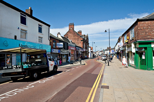


Atherton, United Kingdom
Atherton is a town of 22,000 people in England, United Kingdom.
Why visit Atherton
Townapedia lists 13 museums and landmarks, 14 parks and trails, 67 places to eat, 2 places to stay and 1 attraction in and around town.
Highlights include Tyldesley Little Theatre, OldBankStudio, Tyldesley Chapel and Pennington Flash Country Park.
Weather in Atherton
Forecast from MET Norway (CC BY 4.0). Full forecast
About Atherton
Atherton () is a town in the Metropolitan Borough of Wigan, Greater Manchester, England, historically part of Lancashire. It is 5 miles (8 km) south of Bolton, 7 miles (11 km) east of Wigan, and 10 miles (16 km) northwest of Manchester. During the Industrial Revolution, the town was a key part of the Manchester Coalfield.
From the Wikipedia article Atherton, Greater Manchester (this version), under CC BY-SA 4.0.
Photos of Atherton


Things to do1

Tyldesley Little Theatre
Cinema and theater · 1.2 mi
Theatre in Tyldesley, England
Lemon Street, Tyldesley
Museums and landmarks13

Lancashire Mining Museum
Museum · 2.7 mi
Mining museum in Greater Manchester, United Kingdom

New Hall moated site
Monument and historic site · 2.0 mi
Scheduled monument in Tyldesley, Greater Manchester, England, UK
Bedford Colliery
Monument and historic site · 1.4 mi
Former main site for Bedford Colliery.
Bedford Colliery/Gin Pit Colliery
Monument and historic site · 1.3 mi
Exact boundaries unknown at time of adding, area was larger than what i have mapped from the data i can find. Would appreciate...
1 more on the map.
Parks, trails and playgrounds14

Pennington Flash Country Park
Park · 3.4 mi
Park in Leigh, Greater Manchester, England, United Kingdom; surroundings of lake formed by mining subsidence frequented by birdwatchers
Public Toilets
Park · 1.4 mi
Toilet operated by volunteers. Open most week ends but limited openings during the week due risk of damage.
Sa-Su 10:30 - 16:30


2 more on the map.
Restaurants and cafes67
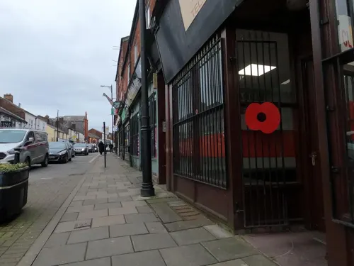


55 more on the map.
History
Atherton was recorded as Aderton in 1212 and 1242, and Atherton in 1259.
Opinions differ as to the derivation of the name. One is the farmstead or village of a man named Aethelhere, an Old English personal name and the suffix tun, meaning an enclosure, farmstead or manor estate; another is adre, Saxon for little brook with the suffix tun. Either is possible as Atherton is bounded by brooks to the west and south, and crossed by several others. The western boundary is Hindsford Brook, originally named Goderic Brook after a Saxon saint.
The Chow – recorded as Chew, Cholle and Chowl – family were tenants of the Athertons living at the valley by Chanters Brook. This part of the township became known as Chow's Bent but the meaning of Bent has been lost, perhaps a bend or slope. It was referred to in the 14th century as Chollebynt or Shollebent. Chowbent, or Bent, was the name given to the built-up part of Atherton from the mid-17th century for at least 300 years. As the population grew, the town was called Atherton, although the names Chowbent or Bent are used by locals.
Read more of the history
Evidence of a Roman road and Bronze Age settlement have been found in and around the area. The Roman road between Manchester and Wigan is shown on the 1849 6" OS map crossing Miller's Lane at 90 degrees about halfway down. The site of Gadbury Brickworks at Gibfield Colliery has been excavated, and evidence of Roman and possibly earlier settlements found.
The manor was held by the Atherton family from the de Botelers, whose chief manor was at Warrington. William and Nicholas Atherton fought at the Battle of Agincourt in 1415. The manor house was situated towards the south of the ancient township. Christopher Saxton's map shows a medieval deer park in the time of Elizabeth I. "Mad" Richard Atherton, the last direct male descendant of the Athertons is remembered for two events; his expulsion of the congregation from the first Atherton Chapel in 1721, and building Atherton Hall on a grand scale, to designs by architect William Wakefield. Work on the hall started in 1723 and was not finished until 1743. The carriage drive from the hall led over Lion's Bridge down an avenue to gates which faced the parish church in Leigh where the Athertons had a chapel. Richard Vernon Atherton was the last of the Atherton male line. He married Elizabeth Farington and had a daughter named Elizabeth.
The Atherton family's association with the township ended with Richard Atherton's death in 1726. His daughter, Elizabeth, married Robert Gwillym and their son, Robert Vernon Atherton, married Henrietta Maria Legh. They had five children; the sons died young, and their eldest daughter Henrietta Maria Atherton married Thomas Powys, 2nd Baron Lilford whose father was ennobled by Pitt the Younger in 1797, taking the title of Baron Lilford. He left his estates to his son, Thomas Atherton Powys. The Atherton estate was inherited by Lord Lilford, who preferred to live at his family seat, Lilford Hall in Northamptonshire. Lord Lilford could not afford the upkeep of another house and Atherton Hall was put up for sale but, after failing to sell, it was demolished in 1824. Some outbuildings were left standing and are private property still known as Atherton Hall.
The area was divided in its allegiance during the Civil War. In 1642, men of Chowbent were on their way to Leigh Church when word came that James Stanley, 7th Earl of Derby's Royalist troops were marching through Leigh, probably en route for Manchester. The men of Chowbent armed themselves and drove the Earl's men back to Lowton Common, killing some, wounding others and taking prisoner about 200 men: "... we are all upon our guard, and the Naylors of Chowbent, instead of making Nayles, have busied themselves making Bills and Battle Axes." (Civil War tracts of Lancashire, Chetham Society Series, vol II).
In 1715, during the Jacobite rising the supporters of the Old Pretender were marching on Preston. General Charles Wills wrote to Minister Wood of Atherton Chapel asking him to raise a force to be at Cuerden Green the following day, 12 November. Minister Wood led a force of Chowbent men who were given the job of guarding the bridge over the River Ribble at Walton-le-Dale and a ford at Penwortham, which they defended successfully. The Highlanders were routed, and for his efforts Parson James Wood was given a £100 annuity (equivalent to £18,900 in 2025) by Parliament and the title "The General" by his congregation.
Atherton, along with neighbouring Shakerley, was associated with coal mining and nail manufacture. Alexander Naylor was taxed on his goods in 1332, showing the industry was present for at least 600 years. Encouraged by the proximity of outcrops of coal, iron was brought from Derbyshire, Yorkshire and Spain. Several types of nails were made, including lath nails, slate nails, thatching nails and sparrowbills. The nail smithies manufactured ploughs and scythes; their products were taken by pack horse to be sold in Manchester, Denbigh, Clitheroe and Kendal. The nail industry developed into the manufacture of nuts and bolts. Thomas Blakemore was the first in 1843 and by 1853 there were eight manufacturers of nuts and bolts including James Prestwich and Robert Parker. Some nut and bolt manufacturers also made spindles and flyers for spinning machinery. Collier Brook Bolt Works on Bag Lane dating from 1856 survives and is a Grade II listed building.
From the History section of Atherton, Greater Manchester on Wikipedia, under CC BY-SA 4.0.
More about Atherton
Geography
At 53°31′23″N 2°29′44″W (53.5231°, −2.4955°), and 171 miles (275 km) northwest of central London, Atherton is situated 7 miles (11 km) east of Wigan and 10 miles (16 km) west-northwest of the city of Manchester, at the eastern end of the Metropolitan Borough of Wigan.
Atherton, which includes Hindsford to the southeast, Howe Bridge in the southwest, and Hag Fold in the north, is generally low lying. The soil is clay in much of the township. The southwest of the town is 100 feet (30 m) above sea level, rising to 250 feet (76 m) in the north. Atherton is built around seven brooks: the Shakerley Brook forms the western boundary with Tyldesley; Chanters Brook flows through the area known as "The Valley"; Knight's Brook (Bag Lane); Colliers Brook; Small Brook is the boundary with Westleigh; Westhoughton Brook forms the boundary with Daisy Hill; and Red Waters Brook. The underlying rocks are the coal measures of the Manchester Coalfield.
Atherton's climate is generally temperate, like the rest of Greater Manchester. The mean highest and lowest temperatures (13.2 °C (55.8 °F) and 6.4 °C (43.5 °F)) are slightly above the national average, while the annual rainfall (806.6 millimetres (31.76 in)) and average hours of sunshine (1394.5 hours) are respectively above and below the national averages.
Economy
Atherton is within the Manchester Travel to Work Area. The town is within the Manchester Larger Urban Zone.
At the time of the 2001 Census, there were 8,755 people (43.1%) in employment who were resident in Atherton. Of these, 19.65% worked in the wholesale and retail trades, including the repair of motor vehicles; 19.28% worked within the manufacturing industry, and 10.27% worked within the health and social work sector. The census recorded the economic activity of residents aged 16–74 as 36.7% in full-time employment, 11.0% in part-time employment, 6.8% self-employed, 4.0% unemployed, 1.7% students with jobs, 3.2% students without jobs, 14.6% retired, 6.5% looking after home or family, 11.8% permanently sick or disabled, and 3.8% economically inactive for other reasons. The 4.0% unemployment rate was high compared with the national rate of 3.3%. According to the Office for National Statistics estimates, during the period between April 2001 and March 2002, the average gross income of households was £380 per week (£19,760 per year), substantially less than the £470 per week (£24,440) for the rest of the North West. The average car ownership per household was 1.01, compared with 0.93 across the Greater Manchester Urban Area; 43.74% of households owned a single car or van, and 30.76% owned none.
Arts and culture
Atherton Botanical Garden Club, which is today a social club, was formed in 1850 and organised lectures, study groups and rambles on Chat Moss for its members. A public library was opened in 1905 with an Andrew Carnegie grant. Bent Chapel already had a library in the Chowbent School and donated 4,000 books to the new town library. Central Park, a 10-acre (4.0 ha) public park, was created in 1912. Other parks were later provided in Lodge Lane, Hindsford and Devonshire Place. The urban district council also acquired the grounds belonging to Howe Bridge Welfare in 1963. In the early and mid-20th century Atherton had three cinemas, the Gem in Bullough Street, the Savoy and the Palace on Market Street. An amateur photographic society was formed in 1938. Formby Hall, demolished in 2018, used to host the Bent 'n' Bongs Beer Festival over the last weekend of every January.
Education
The first school in Atherton was Chowbent Grammar School founded before 1654, followed by Chowbent Chapel School in 1734. Lane Top National School opened in 1840 and Chowbent Unitarian School and Hindsford St Anne's in 1860. Howe Bridge School opened in 1869 and St Philip's a year later. An undenominational school in Lee Street opened in 1871 followed by St George's and Sacred Heart School in Hindsford in 1873. In the 1890s, the technical school originally opened as a school for science and art, followed by St Richard's in 1891 and Flapper Fold Higher Grade School in 1893. Green Hall Special School opened in 1957, and a new infant school was opened on Lodge Lane for Sacred Heart. Meadowbank Primary School can also be found on Flapper Fold Lane, marking the boundary between Atherton and Hag Fold. Hesketh Fletcher Senior School opened in 1967 and closed on 31 August 2011. Atherton High School opened in 2012.
From the Wikipedia article Atherton, Greater Manchester, under CC BY-SA 4.0.
Notable people from Atherton
 Keely HodgkinsonEnglish athlete specialising in the 800 metres, born 2002Photo: Erik van Leeuwen, attribution: Erik..., CC BY-SA 4.0
 Laura WhiteEnglish singerPhoto: Pioneersbrog, CC BY-SA 3.0
 Ken RobertsEnglish rugby league footballer (1937-2017)Photo: Mr. Ken Roberts, CC BY-SA 3.0
 Edward RigbyBritish surgeonPhoto: Artist Joseph Clover, Public domain
 James Caldwell PrestwichBritish architect (1852–1940)Photo: William Thomas Pike (died 1924), Public domain
- Geoffrey UnsworthBritish cinematographer (1914-1978)
- Eric LaithwaiteBritish electrical engineer (1921–1997)
- Bob HaworthEnglish footballer (1897-1962)
- Billy ButlerEnglish footballer (1900-1966)
- Dennis ButlerEnglish football player and manager (born 1944)
- Arthur Aldredassociation football player (1919-2002)
- Herbert ButlerFootballer (born 1906)
Born in Atherton, according to Wikidata (CC0). Each name links to its Wikipedia article.
Where to stay2
Churches and places of worship30
Chowbent Unitarian Chapel
Church · Unitarian
Alderfold Street, Manchester
Shopping9
Gas and EV charging2
Schools, colleges and libraries19
Atherton St George's Church of England Primary School
School · Anglican · 0.4 mi
Derby Street, Manchester
St Richard's Roman Catholic Primary School
School · Roman Catholic · 0.4 mi
Flapper Fold Lane, Manchester
Healthcare7
Map of Atherton
164 places. The map loads OpenStreetMap tiles when you open it.
Getting there and nearby towns
Manchester Airport (MAN) is the nearest airport with scheduled flights listed in OpenStreetMap, 15 miles away.
- Westhoughton 2 mi northwest, about 3 min by car
- Little Hulton 3 mi east, about 5 min by car
- Hindley 4 mi west, about 6 min by car
- Farnworth 4 mi northeast, about 7 min by car
- Bolton 5 mi northeast, about 8 min by car
- Kearsley 5 mi east, about 7 min by car
- Golborne 5 mi southwest, about 9 min by car
- Ince-in-Makerfield 5 mi west, about 8 min by car
- Little Lever 5 mi northeast, about 9 min by car
- Wigan 6 mi west, about 10 min by car
Drive times are estimates from straight-line distance, not routes.
Towns near Atherton


Keep exploring
Local news
Headlines from INDB.
Reviews, tips and questions
Loading what members have shared...
Sources and licences
- GeoNames (CC BY 4.0): population, coordinates, regions and time zone
- Mapillary (see each image): photos
- OpenStreetMap contributors (ODbL 1.0): places, airports, map data
- Wikidata (CC0 1.0): elevation, founding date, time zone, website, landmarks and historic places
- Wikimedia Commons (see each image): photos
- Wikipedia (CC BY-SA 4.0): overview and history text
Photo credits
- Market Street, Atherton, Dave Green, CC BY-SA 2.0
- St John's Church, Atherton, Phil Platt, CC BY-SA 2.0
- St Anne's Church, Atherton, Margaret Clough, CC BY-SA 2.0
- Christ Church, Pennington, David Dixon, CC BY-SA 2.0
- St George, Tyldesley, north, J3Mrs ( talk ), CC BY-SA 3.0
- St James' Church, Daisy Hill, David Long, CC BY-SA 2.0
- St John's Mosley Common, J3Mrs, CC BY-SA 3.0
- Ellenbrook Chapel, Tony Smith, CC BY-SA 2.0
- St Mary's Church, Leigh, SMJ, CC BY-SA 2.0
- Chowbent Chapel, J3Mrs ( talk ), CC BY-SA 3.0
- Yorkshire Heritage Bus Company bus (3747 RH) 1963 AEC Bridgemaster Park Royal, 25 June 2011, Raymond Knapman (original file), cropped by User:Ultra7, CC BY-SA 2.0
- 20190815-Diamond-North-West-66918, Alex Noble, CC0
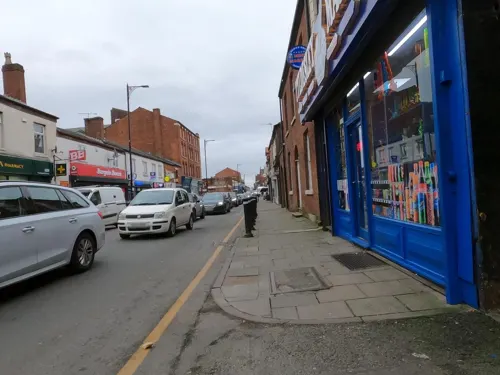
- Street-level photo, tonys999, CC BY-SA 4.0
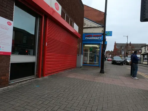
- Street-level photo, tonys999, CC BY-SA 4.0
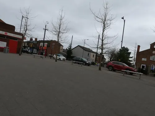
- Street-level photo, tonys999, CC BY-SA 4.0
- Street-level photo, tonys999, CC BY-SA 4.0
- Street-level photo, tonys999, CC BY-SA 4.0
- Street-level photo, tonys999, CC BY-SA 4.0
- Street-level photo, tonys999, CC BY-SA 4.0
- Street-level photo, tonys999, CC BY-SA 4.0
- Street-level photo, tonys999, CC BY-SA 4.0


Page built November 10, 2026. Spotted a mistake? Tell us or suggest a place.