


Why visit Abridge
Townapedia lists 9 museums and landmarks, 8 parks and trails, 11 places to eat and 1 place to stay in and around town.
Highlights include Brook Farmhouse, Hill Farmhouse, Chigwell Row Wood and Hainault Lodge.
Weather in Abridge
Forecast from MET Norway (CC BY 4.0). Full forecast
About Abridge
Abridge is a village in Essex, England. It is on the River Roding, 16 miles (26 km) southwest of the county town of Chelmsford. The village is in the district of Epping Forest and in the parliamentary constituency of Brentwood and Ongar. It is part of the civil parish of Lambourne and is served by Lambourne Parish Council.
From the Wikipedia article Abridge (this version), under CC BY-SA 4.0.
Museums and landmarks9

Hill Hall
Museum · 2.2 mi
Grade I listed country house in Theydon Mount, Essex, England, UK

Parks, trails and playgrounds8


Roding Valley Meadows
Park · 2.8 mi
Essex Wildlife Trust Nature reserve


Restaurants and cafes11
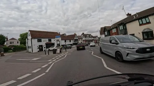
The New Boar
Restaurant · Regional, Burger, Sandwich, American, International
1 Market Place, Abridge
Mo-Th 12:00-23:00; Fr-Sa 12:00-00:00; Su 12:00-22:30




Where to stay1

History
Abridge lies on the historically important stagecoach route between London and Chipping Ongar and has been an important crossing point of the River Roding for many centuries. The boundary of the Conservation Area includes the historic core of the village which is evident on the Chapman and Andre Map of 1777. Originally in the parish of Lambourne, Holy Trinity Church was built in 1836; before this, parishioners had to walk three miles to Lambourne Church by a footpath. A Wesleyan chapel was built in Abridge in 1833; it became Congregational in 1844. The hymn tune "Abridge" by Isaac Smith 1734–1805 was named after the village.
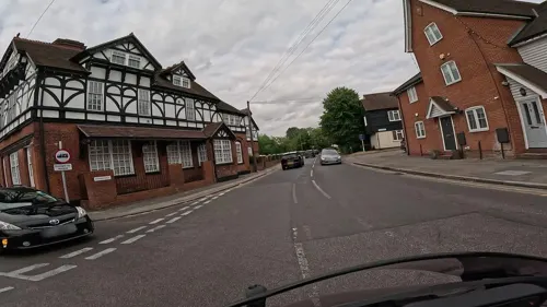
Listed buildings include the Blue Boar Inn (early 19th century), the group of medieval buildings that form the Roding Restaurant, the 18th-century house immediately northeast of the restaurant, Roding House (late medieval), River Cottage in Ongar Road, and the Maltsters Arms (18th century).
To the east of the village is Stapleford Aerodrome formerly RAF Stapleford Tawney of 11 Group east sector.
From the History section of Abridge on Wikipedia, under CC BY-SA 4.0.
More about Abridge
Geography
The village is in the southwest of the county, 16 miles (26 km) from Chelmsford. It is closer to London, being 14 miles (23 km) northeast of central London. It lies on the River Roding and is surrounded by a rural area. The nearest major settlements are Loughton 2.2 miles (3.5 km) to the West, Chigwell 2.4 miles (3.9 km) to the southwest and Theydon Bois 1.7 miles (2.7 km) north of the village.
It lies within the M25, and its closest major road link is the M11 motorway at junction 5 (towards London only). The main road that links the village with the M11 and Essex and London is the A113. Its nearest rail link is Theydon Bois tube station, on the Central line (London fare zone 6), 1.6 miles (2.6 km) to the north of the village. The 541 bus links the village with Loughton, Theydon Bois and Epping. It extends to Harlow on Sundays. On Mon-Fri, the 575 service links the town with Epping and Romford, though these buses are very infrequent.
From the Wikipedia article Abridge, under CC BY-SA 4.0.
Churches and places of worship3
Shopping6
Schools, colleges and libraries4
Healthcare1
Map of Abridge
43 places. The map loads OpenStreetMap tiles when you open it.
Getting there and nearby towns
London City Airport (LCY) is the nearest airport with scheduled flights listed in OpenStreetMap, 11 miles away.
- Chigwell 3 mi southwest, about 4 min by car
- Epping 3 mi north, about 5 min by car
- Buckhurst Hill 4 mi southwest, about 7 min by car
- Chingford 5 mi west, about 9 min by car
- Woodford Green 5 mi southwest, about 8 min by car
- Romford 6 mi southeast, about 9 min by car
- Waltham Abbey 6 mi northwest, about 10 min by car
- Goodmayes 6 mi south, about 10 min by car
- Snaresbrook 6 mi southwest, about 10 min by car
- Ilford 7 mi south, about 11 min by car
Drive times are estimates from straight-line distance, not routes.
Towns near Abridge


Keep exploring
Local news
Headlines from INDB.
Reviews, tips and questions
Loading what members have shared...
Sources and licences
- GeoNames (CC BY 4.0): population, coordinates, regions and time zone
- Mapillary (see each image): photos
- OpenStreetMap contributors (ODbL 1.0): places, airports, map data
- Wikidata (CC0 1.0): elevation, founding date, time zone, website, landmarks and historic places
- Wikimedia Commons (see each image): photos
- Wikipedia (CC BY-SA 4.0): overview and history text
Photo credits
- Abridge, Essex, John Winfield, CC BY-SA 2.0
- Chigwell Row Wood 4, Dudley Miles, CC BY-SA 3.0
- Hainault Lodge, Dudley Miles, CC BY-SA 3.0
- Havering Country Park 5, Dudley Miles, CC BY-SA 3.0
- Roding Valley Meadows 2, Dudley Miles, CC BY-SA 3.0
- Street-level photo, wasd42, CC BY-SA 4.0
- Street-level photo, essexboy, CC BY-SA 4.0
- Street-level photo, wasd42, CC BY-SA 4.0
- Street-level photo, wasd42, CC BY-SA 4.0
- Street-level photo, wasd42, CC BY-SA 4.0
- Street-level photo, wasd42, CC BY-SA 4.0
- Street-level photo, wasd42, CC BY-SA 4.0
- Street-level photo, essexboy, CC BY-SA 4.0
- Street-level photo, wasd42, CC BY-SA 4.0
- Street-level photo, wasd42, CC BY-SA 4.0
- Street-level photo, wasd42, CC BY-SA 4.0
- Street-level photo, wasd42, CC BY-SA 4.0
Page built November 10, 2026. Spotted a mistake? Tell us or suggest a place.