
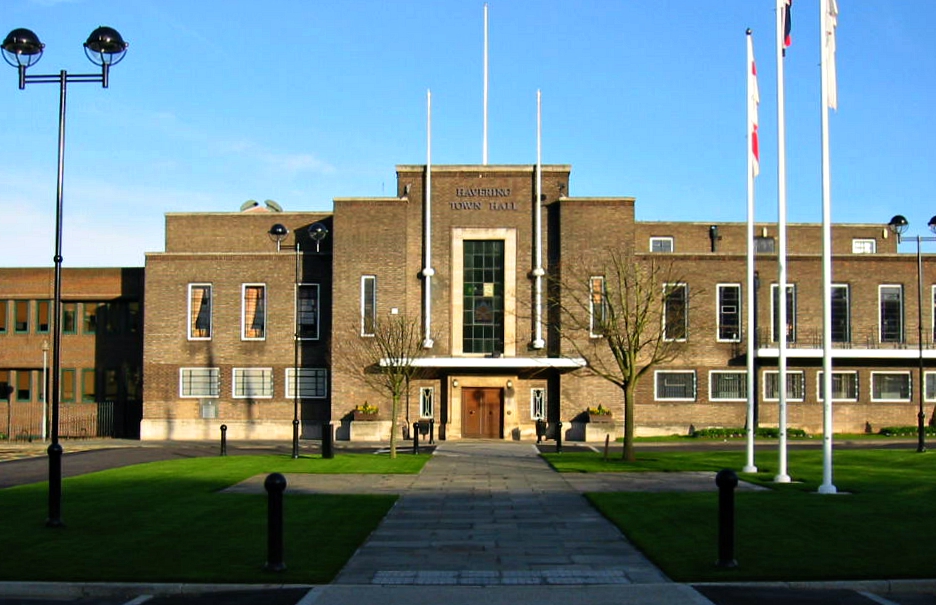


Why visit Romford
Townapedia lists 11 museums and landmarks, 43 parks and trails, 160 places to eat, 7 places to stay and 5 attractions in and around town.
Highlights include Brookside Theatre, Queen's Theatre, Havering Museum and Main Road.
Weather in Romford
Forecast from MET Norway (CC BY 4.0). Full forecast
About Romford
Romford is a large town in east London, England, located 14 mi (23 km) northeast of Charing Cross. Part of the London Borough of Havering, the town is one of the major metropolitan centres of Greater London identified in the London Plan.
From the Wikipedia article Romford (this version), under CC BY-SA 4.0.
Photos of Romford


Things to do5

Brookside Theatre
Cinema and theater
Theatre in Romford, London Borough of Havering, England

Queen's Theatre
Cinema and theater · 1.6 mi
Theatre in Hornchurch, Havering, London, England, UK


Museums and landmarks11



Upminster Tithe Barn
Monument and historic site · 3.1 mi
Historic building in London Borough of Havering, Greater London, England, UK

Upminster Tithe Barn Museum of Nostalgia
Museum · 3.1 mi
Museum in Upminster, London

Valence House Museum
Museum · 2.5 mi
Local museum within a medieval manor house in Dagenham, United Kingdom

RAF Hornchurch Heritage Centre
Museum · 2.4 mi
Aviation museum in England

Parks, trails and playgrounds43
Coronation Gardens
Park · 0.4 mi
Park in the London Borough of Havering, England, UK

Lodge Farm Park
Park · 0.5 mi
Park in the London Borough of Havering, England


Beam Valley Country Park
Park · 2.2 mi
Park in London Borough of Barking and Dagenham, United Kingdom

Bedfords Park
Park · 2.3 mi
Havering London Borough green landscape, also an Essex Wildlife Trust Nature reserve

Dagenham Village Churchyard
Park · 2.7 mi
Church in London Borough of Barking and Dagenham, UK



Hylands Park
Park · 0.7 mi
Park in the London Borough of Havering, England, UK
31 more on the map.
Restaurants and cafes160
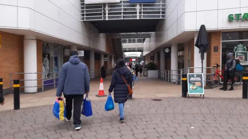
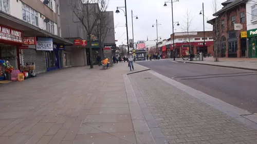
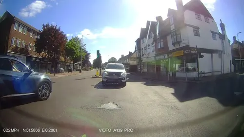
Costa
Cafe · Coffee Shop · 1.0 mi
83 Main Road, Romford
Mo-Su 07:30-17:00

Kervan Kitchen
Restaurant · Turkish · 0.9 mi
160A Balgores Lane, Gidea Park, Romford
Mo-Su 12:00-23:00
Robins Pie and Mash
Restaurant · Pie And Mash
40 South Street, Romford
Mo-Th 10:00-16:30; Fr-Sa 10:00-17:30


Costa
Cafe · Coffee Shop · 0.9 mi
640 Eastern Avenue West, Romford
Mo-Fr 05:30-19:00; Sa 06:00-19:00; Su 07:00-19:00
148 more on the map.
History
Romford is first recorded in 1177 as Romfort, which is formed from Old English 'rūm' and 'ford' and means "the wide or spacious ford". The naming of the River Rom is a local 'back-formation' from the name of the town; and the river is elsewhere known as the Beam. The ford most likely existed on the main London to Colchester road where it crossed that river.
Read more of the history
The town developed in the Middle Ages on the main road to London and the regionally significant Romford Market was established in 1247. The original site of the town was to the south, in an area known as Oldchurch. It was moved northwards to the present site in the later medieval period to avoid the frequent flooding of the River Rom. The first permanent church on the site of the current Church of St Edward the Confessor was built after permission was granted by Henry IV in 1406. The early history of Romford and the immediate area is agricultural and it is recorded as being the location of a number of mills used to grind corn. The area was a focus of the leather industry from the 15th to the early 19th centuries and there is record of a wide range of industries such as cloth making, weaving, charcoal burning, metal working and brewing. Communications played an important part in its development; the main road to London was maintained by the Middlesex and Essex Turnpike Trust from 1721 and Romford became a coaching town in the 18th century.
Several failed attempts were made in the early 19th century to connect the town to the Thames via a Romford Canal. It was initially intended to terminate at a basin near to the Star Brewery, to transport agricultural products to London and, eventually, to serve growing industrial sites in Romford. A later proposal included an extension to Collier Row, whereby timber from Hainault Forest could be transported to the Thames for use in the Royal Dockyards. Only two miles of canal were constructed and the canal company were unable to reach the town.
The development of the town was accelerated by the opening of the railway station in 1839 which stimulated the local economy and was key to the development of the Star Brewery. Initially Eastern Counties Railway services operated between Mile End and Romford, with extensions to Brentwood and to Shoreditch in 1840. A second station was opened on South Street in 1892 by the London, Tilbury and Southend Railway on the line to Upminster and Grays, giving Romford a rail connection to Tilbury Docks. The two stations were combined into one in 1934. Light industry slowly developed, reaching a peak in the 1970s with a number of factories on the edge of town, such as the Roneo Vickers office machinery company, Colvern manufacturers of wireless components, May's Sheet Metal Works and brush manufacturers Betterware. Suburban expansion increased the population and reinforced Romford's position as a significant regional town centre. The Liberty Shopping Centre was constructed in the 1960s, and has been modernised and supplemented with further shopping centres throughout the town, including The Mercury Mall, opened in 1990; and The Brewery, opened in 2000 on the site of the old Star Brewery.
Romford formed a chapelry in the large ancient parish of Hornchurch in the Becontree hundred of Essex; as well as the town it included the wards of Collier Row, Harold Wood, and Noak Hill. Through ancient custom the area enjoyed special status and a charter in 1465 removed the parish from the Becontree hundred and the county of Essex and it instead formed the independent liberty of Havering governed from a court house in the market place. Over time the vestry of Romford chapelry absorbed the local powers that would usually be held by the parish authorities in Hornchurch and in 1849 Romford became a separate parish within the liberty. Improvement commissioners were set up in 1819 for paving, lighting, watching, and cleansing of the marketplace and main streets. As the town grew this arrangement became ineffective at controlling sanitation and in 1851 a local board of health was set up for the parish; although its area was reduced in 1855 to cover only the town ward. The remainder of the parish became part of the Romford rural sanitary district in 1875. These changes and the introduction of the Romford Poor Law Union in 1836 eroded the powers of the liberty and it was finally abolished in 1892 and reincorporated into Essex.
The Local Government Act 1894 reformed local government and created the Romford Urban District and Romford Rural District to replace the local board and sanitary district; following which the Romford parish was split into Romford Urban and Romford Rural along the lines of the urban district. In 1900 the parish was recombined and the urban district expanded to cover all of the former area of the historic chapelry, except for Noak Hill which remained in the rural district and had become a parish in its own right in 1895. The enlarged urban district formed part of the London Traffic Area from 1924 and the London Passenger Transport Area from 1933. The suburban expansion of London caused an increase in population during the 1930s and the urban district was expanded further in 1934, taking in the parishes of Havering-atte-Bower and Noak Hill. It was incorporated as the Municipal Borough of Romford in 1937. In 1965 the municipal borough was abolished and its former area was combined with that of Hornchurch Urban District; it was again removed from Essex and since then has formed the northern part of the London Borough of Havering in Greater London. For elections to the Greater London Council, Romford was part of the Havering electoral division until 1973 and then the Romford electoral division until 1986.
From the History section of Romford on Wikipedia, under CC BY-SA 4.0.
More about Romford
Geography
The town centre is about 50 feet (15 m) above sea level on a gravel terrace rising from the River Thames. The north of the town has developed on London Clay and is situated as much as 150 ft (46 m) above sea level. A continuous gentle rise in the eastern suburbs towards Gidea Park and Harold Wood peaks around 177 feet (54 m) around the Harold Court. On the northern side, Harold Hill peaks at 75 m (246 ft). The semi-rural area north of Collier Row and Harold Hill consists of many rolls of hills, with elevation peaking at the village of Havering-atte-Bower, 344 feet (105 m).
The town centre is for the most part contained within a ring road formed of St Edwards Way, Mercury Gardens, Thurloe Gardens, Oldchurch Road and Waterloo Road. The market place and much of South Street and the High Street are pedestrianised. The railway cuts through the town from east to west on a viaduct, with the bulk of the central Romford area to its north. The River Rom flows through the town in underground channels and joins the Thames after flowing through Hornchurch; elsewhere along its course it is known as the River Beam and forms part of the strategic waterways Blue Ribbon Network.
Romford has formed part of the continuously built-up area of London since the 1930s and is contiguous with Rush Green to the west, Collier Row to the north, Gidea Park to the east and Hornchurch to the southeast.
Economy
Romford is recognised in the London Plan as one of 14 regionally significant metropolitan centres in Greater London, with a considerable catchment area. The town has significant retail, office, leisure and cultural floorspace. There is a developed night-time economy, greater than in any other metropolitan centre in Greater London, with 8,360 m2 (90,000 sq ft) of cinemas, theatres and concert hall space; 9,530 m2 (102,600 sq ft) of bars and pubs; 5,510 m2 (59,300 sq ft) of cafés and restaurants; and 2,680 m2 (28,800 sq ft) of fast food and take away venues. The night-time economy is almost as significant as the day economy with around 12,000 visits to Romford during the day and 11,000 visits to pubs, clubs and bars at night. The night-time economy of clubs, pubs and bars has been growing since 2023. Romford Market has been in a long period of decline with 60 regular traders in 2020, down from a peak of over 300.
Arts and culture
In 2005, Havering Council's urban strategy had the stated aims of making Romford a cultural destination, whilst recognising that Hornchurch forms the main cultural hub of the borough with a large theatre and arts spaces. As a former market and coaching town, Romford is well served by public houses and two that are located in the market place are listed buildings. The market and adjacent streets also form a conservation area.
Mass entertainment facilities in the town include the Brookside Theatre, Romford Greyhound Stadium (the last remaining dog racing track in London), and two multi-screen cinemas. The town is strongly associated with the electronic music group Underworld, who cite Romford in their hit "Born Slippy", affiliated to the movie Trainspotting.
Romford's position as a focus for electronic music production was reinforced by the presence of the Strictly Underground and Suburban Base record labels, with Suburban Base developing from the Boogie Times record store. According to a Billboard article in 1992, Romford-produced dance music formed part of a trend favouring suburban and provincial "bedroom" record labels over those in central London. In 2013, the film Death Walks was filmed in Romford over a four-month period. The cult TV series Garth Marenghi's Darkplace was set in the fictional Darkplace Hospital, in Romford.
From the Wikipedia article Romford, under CC BY-SA 4.0.
Notable people from Romford
 Tony AdamsEnglish footballer (born 1966)Photo: Jade Moulds, Public domain
 Jonjo ShelveyEnglish association football playerPhoto: Matlock-Photo, CC BY 2.0
 Cliff WilliamsEnglish musicianPhoto: Harry (Howard) Potts, CC BY 2.0
 Dean-Charles ChapmanEnglish actorPhoto: Raboe001, CC BY-SA 3.0
 Jesy NelsonBritish singerPhoto: LoliloopLK, CC BY-SA 4.0
 Stuart TaylorEnglish association football player (born 1980)Photo: dalli58, CC BY-SA 2.0
 David MartinEnglish association football playerPhoto: -- Steindy ( talk ) 16:16, 29 August..., CC BY-SA 4.0
 Mark KingEnglish snooker playerPhoto: Benutzer:Bill da Flute, CC BY-SA 3.0
 Ireen SheerBritish-born German singerPhoto: Olaf Kosinsky, CC BY-SA 3.0 de
 Matthew SeltEnglish snooker playerPhoto: LezFraniak, CC BY-SA 4.0
- Frank LampardEnglish association football player and manager
- Alex JenningsBritish actor
Born in Romford, according to Wikidata (CC0). Each name links to its Wikipedia article.
Where to stay7
Churches and places of worship39
St Edward the Confessor's R C Church
Church · Roman Catholic · 0.4 mi
5 Park End Road, Romford
Church of St John the Evangelist, Havering-atte-Bower
Church · 2.8 mi
Shopping36
Gas and EV charging10
Schools, colleges and libraries30
St Edward's Church of England Voluntary Aided Primary School
School · Anglican · 0.7 mi
Havering Drive, Romford
Healthcare11
Map of Romford
250 places. The map loads OpenStreetMap tiles when you open it.
Getting there and nearby towns
London City Airport (LCY) is the nearest airport with scheduled flights listed in OpenStreetMap, 7 miles away.
- Dagenham 2 mi southwest, about 3 min by car
- Upminster 3 mi southeast, about 5 min by car
- Goodmayes 3 mi west, about 5 min by car
- Rainham 4 mi south, about 7 min by car
- Ilford 5 mi west, about 8 min by car
- Barking 5 mi southwest, about 8 min by car
- Thamesmead 6 mi southwest, about 9 min by car
- Chigwell 6 mi northwest, about 9 min by car
- South Ockendon 6 mi southeast, about 10 min by car
- Manor Park 6 mi west, about 10 min by car
Drive times are estimates from straight-line distance, not routes.
Towns near Romford


Keep exploring
Local news
Headlines from INDB.
Reviews, tips and questions
Loading what members have shared...
Sources and licences
- GeoNames (CC BY 4.0): population, coordinates, regions and time zone
- Mapillary (see each image): photos
- OpenStreetMap contributors (ODbL 1.0): places, airports, map data
- Wikidata (CC0 1.0): elevation, founding date, time zone, website, landmarks and historic places
- Wikimedia Commons (see each image): photos
- Wikipedia (CC BY-SA 4.0): overview and history text
Photo credits
- Havering town hall london, MRSC at English Wikipedia, Public domain
- Romford railway station MMB 13 321428, mattbuck ( category ), CC BY-SA 3.0
- LO Class 710 arriving at platform 1 of Romford station, TheFrog001, CC0
- LO Class 710 arriving at pl 1 in Romford up, 2021, TheFrog001, CC0
- Class 345 departing from pl 5, Romford, 2021, TheFrog001, CC0
- Platform 1 down, Romford, 2021, TheFrog001, CC0
- Romford railway station MMB 12 321428, mattbuck ( category ), CC BY-SA 3.0
- 317714 Arrives at Romford, TheJRB, CC BY-SA 2.0
- 90048 Passes Romford, TheJRB, CC BY-SA 2.0
- 321304 Passes Romford, TheJRB, CC BY-SA 2.0
- Queens Court, Romford, Mx. Granger, CC0
- Romford railway station MMB 14 317667, mattbuck ( category ), CC BY-SA 4.0
- 322483 romford station, Matthew Black from London, UK, CC BY-SA 2.0
- Romford to Upminster Overground Timetable, TheJRB, CC BY-SA 2.0
- On the nose - 37 099 "Merl Evans" at Romford, kitmasterbloke, CC BY 4.0
- Romford railway station MMB 11 321428, mattbuck ( category ), CC BY-SA 3.0
- Platform 1 from Passageway, Romford, 2021, TheFrog001, CC0
- Goose, Romford, RM1 (8558678839), Ewan Munro from London, UK, CC BY-SA 2.0
- Bentley's Bar, Romford, RM1, Ewan-M, CC BY-SA 2.0
- Romford bridge plate, kitmasterbloke, CC BY 4.0
- One Three One, Romford, RM1, Ewan-M, CC BY-SA 2.0
- Queens theatre hornchurch, No machine-readable author provided. CommonsHelper2 Bot assumed (based on copyright claims)., Public domain
- Havering Museum 2, Mx. Granger, CC0
- Upminster Tithe Barn 2025 northern elevation from north east, MRSC, CC0
- Upminster tithe barn south, MRSC at English Wikipedia, Public domain
- Valence House Museum 2010, Gordon Joly, CC BY-SA 3.0
- River Beam in Beam Valley Country Park, Dudley Miles, CC BY-SA 3.0
- Dagenham Village Churchyard 6, Dudley Miles, CC BY-SA 3.0
- Eastbrookend Country Park lake 2, Dudley Miles, CC BY-SA 3.0
- Hainault Lodge, Dudley Miles, CC BY-SA 3.0
- Havering Country Park 5, Dudley Miles, CC BY-SA 3.0
- St Andrews Church, Hornchurch, Lonpicman, CC BY-SA 3.0
- St John's, South Hornchurch, Churchy1, CC BY-SA 4.0
- Queens hospital london, MRSC at English Wikipedia, Public domain
- St Edward the Confessor Catholic Church, Romford by Tony O'Dell, Tony O'Dell, CC BY-SA 2.0 uk
- Lumiere Cinema Romford, Daggermark, CC0
- Lodge Farm Park (17949832824), Matt Brown from London, England, CC BY 2.0
- The lake in Harrow Lodge Park, 2020, Serrity, CC BY-SA 4.0
- Interior of 317714, TheJRB, CC BY-SA 2.0
- Brookside Theatre, London, Mx. Granger, CC0
- Romford war memorial snow, User:Romfordian, CC BY-SA 4.0
- Gidea Park - Raphael Park lake, FenchurchAvenue, CC BY-SA 4.0
- A muddy field in Bedfords Park, Robert-brook, CC0
- Street-level photo, andymills, CC BY-SA 4.0
- Street-level photo, andymills, CC BY-SA 4.0
- Street-level photo, andymills, CC BY-SA 4.0
- Street-level photo, IpswichEdits, CC BY-SA 4.0
- Street-level photo, IpswichEdits, CC BY-SA 4.0
- Street-level photo, IpswichEdits, CC BY-SA 4.0
- Street-level photo, andymills, CC BY-SA 4.0
- Street-level photo, southglos, CC BY-SA 4.0
- Street-level photo, rskedgell, CC BY-SA 4.0
- Street-level photo, IpswichEdits, CC BY-SA 4.0
- Street-level photo, andymills, CC BY-SA 4.0
- Street-level photo, southglos, CC BY-SA 4.0
- Street-level photo, IpswichEdits, CC BY-SA 4.0
- Street-level photo, IpswichEdits, CC BY-SA 4.0
- Street-level photo, IpswichEdits, CC BY-SA 4.0
- Street-level photo, IpswichEdits, CC BY-SA 4.0


Page built November 10, 2026. Spotted a mistake? Tell us or suggest a place.