


Goodmayes, United Kingdom
Goodmayes is a town of 13,069 people in England, United Kingdom.
Why visit Goodmayes
Townapedia lists 10 museums and landmarks, 27 parks and trails, 104 places to eat, 2 places to stay and 2 attractions in and around town.
Highlights include Brookside Theatre, The Broadway, Valence House and Redbridge Museum.
Weather in Goodmayes
Forecast from MET Norway (CC BY 4.0). Full forecast
About Goodmayes
Goodmayes is an area in East London, England. It is a ward of the London Borough of Redbridge, eleven miles north-east of Charing Cross, and forms part of both the Romford and Ilford post towns. Historically part of Essex, it was part of the Municipal Borough of Ilford until 1965 when it was incorporated into Greater London.
From the Wikipedia article Goodmayes (this version), under CC BY-SA 4.0.
Things to do2

Brookside Theatre
Cinema and theater · 3.3 mi
Theatre in Romford, London Borough of Havering, England

The Broadway
Cinema and theater · 2.4 mi
Theatre in Barking, London, England, part of Barking Town Hall
Museums and landmarks10


Dr Barnardo's Memorial
Monument and historic site · 2.0 mi
Memorial in London
East End Women's Museum
Museum · 2.5 mi
Women's Museum in London Barking, United Kingdom

Eastbury Manor House
Museum · 2.0 mi
Grade I listed historic house museum in London Borough of Barking and Dagenham, United Kingdom

Valence House Museum
Museum · 1.1 mi
Local museum within a medieval manor house in Dagenham, United Kingdom


Parks, trails and playgrounds27


Beam Valley Country Park
Park · 3.2 mi
Park in London Borough of Barking and Dagenham, United Kingdom

Dagenham Village Churchyard
Park · 2.7 mi
Church in London Borough of Barking and Dagenham, UK


Ripple Nature Reserve
Park · 2.7 mi
Nature reserve in Dagenham, London


15 more on the map.
Restaurants and cafes104
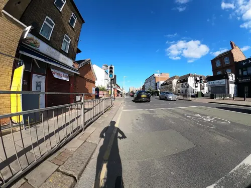
Aladdin's Shisha Lounge
Restaurant · Chinese, Chicken, Burger, Pizza · 1.1 mi
374 High Road, Ilford
Mo-Su 09:00-22:00





92 more on the map.
History
The name Goodmayes and Goodmaistrete is recorded in 1456, and the name is likely to be associated with the family of John Godemay who was referred to in a document of 1319. A farm called Goodmath is recorded on the Chapman and Andre 1 inch to one mile map of Essex from 1777. Barley Lane is believed to be named after Dorothy Barley, the sister of Henry Barley, Dorothy was the last Abbess of nearby Barking Abbey (elected 1527).
Goodmayes was part of the Chadwell ward of the ancient parish of Barking, Essex. In 1888 the Chadwell and Great Ilford wards of Barking became a new parish of Ilford. This became Ilford Urban District in 1894 and was the Municipal Borough of Ilford from 1926 to 1965. The London Borough of Redbridge was formed in 1965 from Ilford and other areas. Councillors for the electoral ward of Goodmayes were first elected in 1964.
Read more of the history
Goodmayes was largely undeveloped until the end of the 19th century, when large scale suburban development took place as London expanded. Most of the area here and in neighbouring Seven Kings was only built up between 1898 and 1910 by the developer A. C. Corbett who used new stations on the Great Eastern Railway to promote the new suburbs. Goodmayes station was built in 1901. Since then, little has changed in the area, although there have been, and still are, regeneration projects taking place within the area. However, the lines of Edwardian terraced housing continue to dominate the district with relatively few more recent additions.
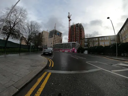
Former extensive railway sidings near Goodmayes Station were closed in the 1970s and later redeveloped for retail purposes. A large Tesco store and a branch of Wickes and Masala Bazaar now occupy the site. On the A118 road, a Homebase store occupied the site until it was demolished in early 2023, and several flats being built in place of it, known as “One Goodmayes”- as of 2025.
From the History section of Goodmayes on Wikipedia, under CC BY-SA 4.0.
Notable people from Goodmayes
 Ian HolmBritish actor (1931–2020)Photo: CossieMoJo at English Wikipedia, CC BY-SA 3.0
- Ainsley Maitland-NilesEnglish association football player
- Kortney HauseEnglish association football player (born 1995)
- Ken PrestonEnglish cricketer (1925-2019)
- Cardew RobinsonComedy actor (1917-1992)
- Aron Nijjarcricketer (born 1994)
- Eda KerseyBritish musician (1904–1944)
- John HoweScottish bishop (1920-2001)
Born in Goodmayes, according to Wikidata (CC0). Each name links to its Wikipedia article.
Where to stay2
Churches and places of worship73
Shopping28
Gas and EV charging7
Schools, colleges and libraries60
Healthcare18
Chadwell Heath Medical Centre
Clinic and pharmacy · 1.4 mi
Ashton Gardens, Romford
Map of Goodmayes
250 places. The map loads OpenStreetMap tiles when you open it.
Getting there and nearby towns
London City Airport (LCY) is the nearest airport with scheduled flights listed in OpenStreetMap, 5 miles away.
- Ilford 2 mi west, about 3 min by car
- Barking 2 mi southwest, about 4 min by car
- Dagenham 3 mi east, about 4 min by car
- Wanstead 4 mi west, about 6 min by car
- Snaresbrook 4 mi west, about 7 min by car
- West Ham 5 mi southwest, about 7 min by car
- Woodford Green 5 mi northwest, about 8 min by car
- Rainham 5 mi southeast, about 8 min by car
- Leyton 5 mi west, about 8 min by car
- Walthamstow 6 mi west, about 10 min by car
Drive times are estimates from straight-line distance, not routes.
Towns near Goodmayes


Keep exploring
Local news
Headlines from INDB.
Reviews, tips and questions
Loading what members have shared...
Sources and licences
- GeoNames (CC BY 4.0): population, coordinates, regions and time zone
- Mapillary (see each image): photos
- OpenStreetMap contributors (ODbL 1.0): places, airports, map data
- Wikidata (CC0 1.0): elevation, founding date, time zone, website, landmarks and historic places
- Wikimedia Commons (see each image): photos
- Wikipedia (CC BY-SA 4.0): overview and history text
Photo credits
- Memorial to Dr Barnardo, Matt Brown, CC BY 2.0
- Eastbury Manor House, Gordon Joly, CC BY 2.5
- Havering Museum 2, Mx. Granger, CC0
- Mayesbrook Park 2, Dudley Miles, CC BY-SA 3.0
- South Park, Ilford (2012-06-21), Thebrid, CC BY-SA 3.0
- River Beam in Beam Valley Country Park, Dudley Miles, CC BY-SA 3.0
- Dagenham Village Churchyard 6, Dudley Miles, CC BY-SA 3.0
- Eastbrookend Country Park lake 2, Dudley Miles, CC BY-SA 3.0
- Greatfields Park (18843012584), Matt Brown from London, England, CC BY 2.0
- Hainault Lodge, Dudley Miles, CC BY-SA 3.0
- Parsloes Park, London Borough of Barking & Dagenham, RM9 (400631455), Ewan Munro from London, UK, CC BY-SA 2.0
- Scrattons Eco Park 1, Dudley Miles, CC BY-SA 3.0
- St. Barnabas Church, Manor Park. Exterior, James Ramsay, CC BY 4.0
- St Mary the Virgin church, Wanstead - 2023-02-27, The wub, CC BY-SA 4.0
- Valence House Museum 2010, Gordon Joly, CC BY-SA 3.0
- Chadwell Academy Ariel View, Shahirmihad, CC BY-SA 3.0
- The Dagenham Roundhouse, Chris Guy from London, UK, CC BY-SA 2.0
- Redbridge central library (34980894720), JuliaC2006 from Rochester, UK, CC BY 2.0
- Eva Hart, Chadwell Heath, RM6 (4608715062), Ewan Munro from London, UK, CC BY-SA 2.0
- Dover Rd, Aldersbrook, Andertpj, CC BY-SA 4.0
- Sunflowers Court, Goodmayes Hospital, 25 February 2020, London Hospital Roamer, CC BY-SA 4.0
- Brookside Theatre, London, Mx. Granger, CC0
- Broadway, Barking, IG11 (4497643932), Ewan Munro from London, UK, CC BY-SA 2.0
- Valentines Mansion, Gardener's Cottage, The wub, CC BY-SA 4.0
- Barking Park, Simon from London, United Kingdom, CC BY 2.0
- Ripple Nature Reserve 5, Dudley Miles, CC BY-SA 3.0
- Street-level photo, dankarran, CC BY-SA 4.0
- Street-level photo, dankarran, CC BY-SA 4.0
- Street-level photo, southglos, CC BY-SA 4.0
- Street-level photo, lamaar639, CC BY-SA 4.0
- Street-level photo, lamaar639, CC BY-SA 4.0
- Street-level photo, essexboy, CC BY-SA 4.0
- Street-level photo, southglos, CC BY-SA 4.0
- Street-level photo, southglos, CC BY-SA 4.0
- Street-level photo, lamaar639, CC BY-SA 4.0
- Street-level photo, dankarran, CC BY-SA 4.0
- Street-level photo, dankarran, CC BY-SA 4.0
- Street-level photo, dankarran, CC BY-SA 4.0
- Street-level photo, dankarran, CC BY-SA 4.0
- Street-level photo, dankarran, CC BY-SA 4.0
- Street-level photo, dankarran, CC BY-SA 4.0
- Street-level photo, dankarran, CC BY-SA 4.0
- Street-level photo, dankarran, CC BY-SA 4.0
- Street-level photo, dankarran, CC BY-SA 4.0
- Street-level photo, dankarran, CC BY-SA 4.0
- Street-level photo, lamaar639, CC BY-SA 4.0
- Street-level photo, dankarran, CC BY-SA 4.0
- Street-level photo, dankarran, CC BY-SA 4.0
- Street-level photo, dankarran, CC BY-SA 4.0
- Street-level photo, dankarran, CC BY-SA 4.0
- Street-level photo, dankarran, CC BY-SA 4.0


Page built November 10, 2026. Spotted a mistake? Tell us or suggest a place.