


Aldershot, United Kingdom
Aldershot is a town of 40,160 people in England, United Kingdom.
Why visit Aldershot
Townapedia lists 23 museums and landmarks, 36 parks and trails, 117 places to eat, 5 places to stay and 19 attractions in and around town.
Highlights include Princes Hall, Inglis Pipe Bridge, Royal Army Physical Training Corps Museum and Aldershot Cenotaph.
Weather in Aldershot
Forecast from MET Norway (CC BY 4.0). Full forecast
About Aldershot
Aldershot is a town in the Rushmoor district of Hampshire, England. It lies on heathland in the extreme north-east corner of the county, 31 mi (50 km) south-west of London. The town has a population of 40,160, while the Aldershot Urban Area – a loose conurbation, which also includes other towns such as Camberley and Farnborough – has a population of 243,344; it is the thirtieth-largest urban area in the UK.
From the Wikipedia article Aldershot (this version), under CC BY-SA 4.0.
Travel tips from other travellers: Aldershot on Wikivoyage (CC BY-SA 4.0).
Photos of Aldershot

Things to do19


Redgrave Theatre, Farnham
Cinema and theater · 2.6 mi
Former theatre in Farnham, England

Hippodrome
Cinema and theater
Former theatre and cinema in Aldershot, England
Theatre Royal, Aldershot
Cinema and theater
Former theatre in Aldershot, England


7 more on the map.
Museums and landmarks23

Royal Army Physical Training Corps Museum
Museum · 1.1 mi
Museum in Aldershot, United Kingdom
Queen's Avenue, Aldershot
Mo-Fr 10:00-16:00

Aldershot Cenotaph
Monument and historic site
War memorial in Aldershot, Hampshire, England, UK

equestrian statue of the Duke of Wellington
Monument and historic site · 0.8 mi
Statue in Aldershot, Hampshire, England, UK


Farnham Castle
Museum · 2.6 mi
Grade I listed historic house museum in Farnham, Surrey, England, UK

FAST Museum
Museum · 2.4 mi
Aviation museum in Hampshire, England, United Kingdom

Museum of Farnham
Museum · 3.0 mi
Museum in Farnham, England, United Kingdom

Museum of Military Medicine
Museum · 3.2 mi
Military museum in Mytchett, Surrey, United Kingdom

Royal Army Medical Corps Boer War Memorial
Monument and historic site · 0.4 mi
Sculpture in Rushmoor, Hampshire, England, UK

Caesar's Camp
Monument and historic site · 1.8 mi
Iron Age hill fort on the Surrey/Hampshire border, England
11 more on the map.
Parks, trails and playgrounds36


Rowhill Nature Reserve
Park · 0.9 mi
Nature reserve on the boundary of Hampshire and Surrey, England, UK



Lakeside Park
Park · 1.7 mi
Local nature reserve in Ash, Surrey, England, UK
24 more on the map.
Restaurants and cafes117
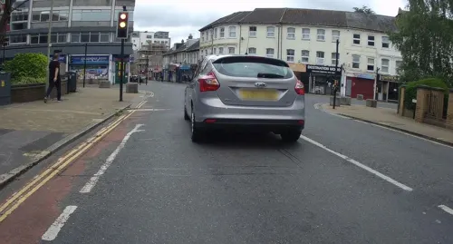
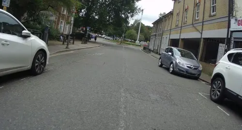
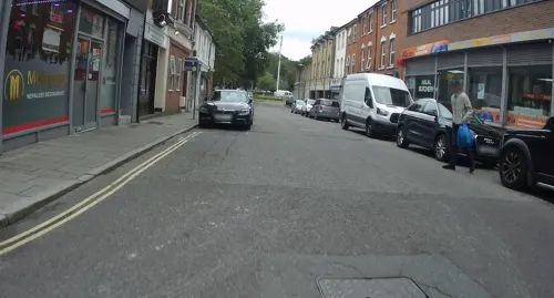
Malinggo
Restaurant · Nepalese
41 Station Road, Aldershot
Mo-Th 12:00-23:00; Fr-Sa 12:00-00:30; Su 12:00-22:00
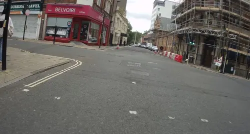
McChina Wok Away
Restaurant · Chinese
79 Victoria Road, Aldershot
Mo 12:00-14:00,17:30-22:30; Tu 12:00-14:00,17:30-23:00; We-Fr...

Jenny's
Restaurant · Burger, Breakfast
20 Wellington Street, Aldershot
Mo-Fr 08:30-18:30; Sa 08:00-18:30; Su 09:00-17:00

105 more on the map.
History
The name is likely to have derived from alder trees found in the area (from the Old English 'alor-sceat' meaning copse, or projecting piece of land, featuring alder trees). Any settlement, though not mentioned by name, would have been included as part of the Hundred of Crondall referred to in the Domesday Book of 1086.
The Church of St Michael the Archangel is the parish church for the town and dates to the 12th century with later additions. There was almost certainly an earlier church on the site. Cistercian monks from the nearby Waverley Abbey established granges or farms on their outlying estates, including one at Aldershot by 1175 for sheep grazing. We do not know when monks from the Abbey first came to Aldershot but the first documentary evidence is from 1287 when the Crondall Rental records that at 'Alreshate the Monks of Waverlye hold 31 acres of encroachment'. This area ran from the church of St Michael's down to the area around the present Brickfields Country Park while the grange itself was near the church. John Norden's map of Hampshire, published in the 1607 edition of William Camden's Britannia, indicates that Aldershot was a market town.
Read more of the history
The area was a vast stretch of sparsely populated common land, considered unsuitable for most forms of agriculture. Aldershot, Crondall, Farnborough, and Yateley were all part of the manor of Crondall in the north-east corner of Hampshire. Crondall manor is mentioned in the Domesday Survey in 1086. It was probably Scandinavian in origin, judging by the ruling family's practice of granting sole inheritance to the eldest child regardless of sex, rather than to the eldest son.
The first recorded mention of the manor of Aldershot is in 1573 in the will of Sir John White of Aldershot (c1512–1573), alderman of London who was knighted when he became Lord Mayor of London (1563-4). He left Aldershot Manor to his son Sir Robert White of Aldershot (died 1599). He, in turn, left the manor to be divided between his two daughters, Ellen the wife of Sir Richard Tichborne and Mary, the wife of Sir Walter Tichborne, brother of Richard. The 18th-century jurist Charles Viner lived in the town and printed his A General Abridgment of Law and Equity on a press in his home. In the 18th century, the stretch of the London to Winchester turnpike that passed through Aldershot between Bagshot and Farnham (now known as the Farnborough Road) was the scene of highway robberies. At one time it had "almost as bad a reputation as Hounslow Heath". Dick Turpin is said to have operated in the area having his headquarters nearby in Farnborough, and there were sightings of Spring-heeled Jack.
In 1854, at the time of the Crimean War, Aldershot Garrison was established as the first permanent training camp for the British Army. This led to a rapid expansion of Aldershot's population, going from 875 in 1851 to in excess of 16,000 by 1861 (including about 9,000 from the military). Mrs Louisa Daniell arrived in the town at this time and set up her Soldiers' Home and Institute to cater for the spiritual needs of the soldiers and their families. During this period Holy Trinity church, the Presbyterian church, the Wesleyan church and Rotunda chapel were built in the town centre to cater for the spiritual needs of the increasing numbers of troops in the nearby camp and the growing civilian town. In August 1856, on her return from the Crimean War and "wishing to be with her sons in the Army", Mary Seacole with her business partner Thomas Day is said to have arrived in Aldershot where they attempted to open a canteen. In her autobiography, Seacole wrote: 'We set to bravely at Aldershott to retrieve our fallen fortunes, and stem off the ruin originated in the Crimea, but all in vain...'. The venture is believed to have failed through lack of funds and the two being declared bankrupt.
The Aldershot Military Tattoo was an annual event dating back to 1894. In the 1920s and 1930s, the Aldershot Command Searchlight Tattoo held at the Rushmoor Arena presented displays from all branches of the services, including performances lit by flame torches. At one time the performances attracted crowds of up to 500,000 people. The Tattoo was organised to raise money for military charities. By the end of the 1930s, the event was raising around £40,000 annually. The Tattoo's modern format, the Army Show, was cancelled in 2010 by the Ministry of Defence due to budget cuts. It was briefly revived the following year and attracted 20,000 visitors. In 2012, it was styled as the Aldershot Garrison Show, a smaller free event held on Armed Forces Day.
The Army Show was replaced in 2013 with a general Military Festival. Events were held across the town, including an art exhibition, live music, sports events and film screenings.
In 1914, Aldershot had the largest army camp in the country, with 20% of the British Army being based in and around the town. Aldershot was home for two Infantry Divisions and a Cavalry Brigade in addition to large numbers of artillery, engineers, service corps and medical services. At the start of World War I, the units based at Aldershot became the 1st Corps of the British Expeditionary Force, and soon tens of thousands of new recruits came to the large training centre in the Camp. This had a great effect on the civilian town as there was a great shortage of accommodation for the troops and many were billeted in local houses and schools. Aldershot played a vital role in the formation of Kitchener's Army, providing the core of the Army from 1914 onwards as well as treating the wounded brought back from the trenches in France and Flanders. The Cambridge Military Hospital was the first base hospital to receive casualties directly from the Western Front and it was here that plastic surgery was first performed in the British Empire by Captain Gillies (later Sir Harold Gillies).
From the History section of Aldershot on Wikipedia, under CC BY-SA 4.0.
More about Aldershot
Education
There are various schools in Aldershot. These will be joined by two new primary schools being built as part of the Aldershot Urban extension development of 3,850 houses. This development will also be served by a further 675 secondary school places being created at the Alderwood and Wavell schools.
Primary schools include Park Primary and St Michael's (C of E). The infant schools are Talavera, Wellington Primary and Bell Vue Infant School. Junior schools include: Newport County, Talavera, Wellington Secondary and St Joseph's Primary (Catholic).
Aldershot has only one secondary school, Alderwood School (formerly Heron Wood School and The Connaught School), though Ash Manor School, Farnham Heath End School, All Hallows Catholic School and The Wavell School are all local. In the town's West End can be found Rowhill School, a special school for students of secondary age unable to attend mainstream schooling for a variety of reasons. There are also two private schools, Salesian College and Farnborough Hill School in nearby Farnborough.
From the Wikipedia article Aldershot, under CC BY-SA 4.0.
Notable people from Aldershot
 Martin FreemanEnglish actorPhoto: Harald Krichel, CC BY-SA 3.0
 Ian McEwanBritish author (born 1948)Photo: TimDuncan, CC BY-SA 4.0
 Claude AuchinleckBritish World War II Army commander (1884–1981)Photo: Cecil Beaton, Public domain
 Heather Millsformer glamour model, activistPhoto: C.Stadler/Bwag, CC BY-SA 4.0
 Bruce RiochScottish footballer (born 1947)Photo: Simon Wedege Petersen, CC BY 3.0
 Simon MannBritish military officer; Equatoguinean detaineePhoto: Chatham House, CC BY 2.0
 James WadeEnglish darts playerPhoto: Sandro Halank , Wikimedia Commons, CC BY-SA 4.0
 Charles TannockBritish politician (born 1957)Photo: Foto-AG Gymnasium Melle, CC BY-SA 3.0
- Peter YatesBritish film director and producer (1929-2011)
- Amelle BerrabahBritish pop singer
- DanTDMBritish gamer and YouTuber
- Tom WhittakerEnglish footballer and manager (1898-1956)
Born in Aldershot, according to Wikidata (CC0). Each name links to its Wikipedia article.
Where to stay5
Churches and places of worship36
Shopping20
Gas and EV charging6
Schools, colleges and libraries21
St Michael's Church of England Controlled Infant School
School · Anglican · 0.7 mi
48 Park Road, Aldershot
St Michael's Church of England Controlled Junior School
School · Anglican · 0.7 mi
Church Lane East, Aldershot
Healthcare9
Map of Aldershot
250 places. The map loads OpenStreetMap tiles when you open it.
Getting there and nearby towns
Farnborough Airport (FAB) is the nearest airport with scheduled flights listed in OpenStreetMap, 2 miles away.
- Farnham 3 mi southwest, about 5 min by car
- Farnborough 3 mi north, about 5 min by car
- Fleet 4 mi northwest, about 6 min by car
- Frimley 5 mi north, about 8 min by car
- Camberley 6 mi north, about 10 min by car
- Sandhurst 7 mi north, about 11 min by car
- Yateley 7 mi northwest, about 11 min by car
- Guildford 8 mi east, about 13 min by car
- Godalming 8 mi southeast, about 12 min by car
- Crowthorne 9 mi north, about 14 min by car
Drive times are estimates from straight-line distance, not routes.
Towns near Aldershot


Keep exploring
Local news
Headlines from INDB.
Reviews, tips and questions
Loading what members have shared...
Sources and licences
- GeoNames (CC BY 4.0): population, coordinates, regions and time zone
- Mapillary (see each image): photos
- OpenStreetMap contributors (ODbL 1.0): places, airports, map data
- Wikidata (CC0 1.0): elevation, founding date, time zone, website, landmarks and historic places
- Wikimedia Commons (see each image): photos
- Wikipedia (CC BY-SA 4.0): overview and history text
Photo credits
- COVID-19 pandemic social distancing, Victoria Road, Aldershot 01, Simon Burchell, CC BY-SA 4.0
- COVID-19 pandemic social distancing, Victoria Road, Aldershot 02, Simon Burchell, CC BY-SA 4.0
- Wellingtonstatue, The original uploader was Wyrdlight at English Wikipedia ., CC BY-SA 3.0
- Princes Hall Aldershot 2016, Jack1956, CC0
- Inglis Bridge Aldershot 2020, Jack1956, CC BY-SA 4.0
- Redgrave Theatre Farnham Entrance, Jack1956, CC0
- Royal Army Physical Training Corps Museum gallery3, Jack1956, CC0
- Municipal Gardens Aldershot Cenotaph, Jack1956, CC0
- Crafts Study Centre, University for the Creative Arts, Farnham, BabelStone, CC BY-SA 4.0
- Farnham Castle keep, Lewis Hulbert, CC BY-SA 3.0
- Back of Wilmer House (Museum of Farnham), BabelStone, CC BY-SA 4.0
- Noel Chavasse Memorial, Gaius Cornelius, CC BY-SA 3.0
- RAMC Memorial Aldershot, Jack1956, CC0
- Municipal Gardens Aldershot Gates, Jack1956, CC0
- Princes Gardens Aldershot Bandstand, Jack1956, CC0
- Rowhill Nature Reserve Pond, Jack1956, CC0
- Crooksbury Hill triangulation point, BabelStone, CC BY-SA 4.0
- Snaky Lane Community Wildlife Area 3, Dudley Miles, CC BY-SA 4.0
- Weybourne Nature Reserve pond, Mrmatiko, CC BY-SA 3.0
- St Andrews Aldershot 2019, Jack1956, CC BY-SA 4.0
- Wesley Chambers, Aldershot, Lewis Hulbert, CC BY-SA 3.0
- AldershotCathedral-2, AldershotCathedral.jpg : JohnArmagh derivative work: Rabanus Flavus, CC BY-SA 3.0
- Church of St Michael the Archangel, Aldershot from the road, Lewis Hulbert, CC BY-SA 3.0
- St Peter's Church, Ash Church Road, Ash (May 2014) (2), Hassocks5489, CC0
- Former Park Lane Baptist Chapel, Bear Lane, Farnham (May 2015) (3), Hassocks5489, CC0
- Holy Trinity Church Aldershot, User:Jack1956, CC0
- Allsaintsalder-wyrd-29O6-0121, http://www.wyrdlight.com Author: Antony McCallum, CC BY-SA 3.0
- Church of St Joseph, Aldershot, Lewis Hulbert, CC BY-SA 3.0
- West End Centre Aldershot, Jack1956, CC0
- St George's Church, Badshot Lea, BabelStone, CC BY-SA 4.0
- Manor Park Aldershot Gates, Jack1956, CC0
- Aldershot Park Signage, Jack1956, CC0
- Brickfields Country Park 2020, Jack1956, CC BY-SA 4.0
- ZJ496 at the FAST Museum (8631013999), Simon Boddy from Maidenhead, Uk, CC BY-SA 2.0
- Street-level photo, cicisxn, CC BY-SA 4.0
- Street-level photo, laye, CC BY-SA 4.0
- Street-level photo, jpennycook, CC BY-SA 4.0
- Street-level photo, jpennycook, CC BY-SA 4.0
- Street-level photo, jpennycook, CC BY-SA 4.0
- Street-level photo, laye, CC BY-SA 4.0
- Street-level photo, jpennycook, CC BY-SA 4.0
- Street-level photo, jpennycook, CC BY-SA 4.0
- Street-level photo, jpennycook, CC BY-SA 4.0
- Street-level photo, jpennycook, CC BY-SA 4.0
- Street-level photo, jpennycook, CC BY-SA 4.0
- Street-level photo, jpennycook, CC BY-SA 4.0
- Street-level photo, laye, CC BY-SA 4.0
- Street-level photo, jpennycook, CC BY-SA 4.0
- Street-level photo, laye, CC BY-SA 4.0
- Street-level photo, jpennycook, CC BY-SA 4.0
- Street-level photo, jpennycook, CC BY-SA 4.0
- Street-level photo, laye, CC BY-SA 4.0
- Street-level photo, jpennycook, CC BY-SA 4.0
- Street-level photo, taft, CC BY-SA 4.0
- Street-level photo, jpennycook, CC BY-SA 4.0


Page built November 10, 2026. Spotted a mistake? Tell us or suggest a place.