


Why visit Farnham
Townapedia lists 54 museums and landmarks, 91 parks and trails, 230 places to eat, 16 places to stay and 29 attractions in and around town.
Highlights include Princes Hall, Birdworld, Museum of Farnham and Farnham Castle.
Weather in Farnham
Forecast from MET Norway (CC BY 4.0). Full forecast
About Farnham
Farnham is a market town and civil parish in Surrey, England, around 36 miles (58 km) southwest of London. It is in the Borough of Waverley, close to the county border with Hampshire. The town is on the north branch of the River Wey, a tributary of the Thames, and is at the western end of the North Downs. The civil parish, which includes the villages of Badshot Lea, Hale and Wrecclesham, covers 14.1 sq mi (37 km2) and had a population of 39,488 in 2011.
From the Wikipedia article Farnham (this version), under CC BY-SA 4.0.
Travel tips from other travellers: Farnham on Wikivoyage (CC BY-SA 4.0).
Photos of Farnham


Things to do29


Redgrave Theatre, Farnham
Cinema and theater
Former theatre in Farnham, England


Hippodrome
Cinema and theater · 2.8 mi
Former theatre and cinema in Aldershot, England
Theatre Royal, Aldershot
Cinema and theater · 2.8 mi
Former theatre in Aldershot, England
Cineworld
Cinema and theater · 2.8 mi
Mo,We 14:20-20:50; Tu 14:30-20:50; Th 13:30-21:00; Fr 14:20-20:30;...
17 more on the map.
Museums and landmarks54


Farnham Castle
Monument and historic site
Grade I listed historic house museum in Farnham, Surrey, England, UK


Aldershot Cenotaph
Monument and historic site · 2.7 mi
War memorial in Aldershot, Hampshire, England, UK


equestrian statue of the Duke of Wellington
Monument and historic site · 2.8 mi
Statue in Aldershot, Hampshire, England, UK


'900 Years of Living History' Permanent Exhibition
Museum
Mo-Fr 09:00-17:00; Sa-Su 10:00-16:00; Dec 24 - Jan 31 off

FAST Museum
Museum · 5.1 mi
Aviation museum in Hampshire, England, United Kingdom

Caesar's Camp
Monument and historic site · 2.0 mi
Iron Age hill fort on the Surrey/Hampshire border, England
42 more on the map.
Parks, trails and playgrounds91


Rowhill Nature Reserve
Park · 2.0 mi
Nature reserve on the boundary of Hampshire and Surrey, England, UK



Lakeside Park
Park · 4.3 mi
Local nature reserve in Ash, Surrey, England, UK
79 more on the map.
Restaurants and cafes230

The Bengal Lounge
Restaurant · 1.3 mi
1 The Street, Farnham
Mo-Th,Su 12:00-14:00,17:30-23:00; Fr-Sa 12:00-14:00,17:30-23:30

The Wheatsheaf
Bar and pub
19 West Street, Farnham
We-Th 12:00-23:00; Fr-Sa 12:00-24:00; Su 12:00-21:00

Nelson Arms
Bar and pub
50 Castle Street, Farnham
Mo-Th 12:00-22:00; Fr-Sa 12:00-24:00; Su 12:00-21:00
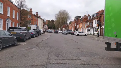
Bill's
Restaurant · British
6-7 Castle Street, Farnham
Mo-Th 08:00-21:00; Fr-Sa 08:00-22:00; Su 09:00-21:00
Caffè Nero
Cafe · Coffee Shop
Castle Street, Farnham
Mo-Fr 06:30-18:00; Sa 07:00-18:00; Su 07:30-17:30
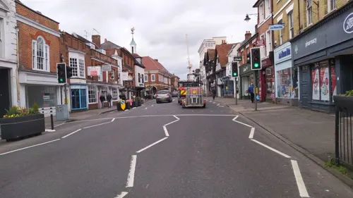
Gagan Chulo
Restaurant · Nepalese, Tibetan · 2.8 mi
22 Station Road, Aldershot
Mo-Tu; Th-Su 12:00-22:00

Cazaro Lounge
Restaurant · Burger, Breakfast, Pasta, Salad, British
Brightwell's Yard, Farnham
Su-Fr 09:00-23:00, Sa 09:00-24:00
Jenny's
Restaurant · Burger, Breakfast · 2.9 mi
20 Wellington Street, Aldershot
Mo-Fr 08:30-18:30; Sa 08:00-18:30; Su 09:00-17:00

218 more on the map.
History
Farnham's history extends back hundreds of thousands of years to the hunter-gatherers of the Paleolithic or early Stone Age, on the basis of stone tools such as many Handaxes found around the town. Most of these were collected by antiquarians in the later 19th and early 20th Century. Additionally prehistoric animal bones, sometimes found together with the aforementioned flint tools in deep gravel pits such as a woolly mammoth tusk, excavated in Badshot Lea at the start of the 21st century. The first known settlement in the area was in the Mesolithic period, some 7,000 years ago; a cluster of pit dwellings and evidence of a flint-knapping industry from that period has been excavated a short distance to the east of the town. There was a Neolithic long barrow at nearby Badshot Lea, now destroyed by quarrying. This monument lay on the route of the prehistoric trackway known as the Harrow Way or Harroway, which passes through Farnham Park, and a sarsen stone still stands nearby, which is believed to have marked the safe crossing point of a marshy area near the present Shepherd and Flock roundabout.
Read more of the history
Occupation of the area continued to grow through the Bronze Age. Two bronze hoards have been discovered on Crooksbury Hill, and further artefacts have been found, particularly at sites in Green Lane and near the Bourne spring in Farnham Park. A significant number of Bronze Age barrows occur in the area, including a triple barrow at Elstead and an urnfield cemetery at Stoneyfield, near the Tilford road.
Hill forts from the early Iron Age have been identified locally at Botany Hill to the south of the town, and at Caesar's Camp to the north. The latter is a very large earthwork on a high promontory, served by a spring which emerges from between two conglomerate boulders called the Jock and Jenny Stones. "Soldier's Ring" earthworks on Crooksbury Hill date from the later Iron Age. The final era of the Iron Age, during the 1st century AD, found Farnham within the territory of the Belgic tribe Atrebates led by Commius, a former ally of Caesar, who had brought his tribe to Britain following a dispute with the Romans. A hut dating from this period was discovered at the Bourne Spring and other occupation material has been discovered at various sites, particularly Green Lane.
During the Roman period the district became a pottery centre due to the plentiful supply of gault clay, oak woodlands for fuel, and good communications via the Harrow Way and the nearby Roman road from Silchester to Chichester. Kilns dating from about AD 100 have been found throughout the area, including Six Bells (near the Bourne Spring), Snailslynch and Mavins Road, but the main centre of pottery had been Alice Holt Forest, on the edge of the town, since about AD 50, just 7 years after the arrival of the Romans. The Alice Holt potteries continued in use, making mainly domestic wares, until about AD 400. Near the Bourne Spring two Roman buildings were discovered; one was a bath-house dating from about AD 270 and the other a house of later date. The Roman Way housing estate stands on this site. William Stukeley propounded that Farnham is the site of the lost Roman settlement of Vindomis, although this is now believed to be at Neatham, near Alton. Large hoards of Roman coins have been discovered some 10 miles (16 km) south-west of Farnham in Woolmer Forest and a temple has been excavated at Wanborough, about 8 miles (13 km) to the east.
In the 7th century, Surrey passed into the hands of King Caedwalla of Wessex, who also conquered Kent and Sussex, and founded a monastery at Farnham in 686.
It was the Anglo-Saxons who gave the town its name—Farnham and it is listed as Fearnhamme in the Anglo-Saxon Chronicle. They arrived in the 6th century and, in AD 688, the West Saxon King Caedwalla donated the district around Farnham to the Church, and to the diocese of Winchester. A Saxon community grew up in the valley by the river. By the year 803 Farnham had passed into the ownership of the Bishop of Winchester and the Manor of Farnham remained so (apart from two short breaks) for the next thousand years. Although Farnham is documented in Saxon texts and most of the local names are derived from their language, there is only one fully attested Saxon site in Farnham, just off the lower part of Firgrove Hill, where a road called Saxon Croft is now sited. Here several Saxon weaving huts from about AD 550 were discovered in 1924.
In 892 Surrey was the scene of another major battle when a large Danish army, variously reported at 200, 250 and 350 ship-loads, moved west from its encampment in Kent and raided in Hampshire and Berkshire. Withdrawing with their loot, the Danes were intercepted and defeated at Farnham by an army led by Alfred the Great's son, the future Edward the Elder, and fled across the Thames towards Essex.
A hundred (county subdivision) was an area that had a general overlord of its lords of the manor, entitled to charge certain rents to certain intermediate lords. Parishes within Farnham hundred were: Frensham (including tything Pitfold with Churt) (partly in the hundred of Alton) Elstead, the liberty of Dockenfield, the liberty of Waverley, Seal (now Seale) the tythings of Badshot, Runfold, Culverlands, Tilford with Culverlands, Farnham, Runwick, Wrecklesham (now Wrecclesham), and Bourne.
In the 14th century, Farnham hundred was owned by the Bishop of Winchester and was one of the wealthiest on the bishop's rolls.
Farnham appears in Domesday Book of 1086 in the Hundred of Farnham as Ferneham, one of the five great "minster" churches in Surrey. Its Domesday assets were: 40 hides; 1 church, 6 mills worth £2 6s 0d, 43 ploughs, 35 acres (140,000 m2) of meadow, woodland worth 175½ hogs. It rendered £53.
From the History section of Farnham on Wikipedia, under CC BY-SA 4.0.
More about Farnham
Geography
Farnham's history and present status are mainly the result of its geography; a combination of river, streams, fresh water springs and varied soils, together with a temperate climate, was attractive in prehistoric times. The geology of the area continues to influence the town, both in terms of communications, scenic and botanic variety and the main local industries of agriculture and minerals extraction. Farnham Geological Society is an active organisation in the town, and the Museum of Farnham has a collection of geological samples and fossils.
Economy
Farnham is a market town with many shops located along the main thoroughfare running through West Street, The Borough and East Street. The town has a significant number of independent retailers, some of which have been in business since the 19th century, such as Rangers Furnishing Stores (est. 1895), Elphicks department store (est. 1881) and Pullingers (est. 1850). The latter evolved into the Pullingers Art Shop chain and is thought to be Farnham's oldest surviving business. There are also branches of many national retailers and grocery markets.
Castle Street's market stalls have been replaced by semi-permanent "orangery" style buildings. Once a month a farmers' market is held in the central car park where produce from farms in Farnham and the surrounding area is sold. The Farnham Maltings hosts a monthly market selling arts, crafts, antiques and bric-a-brac with specialist fairs and festivals held there on a less regular basis.
Arts and culture
Farnham has a strong association with the creative arts. Farnham School of Art opened in 1866 and was associated with the Arts and Crafts movement when architects such as Edwin Lutyens and Harold Falkner, painters such as George Watts and W. H. Allen, potters such as Mary Watts and landscape gardeners such as Gertrude Jekyll worked in the area. Farnham has several art galleries: the New Ashgate Gallery in Lower Church Lane has exhibitions by established and new artists in a variety of media, the exhibition changing on the first Saturday of each month. The gallery at Farnham Maltings also has frequent exhibitions.
Farnham Maltings has diverse concerts including opera, folk and acoustic music gigs, band evenings and stand up comedy nights, as well as shows and workshops for younger people. There is a cinema run every Wednesday at the Maltings. The Maltings hosts an "Acoustic Fridays" evening once a month. A regular blues night takes place in the "Cellar Bar" and the whole venue is taken over for the annual Blues Festival. In keeping with the town's historical link with hop-growing and beer, the Farnham Maltings holds the Farnham Beer Exhibition, an annual event that started in 1977, known as "Farnham Beerex". There are many pubs in Farnham, many of which have live music regularly.
Education
Farnham has a broad mix of state schools and private schools, including faith schools. There are eight infants' schools, nine primary/junior schools, three secondary schools and two schools for pupils with special educational needs.
Farnham College (part of Guildford College) provides further education. The University for the Creative Arts at Canterbury, Epsom, Farnham, Maidstone and Rochester (UCA; a merger of the local Surrey Institute of Art & Design, University College and Kent Institute of Art & Design) provides higher education.
The area includes some of the top state schools (academies) in the country including South Farnham School, Weydon School and others which consistently rank highly in school results year on year including South Farnham, which has more than once been rated the best state primary school in the country based on exam results.
Farnham Grammar School started some time before 1585 (when a donation by a Richard Searle was recorded "to the maintenance of the school in Farnham"). In 1905 the town centre assets of the old grammar school, located in West Street, were sold in order to purchase and build new premises in fields to the south of the town. In 1973 this campus became a Sixth Form College and was renamed Farnham College.
From the Wikipedia article Farnham, under CC BY-SA 4.0.
Notable people from Farnham
 William CobbettEnglish pamphleteer, farmer and journalist (1763–1835)Photo: Possibly George Cooke, Public domain
 Maud GonneIrish revolutionary and activist (1866-1953)Photo: Miscellaneous Items in High Demand,..., Public domain
 Peter PearsEnglish tenor (1910–1986)Photo: Unknown, distributed by PBS, Public domain
 Richard TiceBritish politician (born 1964)Photo: ©House of Commons / Laurie Noble, CC BY 3.0
 John M. BallBritish mathematicianPhoto: Kaihsu Tai, Public domain
 Augustus TopladyBritish hymn writer, Anglican cleric (1740–1778)Photo: Unknown artist Unknown artist, Public domain
 Robert Vansittart, 1st Baron VansittartBritish diplomat (1881-1957)Photo: Underwood & Underwood, Public domain
- Joel FreelandBritish basketball player
- Helen PorterBritish botanist (1899-1987)
- David LawsBritish politician (born 1965)
- William HarvellOlympic cyclist
- Peter StoreyEnglish footballer (born 1945)
Born in Farnham, according to Wikidata (CC0). Each name links to its Wikipedia article.
Where to stay16
Churches and places of worship63
Shopping43
Gas and EV charging14
Schools, colleges and libraries45
St Michael's Church of England Controlled Infant School
School · Anglican · 2.6 mi
48 Park Road, Aldershot
St Michael's Church of England Controlled Junior School
School · Anglican · 2.6 mi
Church Lane East, Aldershot
Healthcare16
Map of Farnham
250 places. The map loads OpenStreetMap tiles when you open it.
Getting there and nearby towns
Farnborough Airport (FAB) is the nearest airport with scheduled flights listed in OpenStreetMap, 4 miles away.
- Fleet 5 mi north, about 8 min by car
- Farnborough 6 mi north, about 9 min by car
- Bordon 7 mi south, about 12 min by car
- Frimley 7 mi north, about 12 min by car
- Godalming 8 mi east, about 13 min by car
- Camberley 9 mi north, about 14 min by car
- Alton 9 mi southwest, about 14 min by car
- Yateley 9 mi north, about 14 min by car
- Sandhurst 9 mi north, about 15 min by car
- Guildford 10 mi east, about 16 min by car
Drive times are estimates from straight-line distance, not routes.
Towns near Farnham


Keep exploring
Local news
Headlines from INDB.
Reviews, tips and questions
Loading what members have shared...
Sources and licences
- GeoNames (CC BY 4.0): population, coordinates, regions and time zone
- Mapillary (see each image): photos
- OpenStreetMap contributors (ODbL 1.0): places, airports, map data
- Wikidata (CC0 1.0): elevation, founding date, time zone, website, landmarks and historic places
- Wikimedia Commons (see each image): photos
- Wikipedia (CC BY-SA 4.0): overview and history text
Photo credits
- 6 West Street, Farnham, BabelStone, CC BY-SA 4.0
- 8-11 West Street, Farnham, BabelStone, CC BY-SA 4.0
- 2-4 West Street, Farnham, BabelStone, CC BY-SA 4.0
- 114-115 West Street, Farnham, BabelStone, CC BY-SA 4.0
- 116-122 West Street, Farnham, BabelStone, CC BY-SA 4.0
- Lion and Lamb House, Farnham, Martinvl, CC BY-SA 4.0
- 13-15 West Street, Farnham, BabelStone, CC BY-SA 4.0
- 12 Downing Street, Farnham, Culturalconnection, CC BY-SA 4.0
- 108-112 West Street, Farnham, BabelStone, CC BY-SA 4.0
- Princes Hall Aldershot 2016, Jack1956, CC0
- Terry Pratchett Owl Parliament at Birdworld, Birdworld, CC BY-SA 4.0
- Inglis Bridge Aldershot 2020, Jack1956, CC BY-SA 4.0
- Redgrave Theatre Farnham Entrance, Jack1956, CC0
- Back of Wilmer House (Museum of Farnham), BabelStone, CC BY-SA 4.0
- Farnham Castle keep, Lewis Hulbert, CC BY-SA 3.0
- Municipal Gardens Aldershot Cenotaph, Jack1956, CC0
- Crafts Study Centre, University for the Creative Arts, Farnham, BabelStone, CC BY-SA 4.0
- Wellingtonstatue, The original uploader was Wyrdlight at English Wikipedia ., CC BY-SA 3.0
- Crooksbury Hill triangulation point, BabelStone, CC BY-SA 4.0
- Municipal Gardens Aldershot Gates, Jack1956, CC0
- Princes Gardens Aldershot Bandstand, Jack1956, CC0
- Rowhill Nature Reserve Pond, Jack1956, CC0
- Wesley Chambers, Aldershot, Lewis Hulbert, CC BY-SA 3.0
- Waverley Abbey 3, Admiralgary, CC BY-SA 4.0
- WMNL Huis Doorn 05, Ziko van Dijk, CC BY-SA 3.0
- Allsaintsalder-wyrd-29O6-0121, http://www.wyrdlight.com Author: Antony McCallum, CC BY-SA 3.0
- Tilford Rural Life Centre 88, Simon Burchell, CC BY-SA 3.0
- St Andrew's Church, West Street, Farnham (May 2015) (1), Hassocks5489, CC0
- Church of St Joseph, Aldershot, Lewis Hulbert, CC BY-SA 3.0
- Hale Methodist Church, The Green, Upper Hale, Farnham (May 2015) (2), Hassocks5489, CC0
- The Bengal Lounge, Wrecclesham, BabelStone, CC BY-SA 4.0
- St Paul's Church, Poyle Road, Tongham (May 2014) (1), Hassocks5489, CC0
- The Wheatsheaf Inn, Farnham, BabelStone, CC BY-SA 4.0
- Nelsons Arms Public House, Farnham, BabelStone, CC BY-SA 4.0
- West End Centre Aldershot, Jack1956, CC0
- Farnham Library, BabelStone, CC BY-SA 4.0
- St Thomas on The Bourne west end, BabelStone, CC BY-SA 3.0
- Potters Gate Primary School, Farnham, BabelStone, CC BY-SA 4.0
- St Peter's Primary School, Farnham, BabelStone, CC BY-SA 4.0
- St Mark's Exterior, RevLesley, CC BY-SA 4.0
- مسجد مبارک، اسلام آباد, HolyArtThou, CC BY 4.0
- St George's Church, Badshot Lea, BabelStone, CC BY-SA 4.0
- Brambleton Hall, Farnham, BabelStone, CC BY-SA 4.0
- Manor Park Aldershot Gates, Jack1956, CC0
- Aldershot Park Signage, Jack1956, CC0
- Brickfields Country Park 2020, Jack1956, CC BY-SA 4.0
- ZJ496 at the FAST Museum (8631013999), Simon Boddy from Maidenhead, Uk, CC BY-SA 2.0
- Thundry Meadows 3, Dudley Miles, CC BY-SA 4.0
- Street-level photo, noid, CC BY-SA 4.0
- Street-level photo, jpennycook, CC BY-SA 4.0
- Street-level photo, jpennycook, CC BY-SA 4.0
- Street-level photo, noid, CC BY-SA 4.0
- Street-level photo, jpennycook, CC BY-SA 4.0
- Street-level photo, noid, CC BY-SA 4.0
- Street-level photo, jpennycook, CC BY-SA 4.0
- Street-level photo, jpennycook, CC BY-SA 4.0
- Street-level photo, jpennycook, CC BY-SA 4.0
- Street-level photo, jpennycook, CC BY-SA 4.0
- Street-level photo, jpennycook, CC BY-SA 4.0
- Street-level photo, jpennycook, CC BY-SA 4.0
- Street-level photo, jpennycook, CC BY-SA 4.0
- Street-level photo, xdTAGCLAN, CC BY-SA 4.0
- Street-level photo, jpennycook, CC BY-SA 4.0
- Street-level photo, jpennycook, CC BY-SA 4.0
- Street-level photo, jpennycook, CC BY-SA 4.0
- Street-level photo, jpennycook, CC BY-SA 4.0
- Street-level photo, jpennycook, CC BY-SA 4.0
- Street-level photo, jpennycook, CC BY-SA 4.0


Page built November 10, 2026. Spotted a mistake? Tell us or suggest a place.