
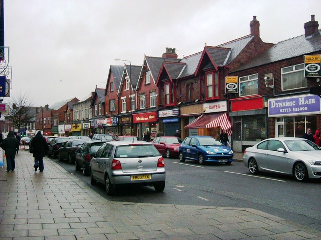


Alfreton, United Kingdom
Alfreton is a town of 22,550 people in England, United Kingdom.
Why visit Alfreton
Townapedia lists 5 museums and landmarks, 5 parks and trails, 70 places to eat and 1 place to stay in and around town.
Highlights include War Memorial and Railings, War Memorial Alfreton, Impact Arena and Alfreton Golf Club.
Weather in Alfreton
Forecast from MET Norway (CC BY 4.0). Full forecast
About Alfreton
Alfreton is a town and civil parish in the Amber Valley district of Derbyshire, England. The town was formerly a Norman Manor and later an Urban District. The population of the Alfreton parish was 8,799 at the 2021 census. The villages of Ironville, Riddings, Somercotes and Swanwick were historically part of the Manor and Urban District, and the population including these was 24,476 in 2001.
From the Wikipedia article Alfreton (this version), under CC BY-SA 4.0.
Travel tips from other travellers: Alfreton on Wikivoyage (CC BY-SA 4.0).
Museums and landmarks5

War Memorial and Railings
Monument and historic site
War memorial in Alfreton, Amber Valley, Derbyshire, England, UK

Carnfield Hall
Museum · 0.8 mi
Country house in Derbyshire, England, UK

Parks, trails and playgrounds5



Restaurants and cafes70
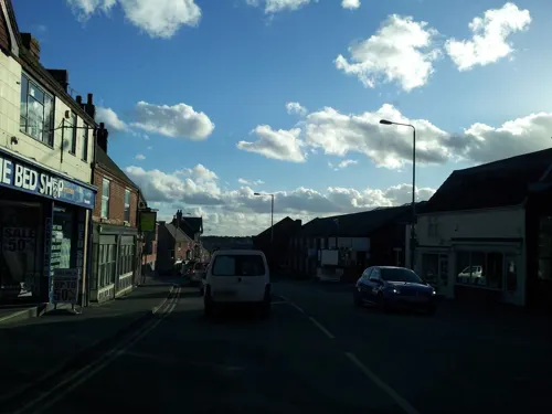
Waggon and Horses
Bar and pub
9 King Street, Alfreton
Mo-Th 08:00-00:00; Fr-Sa 08:00-01:00; Su 08:00-00:00



The Hawthorns
Bar and pub · 1.6 mi
Alfreton Road, Alfreton
12:00-23:00

Crown Inn
Bar and pub · 1.2 mi
73 Sleetmoor Lane, Alfreton
Su-Fr 12:00-00:00; Sa 12:00-01:00
Prospect Street Micropub
Bar and pub
55 Prospect Street, Alfreton
Fr 18:00-22:00; Sa 12:00-22:00; Su 13:00-18:00

58 more on the map.
Where to stay1

History
Alfreton is said to have been founded by Alfred the Great (King Alfred) and to have derived its name from him. The placename appears in different forms throughout the ages, such as 'Elstretune' in the Domesday Book (1086), but the earliest record appears to occur in 1004AD in the will of Wulfric Spot, the founder of Burton Abbey. Amongst his bequests was 'Aelfredingtune', or 'Alfred's farmstead', which is believed to relate to Alfreton. However, there is no evidence that this Alfred was the aforementioned king.
To the southwest near Pentrich was a Roman fortlet on the major road known as Icknield Street. Another Roman road known as Lilley Street ran from there to the southern end of Alfreton, suggesting that settlement in the area predated the time of King Alfred by several centuries.
Read more of the history
The initial settlement was centred at the top of the modern King Street hill, where the original market place developed. On the hilltop there was also an ancient meeting hall (the 'Moot Hall') until 1914, and several inns became established over the centuries, some of which survive today. To the west was a manor house, and the nearby Church of St. Martin, parts of which date back to 1200. The manor of Alfreton spread over lands to the south and east, including the parishes of Somercotes, Swanwick, Riddings, and Ironville. The first Lord of the Manor was Earl Roger de Busli, who delegated the position to Baron Ralf Ingram. The position was passed down variously through heredity, gift, and sale over the centuries up until William Palmer-Morewood, the last Lord of Alfreton, who died in 1957.
The economy during the Middle Ages centred on agriculture. However, the presence of readily accessible and extensive deposits of coal and ironstone in the area meant that mining and iron-working grew in importance. In some parts of the manor, coal seams were so close to the surface they were often ploughed up, and numerous small workings developed. Pits developed throughout the Manor, with those in Swanwick and Alfreton being the most productive. Alfreton colliery was sited to the northeast of the town. Ropemaking was allied to this industry, and the locality became famous for the quality of its ropes. In the 18th century Alfreton was the chief coal mining centre in Derbyshire, and the third-largest town in the county. The pits closed in the late 1960s and their sites have been reclaimed for other development.
Local iron working began in the low-lying land to the south of the current town in the vicinity of the A61, where a dam was made to power a water mill. This would have been quite a small operation, along with another at Lower Birchwood, and it was not until the 18th century that iron working was expanded into major enterprises, centred on Riddings and Butterley, south and southeast of the manor.
The growth of these industries grounded the area's prosperity and attracted huge numbers of workers in the 19th century, rapidly swelling the local population. The extensive brick terraced housing in the area dates to this period, and brickmaking and tilemaking were significant local industries. Bootmaking and repairing, and tanning of leather, were also substantial employers due to the need for footwear for these heavy industries. According to census figures, in 1801 the population of the area that would become the Urban District stood at 2,301, rising to 21,232 in 1931. It has remained within about 3,000 of that number ever since.
After the closure of the pits and Riddings Ironworks in the 1960s, local employment shifted to factory, retail, and service enterprises, many of which grew up on industrial estates occupying formerly despoiled colliery lands. Initially only a few major employers were present, such as Aertex and English Rose, but this changed with the development of several industrial estates to the east of the town.
The development of transport in the area followed much the same pattern as elsewhere in England, with roads being vastly improved by turnpiking from the late 18th century onwards. Turnpike Acts affecting the area were obtained in 1759, 1764 (amended in 1790 and 1812), 1786, and 1802. These provided Alfreton with good road links to Derby, Nottingham, Mansfield, Chesterfield, and the High Peak. The town became a coaching centre, which accounts for the inordinate number of inns that were formerly in the vicinity of the market place. A legal requirement on turnpike companies to provide milestones resulted in a local curiosity, a cast-iron marker on the town crossroads with the notation 'Alfreton 0 Miles'. Around the same time as turnpikes were introduced the coal and iron industries benefited from the building of canals in the southern and eastern parts of the area. The Cromford Canal, built in 1793, had a 3,000-yard-long tunnel. In the 19th century, coaching and canal transport were rendered increasingly obsolete by railways built to the east of the town and along the eastern and southern boundaries of the former manor. As canals fell into disuse, road and rail transport burgeoned. Rail transport temporarily declined in the 1960s when Alfreton station was closed due to the Beeching cuts, before being reopened in May 1973.
From the History section of Alfreton on Wikipedia, under CC BY-SA 4.0.
More about Alfreton
Geography
Alfreton is 2.45 miles (3.94 kilometres) from the border with Nottinghamshire and lies near the towns of Kirkby-in-Ashfield 5 miles (8.0 kilometres), Sutton-in-Ashfield 5.09 miles (8.19 kilometres) and Mansfield 8.3 miles (13.4 kilometres). The towns of Clay Cross 4.95 miles (7.97 kilometres) and Ripley 3.38 miles (5.44 kilometres) are also nearby. Chesterfield is 9.66 miles (15.55 kilometres) north of Alfreton.
Economy
The main industry of Alfreton was historically coal mining but after the mines closed in the 1960s it changed to light industry, warehousing, retailing, and the service sector. A substantial proportion of local jobs are in health, education, and leisure. A significant but declining proportion of the area is still agricultural. Alfreton town centre features a number of national chain stores, along with independent businesses and charity shops, but it is dominated by a large branch of Tesco. There are several banks, building societies, estate agents, and other services. There is an indoor market, library, two post offices, a job centre, and numerous pubs and food outlets. There is a health centre, a leisure centre, swimming pool and park at the west end of the town, and a golf course outside the town to the west.
The chocolate company Thorntons, women's fashion company David Nieper and safety footwear manufacturer Rock Fall are based in Alfreton. Margaret Miles-Bramwell started Slimming World here and it, in time, employed 500 people.
Education
The local secondary school is David Nieper Academy. Before September 2008 the school was known as Mortimer Wilson School for many decades. In September 2017 it became David Nieper Academy, after the clothing line that now owns it.
Schools for children aged 4–6 are Copthorne Infant School and Croft Infant School. Leys Junior School, on Flowery Leys Lane, and Woodbridge Junior school, which shares the Alfreton Grange site on Grange Street, provide for children aged 7–11.
There is also a Roman Catholic school named Christ the King on Firs Avenue, for children 4–11, as well as an adjoining nursery for children 2–4.
From the Wikipedia article Alfreton, under CC BY-SA 4.0.
Notable people from Alfreton
- Alf BentleyEnglish footballer (1887-1940)
- George DavisEnglish footballer (1881-1969)
- Shirley AbbottEnglish footballer (1889-1947)
- Ben UnderwoodEnglish footballer (1901-1958)
- Len LangfordEnglish footballer (1899-1973)
- Frank BinghamEnglish cricketer (1874-1915)
- Sam BriddonEnglish footballer (1915-1975)
- Barry JepsonFootballer (1929-2001)
- Dick BaylissEnglish football player and manager (1899-1947)
- Ernest HodkinEnglish footballer (1890-1967)
- Arthur SevernEnglish cricketer (1893-1949)
- Freddie WheatcroftEnglish footballer (1882-1917)
Born in Alfreton, according to Wikidata (CC0). Each name links to its Wikipedia article.
Churches and places of worship20
Shopping14
Gas and EV charging4
Schools, colleges and libraries8
Healthcare8
Map of Alfreton
135 places. The map loads OpenStreetMap tiles when you open it.
Getting there and nearby towns
Nottingham City Airport (NQT) is the nearest airport with scheduled flights listed in OpenStreetMap, 17 miles away.
- Pinxton 3 mi east, about 4 min by car
- Ripley 4 mi south, about 7 min by car
- Kirkby in Ashfield 6 mi east, about 9 min by car
- Heanor 6 mi south, about 10 min by car
- Belper 7 mi southwest, about 11 min by car
- Mansfield 8 mi east, about 13 min by car
- Eastwood 8 mi southeast, about 12 min by car
- Matlock 8 mi west, about 12 min by car
- Hucknall 9 mi southeast, about 14 min by car
- Mansfield Woodhouse 9 mi northeast, about 15 min by car
Drive times are estimates from straight-line distance, not routes.
Towns near Alfreton


Keep exploring
Local news
Headlines from INDB.
Reviews, tips and questions
Loading what members have shared...
Sources and licences
- GeoNames (CC BY 4.0): population, coordinates, regions and time zone
- Mapillary (see each image): photos
- OpenStreetMap contributors (ODbL 1.0): places, airports, map data
- Wikidata (CC0 1.0): elevation, founding date, time zone, website, landmarks and historic places
- Wikimedia Commons (see each image): photos
- Wikipedia (CC BY-SA 4.0): overview and history text
Photo credits
- Alfreton High St 677145 11f1ca81, Phillip Perry, CC BY-SA 2.0
- Alfreton house, Nikki Mahadevan, CC BY-SA 2.0
- All Saints, South Wingfield 2, Poliphilo, CC0
- Riddings, Derbys, SW aspect, Russ Hamer, CC BY-SA 3.0
- Alfreton war memorial, Kmtextor, CC BY-SA 4.0
- Alfreton new life church, Kmtextor, CC BY-SA 4.0
- Street-level photo, adam2, CC BY-SA 4.0
- Street-level photo, adam2, CC BY-SA 4.0
- Street-level photo, adam2, CC BY-SA 4.0
- Street-level photo, adam2, CC BY-SA 4.0
Page built November 10, 2026. Spotted a mistake? Tell us or suggest a place.