


Alresford, United Kingdom
Alresford is a town of 2,009 people in England, United Kingdom.
Why visit Alresford
Townapedia lists 6 museums and landmarks, 14 parks and trails, 8 places to eat, 15 places to stay and 2 attractions in and around town.
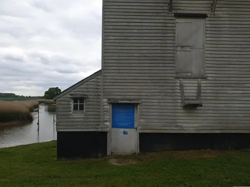
Highlights include Saint Peter's Church, Thorrington Tide Mill, Cockaynes Wood and Cockaynes Wood Nature Reserve.
Weather in Alresford
Forecast from MET Norway (CC BY 4.0). Full forecast
About Alresford
Alresford is a village and civil parish in the Tendring district of Essex, England. It is centred 9 km (5.6 mi) southeast of Colchester and is 39 km (24 mi) northeast from the county town of Chelmsford. It has a primary school, pre-school and church. Alresford won the Essex Village of the year competition in 2012 and tied for first place (in its class) for another Essex Village of the Year award in 2019.
From the Wikipedia article Alresford, Essex (this version), under CC BY-SA 4.0.
Photos of Alresford


Things to do2

Museums and landmarks6

Saint Peter's Church
Monument and historic site · 0.6 mi
Built circa 1320. Destroyed by fire 1971

Parks, trails and playgrounds14


Colne Local Nature Reserve
Park · 2.3 mi
Nature reserve in Essex, England

Salary Brook Local Nature Reserve
Park · 3.3 mi
Park in United Kingdom




2 more on the map.
Restaurants and cafes8

History
Some prehistoric finds have been found in Alresford. These include cropmark sites and the discovery of a Bronze Age cinerary urn at Alresford Grange in 1942 by school-girl Anne Pilkington in the remains of a barrow. Shards of a potential Early Bronze Age urn made from coarse flint-tempered fabric were found in a gully at Blue Gates Farm Quarry There were also 52 Middle Iron Age pottery shards (600-500 BC), 87 flints (one Mesolithic, the others Neolithic and Bronze Age tools) and two barbed arrow-heads at Broomfield Plantation.
Read more of the history
The earliest recorded building in Alresford was a Roman winged-corridor villa, and possibly a bathhouse, that was found in a field 300 yards South-East of Alresford Lodge Farm near to the Creek (TM 0609 1993), excavated in 1885 by H. Laver. The walls had been robbed out but the remaining tesselated corridors and hypocaust showed the villa was 162 1/2 feet long and 10 feet wide. It turned south at a right-angle at both ends. Coins from Faustona and Commodus (161-192 AD) as well as Samian-ware pottery shards are now preserved in Colchester Castle Museum. Plate glass was also found. During the 1920s, ploughing in this field uncovered a large marble basin. Roman bricks can be seen in the ruins of St Peter's and were also found in the foundations of Stable Cottage, Alresford Hall. At Marsh Farm pit five sherds of Late pre-Roman Iron Age/early Romano-British pottery and four struck flint flakes were recovered.
A double-ditched Romano-British enclosure (60x80m) was found with second century samian pottery shards between the Quarters and Plumptons Farm. There were also several ring-ditches containing graves in land quarried at Broomfield Plantation overlooking Alresford Creek. A Saxon ironhead and 4th century axe were found in the area of the Roman Villa excavation.
From 886 East Anglia was under Danelaw, ruled by Guthrum. This lasted until the sieges of nearby Colchester and Maldon in 917 which were won by the Wessex King Edward. Ælfar had estates on both side of the Colne. On his death around 951 these were willed to his daughter, Ælfflæd, and her husband Byrhtnoth. Byrhnoth became Ealdorman of Essex in 956. The Vikings raided periodically from 980 until Olaf Tryggvason returned in 991 with 93 ships. They landed and destroyed Folkestone, Sandwich and Ipswich before heading to Maldon. Here Ealdorman Byrhtnoth and the Essex forces were defeated at the Battle of Maldon. Ælfflæd, his widow willed Ælesforda, consisting of 2 hides and 50 acres, in 1000x1002 to her lord the king. "..In Essex the Domesday hide usually comprised four virgates, each of 30 acres, making a total of 120 acres. On royal manors, however, or at least on some of them, the hide was abnormally large…" So the estate could have been between 290 and 1000 acres. This land is the location of the current Alresford Hall.
In 1086, recorded in separate four Little Folios of the Domesday Book, Alresford was in the ancient hundred of Tendring. There were nineteen households (2 villagers, 13 smallholders, 4 slaves), 2 plough-teams, 60 sheep and 100 pigs owned by four tenants-in-chief. Nominally these were the Bishop of London (St Paul's), Bishop Odo of Bayeux, Eustace II, Count of Boulogne (formerly the King's land valued at £3) and Richard son of Count Gilbert but were let to separate tenants. The land was only valued at about half of its 1066 value and three of the four tenants had changed. No church was mentioned. Within a year, Count Eustace was dead and succeeded by his son Eustace III, Count of Boulogne. In 1088, Bishop Odo and Count Eustace III rebelled against the King, William II, were defeated at Rochester and forced into exile.
The manor in 1211 was held by Geoffrey de Fercles for three knight's fees of the Honour of Boulogne. The assessed value of the lands was 20s 9d By 1300 the manor was owned by Philip de Thundersley. Andrew de Thunderley (died 1311) held of the king 120 acres of arable and 140 acres of wood. The Manor was then valued at 17s 2d, a race of ginger and a stalk of clove gillyflower. The Manor was then inherited by Anfrid de Staunton in 1312 until 1337 and his son Humphrey, then sister Margaret who married Sir John Coggeshall, MP for Essex (UK Parliament constituency) six times between 1334 and 1358, of Codham Hall and Coggeshall, Essex.
Indications of medieval life and 87 pottery shards from the thirteenth to seventeenth century were also found in 1994 and 2001 during field-walking and test trenches in three hectares of land surveyed, at Church Farm north-west of the medieval church by the Essex Archaeological Trust. Agriculture and fishing remained the main form of employment. During Edward I's reign a disagreement about fishing rights led to a fight with men from neighbouring villages and three men drowned.
In 1279, the Manor of Cockaynes was held by Sir John de Sutton of Wivenhoe valued at 19s.
The oldest existent building in Alresford is Brook Farm house dating from the late 15th or 16th century, about three-quarters of a mile East-North-East of the church, on the modern Thorrington Road.
During the Tudor era, a number of wills detailed charity for the poor. A yearly rent-charge of 12s. 8d. on the Milch Pightle field (of the Heath Farm) was left in 1508 by Edmund Porter for the relief of the poor. In 1588, Edmund Porter left Knapps and lands of 31 acres to John Porter and his heirs. In return, Porter was expected to give the poor every Sunday from Whitsun to Michaelmas the milk of two cows; 3s/4d on Good Friday and Christmas Day. This milk tribute was later commuted into a distribution of bread. In 1571, yeoman Richard Boller refers to his almshouse at Alresford.
From the History section of Alresford, Essex on Wikipedia, under CC BY-SA 4.0.
More about Alresford
Geography
The village, 9 km (5.6 mi) southeast of Colchester, lies above Alresford Creek, a tributary to the River Colne.
The village's railway station usually sees one service per hour to Walton-on-the-Naze and Colchester. There are also some peak-time services to Clacton-on-Sea and London, operated by Greater Anglia.
The village is on the 62 and 98 bus routes. Services are provided by First Essex.
From the Wikipedia article Alresford, Essex, under CC BY-SA 4.0.
Notable people from Alresford
 John GreavesEnglish mathematician, astronomer and antiquarianPhoto: Internet Archive Book Images, No restrictions
Born in Alresford, according to Wikidata (CC0). Each name links to its Wikipedia article.
Where to stay15
Churches and places of worship3
Shopping2
Schools, colleges and libraries3
Map of Alresford
53 places. The map loads OpenStreetMap tiles when you open it.
Getting there and nearby towns
London Southend Airport (SEN) is the nearest airport with scheduled flights listed in OpenStreetMap, 24 miles away.
- Elmstead Market 2 mi north, about 3 min by car
- Rowhedge 2 mi west, about 4 min by car
- Great Bentley 3 mi east, about 4 min by car
- Colchester 5 mi northwest, about 8 min by car
- Saint Osyth 5 mi southeast, about 8 min by car
- Layer de la Haye 6 mi west, about 10 min by car
- Mistley 7 mi northeast, about 11 min by car
- Thorpe le Soken 7 mi east, about 11 min by car
- Dedham 7 mi north, about 12 min by car
- Clacton-on-Sea 8 mi southeast, about 13 min by car
Drive times are estimates from straight-line distance, not routes.
Towns near Alresford


Keep exploring
Local news
Headlines from INDB.
Reviews, tips and questions
Loading what members have shared...
Sources and licences
- GeoNames (CC BY 4.0): population, coordinates, regions and time zone
- Mapillary (see each image): photos
- OpenStreetMap contributors (ODbL 1.0): places, airports, map data
- Wikidata (CC0 1.0): elevation, founding date, time zone, website, landmarks and historic places
- Wikimedia Commons (see each image): photos
- Wikipedia (CC BY-SA 4.0): overview and history text
Photo credits
- LWB166 Alresford Essex 290691, kitmasterbloke, CC BY 2.0
- 720586, Alresford, June 19th 2023, Southsea_Matt, CC BY-SA 4.0
- Alresford Station - 54486970888, hugh llewelyn, CC BY-SA 2.0
- Alresford Station - 52418393389, hugh llewelyn, CC BY-SA 2.0
- 76017 at Alresford Station, hugh llewelyn, CC BY-SA 2.0
- Alresford Station - 51158717327, hugh llewelyn, CC BY-SA 2.0
- Alresford Station - 51160486355, hugh llewelyn, CC BY-SA 2.0
- Alresford Station 1, hugh llewelyn, CC BY-SA 2.0
- Alresford Signal Box, hugh llewelyn, CC BY-SA 2.0
- 720528, Alresford, June 19th 2023, Southsea_Matt, CC BY-SA 4.0
- Colne Local Nature Reserve 3, Dudley Miles, CC BY-SA 4.0
- Salary Brook Local Nature Reserve 3, Dudley Miles, CC BY-SA 4.0
- Wivenhoe Park, Essex, John Constable, Public domain
- University of Essex - Albert Sloman Library, Goosta, CC BY-SA 3.0
- Cockaynes Wood 16, Dudley Miles, CC BY-SA 4.0
- Alresford Church StPeter Ruins, Witchfinder9, Public domain
- Mid Hants Railway 11456, hugh llewelyn, CC BY-SA 2.0
- Mid Hants Railway 34058, hugh llewelyn, CC BY-SA 2.0
- SR Bulleid Brake Third Semi-Open No.4211 - 51160761795, hugh llewelyn, CC BY-SA 2.0
- SR Bulleid Brake Third Semi-Open No.4211 - 51158992502, hugh llewelyn, CC BY-SA 2.0
- Mid Hants Railway 563 - 54485366190, hugh llewelyn, CC BY-SA 2.0
- BR Mk.I RE No.S1105, hugh llewelyn, CC BY-SA 2.0
- Mid Hants Railway 563, hugh llewelyn, CC BY-SA 2.0
- SR Bulleid Brake Third Semi-Open No.4211, hugh llewelyn, CC BY-SA 2.0
- Mid Hants Railway 76017 - 52418112271, hugh llewelyn, CC BY-SA 2.0
- Mid Hants Railway 35005 - 54484917826, hugh llewelyn, CC BY-SA 2.0
- Mid Hants Railway 35005 - 54485114704, hugh llewelyn, CC BY-SA 2.0
- Mid Hants Railway 563 - 54485289863, hugh llewelyn, CC BY-SA 2.0
- D3462, hugh llewelyn, CC BY-SA 2.0
- Street-level photo, edloach, CC BY-SA 4.0
- Street-level photo, edloach, CC BY-SA 4.0
- Street-level photo, edloach, CC BY-SA 4.0
- Street-level photo, edloach, CC BY-SA 4.0
- Street-level photo, edloach, CC BY-SA 4.0
- Street-level photo, edloach, CC BY-SA 4.0
- Street-level photo, edloach, CC BY-SA 4.0
- Street-level photo, edloach, CC BY-SA 4.0
- Street-level photo, edloach, CC BY-SA 4.0
- Street-level photo, edloach, CC BY-SA 4.0
- Street-level photo, edloach, CC BY-SA 4.0
- Street-level photo, edloach, CC BY-SA 4.0
- Street-level photo, edloach, CC BY-SA 4.0
- Street-level photo, edloach, CC BY-SA 4.0
- Street-level photo, edloach, CC BY-SA 4.0
- Street-level photo, edloach, CC BY-SA 4.0


Page built November 10, 2026. Spotted a mistake? Tell us or suggest a place.