
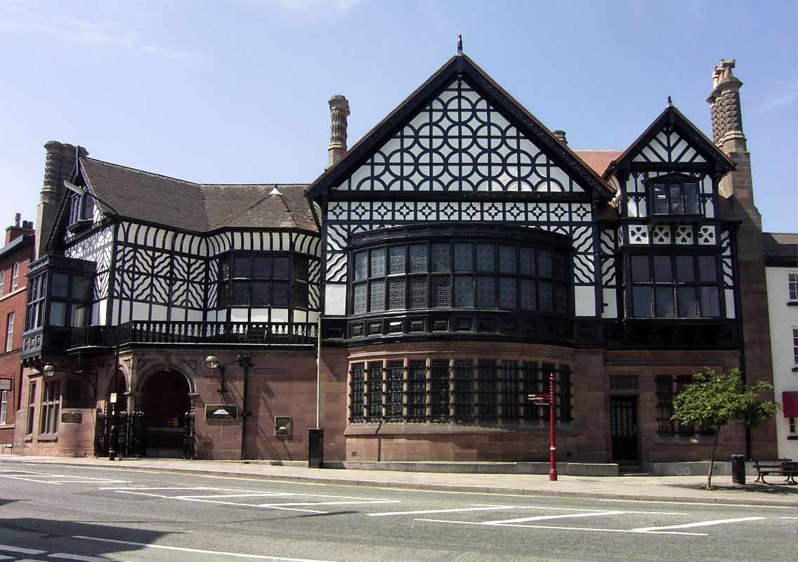


Altrincham, United Kingdom
Altrincham is a town of 49,680 people in England, United Kingdom.
Why visit Altrincham
Townapedia lists 9 museums and landmarks, 45 parks and trails, 164 places to eat, 6 places to stay and 7 attractions in and around town.
Highlights include Altrincham Garrick, Everyman Altrincham, Watch Hill Castle and Dunham Massey Hall.
Weather in Altrincham
Forecast from MET Norway (CC BY 4.0). Full forecast
About Altrincham
Altrincham is a market town in the Metropolitan Borough of Trafford, Greater Manchester, England. It is located south of the River Mersey, 8 miles (13 km) south-west of Manchester, 3 miles (5 km) south-west of Sale and 10 miles (16 km) east of Warrington. At the 2021 census, the built up area had a population of 49,680.
From the Wikipedia article Altrincham (this version), under CC BY-SA 4.0.
Travel tips from other travellers: Altrincham on Wikivoyage (CC BY-SA 4.0).
Things to do7

Altrincham Garrick
Cinema and theater · 0.4 mi
Theatre in Altrincham, Greater Manchester, England


Museums and landmarks9

Watch Hill Castle
Monument and historic site · 1.8 mi
Medieval castle in Bowdon, Greater Manchester, England, UK

Dunham Massey Hall
Museum · 2.1 mi
Grade I listed building in Trafford, Greater Manchester, England, UK


Ullerwood Castle
Monument and historic site · 3.2 mi
Castle in Greater Manchester, England
Timperley Old Hall Moated Site
Monument and historic site · 0.5 mi
Moated walled garden comprising original site of mediaeval Timperley Old Hall.

Parks, trails and playgrounds45


Sale Water Park
Park · 3.7 mi
Public park in Sale Moor, Greater Manchester



Black Moss Covert Nature Reserve
Park · 1.6 mi
Nature reserve in Greater Manchester, England

Pitch and Putt
Golf course · 1.6 mi
Kenmore Road
Su-Sa,PH 10:30-18:30 "(last tee Spring/Summer time) Autumn/Winter...
33 more on the map.
Restaurants and cafes164

Asda Café
Cafe · Coffee Shop · 1.0 mi
90 George Richards Way, Altrincham
Mo-Sa 08:30-18:00; Su 10:00-16:00

Caffè Nero
Cafe · Coffee Shop
Shaw's Road, Altrincham
Mo-Fr 07:30-18:00; Sa 07:30-18:30; Su 08:00-17:30

Gardeners Arms
Bar and pub · 0.8 mi
41 Deansgate Lane, Altrincham
Mo-Th 11:30-23:00; Fr 11:30-00:00; Sa 10:00-00:00; Su 10:00-23:00
Kickback Coffee
Cafe · Coffee Shop · 0.8 mi
4 Viaduct Road, Altrincham
Mo-Fr 08:00-15:00; Sa-Su 09:00-16:00

Stubborn Mule Brewery and Tap
Brewery and winery · 0.9 mi
1 Skelton Road, Altrincham
Fr 16:00-21:00; Sa 14:00-21:00
152 more on the map.
History
Local evidence of prehistoric human activity exists in the form of two Neolithic arrowheads found in Altrincham and, further afield, a concentration of artefacts around Dunham. The remains of a Roman road, part of one of the major Roman roads in North West England connecting the legionary fortresses of Chester (Deva Victrix) and York (Eboracum), run through the Broadheath area. As it shows signs of having been repaired, the road was in use for a considerable period of time. The town's name first appears as Aldringeham, probably meaning "homestead of Aldhere's people". As recently as the 19th century, it was spelt both Altrincham and Altringham.
Read more of the history
Until the Normans invaded England, the manors surrounding Altrincham were owned by the Saxon thegn Alweard; after the invasion they became the property of Hamon de Massey, though Altrincham is not mentioned in the Domesday Book of 1086. The earliest documented reference to the town is from 1290, when it was granted its charter as a 'free borough' by Baron Hamon de Massey V. The charter, which still exists and is held by Trafford Council, allowed a weekly market to be held, and it is possible that de Massey established the town to generate income through taxes on trade and tolls. Altrincham was probably chosen as the site of the planned town rather than Dunham, which would have been protected by Dunham Castle, because its good access to roads was important for trade.
Altrincham Fair became St James's Fair, or Samjam, in 1319 and continued until 1895. Fair days had their own court of Pye Powder (a corruption of the French for "dusty feet"), presided over by the mayor and held to settle disputes arising from the day's dealings. By 1348, the town had 120 burgage plots (ownership of land used as a measure of status and importance in an area), putting it on a par with the Cheshire town of Macclesfield, and above Stockport and Knutsford. The earliest known residence in Altrincham was the Knoll, on Stamford Street near the centre of the medieval town. A 1983 excavation on the demolished building, made by South Trafford Archaeological Group, discovered evidence that the house dated from the 13th or 14th century and that it may have contained a drying kiln or malting floor. During the English Civil War, men from Altrincham fought for the Parliamentarian Sir George Booth. During the war, armies camped on nearby Bowdon Downs on several occasions.
In 1754, a stretch of road south of Altrincham, along the Manchester to Chester route, was turnpiked. Turnpikes were toll roads which taxed passengers for the maintenance of the road. Further sections were turnpiked in 1765 from Timperley to Sale, and 1821 from Altrincham to Stockport. The maintenance of roads passed to local authorities in 1888, although by then most turnpike trusts had already declined. The connection of the Bridgewater Canal to Altrincham in 1765 stimulated the development of market gardening, and for many years Altrincham was noted for its vegetables. By 1767, warehouses had been built alongside the canal at Broadheath, the first step in the development of Broadheath as an industrial area and the beginning of Altrincham's industrialisation. The canal was connected in 1776 to the River Mersey, providing the town not only with a water route to Manchester, but also to the Irish Sea.
Moves to connect the town to the UK's railway network gained pace in 1845, when the Act of Parliament for the construction of the Manchester, South Junction and Altrincham Railway (MSJAR) was passed. The first train left Altrincham early on 20 July 1849, carrying 65 passengers. The MSJAR had two stations in the town: Altrincham, on Stockport Road, and Bowdon, though not actually in Bowdon, but on Lloyd Street/Railway Street. Both were replaced in 1881 by Altrincham & Bowdon station on Stamford New Road.
Broadheath railway station served the northern part of Altrincham between 1853 and 1962, on the London and North Western Railway's line from Manchester London Road to Warrington Bank Quay, via Lymm. A further connection was created on 12 May 1862 by the Cheshire Midland Railway (later the Cheshire Lines Committee), which opened its line from Altrincham to Knutsford.
With its new railway links, Altrincham and the surrounding areas became desirable places for the middle classes and commuters to live. Professionals and industrialists moved to the town, commuting into Manchester. While some travelled daily by coach, the less well–to–do commuted by express or "flyer" barges from Broadheath. Between 1851 and 1881, the population increased from 4,488 to 11,250. Broadheath's industrial area, covering about 250 acres (1.0 km2), was founded in 1885 by Harry Grey, 8th Earl of Stamford, to attract businesses. By 1900 Broadheath had its own docks, warehouses and electricity generating station. The site's proximity to rail, canal and road links proved attractive to companies making machine tools, cameras and grinding machines. The presence of companies like Tilghmans Sand Blast, and the Linotype and Machinery Company, established Broadheath as an industrial area of national standing. By 1914, 14 companies operated in Broadheath, employing thousands of workers. One of those was the Budenberg Gauge Company. Linotype also created 172 workers' homes near its factory, helping cater for the population boom created by Broadheath's industrialisation. Between 1891 and 1901, the population of Altrincham increased by 35%, from 12,440 to 16,831.
From the History section of Altrincham on Wikipedia, under CC BY-SA 4.0.
More about Altrincham
Geography
Altrincham lies on the south-western edge of the Greater Manchester Urban Area, immediately south of Sale and 8 miles (13 km) south-west of Manchester city centre. It lies in the north-west corner of the Cheshire Plain, just south of the River Mersey. The Bridgewater Canal passes through the Broadheath area of the town. Altrincham's drinking water is supplied by United Utilities. The local bedrock consists mainly of Keuper Waterstone, a type of sandstone, and water retrieved from those rocks is very hard and often saline, making it undrinkable. The town's climate is generally temperate, with few extremes of temperature or weather. The mean temperature is slightly above average for the United Kingdom, whereas both annual rainfall and average hours of sunshine are slightly below the average for the UK.
Economy
Historically, Altrincham was a market town and the two main areas of employment were agriculture and market trade. Although the town went into decline in the 15th century, it recovered and the annual fairs lasted until the mid-19th century and the market still continues. During the Industrial Revolution, Altrincham grew as an industrial town, particularly the Broadheath area, which was developed into an industrial estate. In 1801, there were four cotton mills in Altrincham, although they had closed by the 1851 census. The decline of the textile industry in Altrincham mirrored the decline of the industry in the Trafford area as a result of a lack of investment and the development of more established industrial areas such as Manchester, Ashton-under-Lyne and Oldham.
Arts and culture
The Old Market Place is thought to stand on the site of the original town settlement. Now a registered conservation area, it consists of a series of part timber-framed buildings echoing the wattle and daube constructions of the original houses and burgage plots; the cobblestone paving was replaced in 1896. The Buttermarket, which stood in the area near the Old Market Place from the 17th century until the late 19th century, was also the site for dispensing early local justice. A courtroom, stocks and whipping post saw public floggings take place there until the early 19th century. The whipping post and stocks were restored as a tourist attraction by local traders in the 1990s.
Education
As Altrincham was part of the Bowdon parish, children from the township may have gone to the 16th-century school established at Bowdon; before that point, the town had no formal education system. A salt merchant from Dunham Woodhouses founded a school at Oldfield House intended for 40 boys aged 8–11 from the surrounding area. Sunday schools were set up in the late 18th and early 19th centuries. Altrincham's increasing population prompted the founding of more schools during the early 19th century; by 1856 the town had nineschools, one college and 23 teachers. The introduction of compulsory education during the second half of the 19th century increased the demand for schools; by 1886, Altrincham had 12 church schools and eight private schools.
Responsibility for local education fell to Cheshire County Council in 1903. Loreto Convent, the County High School for Girls and Altrincham County High School for Boys, were founded in 1909, 1910 and 1912 respectively. Although still open, these schools have since changed their names to Altrincham Grammar School for Girls, Altrincham Grammar School for Boys and Loreto Grammar School. Altrincham received evacuees during the Second World War and it was in this period that St. Ambrose College was founded.
From the Wikipedia article Altrincham, under CC BY-SA 4.0.
Notable people from Altrincham
 Eileen PowerBritish historian (1889–1940)Photo: Auguste Léon, Public domain
 Philip EganBritish bishopPhoto: Apostleship of the Sea, Public domain
 Belinda Washingtonactress and TV presenterPhoto: Pedro J Pacheco, CC BY-SA 4.0
 Stephen WhittleBritish academic, trans-man and LGBT rights activistPhoto: Pretzelles, CC BY-SA 4.0
 Alan BarnesBritish musicianPhoto: Jeff Hardcastle England, CC BY 2.0
- Angela CartwrightBritish actress
- Steve JacksonBritish game designer
- Margaret FishendenFishenden [née White], Margaret (1889–1977), industrial researcher
- Paul Bradshawprofessional footballer (1956-2024)
- Paul AllottCricket player of England. (born 1956)
- Alan BlinstonBritish athletics competitor
- Ben BarclayEnglish association football player (born 1996)
Born in Altrincham, according to Wikidata (CC0). Each name links to its Wikipedia article.
Where to stay6
Churches and places of worship42
Shopping27
Gas and EV charging8
Schools, colleges and libraries45
Healthcare20
Cohens Chemist
Clinic and pharmacy · 1.2 mi
6 Vale View Vicarage Lane, Altrincham
Map of Altrincham
250 places. The map loads OpenStreetMap tiles when you open it.
Getting there and nearby towns
Manchester Airport (MAN) is the nearest airport with scheduled flights listed in OpenStreetMap, 4 miles away.
- Hale 1 mi southeast, about 1 min by car
- Timperley 1 mi northeast, about 2 min by car
- Sale 3 mi north, about 4 min by car
- Urmston 4 mi north, about 7 min by car
- Stretford 5 mi north, about 7 min by car
- Irlam 5 mi northwest, about 8 min by car
- Didsbury 5 mi northeast, about 8 min by car
- Lymm 5 mi west, about 9 min by car
- Knutsford 6 mi south, about 10 min by car
- Wilmslow 6 mi southeast, about 10 min by car
Drive times are estimates from straight-line distance, not routes.
Towns near Altrincham


Keep exploring
Local news
Headlines from INDB.
Reviews, tips and questions
Loading what members have shared...
Sources and licences
- GeoNames (CC BY 4.0): population, coordinates, regions and time zone
- Mapillary (see each image): photos
- OpenStreetMap contributors (ODbL 1.0): places, airports, map data
- Wikidata (CC0 1.0): elevation, founding date, time zone, website, landmarks and historic places
- Wikimedia Commons (see each image): photos
- Wikipedia (CC BY-SA 4.0): overview and history text
Photo credits
- Altrincham Old Market Place, User:Andreeg2001, Public domain
- Altrincham Station clock tower, Cnbrb, CC BY-SA 4.0
- Altrincham Interchange, Cnbrb, CC BY-SA 4.0
- Clock Tower, Altrincham, Richard Sutcliffe, CC BY-SA 2.0
- Altrincham Interchange concourse 11 18 37 389000, Cnbrb, CC BY-SA 4.0
- Watch Hill Castle, 2009, Richard Nevell, CC BY-SA 4.0
- Dunham Massey 2015 105, Photograph by Mike Peel ( www.mikepeel.net )., CC BY-SA 4.0
- Birch Moss covert, Parrot of Doom, CC BY-SA 3.0
- SaleWaterPark640, Malleus Fatuorum at en.wikipedia, Public domain
- St Margaret’s Church Dunham Rd Altrincham, ArcLight, CC BY-SA 3.0
- St Mary's Church, Bowdon, David Long, CC BY-SA 2.0
- St Elizabeth's Church, Ashley 02, Dave.Dunford, CC BY-SA 4.0
- Stgeorgeschurch, Dave Smethurst, CC BY-SA 2.0
- Moss Lane, Jimbo online at English Wikipedia, Public domain
- Altrincham Grammar School for Boys (1), Rept0n1x, CC BY-SA 3.0
- Icedomeinterior, LearnedRobb, CC BY-SA 3.0
- Saint Ambrose College - Main Entrance, Stuart Newmanite, CC BY-SA 4.0
- Frank Sidebottom statue Timperley Manchester, Duncan.Hull, CC BY-SA 3.0
- Street-level photo, julianlb, CC BY-SA 4.0
- Street-level photo, southglos, CC BY-SA 4.0
- Street-level photo, southglos, CC BY-SA 4.0
- Street-level photo, southglos, CC BY-SA 4.0
- Street-level photo, southglos, CC BY-SA 4.0
- Street-level photo, julianlb, CC BY-SA 4.0


Page built November 10, 2026. Spotted a mistake? Tell us or suggest a place.