
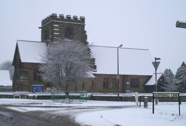


Appleton Thorn, United Kingdom
Appleton Thorn is a town of 1,324 people in England, United Kingdom.
Why visit Appleton Thorn
Townapedia lists 7 museums and landmarks, 9 parks and trails, 7 places to eat, 3 places to stay and 3 attractions in and around town.
Highlights include Thelwall Viaduct, Warrington Bridge, Arley Hall and Warrington Museum and Art Gallery.
Weather in Appleton Thorn
Forecast from MET Norway (CC BY 4.0). Full forecast
About Appleton Thorn
Appleton Thorn is a village in the borough of Warrington in Cheshire, England.
From the Wikipedia article Appleton Thorn (this version), under CC BY-SA 4.0.
Photos of Appleton Thorn


Things to do3

Thelwall Viaduct
Bridge · 3.1 mi
Motorway viaduct in Warrington, United Kingdom

Warrington Bridge
Bridge · 3.1 mi
Bridge in Warrington, Cheshire, England, United Kingdom

Howley Footbridge
Bridge · 2.9 mi
Footbridge in Warrington, Cheshire, England, UK
Museums and landmarks7


Warrington Museum and Art Gallery
Museum · 3.3 mi
Grade II listed building and museum in Warrington, United Kingdom


Museum of Policing in Cheshire
Museum · 3.4 mi
Museum in Warrington, England, United Kingdom

Parks, trails and playgrounds9

Paddington Meadows
Park · 3.0 mi
Nature reserve in Paddington, Warrington, Cheshire, England, United Kingdom


Grappenhall Heys Walled Garden
Park · 1.1 mi
Park in Grappenhall, United Kingdom



Restaurants and cafes7

Parr Arms
Bar and pub · 1.5 mi
4 Church Lane, Warrington
Mo-Th,Sa 12:00-23:00; Fr 12:00-23:30; Su 12:00-22:30

Primrose Cafe at the Walled Gardens
Cafe · Sandwich, Cake, Tea · 1.1 mi
Rivington Lane
Fr-Su 10:00-16:00
The Thorn Inn
Bar and pub
Grappenhall Lane, Warrington
Mo-Sa 12:00-23:00; Su 12:00-22:30
Ram's Head
Bar and pub · 1.5 mi
Church Lane, Warrington
Mo-Th 12:00-23:00, Fr,Sa 12:00-24:00, Su 12:00-22:00
Where to stay3
Churches and places of worship17
Shopping1
Gas and EV charging1
Schools, colleges and libraries8
Healthcare1
Map of Appleton Thorn
57 places. The map loads OpenStreetMap tiles when you open it.
Getting there and nearby towns
Manchester Airport (MAN) is the nearest airport with scheduled flights listed in OpenStreetMap, 11 miles away.
- Warrington 3 mi northwest, about 5 min by car
- Lymm 3 mi northeast, about 6 min by car
- High Legh 4 mi east, about 6 min by car
- Great Sankey 5 mi northwest, about 8 min by car
- Northwich 6 mi south, about 10 min by car
- Croft 6 mi north, about 9 min by car
- Newton-le-Willows 7 mi north, about 12 min by car
- Runcorn 8 mi west, about 12 min by car
- Widnes 8 mi west, about 13 min by car
- Knutsford 8 mi southeast, about 12 min by car
Drive times are estimates from straight-line distance, not routes.
Towns near Appleton Thorn


Keep exploring
Local news
Headlines from INDB.
Reviews, tips and questions
Loading what members have shared...
Sources and licences
- GeoNames (CC BY 4.0): population, coordinates, regions and time zone
- Mapillary (see each image): photos
- OpenStreetMap contributors (ODbL 1.0): places, airports, map data
- Wikidata (CC0 1.0): elevation, founding date, time zone, website, landmarks and historic places
- Wikimedia Commons (see each image): photos
- Wikipedia (CC BY-SA 4.0): overview and history text
Photo credits
- St Cross Church, Appleton Thorn, David Long, CC BY-SA 2.0
- Appleton Thorn Primary School, Frombowen, CC BY-SA 4.0
- Thelwall viaduct, Martin Clark, CC BY-SA 2.0
- Mersey Street Bridge, Warrington, Lancs, Mersey_Street_Bridge,_Warrington_-_DSC05919.JPG : Green Lane derivative work: Hogweard ( talk ), CC BY-SA 3.0
- Arley hall, Pixie2000 at English Wikipedia, Public domain
- Front of Museum, RDJ226, CC BY 3.0
- Woolston Eyes nature reserve main hide, Andy Mabbett, CC BY 3.0
- Thelwall All Saints 2, Peter I. Vardy, Public domain
- St John the Evangelist's Church, Higher Walton 01, Dave.Dunford, CC BY-SA 4.0
- Arley Hall Chapel 1, Peter I. Vardy, CC BY-SA 4.0
- Lymm St Mary 4, Peter I. Vardy, Public domain
- St Mary's Church, Warrington, JThomas, CC BY-SA 2.0
- Appleton - Appleton Cross, David Marten, CC BY-SA 2.0
- St Cross Church 1139338, Peter.r.howard, CC BY-SA 3.0
- HM Prison Thorn Cross, Liverpoolpics, CC BY-SA 3.0
- Appleton 2, Liverpoolpics, CC BY-SA 3.0
- River Mersey at Paddington Meadows, Warrington, Szzuk, CC0
- Street-level photo, mapillarygelec, CC BY-SA 4.0
- Street-level photo, mapillarygelec, CC BY-SA 4.0


Page built November 10, 2026. Spotted a mistake? Tell us or suggest a place.