


Northwich, United Kingdom
Northwich is a town of 47,421 people in England, United Kingdom.
Why visit Northwich
Townapedia lists 12 museums and landmarks, 23 parks and trails, 100 places to eat, 2 places to stay and 6 attractions in and around town.
Highlights include Harlequin Theatre, Northwich, Hartford Bridge, Cheshire, Lion Salt Works and Weaver Hall Museum & Workhouse.
Weather in Northwich
Forecast from MET Norway (CC BY 4.0). Full forecast
About Northwich
Northwich is a market town and civil parish in the Cheshire West and Chester borough of Cheshire, England. It lies on the Cheshire Plain, at the confluence of the rivers Weaver and Dane, 18 miles (29 km) east of Chester, 15 miles (24 km) south of Warrington, 19 miles (31 km) south of Manchester, 69 miles (111 km) north of Birmingham and 22 miles (35 km) south-east of Liverpool. The population of the parish was 22,726 at the 2021 census.
From the Wikipedia article Northwich (this version), under CC BY-SA 4.0.
Travel tips from other travellers: Northwich on Wikivoyage (CC BY-SA 4.0).
Photos of Northwich

Things to do6

Harlequin Theatre, Northwich
Cinema and theater
Theatre in Northwich, Cheshire, England
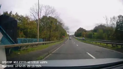
Hartford Bridge, Cheshire
Bridge · 1.5 mi
Bridge near Hartford, Cheshire, United Kingdom
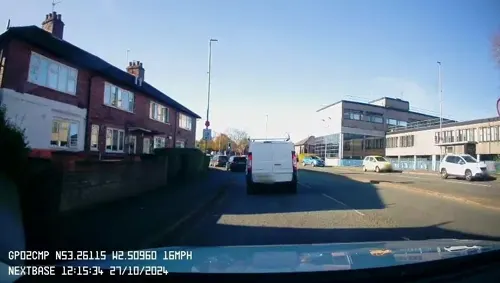
Northwich Memorial Hall
Cinema and theater · 0.4 mi
Former theater in England

Museums and landmarks12

Lion Salt Works
Museum · 1.5 mi
Salt works in Cheshire, UK, preserved as a museum
Ollershaw Lane, Marston
Tu-Su 10:30-17:00; Mo off; PH 10:30-17:00

Weaver Hall Museum & Workhouse
Museum · 0.4 mi
162 London Road, Northwich
Tu-Fr 10:00-17:00,Sa-Su 14:00-17:00

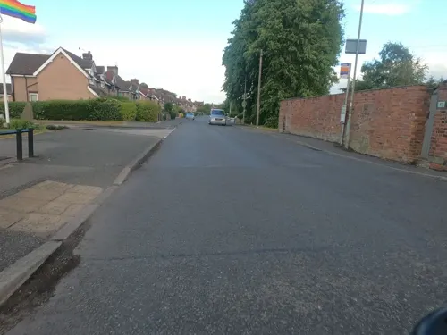
Moulton War Memorial
Monument and historic site · 2.5 mi
War memorial in Cheshire, England, UK

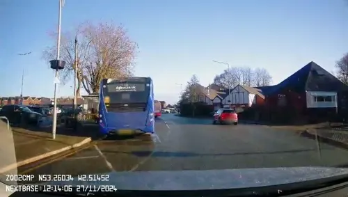
Weaver Hall Museum and Workhouse
Museum · 0.4 mi
Grade II listed museum in Northwich, Cheshire West and Chester, UK



Parks, trails and playgrounds23



Marbury Reedbed Nature Reserve
Park · 1.9 mi
Nature Reserve in England



11 more on the map.
Restaurants and cafes100



Northwich Tandoori
Restaurant · Indian · 0.5 mi
104 Witton Street, Northwich
Mo-Th 17:15-22:30; Fr,Sa 17:00-23:00; Su 16:30-22:30
After Five
Restaurant · Chinese · 0.9 mi
73-75 Station Road, Northwich
Th-Mo 16:00-21:00
88 more on the map.
History
During Roman times, Northwich was known as Condate, thought to be a Latinisation of a Brittonic name meaning "Confluence". There are several other sites of the same name, mostly in France; in Northwich's case, it lies at the junction of the rivers Dane and Weaver.
Northwich can be identified through two contemporary Roman documents. The first of these is the Antonine Itinerary, a 3rd-century road map split into 14 sections. Two of these sections, or Itinerary, mention Condate: Route II ("the route from the Wall to the port of Rutupiae") and Route X ("the route from Glannoventa to Mediolanum"). The second document is the 7th-century Ravenna Cosmography; it refers to Condate between the entries for Salinae (now Middlewich, Cheshire) and Ratae (now Leicester, Leicestershire), at the time the capital of the Corieltauvi tribe.
Read more of the history
The Romans' interest in the Northwich area is thought to be due to the strategic river crossing and the location of the salt brines. Salt was very important in Roman society; the Roman word salarium, linked employment, salt and soldiers, but the exact link is unclear. It is also theorised that this is the basis for the modern word salary. Another theory is that the word soldier itself comes from the Latin sal dare (to give salt). There is archaeological evidence of a Roman auxiliary fort within the area of Northwich, now known as "Castle", dated to AD 70. This, and other north-western forts, were built as the Romans moved north from their stronghold in Chester.
The association with salt continues in the etymology of Northwich. The "wich" (or "wych") suffix applies to other towns in the area: Middlewich, Nantwich and Leftwich. This is considered to have been derived from the Norse, wic for bay, and is associated with the more traditional method of obtaining salt by evaporating sea water. Therefore, a place for making salt became a wych-house; Northwich was the most northern of the -wich towns in Cheshire.
The existence of Northwich in the early medieval period is shown by its record in the Domesday Book of 1086:
In the same Mildestuic hundred, there was a third wich called Norwich [Northwich] and it was at farm for £8.
There were the same laws and customs there as there were in the other wiches and the king and the earl similarly divided the renders.
This was waste when (Earl) Hugh received it; it is now worth 35s.
The manor of Northwich belonged to the Earls of Chester until 1237, when the family line died out. Subsequently, Northwich became a royal manor and was given to a noble family to collect tolls in exchange for a set rent.
The Cheshire archers were a body of élite soldiers noted for their skills with the longbow, who fought in many engagements in Britain and France in the Middle Ages. Battles at which there were sizeable numbers of Cheshire archers include Agincourt and Crécy; many of these archers hailed from the Northwich Hundred. Richard II employed a bodyguard of these yeoman archers who came from the Macclesfield Hundred and the forest districts of Cheshire.
That salt production continued throughout the centuries and can be seen through John Leland's description of the town in 1540:
and by the Salters houses be great stakes of smaul cloven wood,
Between 1642 and 1643, during the English Civil War, Northwich was fortified and garrisoned by Sir William Brereton for the Parliamentarians.
The salt beds beneath Northwich were rediscovered in the 1670s by employees of the local Smith-Barry family. The Smith-Barrys were looking for coal, but instead discovered rock salt, in the grounds of the family home, Marbury Hall (since demolished) to the north of Northwich.
During the 19th century, it became uneconomical to mine for the salt; instead, hot water was pumped through the mines, which dissolved the salt. The resultant brine was pumped out, from which the salt was extracted. This technique weakened the mines and led to land subsidence as they collapsed. Subsidence affected the town and the surrounding landscape. For example, collapses in 1880 formed Witton Flash as the River Weaver flowed into a huge hole caused by subsidence. Subsidence also allegedly accounts for many old timber-framed houses in the town centre, which were better able to withstand the movement of the ground. Some houses were built on a base of steel girders that could be jacked up to level the house with each change in the underlying ground. The town's historical link with the salt industry is celebrated in its the Weaver Hall Museum and Workhouse, which is now in the old workhouse.
In 1874, John Brunner and Ludwig Mond founded Brunner Mond in Winnington and started manufacturing soda ash using the Solvay ammonia-soda process. This process used salt as a main raw material. The chemical industry used the subsided land for the disposal of waste from the manufacture of soda-ash. The waste was transported through a network of cranes and rails to the produce limebeds. This was a dangerous alkaline substance and caused the landscape to be abandoned as unusable.
From the History section of Northwich on Wikipedia, under CC BY-SA 4.0.
More about Northwich
Geography
Northwich is situated in the Cheshire Plain . The town lies between 15 and 35 metres (49 and 115 ft) above mean sea level. It is surrounded by the following civil parishes, starting due north and proceeding in a clockwise direction: Anderton with Marbury, Marston, Wincham, Lostock Gralam, Rudheath, Davenham, Hartford, Weaverham and Barnton.
Two rivers meet in the town centre: the Weaver and the Dane; the town is surrounded by undulating pasture. Subsidence and the collapse of underground saltworks has created flashes and there are also local meres; for example, to the north is Budworth Mere and to the north-east is Pick Mere.
Economy
Northwich has been described by Leland as having a market since at least 1535, but there is no surviving charter. The town still has a market today, which is earmarked for refurbishment as part of the Northwich Vision plans.
The town's economy was dominated by the salt industry. However, a list of tolls for goods crossing over Northwich bridge in 1353 shows goods coming into the town, including a wide range of carcasses, fleeces, hides and skins, cloth, fish, alcoholic drinks, dairy products, building materials, household goods, metals and glass, and millstones. This indicates a much wider economic base to medieval Northwich than just the salt trade. Documentary evidence also exists for a mill from 1332 onwards and there is evidence for more than one mill from 1343.
Allied to the extraction of salt was a bulk chemical industry, which became concentrated at the three ICI sites at Winnington, Wallerscote and Lostock. The first industrially practical method for producing polythene was accidentally discovered at the Winnington Laboratory in 1933.
The bakers Frank Roberts & Sons have been associated with the town since 1887 and continues to be based near the town at Rudheath on the A556. Two of its three main business divisions, Roberts Bakery and The Little Treats Co, are based in Northwich; Aldred's The Bakers is in Ilkeston, Derbyshire.
Arts and culture
The town hosts a number of large annual festivals, including music, river and the famous Northwich Pina Colada events.
Since 2021, an annual Piña Colada Festival has taken place in recognition of Rupert Holmes who was born in the town and wrote "Escape (The Piña Colada Song)", released in 1979. The festival grew in 2022, with live music, fairground rides and old school street games among other attractions. Local bars, restaurants and cafés offered piña coladas alongside other tropical themed drinks and snacks.
Northwich Memorial Hall was opened in 1960, but closed for redevelopment in 2013 to be replaced by the Memorial Court Facility; this opened in 2015. It hosted a range of activities, including pantomimes, music events and the Purple Cactus Comedy Club.
The Harlequin Theatre produces six plays each year and is also the home of Northwich Folk Club, which has run continuously since 1977.
The Regal cinema closed in 2007 and was demolished; a new cinema opened in the Barons Quay development in 2016. Northwich Plaza also offered a wide range of music gigs and other cultural events.
Local horror author Stuart Neild's first novel, A Haunted Man, was set in the salt mines that run underneath Northwich, combining fact with supernatural fiction. Neild's novels featuring Northwich and other North West locations. A Hollywood film and television series was in development.
Education
Northwich and its surroundings has a number of schools and colleges. Sir John Deane's College is now a sixth form college, but was originally formed as a grammar school in 1557. The school was originally known as Witton Grammar School and was erected close to Witton Chapel. The school moved to its current location, to the south of the town, in 1907–08. The Grange School, Northwich is an independent school.
Kingsmead was shortlisted for the Prime Minister's Better Public Building award in 2005.
Rosebank School is a school for autistic children, aged 3–11 years.
During the 19th century, many new schools were founded and, by 1850, twelve academies were recorded in the area. The town is now served by County High School Leftwich, a specialist media arts college, while Rudheath Senior Academy, a specialist performing arts college and Hartford Church of England High School both admit pupils from Northwich. There are also several primary schools in the area. St. Nicholas Catholic High School is also in the local vicinity and performs well on national exam boards, coming second in the whole of Cheshire.
Mid Cheshire College had its main campus in nearby Hartford, offering further education courses. The campus closed in 2018 after it merged with Warrington Collegiate a year earlier to form Warrington and Vale Royal College.
From the Wikipedia article Northwich, under CC BY-SA 4.0.
Notable people from Northwich
 Rupert HolmesBritish-American composer and singer-songwriter and playwrightPhoto: Infinity Records, Public domain
 Geoff BarnettEnglish footballer (born 1946)Photo: Rob Mieremet / Anefo, CC0
- Paula RadcliffeEnglish long-distance runner
- Shirley StrongBritish athletics competitor (born 1958)
- Peter Egerton-WarburtonBritish military officer, Commissioner of Police for South Australia and Australian explorer (1813–1889)
- Michael OakesEnglish footballer (born 1973)
- Sue BirtwistleBritish television producer
- Arron BanksEnglish businessman and political donor
- Percy M. YoungBritish musicologist (1912–2004)
- Tom ManleyEnglish footballer and manager (1912-1988)
- Harry LoweEnglish footballer (1886-1966)
- Joe DaleBritish footballer (1921-2000)
Born in Northwich, according to Wikidata (CC0). Each name links to its Wikipedia article.
Where to stay2
Churches and places of worship31
Shopping28
Schools, colleges and libraries18
Witton Church Walk CofE Aided Nursery and Primary School
School · Anglican · 0.6 mi
Church Walk, Northwich
Healthcare11
Map of Northwich
231 places. The map loads OpenStreetMap tiles when you open it.
Getting there and nearby towns
Manchester Airport (MAN) is the nearest airport with scheduled flights listed in OpenStreetMap, 12 miles away.
- Winsford 5 mi south, about 7 min by car
- Middlewich 6 mi southeast, about 9 min by car
- Knutsford 7 mi northeast, about 11 min by car
- Lymm 9 mi north, about 14 min by car
- Warrington 10 mi north, about 15 min by car
- Runcorn 10 mi northwest, about 17 min by car
- Sandbach 10 mi southeast, about 16 min by car
- Widnes 11 mi northwest, about 18 min by car
- Hale 11 mi northeast, about 18 min by car
- Wilmslow 13 mi east, about 21 min by car
Drive times are estimates from straight-line distance, not routes.
Towns near Northwich


Keep exploring
Local news
Headlines from INDB.
Reviews, tips and questions
Loading what members have shared...
Sources and licences
- GeoNames (CC BY 4.0): population, coordinates, regions and time zone
- Mapillary (see each image): photos
- OpenStreetMap contributors (ODbL 1.0): places, airports, map data
- Wikidata (CC0 1.0): elevation, founding date, time zone, website, landmarks and historic places
- Wikimedia Commons (see each image): photos
- Wikipedia (CC BY-SA 4.0): overview and history text
Photo credits
- Northwich - Public Library, Dave Bevis, CC BY-SA 2.0
- Northwich - Town Bridge, Lizzie, CC BY-SA 2.0
- Salt museum northwich, Lizzie, CC BY-SA 2.0
- Hayhurst Swing Bridge, Northwich, Mike Todd, CC BY-SA 2.0
- Northwich Wharves on River Weaver 1729216 f3d011f0, Ben Brooksbank, CC BY-SA 2.0
- Northwich Twinned with Dole - Flickr - psd, Paul Downey from Berkhamsted, UK, CC BY 2.0
- Harlequin Theatre, Northwich, Johnsongwriter54, CC BY-SA 3.0
- Lion Salt Works, Chris Allen, CC BY-SA 2.0
- Marbury park, Mike Harris, CC BY-SA 2.0
- Weaverham Methodist Church, Sue Adair, CC BY-SA 2.0
- Sandiway St John 1, Peter I. Vardy, Public domain
- WeaverHall1837, RLamb, CC0
- StHelenWitton2, RLamb, Public domain
- Hartford church, Jo Lxix, CC BY-SA 2.0
- Anderton Boat Lift 4, Photograph by Mike Peel ( www.mikepeel.net )., CC BY-SA 4.0
- Sir john deane college, Lizzie, CC BY-SA 2.0
- The Hollies, Hartford, Dave.Dunford, CC BY-SA 4.0
- Whitehall, Hartford, Cheshire, Dave.Dunford, CC BY-SA 4.0
- Anderton Boat Lift 8, Photograph by Mike Peel ( www.mikepeel.net )., CC BY-SA 4.0
- The Brunner library, Northwich (24464362501), Libraries Taskforce, CC BY 2.0
- Autumn in Anderton Nature Park - panoramio, Copta, CC BY 3.0
- Street-level photo, mapillarygelec, CC BY-SA 4.0
- Street-level photo, mapillarygelec, CC BY-SA 4.0
- Street-level photo, mapillarygelec, CC BY-SA 4.0
- Street-level photo, rossa, CC BY-SA 4.0
- Street-level photo, mapillarygelec, CC BY-SA 4.0
- Street-level photo, mapillarygelec, CC BY-SA 4.0
- Street-level photo, rossa, CC BY-SA 4.0
- Street-level photo, mapillarygelec, CC BY-SA 4.0
- Street-level photo, mapillarygelec, CC BY-SA 4.0
- Street-level photo, mapillarygelec, CC BY-SA 4.0
- Street-level photo, mapillarygelec, CC BY-SA 4.0
- Street-level photo, rossa, CC BY-SA 4.0
- Street-level photo, mapillarygelec, CC BY-SA 4.0
- Street-level photo, rossa, CC BY-SA 4.0
- Street-level photo, mapillarygelec, CC BY-SA 4.0
- Street-level photo, rossa, CC BY-SA 4.0
- Street-level photo, rossa, CC BY-SA 4.0
- Street-level photo, mapillarygelec, CC BY-SA 4.0


Page built November 10, 2026. Spotted a mistake? Tell us or suggest a place.