


Why visit Banwell
Townapedia lists 11 museums and landmarks, 1 park or trail, 8 places to eat, 4 places to stay and 2 attractions in and around town.
Highlights include The Helicopter Museum.
Weather in Banwell
Forecast from MET Norway (CC BY 4.0). Full forecast
About Banwell
Banwell is a village and civil parish on the River Banwell in the North Somerset district of Somerset, England. Its population was 3,251 according to the 2021 census.
From the Wikipedia article Banwell (this version), under CC BY-SA 4.0.
Things to do2


Museums and landmarks11

The Helicopter Museum
Museum · 2.7 mi
Aviation museum in Somerset, United Kingdom


Parks, trails and playgrounds1

Restaurants and cafes8
Banwell Garden Centre
Cafe · 0.7 mi
Castle Hill, Banwell
Mo-Fr 08:30-17:30; Sa 09:00-17:30; Su 10:00-16:30
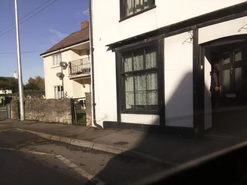

Chillies Indian restaurant
Restaurant · Indian
26 Church Street, Banwell
Mo, We, Th, Su 17:00-22:30; Fr, Sa 17:00-23:00


History
Banwell Camp, east of the village, is a univallate hillfort which has yielded flint implements from the Palaeolithic, Neolithic and Bronze Age. It was also occupied in the Iron Age. In the late 1950s it was excavated by J. W. Hunt of the Banwell Society of Archaeology. It is surrounded by a 4 metres (13 ft) high bank and ditch.
The remains of a Romano-British villa were discovered in 1968. It included a courtyard, wall and bath house close to the River Banwell. Artefacts from the site suggest it fell into disuse in the 4th century. Earthworks from farm buildings, 420 metres (1,380 ft) south of Gout House Farm, occupied from the 11th to 14th centuries where archaeological remains suggest the site was first occupied in the Romano-British period. The raised area which was occupied by the Bower House was surrounded by a water-filled ditch, part of which has since been incorporated into a rhyne (a drainage ditch).
Banwell Abbey was built as a bishop’s residence in the 14th and 15th century on the site of a monastic foundation. It was renovated in 1870 by Hans Price, and is now a Grade II* listed building. Nearby is a small building presented to the village by Miss Elizabeth Fazakerly, who lived at The Abbey in 1887, to house a small fire-engine. It served as the fire station until the 1960s and now houses a small museum of memorabilia related to the fire station.
Read more of the history
"Beard's Stone" in Cave's Wood dates from 1842. It marks the reburial site of an ancient human skeleton found in a cave near Bishop's Cottage. William Beard, an amateur archaeologist who had found the bones, had them reinterred and marked the site with the stone with a poetic inscription.
Banwell Castle is a Victorian castle built in 1847 by John Dyer Sympson, a solicitor from London. Originally built as his home, it is now a hotel and restaurant and is a Grade II* listed building.
Of the two historical village pumps standing in the village, one of them was erected to commemorate Queen Victoria's Diamond Jubilee.
From the History section of Banwell on Wikipedia, under CC BY-SA 4.0.
More about Banwell
Geography
Banwell is located 5 miles (8.0 km) east of Weston-super-Mare on the A371 road and is where the western end of the A368 road begins. The village is at the west end of the northern side of the Mendip hills.
The village is located between the M5 motorway and the A38, and is used by a significant volume of commuter traffic. This traffic, together with other users of the A371 and A368, often causes the narrow streets of Banwell to become jammed.
There has been a campaign to bypass Banwell for many years, but other villages in the area have objected as increasing the traffic capacity on the roads would create problem on their roads. The Greater Bristol Strategic Transport Study in 2006 recommended that a road be built from Junction 21 of the M5 directly to Bristol Airport, bypassing Banwell and all the other local villages, thus alleviating their concerns.
However, this would not benefit local traffic passing through Banwell to and from Weston-super-Mare, Wells and Bath, so some traffic problems would still exist.
Banwell Caves is a 1.7 hectares (4.2 acres) geological and biological Site of Special Scientific Interest at the western end of Banwell Hill.
From the Wikipedia article Banwell, under CC BY-SA 4.0.
Notable people from Banwell
- Mike Adamsprofessional footballer (born 1965)
- Derek HodgkinsonFootballer (born 1944)
- John Alan Lyde CaunterBritish general
- William Job MaillardBritish naval medical officer (1863–1903); recipient of the Victoria Cross
Born in Banwell, according to Wikidata (CC0). Each name links to its Wikipedia article.
Where to stay4
Churches and places of worship12
Schools, colleges and libraries1
Map of Banwell
39 places. The map loads OpenStreetMap tiles when you open it.
Getting there and nearby towns
Bristol Airport (BRS) is the nearest airport with scheduled flights listed in OpenStreetMap, 7 miles away.
- Sandford 2 mi east, about 3 min by car
- Locking 2 mi west, about 3 min by car
- Shipham 3 mi east, about 5 min by car
- Churchill 4 mi east, about 6 min by car
- Weston-super-Mare 5 mi west, about 8 min by car
- Yatton 5 mi northeast, about 7 min by car
- Wrington 5 mi northeast, about 8 min by car
- Brent Knoll 7 mi southwest, about 11 min by car
- Blagdon 7 mi east, about 11 min by car
- Clevedon 8 mi north, about 13 min by car
Drive times are estimates from straight-line distance, not routes.
Towns near Banwell


Keep exploring
Local news
Headlines from INDB.
Reviews, tips and questions
Loading what members have shared...
Sources and licences
- GeoNames (CC BY 4.0): population, coordinates, regions and time zone
- Mapillary (see each image): photos
- OpenStreetMap contributors (ODbL 1.0): places, airports, map data
- Wikidata (CC0 1.0): elevation, founding date, time zone, website, landmarks and historic places
- Wikimedia Commons (see each image): photos
- Wikipedia (CC BY-SA 4.0): overview and history text
Photo credits
- Banwell Church (St. Andrew), hugh llewelyn, CC BY-SA 2.0
- WestonHelicopterMuseum, Adrian and Janet Quantock, CC BY-SA 2.0
- Comptonbishopchurch, Rodw at English Wikipedia, Public domain
- St James' Church, Winscombe, Somerset (5519394930), Robert Cutts from Bristol, England, UK, CC BY 2.0
- Church of St. John the Baptist, Churchill, Andrew Riley, CC BY-SA 2.0
- Christon church, Ruth Sharville, CC BY-SA 2.0
- Puxton church, Brian Robert Marshall, CC BY-SA 2.0
- Churchill Methodist Church, Gricharduk, CC BY-SA 4.0
- Banwellchurch, dbown100, CC BY 3.0
- Street-level photo, southglos, CC BY-SA 4.0
- Street-level photo, southglos, CC BY-SA 4.0
- Street-level photo, southglos, CC BY-SA 4.0
- Street-level photo, southglos, CC BY-SA 4.0
- Street-level photo, southglos, CC BY-SA 4.0
- Street-level photo, southglos, CC BY-SA 4.0
- Street-level photo, southglos, CC BY-SA 4.0


Page built November 10, 2026. Spotted a mistake? Tell us or suggest a place.