


Weston-super-Mare, United Kingdom
Weston-super-Mare is a town of 82,903 people in England, United Kingdom.
Why visit Weston-super-Mare
Townapedia lists 24 museums and landmarks, 22 parks and trails, 161 places to eat, 34 places to stay and 11 attractions in and around town.
Highlights include Plaza Weston, Grand Pier, Weston Museum and The Helicopter Museum.
Weather in Weston-super-Mare
Forecast from MET Norway (CC BY 4.0). Full forecast
About Weston-super-Mare
Weston-super-Mare ( ... MAIR) is a seaside town and civil parish in the North Somerset unitary district, in the ceremonial county of Somerset, England. It lies by the Bristol Channel 20 miles (32 km) south-west of Bristol between Worlebury Hill and Bleadon Hill. At the 2021 census, the parish had a population of 82,225 and the built-up area had a population of 84,605.
From the Wikipedia article Weston-super-Mare (this version), under CC BY-SA 4.0.
Travel tips from other travellers: Weston-super-Mare on Wikivoyage (CC BY-SA 4.0).
Things to do11

Plaza Weston
Cinema and theater
The Centre, Weston-Super-Mare
Mo-Su "15 minutes before the first screening of the day"

Grand Pier
Cinema and theater · 0.4 mi
Pier with pier pavilion in Weston-Super-Mare, Somerset, England, UK

Winter Gardens Pavilion
Cinema and theater
Former theatre in Weston-super-Mare, now a lecture hall



Museums and landmarks24
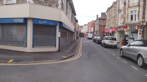

The Helicopter Museum
Museum · 2.1 mi
Aviation museum in Somerset, United Kingdom

Woodspring Priory
Monument and historic site · 3.3 mi
Grade I listed priory in North Somerset, England, UK



Lambretta Scooter Museum
Museum
Automotive museum in Weston-super-Mare, England

12 more on the map.
Parks, trails and playgrounds22



Weston-Super-Mare Football Club
Sports field and stadium · 1.4 mi
Winterstoke Road, Weston-super-Mare

10 more on the map.
Restaurants and cafes161
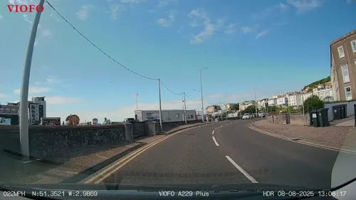
Il Michelangelo
Restaurant · Italian · 0.6 mi
50A Knightstone Road, Weston-Super-Mare
Mo-Sa 12:00-15:00, 17:00-22:00; Su 12:00-21:00

The Duke of Oxford
Bar and pub
Some accommodation also available
27 Oxford Street, Weston-super-Mare
Mo 10:00-22:00; Tu-Th 10:00-23:00; Fr-Sa 10:00-24:00; Su 10:00-22:00
The Bear Inn
Bar and pub · 0.4 mi
66 Walliscote Road, Weston-Super-Mare
Mo-Th 13:00-23:30; Fr-Sa 12:00-00:00; Su 12:00-23:00
The Fork 'n' Ale
Bar and pub
18 Walliscote Road, Weston-Super-Mare
Mo-Th 11:30-23:00; Fr 11:00-24:00; Su 12:00-18:00

Coffee#1
Cafe · Coffee Shop
18-20 High Street, Weston-super-Mare
Mo-Fr 07:00-17:00; Sa 07:30-17:30; Su 09:00-17:00
Costa
Cafe · Coffee Shop
30 Oxford Street, Weston-Super-Mare
Mo 09:00-18:00; Tu-Sa 07:00-18:00; Su 09:00-17:00

Ikanji
Restaurant · Japanese
14-16 Walliscote Road, Weston-super-Mare
Tu-Th 17:00-21:30; Fr-Sa 17:00-22:00; Su 17:00-21:30
Mimi's Thai Bistro
Restaurant · Thai
6 Walliscote Road, Weston-super-Mare
Tu-Sa 17:30-22:30; Su-Mo "by appointment - 15 or more people"
Nero Express
Cafe · Coffee Shop
53-55 High Street, Weston-super-Mare
Mo-Sa 07:30-18:00; Su 08:30-17:30
PizzaExpress
Restaurant · Pizza
Unit 3-5 Dolphin Square, Weston-Super-Mare
Mo-Sa 11:30-23:00, Su 11:30-22:30
149 more on the map.
History
Weston's oldest structure is Worlebury Camp on Worlebury Hill which dates from the Iron Age.
Outside the hillfort are many rock-cut burials and fragmentary remains which have been discovered during the course of progressive development on the southern slope of the hill. Two particular clusters of these burials have been identified: one in the Montpelier area, and the other to the north-east of Knightstone Road. Recent researchers suggest that there may have been a major Iron Age cemetery related to the hillfort, in the area near Knightstone Road, the site later chosen for the parish church, suggesting a link to the Iron Age burials. Many of these remains were chance finds during building work in the 19th and early 20th century and were poorly recorded. During archaeological evaluation work in 2005, prior to the construction of a new parish room on the north-western side of St John's church, a crouched inhumation burial, with pottery indicating a mid- to late-Iron Age date, was discovered within the churchyard, below a series of unmarked post-medieval burials.
Read more of the history
An occupation site of Romano-British date was investigated in 2008–2009 as part of a planning application by Weston College immediately to the west of their School of Science and Art, on the south side of South Terrace. This built on investigations that had already been carried out on the site in the late 1950s which strongly suggested the presence of Romano-British occupation. It is the only site known of this date in central Weston and was probably a small farmstead or hamlet. Finds included a burial of a male individual who had clearly led a very hard life, and had suffered multiple medical conditions which were expressed on his skeletal remains. It is possible that he had been a slave.
Defences were built after the Norman Conquest near the settlements on Worlebury Hill at Worle (today's Castle Batch) and Ashcombe.{ The parish was part of the Hundred of Winterstoke. The medieval church of St John was demolished in 1824 and rebuilt on the same site. The former rectory, now known as Glebe House, is a largely 19th-century structure remodelled from a much older building. Seventeenth-century timbers survive in what was originally the entrance hall. It is Weston-super-Mare's oldest surviving building.
The Pigott family of Brockley were the lord of the manor of Weston-super-Mare and Ashcombe from 1695. They built a summer residence at Grove House near the church two years later.
The Old Thatched Cottage restaurant on the seafront is listed Grade II. Its official Historic England list entry states that it is 'late 18th century, certainly before 1804'. The building carries the date 1774 but the date of its construction is unknown. Evidence exists that it was definitely built by June 1804.
Weston was a small village of about 30 houses in the early part of the 19th century. They were some 2 mi (3.2 km) from Uphill, the moors between the two villages having some protection from the sea by a line of sand dunes which had grown after the Bristol Channel floods of 1607. Sea bathing became fashionable in England in the second half of the 18th century and people started to visit to Uphill and Weston for the sea. The town's growth during the 19th century was largely due to its development as a seaside resort. The first hotel was built in 1807–1810. At first it was just 'The Hotel' but later became 'Reeve's Hotel' and is now part of the Royal Hotel. It opened in 1810 but closed from time to time until opening permanently in 1814. A bath house using sea water was opened on Knightstone Island in 1820 which was later linked to the mainland by a causeway. A walkway was built along the dunes in 1826 from Knightstone to the hotel and in 1829 an extension carried it to the end of Regent Street.
John Pigott sold off some land for development from 1807 but retained 396 acres (160 ha) on the hill which was planted with trees in 1823, creating a game reserve and what became Weston Woods. An estate road was opened through the woods on the north side of the hill in 1848; it was open to the public and was a private toll road for many years.
The sale of the estate's land resulted in high-density housing being built south of Watersill Road (now Regent Street) and houses for the middle classes in the Whitecross area which extended to the town boundary at Moorland Road. Large detached villas were built on the southern slopes of Worlebury Hill. Many of the houses and public buildings erected from about 1870 were built from local grey limestone with details of soft yellow Bath Stone and slate roofs. These were designed by local architect Hans Price.
The Bristol and Exeter Railway opened the first part of its line on 14 June 1841. A station at Weston Junction gave a connection to a station in the town centre. The railway connected with the Great Western Railway at Bristol Temple Meads and made it easier for visitors from Bristol, the Midlands, London and further afield to travel to Weston for a day or longer holidays.
Birnbeck Pier was opened in 1867 at the end of Worlebury Hill. Visitors, including many Welsh mining families, came across the Bristol Channel by paddle steamer to the pier. In its heyday it offered amusement arcades, tea rooms, amusement rides and a photographic studio. Although listed Grade II* it is now in a derelict state and is classed as 'highly vulnerable' on Historic England's Heritage at Risk Register. It was designed by Eugenius Birch with ironwork by the Isca Foundry of Newport, Monmouthshire.
From the History section of Weston-super-Mare on Wikipedia, under CC BY-SA 4.0.
More about Weston-super-Mare
Geography
The mainly flat landscape of Weston is dominated to the north by Worlebury Hill (109 m (358 ft) above sea level). Bleadon Hill (176 m (577 ft) and Brean Down (97 m (318 ft)) forms its southern border. The River Axe flows into Weston Bay at Uphill, cutting Brean Down off from the town. Much of Worlebury Hill is wooded with some Ancient Woodland sites. The remains of Worlebury Camp hillfort are at its far western end.
The beach lies on the western edge of the town. The upper part is sandy, but the tidal rise and fall in the Severn Estuary and Bristol Channel can be as great as 14.5 m (48 ft), second only to Bay of Fundy in Eastern Canada. This tidal movement contributes to the deposition of natural mud in bays such as Weston. There has been concern about pollution levels from industrial areas in Wales and at the eastern end of the Bristol Channel; however this tends to be diluted by the Atlantic waters. There are measurable levels of chemical pollutants, and little is known about their effects. Of particular concern are the levels of cadmium and to a lesser degree residual pesticides and hydrocarbons.
Ellenborough Park, on the sea front near the town centre, is a Site of Special Scientific Interest due to the range of plant species found there.
Economy
Since the 1970s, Weston has suffered a decline in popularity as a holiday destination, as have most British seaside resorts, due to the advent of cheap foreign holidays and the demise of the traditional "works holidays" of heavy and manufacturing industries elsewhere in UK. The town had become a centre of industries such as helicopter production, and maintenance at the GKN Westland factory until its closure in 2002, however the company still retains a design office under the name GKN Aerospace Engineering Services at the Winterstoke Road site. Road transport links were improved with the M5 motorway running close by, and the town now supports light industries and distribution depots, including Lidl's distribution centre for its southern based stores, and is also a dormitory town for Bristol. Vutrix, one of the largest semiconductor and video/audio distribution equipment companies in the television broadcasting industry, is based in the town. Two of the town's largest employers are the local council and Weston College, which has recently begun to offer university degrees as a secondary campus of Bath Spa University.
Arts and culture
The Playhouse theatre is in High Street near Grove Park. It opened in 1946 but burnt down in 1964; the current building dates from 1969. The Winter Gardens Pavilion opened on the seafront in 1927 for shows but now also hosts exhibitions and conferences in an extension. The Blakehay is a small concert hall and exhibition space in Wadham Street near The Playhouse. It is housed in a former Baptist church and managed by Weston-super-Mare Civic Society. All Saints Church hosts concerts, has been used for recording, for example by the Emerald Ensemble, and has featured on BBC TV's Songs of Praise.
The Plaza Cinema was opened as the Odeon in 1935. It is a Grade II listed in art deco. It houses the only Compton theatre pipe organ in an Odeon cinema outside London, and is one of only two working theatre organs left in the country still performing in their original location in commercially operating cinemas.
The Weston Arts Festival takes place each year during September and October using local venues including the Blakehay Theatre, Playhouse, All Saints, and galleries and offering a wide range of cultural events.
Weston has hosted Weston Wallz since 2021. This is a street art programme curated by the Upfest team and has resulted in more than 75 murals across the town.
Education
Churches and charities provided the first schools for poorer families but many private boarding schools were set up as Weston was considered a healthy location for children. These included The College on the sea front (which was sold in the 1880s and enlarged to become the Grand Atlantic Hotel), Stanmore School in the Royal Crescent, Winthorpe in Wilton Gardens, Burton House in Walliscote Road, and Etonhurst at Ellenborough Park. The Sisters of La Retraite opened a Catholic school in 1899 and it moved to South Road in 1907 where it remained until 1971. St Peter's started in Highbury House in 1882 and moved a short distance to the Shrubbery when a new school was built in 1906. This operated until 1970. Roald Dahl was a boarder from 1925; John Cleese was a day pupil from 1948 and later returned as a teacher.
The church schools resisted the formation of a School Board in the 1870s but one was finally established in 1893. The first Board School was provided in Walliscote Road near the Town Hall in 1893, and a second in Locking Road in 1900. Responsibility for education was transferred to Somerset County Council in 1903.
From the Wikipedia article Weston-super-Mare, under CC BY-SA 4.0.
Notable people from Weston-super-Mare
 John CleeseEnglish comedian and actor (born 1939)Photo: Miguel Discart & Kiri Karma, CC BY-SA 4.0
 Ritchie BlackmoreBritish guitaristPhoto: kitmasterbloke, CC BY 2.0
 Rupert GravesEnglish film, television, and theatre actorPhoto: Rupert_Graves_2010.jpg : Ian Smith..., CC BY-SA 2.0
 John Polkinghornephysicist, theologian and anglican priest (1930–2021)Photo: Jack1956, CC BY-SA 3.0
 Con O'NeillEnglish actor and singerPhoto: Super Festivals from Ft. Lauderdale, USA, CC BY 2.0
 Lance DossorAustralian musicianPhoto: Koncern Ilustrowany Kurier Codzienny..., Public domain
- Jill Dandomurdered English journalist and television presenter (1961–1999)
- Augustus Edward Hough LoveEnglish mathematician (1863–1940)
- Henry EdwardsBritish actor, film director (1882-1952)
- Edwin Stephen GoodrichEnglish zoologist (1868–1946)
- A. V. Alexander, 1st Earl Alexander of HillsboroughBritish Labour Co-operative politician (1885-1965)
- Thomas ThouldBritish water polo player (1886–1971)
Born in Weston-super-Mare, according to Wikidata (CC0). Each name links to its Wikipedia article.
Where to stay34
Churches and places of worship26
Bristol Road Baptist Church
Church · Baptist · 0.4 mi
Southside, Weston-super-Mare
Shopping32
Gas and EV charging3
Schools, colleges and libraries17
Corpus Christi Catholic Primary School
School · Roman Catholic
Ellenborough Park South, Weston-super-Mare
Healthcare6
Map of Weston-super-Mare
250 places. The map loads OpenStreetMap tiles when you open it.
Getting there and nearby towns
Bristol Airport (BRS) is the nearest airport with scheduled flights listed in OpenStreetMap, 11 miles away.
- Burnham-on-Sea 7 mi south, about 12 min by car
- Yatton 7 mi northeast, about 12 min by car
- Clevedon 8 mi northeast, about 14 min by car
- Nailsea 11 mi northeast, about 18 min by car
- Cardiff 13 mi northwest, about 21 min by car
- Portishead 13 mi northeast, about 21 min by car
- Newport 17 mi north, about 27 min by car
- Wells 17 mi southeast, about 27 min by car
- Bristol 18 mi northeast, about 29 min by car
- Street 18 mi southeast, about 30 min by car
Drive times are estimates from straight-line distance, not routes.
Towns near Weston-super-Mare


Keep exploring
Local news
Headlines from INDB.
Reviews, tips and questions
Loading what members have shared...
Sources and licences
- GeoNames (CC BY 4.0): population, coordinates, regions and time zone
- Mapillary (see each image): photos
- OpenStreetMap contributors (ODbL 1.0): places, airports, map data
- Wikidata (CC0 1.0): elevation, founding date, time zone, website, landmarks and historic places
- Wikimedia Commons (see each image): photos
- Wikipedia (CC BY-SA 4.0): overview and history text
Photo credits
- The three piers, Weston-super-Mare (2022), Geof Sheppard, CC BY-SA 4.0
- Grand Pier, Weston-Super-Mare, Somerset, England, UK (7304088786), tsaiproject from Canada, CC BY 2.0
- Weston-super-Mare church, ArticCynda, CC BY-SA 4.0
- Weston-super-Mare Grand Pier June 2010, Geof Sheppard, CC BY-SA 4.0
- Weston-super-Mare Winter Gardens Pavilion, Photograph by Mike Peel ( www.mikepeel.net )., CC BY-SA 4.0
- WestonHelicopterMuseum, Adrian and Janet Quantock, CC BY-SA 2.0
- Woodspring Priory barn, Rodw, CC BY-SA 3.0
- Wadham Street Baptist Church, Geof Sheppard, CC BY-SA 4.0
- St Martin's Church Worle exterior, Boulevard32, CC BY-SA 4.0
- Church of St Paul Kewstoke, Rodw, Public domain
- St Nicholas' Church, Uphill, Somerset, Geof Sheppard, CC BY-SA 4.0
- Broadoak Mathematics and Computing College, Rodw, CC0
- Clarence park, Harrias, CC BY-SA 3.0
- Ellenborough Park, Weston-super-mare, Rodw, Public domain
- Wyvern Community School, Rodw, CC0
- Tropicana frontage, Chris Sampson, CC BY 2.0
- Worlebury Hill British Encampment, Geof Sheppard, CC BY-SA 3.0
- Holy Trinity Church Weston-Super-Mare, Fla1, CC BY-SA 4.0
- Odeon Weston super Mare, Alan Cooper, CC BY-SA 2.0
- Weston-super-Mare MMB 51 Winter Gardens, mattbuck ( category ), CC BY-SA 3.0
- Grove Park War Memorial2, Fla1, CC BY-SA 4.0
- Street-level photo, noid, CC BY-SA 4.0
- Street-level photo, southglos, CC BY-SA 4.0
- Street-level photo, RyanBush, CC BY-SA 4.0
- Street-level photo, southglos, CC BY-SA 4.0
- Street-level photo, RyanBush, CC BY-SA 4.0
- Street-level photo, chunkymonkey909, CC BY-SA 4.0
- Street-level photo, noid, CC BY-SA 4.0
- Street-level photo, southglos, CC BY-SA 4.0
- Street-level photo, southglos, CC BY-SA 4.0
- Street-level photo, southglos, CC BY-SA 4.0
- Street-level photo, chunkymonkey909, CC BY-SA 4.0


Page built November 10, 2026. Spotted a mistake? Tell us or suggest a place.