


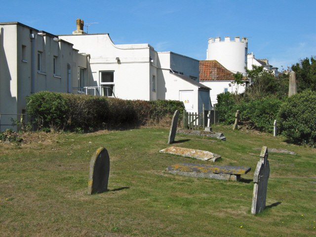


Brent Knoll, United Kingdom
Brent Knoll is a town of 1,271 people in England, United Kingdom.
Why visit Brent Knoll
Townapedia lists 1 museum or landmark, 3 parks and trails, 9 places to eat, 3 places to stay and 5 attractions in and around town.
Highlights include Brean Leisure Park, Burnham-on-Sea High Lighthouse, Brent Knoll Camp and Apex Leisure and Wildlife Park.
Weather in Brent Knoll
Forecast from MET Norway (CC BY 4.0). Full forecast
About Brent Knoll
Brent Knoll, formerly known as South Brent, is a village and civil parish in Somerset, England, which lies on the southern edge of Brent Knoll – a hill with a height of 137 metres (450 ft) that dominates the low surrounding landscape of the Somerset Levels. The parish had a population of 1,255 at the 2021 census.
From the Wikipedia article Brent Knoll (village) (this version), under CC BY-SA 4.0.
Things to do5

Brean Leisure Park
Monument and historic site · 3.2 mi
Amusement park in the coastal resort of Brean, near Burnham-on-Sea, Somerset, England, UK

Burnham-on-Sea High Lighthouse
Lighthouse · 1.8 mi
Lighthouse in Burnham-on-Sea and Highbridge, Sedgemoor, Somerset, England, UK
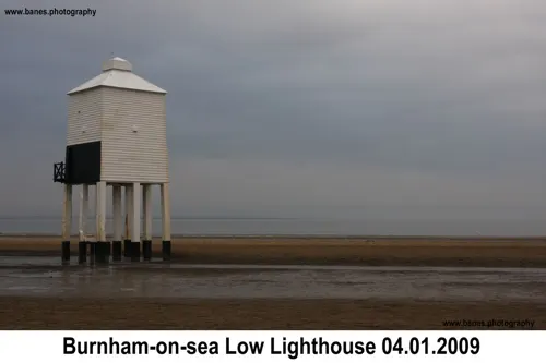
Burnham-on-Sea Low Lighthouse
Lighthouse · 2.1 mi
Lighthouse in Burnham-on-Sea and Highbridge, Sedgemoor, Somerset, England, UK

Burnham-on-Sea Round Tower
Lighthouse · 2.0 mi
Lighthouse in Somerset, England

Museums and landmarks1

Parks, trails and playgrounds3

Apex Leisure and Wildlife Park
Park · 2.6 mi
Park and wildlife centre in England, United Kingdom

Restaurants and cafes9
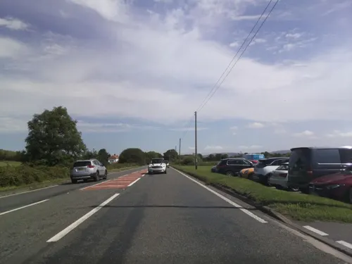
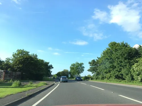

Brent Knoll Inn
Bar and pub · 1.3 mi
Brent Road, Highbridge
Mo-Sa 12:00-15:00,18:00-21:00; Su 12:00-16:00

History
The village of Brent Knoll lies at the south west base of the hill. Between 1875 and 1883 its name was changed from South Brent to Brent Knoll to avoid rail passenger confusion with the village of South Brent in Devon.
Brent Knoll railway station, at the western extremity of the village, was built as part of the Bristol and Exeter Railway and operated from 1875 until its closure on 4 January 1971.
Somerset Court, at the eastern end of the village, was built in the late 18th century and is a Grade II listed building. From 1940 until 1968, it housed Hill Brow Preparatory School for Boys and since 1974 it has been occupied by the National Autistic Society who use it as one of its main centres for the care of autistic adults.
From the History section of Brent Knoll (village) on Wikipedia, under CC BY-SA 4.0.
Where to stay3
Churches and places of worship7
Schools, colleges and libraries3
Map of Brent Knoll
31 places. The map loads OpenStreetMap tiles when you open it.
Getting there and nearby towns
Bristol Airport (BRS) is the nearest airport with scheduled flights listed in OpenStreetMap, 14 miles away.
- Burnham-on-Sea 2 mi southwest, about 3 min by car
- Huntspill 3 mi south, about 6 min by car
- Locking 6 mi north, about 10 min by car
- Weston-super-Mare 7 mi north, about 11 min by car
- Wedmore 7 mi east, about 11 min by car
- Shipham 8 mi northeast, about 13 min by car
- Bridgwater 9 mi south, about 14 min by car
- Draycott 9 mi east, about 14 min by car
- Churchill 10 mi northeast, about 16 min by car
- Yatton 11 mi northeast, about 18 min by car
Drive times are estimates from straight-line distance, not routes.
Towns near Brent Knoll


Keep exploring
Local news
Headlines from INDB.
Reviews, tips and questions
Loading what members have shared...
Sources and licences
- GeoNames (CC BY 4.0): population, coordinates, regions and time zone
- Mapillary (see each image): photos
- OpenStreetMap contributors (ODbL 1.0): places, airports, map data
- Wikidata (CC0 1.0): elevation, founding date, time zone, website, landmarks and historic places
- Wikimedia Commons (see each image): photos
- Wikipedia (CC BY-SA 4.0): overview and history text
Photo credits
- Brent Knoll vicarage, Tim, CC BY-SA 2.0
- Sizzler ride - Brean Leisure Park, Cboomf ( talk ) ( Uploads ), Public domain
- Burnham on Sea - panoramio (17), Tanya Dedyukhina, CC BY 3.0
- Bunrham Round Tower1510008 64bb67f5, Ken Grainger, CC BY-SA 2.0
- St Christopher Lympsham, Geoff Pick, CC BY-SA 2.0
- Berrow church, Adrian and Janet Quantock, CC BY-SA 2.0
- Standrewsburnham, Major Slateley Boncass, CC BY-SA 2.0
- BrentKnoll, Kicior99, CC BY-SA 4.0
- Street-level photo, colinpeachey, CC BY-SA 4.0
- Street-level photo, southglos, CC BY-SA 4.0
- Street-level photo, southglos, CC BY-SA 4.0
- Street-level photo, southglos, CC BY-SA 4.0
- Street-level photo, ukchris, CC BY-SA 4.0
- Street-level photo, ukchris, CC BY-SA 4.0
- Street-level photo, southglos, CC BY-SA 4.0
- Street-level photo, southglos, CC BY-SA 4.0

Page built November 10, 2026. Spotted a mistake? Tell us or suggest a place.