


Why visit Barrowby
Townapedia lists 2 museums and landmarks, 1 park or trail, 8 places to eat and 2 attractions in and around town.
Highlights include Grantham House and Grantham Museum.
Weather in Barrowby
Forecast from MET Norway (CC BY 4.0). Full forecast
About Barrowby
Barrowby is a village and civil parish in the South Kesteven district of Lincolnshire, England. It is 2 miles (3.2 km) west of Grantham. It overlooks the Vale of Belvoir and has a Grade I listed parish church. The hamlet of Casthorpe is part of the parish.
From the Wikipedia article Barrowby (this version), under CC BY-SA 4.0.
Things to do2

Museums and landmarks2
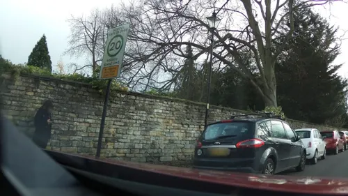
Grantham House
Museum · 2.1 mi
Grade I listed historic house museum in Grantham, Lincolnshire, England, UK

Grantham Museum
Museum · 2.2 mi
Museum in Grantham, Lincolnshire, England, United Kingdom
Parks, trails and playgrounds1

South Kesteven Sports Stadium
Sports field and stadium · 1.2 mi
Trent Road, Grantham
Restaurants and cafes8




History
The Domesday Book record shows there was a church with a priest and 60 acres (0.24 km2) of meadow. The village belonged until the 19th century to the historical wapentake of Winnibriggs and Threo.
The Domesday village of Casthorpe is 1.5 miles (2.4 km) west from Barrowby. By the 14th century it was referred to in records as two holdings, East and West Casthorpe. It is now little more than a cluster of farm buildings. A further deserted medieval village is Newbo, 1.5 miles (2.4 km) to the north-west, site of Newbo Abbey. The village was located by archaeologists in 1970.
On 11 October 1941, at 9.20pm, a Junkers Ju 88 'R4+NL', of Nachtjagdgeschwader 2, had a mid-air collision with a RAF Airspeed Ltd. aircraft; the British aircraft AB767 crashed at 87 Dysart Road. Three German aircrew were killed, after the Junkers aircraft crashed at Westry Corner.
Leutnant Hans Hahn (21 February 1919- 1941, a Ritterkreuzträger, awarded on 9 July 1941)
On Monday 21 April 1941 2.35am, over nearby Stroxton, Hans Hahn had shot down Fairey Battle 'P6674'.
From the History section of Barrowby on Wikipedia, under CC BY-SA 4.0.
More about Barrowby
Geography
Barrowby stands where the A52 road crosses the A1 road, which separates the village from the western edge of Grantham. The village is close to the Lincolnshire border with Leicestershire and Nottinghamshire.
It is 300 feet (91 m) above sea level and adjacent to the Vale of Belvoir. From the village it is possible to see Belvoir Castle, Lincoln Cathedral, and multiple power stations in the Trent valley, including West Burton and Cottam, near Gainsborough over 40 miles (60 km) away.
Adjoining villages include Sedgebrook, Harlaxton, Denton and the hamlets of Casthorpe and Stenwith.
Arts and culture
There has been a Barrowby fête or gala in various forms since the 1950s. From 2004 until recently, an annual Barrowby Gala and Beer Festival was held on the village green. The event, with stalls, games, fairground rides, and tug of war, was organised by a committee of village residents.
Barrowby combines old buildings, cottages and manor houses, with newer buildings in a housing estate built within the last few decades. Linking the new housing estate and the original Barrowby centre are two main roads, High Road and Low Road. Some surrounding road names reflect the names of patrons and residents who established and shaped the village.
Barrowby contains a cafe and a Co-op. It had a post office till 2023 when the post mistress left and a butcher's that closed in 2023. The village public house is The White Swan. Until 1959 there was a second public house, The Marquis of Granby Inn, on the corner of Welby Court and Main Street. It is pictured in a 1910 postcard of the village.
Education
Barrowby parish school was built in 1852 adjacent to the church. Part of the original school hall and bell tower remain. It has since been modernised with additional buildings. It has a school roll of about 240 pupils aged 4–11 and has received Basic Skills Mark, Healthy Schools, and Eco-Schools Silver Status awards.
From the Wikipedia article Barrowby, under CC BY-SA 4.0.
Churches and places of worship7
Shopping2
Schools, colleges and libraries7
The Gonerby Hill Foot Church of England Primary School
School · Anglican · 1.5 mi
Gonerby Road, Grantham
Healthcare2
Map of Barrowby
31 places. The map loads OpenStreetMap tiles when you open it.
Getting there and nearby towns
Nottingham City Airport (NQT) is the nearest airport with scheduled flights listed in OpenStreetMap, 16 miles away.
- Grantham 2 mi east, about 3 min by car
- Ancaster 8 mi northeast, about 13 min by car
- Colsterworth 8 mi south, about 13 min by car
- Corby Glen 10 mi southeast, about 16 min by car
- South Witham 11 mi south, about 17 min by car
- Long Clawson 11 mi southwest, about 18 min by car
- Newark on Trent 12 mi northwest, about 19 min by car
- Cropwell Bishop 12 mi west, about 20 min by car
- Melton Mowbray 13 mi southwest, about 21 min by car
- Sleaford 13 mi northeast, about 21 min by car
Drive times are estimates from straight-line distance, not routes.
Towns near Barrowby


Keep exploring
Local news
Headlines from INDB.
Reviews, tips and questions
Loading what members have shared...
Sources and licences
- GeoNames (CC BY 4.0): population, coordinates, regions and time zone
- Mapillary (see each image): photos
- OpenStreetMap contributors (ODbL 1.0): places, airports, map data
- Wikidata (CC0 1.0): elevation, founding date, time zone, website, landmarks and historic places
- Wikimedia Commons (see each image): photos
- Wikipedia (CC BY-SA 4.0): overview and history text
Photo credits
- Barrowby Chapel, Russ Hamer, CC BY-SA 3.0
- Barrowby 17th C House, Russ Hamer, CC BY-SA 3.0
- St Wulfram's, Grantham - from school, Martinevans123, CC BY-SA 3.0
- Barrowby Lincolnshire,All Saints Church, Russ Hamer, CC BY-SA 3.0
- Barrowby, White Swan, Russ Hamer, CC BY-SA 3.0
- Grantham Museum St Peter's Hill Grantham NG31 6PY, Spudgun67, CC0
- Street-level photo, adam2, CC BY-SA 4.0
- Street-level photo, adam2, CC BY-SA 4.0
- Street-level photo, southglos, CC BY-SA 4.0
- Street-level photo, adam2, CC BY-SA 4.0
- Street-level photo, coljay72, CC BY-SA 4.0
- Street-level photo, adam2, CC BY-SA 4.0
Page built November 10, 2026. Spotted a mistake? Tell us or suggest a place.