


Why visit Beer
Townapedia lists 15 museums and landmarks, 18 parks and trails, 39 places to eat, 12 places to stay and 5 attractions in and around town.
Highlights include Axmouth Old Bridge, The Forge and Seaton Tramway.
Weather in Beer
Forecast from MET Norway (CC BY 4.0). Full forecast
About Beer
Beer is a seaside village and civil parish in the East Devon district of Devon, England. The village faces Lyme Bay and is a little over 1 mile (1.6 km) west of the town of Seaton. It is situated on the Jurassic Coast World Heritage Site and its picturesque cliffs, including Beer Head, form part of the South West Coast Path.
From the Wikipedia article Beer, Devon (this version), under CC BY-SA 4.0.
Travel tips from other travellers: Beer on Wikivoyage (CC BY-SA 4.0).
Photos of Beer


Things to do5

Axmouth Old Bridge
Bridge · 1.8 mi
Bridge in Axmouth, Devon, England, UK


Museums and landmarks15
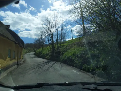



3 more on the map.
Parks, trails and playgrounds18




6 more on the map.
Restaurants and cafes39


The Malt House
Bar and pub · 1.3 mi
The Square, Seaton
Su-Th 12:00-22:30, Fr,Sa 12:00-24:00
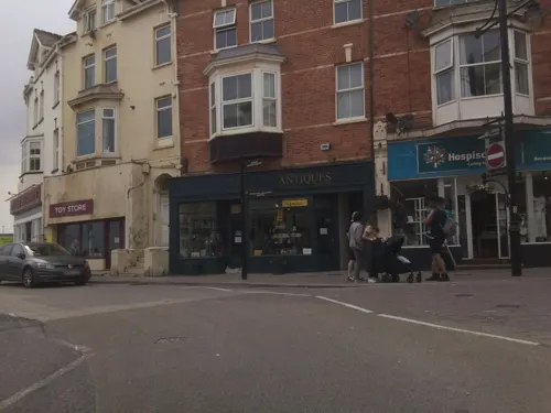

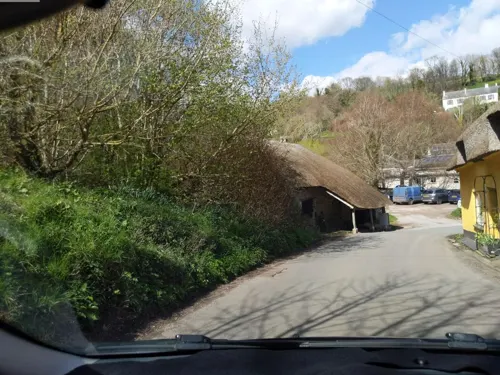
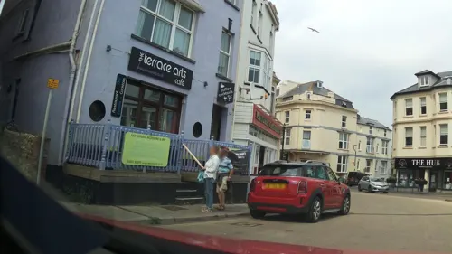
Pebbles Bistro Coffee House
Cafe · 1.3 mi
4 Marine Place
Mo-Su 09:00-16:00



Barrel of Beer
Bar and pub · Pub Food, English Classics · 0.4 mi
Fore Street, Beer
Mo-Sa 10:00-23:00; Su 11:00-23:00
27 more on the map.
History
Beer is mentioned in the Domesday Book of 1086, at which time it was located within Colyton hundred and had 28 households. Its name is not derived from the drink, but from the Old English word bearu, meaning "grove" and referring to the original forestation that surrounded the village.
It is a coastal village that grew up around a smugglers' cove and caves which were once used to store contraband goods. These are now part of the attraction of the village.
Beer is home to a cave complex, the Beer Quarry Caves, resulting from the quarrying of Beer stone. This stone has been prized since Roman times, because of its workability for carving and for its gentle yellow colour on exposure to air. Beer stone was used in the construction of 24 cathedrals around the UK, including Exeter Cathedral, Westminster Abbey and St. Paul's Cathedral, and was also used in the building of Christ Church Cathedral, Missouri.
Historically, the main sources of income for the village included fishing and lace production.
Read more of the history
Bacteria taken from cliffs at Beer on the south coast were launched to the International Space Station in 2008. The Beer microbes were placed on the European Space Agency's (ESA) Technology Exposure Facility and were sent up still sitting on, and in, small chunks of cliff rock from the Jurassic Coast. After 553-days scientists found that many were still alive. The survivors are now reproducing in a laboratory. This was part of an experiment to study the survival of microbes (which naturally live on the stone) in extreme conditions. A new species of cyanobacteria was isolated at the Open University that could be used in future space settlements on the Moon and Mars to produce oxygen and break down rocks.
From the History section of Beer, Devon on Wikipedia, under CC BY-SA 4.0.
More about Beer
Economy
Nowadays, the sources of income are mainly tourism and fishing. Beer was also the home of the Pecorama (run by the PECO model railway manufacturer), which closed in November 2025, and included pleasure gardens and the Beer Heights Light Railway.
The shape of the coastline allowed local seafarers to operate in weather conditions when other towns could not, because it is protected from the prevailing westerly winds by Beer Head and the chalk cliffs which are the westernmost outcrop of limestone on the southwest coast. Boats are winched up the beach as there is no harbour, and fresh fish is sold nearby. Nowadays small electrically-driven winches using steel cables or tractors are located on the beach to haul boats in. Higher up is an old manual capstan operated by up to 20 men, now disused.
From the Wikipedia article Beer, Devon, under CC BY-SA 4.0.
Notable people from Beer
 Innes FitzGeraldBritish athletePhoto: Ssu, CC BY-SA 4.0
- George Beer EndacottHong Kong historian
- William Henry Woodgate
Born in Beer, according to Wikidata (CC0). Each name links to its Wikipedia article.
Where to stay12
Churches and places of worship8
Shopping10
Gas and EV charging2
Schools, colleges and libraries3
Healthcare4
Map of Beer
116 places. The map loads OpenStreetMap tiles when you open it.
Getting there and nearby towns
Exeter Airport (EXT) is the nearest airport with scheduled flights listed in OpenStreetMap, 14 miles away.
- Sidmouth 6 mi west, about 10 min by car
- Honiton 8 mi northwest, about 13 min by car
- Newton Poppleford 9 mi west, about 14 min by car
- Charmouth 9 mi east, about 15 min by car
- Whimple 12 mi west, about 20 min by car
- Dunkeswell 12 mi northwest, about 20 min by car
- Chard 13 mi northeast, about 21 min by car
- Exmouth 14 mi southwest, about 23 min by car
- Bridport 15 mi east, about 24 min by car
- Exeter 19 mi west, about 30 min by car
Drive times are estimates from straight-line distance, not routes.
Towns near Beer


Keep exploring
Local news
Headlines from INDB.
Reviews, tips and questions
Loading what members have shared...
Sources and licences
- GeoNames (CC BY 4.0): population, coordinates, regions and time zone
- Mapillary (see each image): photos
- OpenStreetMap contributors (ODbL 1.0): places, airports, map data
- Wikidata (CC0 1.0): elevation, founding date, time zone, website, landmarks and historic places
- Wikimedia Commons (see each image): photos
- Wikipedia (CC BY-SA 4.0): overview and history text
Photo credits
- Beach at Beer, Devon, No machine-readable author provided. Gaius Cornelius assumed (based on copyright claims)., Public domain
- Beer (2021-04-24) 60, Simon Cobb, CC0
- Beer (2021-04-24) 61, Simon Cobb, CC0
- Beer (2021-04-24) 59, Simon Cobb, CC0
- Beer (2021-04-24) 58, Simon Cobb, CC0
- St Michael's Church Colyford Devon, Derek Harper, CC BY-SA 2.0
- St Gregorys Church Seaton, Pengannel, CC BY 2.0
- Beer (2026-03-07) 39, Simon Cobb, CC0
- Beer (2021-04-24) 41, Simon Cobb, CC0
- Seaton (2021-04-24) 14, Simon Cobb, CC0
- Anchor Inn, Simon Cobb, CC0
- Seaton (2021-04-24) 29, Simon Cobb, CC0
- Seaton (2021-04-24) 08, Simon Cobb, CC0
- Seaton (2021-04-24) 03, Simon Cobb, CC0
- St Augustine's Roman Catholic Church, Manor Road, Seaton, Devon (September 2019) (5), Hassocks5489, CC0
- ISS043-E-103670 - View of Earth, Earth Science and Remote Sensing Unit , Lyndon B. Johnson Space Center, Public domain
- ISS008-E-15177 - View of England, Earth Science and Remote Sensing Unit , Lyndon B. Johnson Space Center, Public domain
- ISS025-E-19551 - View of Earth, Earth Science and Remote Sensing Unit , Lyndon B. Johnson Space Center, Public domain
- ISS030-E-78844 - View of Earth, Earth Science and Remote Sensing Unit , Lyndon B. Johnson Space Center, Public domain
- ISS041-E-56553 - View of Earth, Earth Science and Remote Sensing Unit , Lyndon B. Johnson Space Center, Public domain
- ISS030-E-209777 - View of Earth, Earth Science and Remote Sensing Unit , Lyndon B. Johnson Space Center, Public domain
- ISS059-E-46172 - View of Earth, Earth Science and Remote Sensing Unit, NASA Johnson Space Center, Public domain
- ISS025-E-19552 - View of Earth, Earth Science and Remote Sensing Unit , Lyndon B. Johnson Space Center, Public domain
- ISS040-E-132838 - View of Earth, Earth Science and Remote Sensing Unit , Lyndon B. Johnson Space Center, Public domain
- Axmouth Old Bridge (2021-08-02) 06, Simon Cobb, CC0
- Seaton Tramway. - panoramio (1), Robert Powell, CC BY-SA 3.0
- Street-level photo, southglos, CC BY-SA 4.0
- Street-level photo, southglos, CC BY-SA 4.0
- Street-level photo, southglos, CC BY-SA 4.0
- Street-level photo, southglos, CC BY-SA 4.0
- Street-level photo, WaggyDog, CC BY-SA 4.0
- Street-level photo, WaggyDog, CC BY-SA 4.0
- Street-level photo, WaggyDog, CC BY-SA 4.0
- Street-level photo, southglos, CC BY-SA 4.0
- Street-level photo, southglos, CC BY-SA 4.0
- Street-level photo, southglos, CC BY-SA 4.0
- Street-level photo, southglos, CC BY-SA 4.0
- Street-level photo, WaggyDog, CC BY-SA 4.0


Page built November 10, 2026. Spotted a mistake? Tell us or suggest a place.