


Bridport, United Kingdom
Bridport is a town of 12,295 people in England, United Kingdom.
Why visit Bridport
Townapedia lists 6 museums and landmarks, 8 parks and trails, 63 places to eat, 14 places to stay and 7 attractions in and around town.
Highlights include The Lyric Theatre, Electric Palace, Bridport Arts Centre and Bridport Museum.
Weather in Bridport
Forecast from MET Norway (CC BY 4.0). Full forecast
About Bridport
Bridport is a market town and civil parish in Dorset, England, 1+1⁄2 miles (2.4 km) inland from the English Channel near the confluence of the River Brit and its tributary the Asker. Its origins are Saxon and it has a long history as a rope-making centre. On the coast and within the town's boundary is West Bay, a small fishing harbour also known as Bridport Harbour.
From the Wikipedia article Bridport (this version), under CC BY-SA 4.0.
Travel tips from other travellers: Bridport on Wikivoyage (CC BY-SA 4.0).
Photos of Bridport

Things to do7



Museums and landmarks6




West Bay Wreck
Monument and historic site · 2.2 mi
Shipwreck near West Bay, Dorset, England, UK
Parks, trails and playgrounds8



Restaurants and cafes63

The Greyhound
Bar and pub
2 East Street, Bridport
Mo-Th 07:00-00:00; Fr,Sa 07:00-01:00; Su 07:00-24:00
Coffee#1
Cafe · Coffee Shop
35 East Street, Bridport
Mo-Fr 07:30-17:30; Sa 07:30-18:00; Su 09:00-17:00



Martin's Bar and Restaurant
Restaurant · Burger, Coffee Shop, Pizza, Ice Cream, Breakfast, Seafood, Fish And Chips, Fish, Grill, Salad, Dessert, Curry, Fries, British · 1.2 mi
Family-owned bar and restaurant at Highlands End, open to the public. Features vintage fire engines, soft play, and local food....
Eype, Bridport
51 more on the map.
History
Bridport's origins are Saxon. During the reign of King Alfred it became one of the four most important settlements in Dorset – the other three being Dorchester, Shaftesbury and Wareham – with the construction of fortifications and establishment of a mint.
Bridport's name probably derives from another location nearby. In the early 10th century the Burghal Hidage recorded the existence of a fortified centre or burh in this area, called 'Brydian', which is generally accepted as referring to Bridport. 'Brydian' means 'place at the (River) Bride', and this name may have come from an earlier burh in the Bride Valley a few miles to the east, which perhaps was abandoned or not completed in favour of the harbour site at Bridport. A probable location for an earlier burh is at Littlebredy. In 1086 the Domesday Book recorded that the town was called 'Brideport'; 'port' is Old English for a market town, thus 'Brideport' may have described the market town belonging to or associated with Bredy. At a later date, in a reversal of a more typical derivation, the town lent its name to the river on which it stood; previously this had been the River Wooth, but it became the River Brit.
Read more of the history
The Domesday Book recorded that Bridport had 120 houses in the reign of Edward the Confessor (1042–1066). In 1253 the town was awarded its first charter by Henry III, and by the subsequent reign of Edward I Bridport sent two members to Parliament. In the 14th and 15th centuries, like other Dorset coastal towns, Bridport suffered heavy losses due to frequent outbreaks of the Black Death; one 14th-century account by Geoffrey Baker recorded that the disease "almost stripped the seaports of Dorset of their inhabitants". Around this time the town was also subjected to attacks by raiding French and Spanish forces.
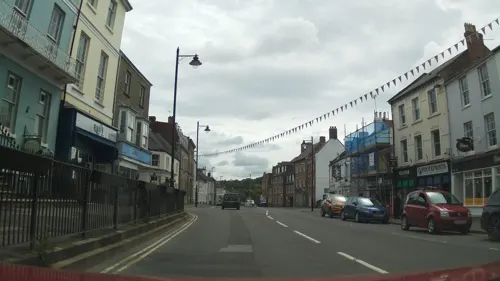
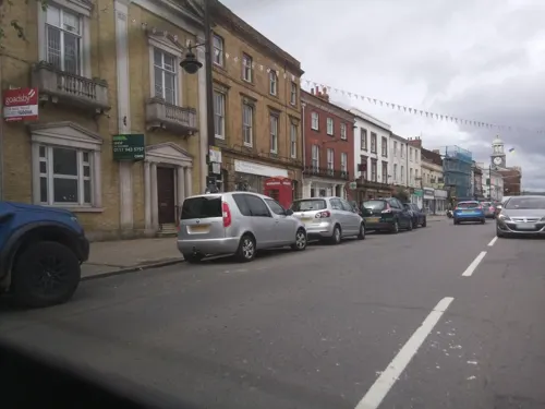
Since the Middle Ages Bridport has been associated with the production of rope and nets. The earliest official record of this industry dates from 1211, when King John ordered that Bridport make "as many ropes for ships both large and small and as many cables as you can". The raw materials needed, flax and hemp, used to be grown in the surrounding countryside, though they were superseded in modern times by artificial fibres such as nylon. Bridport's main street is particularly wide due to it previously having been used to dry the ropes, after they had been spun in long gardens behind the houses. Ropes for gallows used to be made in the town, hence the phrase "stabbed with a Bridport dagger" being used to describe a hanging.
In the English Civil War (1642–1651) the population of Bridport mainly supported the royalists. At the end of the war in 1651 Charles II briefly stayed in the town at The George Inn as he sought to escape Parliamentarian forces after his defeat at the Battle of Worcester. Local loyalty to the king again played a part in the first action in the Duke of Monmouth's Rebellion when on 16 June 1685, 40 cavalry and 400 foot soldiers, commanded for Monmouth, moved on from Lyme Regis to Bridport, where they encountered 1,200 men from the local royalist Dorset militia. The skirmish ended with retreat of the rebel force, although many of the militiamen deserted and joined Monmouth's army.
Many buildings in Bridport, particularly in the main street, date from the 18th century. Bridport Town Hall was built in 1785–6, with its clock tower and cupola added about twenty years later. Older buildings can be found in South Street, and include the 13th-century St. Mary's parish church, the 14th-century chantry and the 16th-century Bridport Museum.
The population of Bridport in 1841 was 4,787. During the 19th century Bridport's population grew little, unlike many Dorset towns, although many sturdy buildings were constructed at this time, showing that at least parts of the population remained prosperous. In 1857 the Bridport Railway was opened, which joined the town with the existing national rail network. This benefitted the town's textile industry and brought cheaper goods such as coal to the area. In 1884 the line was extended from Bridport's station to a new terminus on the coast at Bridport Harbour, which was renamed West Bay as part of attempts to promote it as a resort. The West Bay extension closed to passengers in 1930 and all traffic in 1962. The entire Bridport line closed in 1975.
The town gave its name to Bridport, Vermont and Bridport, Tasmania.
From the History section of Bridport on Wikipedia, under CC BY-SA 4.0.
More about Bridport
Geography
Bridport is in the county of Dorset in South West England. Measured directly, it is about 14 miles (23 km) west of the county town Dorchester, 15+1⁄2 miles (25 km) SSW of Yeovil in Somerset, 33 miles (53 km) east of Exeter in Devon and 1+1⁄2 miles (2.4 km) inland from the English Channel at West Bay. The town centre is sited between the small River Brit and its tributary the Asker, about 800 yards (730 m) north of their confluence, at an altitude of 10–15 metres (33–49 ft). Another small tributary, the River Simene, also joins the Brit to the west of the town centre.
Bridport contains several neighbourhoods, some of which used to be separate villages. These include Allington, Skilling, Coneygar, Bothenhampton, Bradpole, Court Orchard and St Andrew's Well. South of the town centre and within the town's boundary is West Bay, a small fishing harbour known as Bridport Harbour until the arrival of the railway.
Economy
Writing in 1965, Ralph Wightman stated that "in the best possible meaning of the word Bridport has always been an industrial town, and its industries always had a connection with the countryside and the sea [...] Bridport has not had any industrial revolution. It has not blasted the countryside, and it has escaped the worst depressions. Perhaps this accounts for the fact that it has always been famous for good food and drink".
Arts and culture
In the 21st century, Bridport's arts scene has contributed to the town becoming increasingly popular with people from outside the locality. It has an arts centre, theatre, library, cinema and museum, and several annual events.
Bridport Arts Centre originated in the early 1970s when local activists bought an old Wesleyan chapel and adjacent schoolroom on South Street and converted them into a theatre and art gallery—named the Allsop Gallery in memory of broadcaster and local resident Kenneth Allsop. The centre hosts a diverse programme of cultural events and since the 1990s has received funding from the Arts Council. In 1973 the centre founded the Bridport Prize, an annual international poetry and short story competition described by its patron Fay Weldon as "a prize really worth fighting for in terms of prestige and genuine literary accomplishment".
The Electric Palace Cinema has occupied its existing site since 1926. It closed down in 1999 but an ensuing campaign to 'Save the Palace' resulted in the building being listed before being bought by a new owner and refurbished to include a digital projector, auditorium murals, a new restaurant and art deco bar. It reopened in 2007 and in March 2009 hosted the world premiere of The Young Victoria.
Education
Primary schools in Bridport are Bridport Primary School, St Mary's CE VC Primary School, St Catherine's RC Primary School and Symondsbury CE VC Primary School. The Sir John Colfox Academy is the town's only secondary school. It is located on the outskirts of the town and serves ages 11 to 18. The sixth form is combined with Beaminster School in nearby Beaminster. Children also attend other secondary schools within the region: The Woodroffe School in Lyme Regis, Colyton Grammar School in east Devon, and the Thomas Hardye School in Dorchester. There are daily buses running to these schools from Bridport. Further and higher education in the region is provided by Yeovil College, Weymouth College, Kingston Maurward College and Bournemouth University.
From the Wikipedia article Bridport, under CC BY-SA 4.0.
Notable people from Bridport
 Brian UrquhartBritish international civil servantPhoto: Bernard Gotfryd, Public domain
 Charles William BartlettEnglish painter and printmaker (1860-1940)Photo: Charles William Bartlett, Public domain
 Bert LeeEnglish professional footballer (1879-1958)Photo: Unknown author Unknown author, Public domain
- Frederick WeldNew Zealand politician and governor of various British colonies (1823-1891)
- Arthur Lee, 1st Viscount Lee of FarehamBritish politician (1868-1947)
- Colin GibsonBritish footballer (born 1960)
- Irene RookeBritish actress (1878-1958)
- Mike BalsonEnglish footballer (1947-2019)
- Frederick Stratten RussellEnglish marine biologist (1897-1984)
- Mike TurnerEnglish footballer (born 1938)
- Tamara KrikorianBritish video artist and a public art curator (1944–2009)
- Sir Philip Colfox, 1st BaronetBritish politician (1888-1966)
Born in Bridport, according to Wikidata (CC0). Each name links to its Wikipedia article.
Where to stay14
Churches and places of worship20
Shopping22
Gas and EV charging2
Schools, colleges and libraries6
Symondsbury Church of England Voluntary Aided Primary School
School · Anglican · 1.3 mi
Healthcare4
Map of Bridport
152 places. The map loads OpenStreetMap tiles when you open it.
Getting there and nearby towns
Royal Naval Air Station Yeovilton (YEO) is the nearest airport with scheduled flights listed in OpenStreetMap, 20 miles away.
- Chard 13 mi northwest, about 21 min by car
- Dorchester 14 mi east, about 23 min by car
- Honiton 19 mi west, about 31 min by car
- Sidmouth 21 mi west, about 34 min by car
- Street 27 mi north, about 43 min by car
- Dawlish 33 mi west, about 53 min by car
- Shepton Mallet 33 mi north, about 53 min by car
- Poole 34 mi east, about 55 min by car
- Exeter 34 mi west, about 54 min by car
- Tiverton 34 mi west, about 55 min by car
Drive times are estimates from straight-line distance, not routes.
Towns near Bridport


Keep exploring
Local news
Headlines from INDB.
Reviews, tips and questions
Loading what members have shared...
Sources and licences
- GeoNames (CC BY 4.0): population, coordinates, regions and time zone
- Mapillary (see each image): photos
- OpenStreetMap contributors (ODbL 1.0): places, airports, map data
- Wikidata (CC0 1.0): elevation, founding date, time zone, website, landmarks and historic places
- Wikimedia Commons (see each image): photos
- Wikipedia (CC BY-SA 4.0): overview and history text
Photo credits
- Bridport Town Hall, Tom Bastin uploaded and derivative work: MrPanyGoff, CC BY 2.0
- BridportByFKJU, BenRobinson247, CC BY-SA 4.0
- Bridport Museum Dorset, Rob Noble, CC BY-SA 2.0
- St Andrew's Church, Bridport, Dorset, Ashley Smith, CC BY-SA 4.0
- St.Mary'sChuchBridport, MajesticEli, CC BY-SA 4.0
- St John's church, West Bay, Stevekeiretsu, CC BY-SA 4.0
- St Saviour's Church, Dottery, Dorset, Derek Harper, CC BY-SA 2.0
- Bridport Arts Centre (1752), Nilfanion, CC BY-SA 4.0
- The Greyhound, Bridport, Paul the Archivist, CC BY-SA 4.0
- Palmers Brewery, D1169254, CC BY-SA 3.0
- Bridport Arts Centre, D1169254, CC BY-SA 3.0
- Street-level photo, southglos, CC BY-SA 4.0
- Street-level photo, WaggyDog, CC BY-SA 4.0
- Street-level photo, WaggyDog, CC BY-SA 4.0
- Street-level photo, southglos, CC BY-SA 4.0
- Street-level photo, WaggyDog, CC BY-SA 4.0
- Street-level photo, WaggyDog, CC BY-SA 4.0
- Street-level photo, southglos, CC BY-SA 4.0
- Street-level photo, WaggyDog, CC BY-SA 4.0
- Street-level photo, WaggyDog, CC BY-SA 4.0
- Street-level photo, southglos, CC BY-SA 4.0
- Street-level photo, WaggyDog, CC BY-SA 4.0
- Street-level photo, WaggyDog, CC BY-SA 4.0
- Street-level photo, WaggyDog, CC BY-SA 4.0
- Street-level photo, WaggyDog, CC BY-SA 4.0
- Street-level photo, WaggyDog, CC BY-SA 4.0
- Street-level photo, WaggyDog, CC BY-SA 4.0
- Street-level photo, WaggyDog, CC BY-SA 4.0
- Street-level photo, WaggyDog, CC BY-SA 4.0

Page built November 10, 2026. Spotted a mistake? Tell us or suggest a place.