


Betws-y-Coed, United Kingdom
Betws-y-Coed is a town of 1,200 people in Wales, United Kingdom.
Why visit Betws-y-Coed
Townapedia lists 15 museums and landmarks, 6 parks and trails, 22 places to eat, 44 places to stay and 18 attractions in and around town.
Highlights include Conwy Falls, Swallow Falls, Ugly House and Conwy Valley Railway Museum.
Weather in Betws-y-Coed
Forecast from MET Norway (CC BY 4.0). Full forecast
About Betws-y-Coed
Betws-y-Coed (Welsh: [ˈbɛtʊs ə ˈkoːɨ̯d] ) is a village and community in Conwy County Borough, Wales. The village is located near the confluence of the River Conwy and the River Llugwy and is on the eastern edge of Snowdonia. The population of the community as of the 2021 census was 476, a decline on the previous census.
From the Wikipedia article Betws-y-Coed (this version), under CC BY-SA 4.0.
Travel tips from other travellers: Betws-y-Coed on Wikivoyage (CC BY-SA 4.0).
Photos of Betws-y-Coed


Things to do18

Conwy Falls
Waterfall · 2.3 mi
Waterfall in Conwy County Borough, Wales, UK

Swallow Falls
Waterfall · 1.8 mi
Waterfall in Conwy County Borough, Wales, UK

Fairy Falls
Waterfall · 4.1 mi
Waterfall in Trefriw, Conwy County Borough, Wales, UK

Pont Fawr
Bridge · 3.0 mi
Bridge in Llanrwst, Conwy County Borough, Wales

Waterloo Bridge
Bridge · 0.8 mi
Grade I listed bridge in Betws-y-Coed, Wales
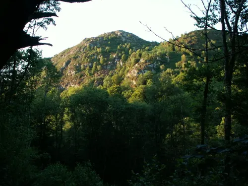

Grey Mare's Tail
Waterfall · 2.7 mi
Waterfall in Snowdonia National Park, Wales

6 more on the map.
Museums and landmarks15


Go Below
Monument and historic site · 2.3 mi
Meeting Point for half day go below challenge
Mo-Su 09:30-18:00

Gwydir Castle
Museum · 2.7 mi
Grade I listed building in Conwy County Borough


3 more on the map.
Parks, trails and playgrounds6



Restaurants and cafes22

Olif
Restaurant · Tapas, Welsh, Spanish
Olif is a Welsh tapas & gin bar with boutique rooms in the centre of Betws Y Coed, in the heart of the Snowdonia National Park.
Holyhead Road, Betws-y-Coed



Alpine Coffee Shop
Cafe
Station Road, Betws-y-Coed
Mo-Fr 08:30-16:00; Sa,Su 08:00-16:30

10 more on the map.
History
The village, which is now within Snowdonia National Park, stands in a valley near the point where the River Llugwy and the River Lledr join the River Conwy. The location is where a Celtic Christian community founded a monastery in the late 6th century AD. A village developed around the site over subsequent centuries. In the medieval period, the local lead mining industry brought miners and their families to the village.
Following the Acts of Union 1800 between Ireland and the UK, better transport links were proposed between the two countries. Surveyors decided that the best route for a road (now the A5) between London and Holyhead should pass through the village. In 1815, Waterloo Bridge, built by Thomas Telford, opened to carry the Irish Mail road across the River Conwy and through the village. The establishment of the route brought an economic boost to the area as the village became a major mail coach stop between Corwen (to the east) and Capel Curig (to the west). It also led to improvement of the roads to Blaenau Ffestiniog and to Llanrwst and Conwy.
In 1868, Betws-y-Coed railway station opened with the extension of the Conwy Valley line from Llanrwst. The railway was later further extended to serve the mineral industries in Blaenau Ffestiniog. With the arrival of the railway from Llandudno Junction railway station, the village's population increased by around 500 people.
Read more of the history
The village was historically within Caernarfonshire, with the River Conwy at this point forming the border with Denbighshire.
From the History section of Betws-y-Coed on Wikipedia, under CC BY-SA 4.0.
More about Betws-y-Coed
Arts and culture
The village is a centre for outdoor activities and lies within the Gwydir Forest.
The current Betws-y-Coed Golf Club was founded in the 1970s. There was an earlier club and course located on or near the Recreation Ground.
The Llyn Elsi reservoir nearby is used by walkers and anglers, and provides water for the village. Footpaths provide access to the lake, both from Betws-y-Coed itself and the outlying village of Pentre Du.
From the Wikipedia article Betws-y-Coed, under CC BY-SA 4.0.
Notable people from Betws-y-Coed
 Agnes Charlotte GudeNorwegian illustrator, artist (1863–1929)Photo: Norwegian Museum of Cultural History, CC0
- Elfyn LlwydWelsh barrister and politician (born 1951)
Born in Betws-y-Coed, according to Wikidata (CC0). Each name links to its Wikipedia article.
Where to stay44
Churches and places of worship6
Shopping15
Gas and EV charging1
Schools, colleges and libraries2
Map of Betws-y-Coed
129 places. The map loads OpenStreetMap tiles when you open it.
Getting there and nearby towns
RAF Valley - Anglesey Airport (VLY) is the nearest airport with scheduled flights listed in OpenStreetMap, 32 miles away.
- Llanrwst 3 mi north, about 5 min by car
- Blaenau-Ffestiniog 9 mi southwest, about 14 min by car
- Llansantffraid Glan Conwy 12 mi north, about 19 min by car
- Conwy 13 mi north, about 21 min by car
- Llanfairfechan 13 mi northwest, about 21 min by car
- Penmaenmawr 13 mi northwest, about 21 min by car
- Llanberis 13 mi west, about 22 min by car
- Tregarth 13 mi northwest, about 22 min by car
- Colwyn Bay 14 mi north, about 23 min by car
- Deganwy 15 mi north, about 23 min by car
Drive times are estimates from straight-line distance, not routes.
Towns near Betws-y-Coed


Keep exploring
Local news
Headlines from INDB.
Reviews, tips and questions
Loading what members have shared...
Sources and licences
- GeoNames (CC BY 4.0): population, coordinates, regions and time zone
- Mapillary (see each image): photos
- OpenStreetMap contributors (ODbL 1.0): places, airports, map data
- Openverse (see each image): photos
- Wikidata (CC0 1.0): elevation, founding date, time zone, website, landmarks and historic places
- Wikimedia Commons (see each image): photos
- Wikipedia (CC BY-SA 4.0): overview and history text
Photo credits
- Betws-y-coed o'r awyr - aerial view of Betws-y-coed, Gwynedd, Wales 27, Llywelyn2000, CC BY-SA 4.0
- Conwy Falls after heavy rain, Steve Foster, CC BY-SA 3.0
- Pont Fawr Bridge, Llanrwst, Mark Warren 1973, CC BY-SA 4.0
- Betws-y-coed o'r awyr - aerial view of Betws-y-coed, Gwynedd, Wales 02, Llywelyn2000, CC BY-SA 4.0
- Gwydir Castle - view from SE, Tom Parnell, CC BY-SA 4.0
- St Garmon's Church, Capel Garmon, Phil Champion, CC BY-SA 2.0
- Conwy-valley-railway-museum, Tudor Williams, CC BY-SA 2.0
- Ty Hyll, The Ugly House, Rude Health, CC BY-SA 2.0
- Conwy Falls from the viewpoint, Backflipping duck, CC0
- Conwy Falls Cafe, Backflipping duck, CC0
- Fairy Falls Trefriw after heavy rainfall, Hogyn Lleol, CC BY-SA 4.0
- Pont Y Pair Inn, Octavius Aurelius, CC BY-SA 4.0
- Waterfall, Betws Y Coed - panoramio, Graham Thomson, CC BY 3.0
- Swallow Falls July 25, Annaaash, CC BY-SA 4.0
- Dinas Mawr, Betws-y-Coed, Nigel Callaghan, CC BY-SA 2.0
- Street-level photo, trigpoint, CC BY-SA 4.0
- Street-level photo, trigpoint, CC BY-SA 4.0
- Street-level photo, trigpoint, CC BY-SA 4.0
- Street-level photo, trigpoint, CC BY-SA 4.0
- Street-level photo, trigpoint, CC BY-SA 4.0
- Street-level photo, davidsong, CC BY-SA 4.0
- Street-level photo, trigpoint, CC BY-SA 4.0
- Street-level photo, trigpoint, CC BY-SA 4.0
- Street-level photo, trigpoint, CC BY-SA 4.0
- Street-level photo, trigpoint, CC BY-SA 4.0
- Street-level photo, trigpoint, CC BY-SA 4.0
- Street-level photo, lamaar639, CC BY-SA 4.0
- Street-level photo, trigpoint, CC BY-SA 4.0
- Street-level photo, trigpoint, CC BY-SA 4.0
- Street-level photo, trigpoint, CC BY-SA 4.0
- Street-level photo, trigpoint, CC BY-SA 4.0
- Street-level photo, trigpoint, CC BY-SA 4.0
- Street-level photo, trigpoint, CC BY-SA 4.0
- Street-level photo, trigpoint, CC BY-SA 4.0
- Street-level photo, trigpoint, CC BY-SA 4.0
- Street-level photo, trigpoint, CC BY-SA 4.0
- Street-level photo, trigpoint, CC BY-SA 4.0
- Street-level photo, trigpoint, CC BY-SA 4.0
- Street-level photo, trigpoint, CC BY-SA 4.0
Page built November 10, 2026. Spotted a mistake? Tell us or suggest a place.