


Blaenau-Ffestiniog, United Kingdom
Blaenau-Ffestiniog is a town of 4,005 people in Wales, United Kingdom.
Why visit Blaenau-Ffestiniog
Townapedia lists 10 museums and landmarks, 5 parks and trails, 22 places to eat, 7 places to stay and 9 attractions in and around town.
Highlights include Allt-fawr, Manod Bach, Llechwedd Slate Caverns and Zipline Three - Charlie.
Weather in Blaenau-Ffestiniog
Forecast from MET Norway (CC BY 4.0). Full forecast
About Blaenau-Ffestiniog
Blaenau Ffestiniog ( or ; Welsh pronunciation: [ˈbleɨ̯naɨ̯ fɛstˈɪnjɔɡ]) is a town in Gwynedd, Wales. Once a slate mining centre in historic Merionethshire, it now relies heavily on tourism, drawn to the Ffestiniog Railway and Llechwedd Slate Caverns. Its population reached 12,000 at the peak of the slate industry, and fell with the decline in demand for slate. The population of the community, including the nearby village Llan Ffestiniog, was 4,875 at the 2011 census – the fourth most populous in Gwynedd after Bangor, Caernarfon and Llandeiniolen.
From the Wikipedia article Blaenau Ffestiniog (this version), under CC BY-SA 4.0.
Travel tips from other travellers: Blaenau-Ffestiniog on Wikivoyage (CC BY-SA 4.0).
Photos of Blaenau-Ffestiniog


Things to do9




Museums and landmarks10

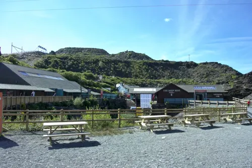
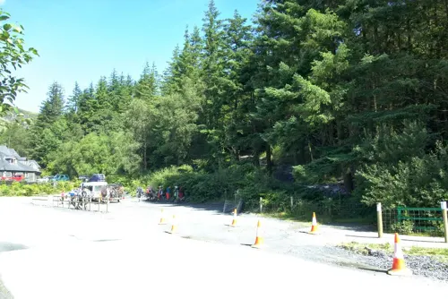

Parks, trails and playgrounds5

Ceunant Cynfal National Nature Reserve
Park · 3.2 mi
Canyon in the United Kingdom

Coedydd Maentwrog National Nature Reserve
Park · 2.6 mi
National nature reserve in Gwynedd, Wales

Restaurants and cafes22
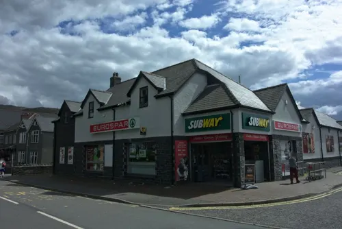
Y Pafiliwn
Cafe
Mo off; Tu off; We-Sa 09:00-16:00; Su 12:00-15:00
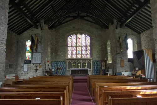
Royal Welch Fusiliers Comrades
Bar and pub
Royal Welch Fusiliers Club
Heol Yr Eglwys, Blaenau Ffestiniog


Lakeside Cafe
Cafe · Diner · 1.3 mi
Y Fuddau, Blaenau Ffestiniog
Mo-Th 09:00-16:00; Fr-Su 09:00-21:00


10 more on the map.
History
Before the slate industry grew, Blaenau Ffestiniog was a farming region, with scattered farms working the uplands below the cliffs of Dolgaregddu and Nyth-y-Gigfran. A few of the historic farmhouses survive, at Cwm Bowydd, Neuadd Ddu, Gelli, Pen y Bryn and Cefn Bychan. Much of the land was owned by large estates.
Blaenau Ffestiniog town arose to support workers in the local slate mines. At its peak, it was the largest in Merioneth. In 1765, two men from the long-established Cilgwyn quarry near Nantlle began quarrying in Ceunant y Diphwys, to the north-east of the present town. The valley had long been known for slate beds worked on a small scale. The original quarry was absorbed by subsequent mining, but it was probably at or near Diphwys Casson Quarry. Led by Methusalem Jones, eight Cilgwyn partners took a lease on Gelli Farm for their quarry. In 1800, William Turner and William Casson from the Lake District bought the lease and expanded production. Turner also owned Dorothea quarry in the Nantlle Valley, adjacent to Cilgwyn.
In 1819, quarrying began on slopes at Allt-fawr near Rhiwbryfdir Farm, on land owned by the Oakeley family from Tan y Bwlch. Within a decade, three slate quarries were operating on Allt-fawr. These amalgamated to form Oakeley Quarry, which became the largest underground slate mine in the world.
Read more of the history
Quarrying grew fast in the earlier 19th century. Notable quarries opened at Llechwedd, Maenofferen and Votty & Bowydd, while Turner and Casson's Diphwys Casson flourished. Further off, Cwmorthin and Wrysgan quarries were dug to the south of the town, while at the head of Cwm Penmachno to the north-east, a series of quarries started at Rhiwbach, Cwt y Bugail and Blaen y Cwm. To the south-east another cluster worked the slopes of Manod Mawr. The workforce for these was drawn initially from nearby towns and villages such as Ffestiniog and Maentwrog. Before the arrival of railways, travel to the quarries was difficult and workers' houses were built nearby. These typically grew up round existing farms and roads between them. An early settlement was at Rhiwbryfdir, for the Oakeley and Llechwedd quarries. As early as 1801, new roads were built specifically for the quarries. By 1851, there were 3,460 people living in the new town of Blaenau Ffestiniog.
During the 1860s and 1870s, the boom in the slate industry fed the nascent town of Blaenau Ffestiniog. It gained its first church and first school and saw much ribbon development along its roads. The Old Market Hall, which also served as the town hall, was completed in 1864. By 1881, its population had reached 11,274. In the 1890s, the slate industry experienced a sharp decline. A number of quarries lost money for the first time, and several failed entirely, including Cwmorthin and Nyth-y-Gigfran.
The slate industry recovered only partly from the recession of the 1890s. Many quarrymen joined the armed force in World War I and production fell. There was a short post-war boom, but the long-term trend was towards mass-produced tiles and cheaper slate sourced from Spain. Oakeley Quarry took over Cwmorthin, Votty & Bowydd and Diphwys Casson, while Llechwedd acquired Maenofferen. Despite that consolidation, the decline continued. World War II brought a further loss of workforce. In 1946, the Ffestiniog Railway closed.
In August 1945, the secluded farmhouse of Bwlch Ocyn at Manod, belonging to Clough Williams-Ellis, became the home of the writer Arthur Koestler and his wife Mamaine for three years. While there, Koestler became a close friend of his fellow writer George Orwell.
The remaining quarries served by the Rhiwbach Tramway closed in the 1950s and 1960s. Oakeley closed in 1970, with the loss of many jobs. The quarry re-opened in 1974 on a much smaller scale and continued to be worked until 2010. Maenofferen and Llechwedd continued, but Maenofferen finally closed in 1998. Llechwedd is still a working quarry, working the David Jones part of Maenofferen (level two-and-a-half).
As the slate industry shrank, so did the population of the community of Ffestiniog, which fell to 4,875 in 2011. Tourism became the town's largest employer, with the development of Gloddfa Ganol in the Oakeley quarry and the slate caverns at Llechwedd quarry. The revived Ffestiniog Railway and the slate caverns remain popular attractions, as does the Antur Stiniog downhill mountain-biking centre and, more recently, the Zip World Titan zip-line site, which includes the Bounce Below slate-mine activity centre.
From the History section of Blaenau Ffestiniog on Wikipedia, under CC BY-SA 4.0.
More about Blaenau-Ffestiniog
Geography
Some local villages, notably Tanygrisiau and Manod, are sometimes seen as parts of Blaenau Ffestiniog.
Although the town is in the centre of the Snowdonia National Park, the boundaries exclude it and its substantial slate-waste heaps. There were proposals in 2010 for the town to become part of the national park.
Blaenau Ffestiniog has one of the highest rainfalls in Wales. It has several reservoirs, one of which supplies the Ffestiniog Power Station. Stwlan Dam lies between two of the mountains in the area, Moelwyn Bach and Moelwyn Mawr. The mountains round the town form a watershed between the River Lledr flowing north as a tributary of the River Conwy and the River Dwyryd flowing west.
Arts and culture
Blaenau Ffestiniog's tourist attractions include the Ffestiniog Railway and the Llechwedd Slate Caverns, a former slate mine open to visitors. Llechwedd is often placed among Wales's top five visitor attractions. Near Blaenau Ffestiniog there are miles of mountain landscape with derelict quarries, rivers, various lakes and walking routes.
Several mountain biking trails have been created, some suitable for competitions. Bikes are available for hire.
Education
Ysgol y Moelwyn is the main secondary school, covering Blaenau, Manod, Tanygrisiau, Llan Ffestiniog, Trawsfynydd, Gellilydan, Maentwrog and stretching into the Vale of Ffestiniog and Dolwyddelan. It had 309 pupils in 2016. Some pupils travel to neighbouring towns.
From the Wikipedia article Blaenau Ffestiniog, under CC BY-SA 4.0.
Notable people from Blaenau-Ffestiniog
 John Kelt Edwardscartoonist (1875–1934)Photo: John Kelt Edwards, Public domain
 Thomas Carey-EvansWelsh surgeon and British Army officer (1884-1947)Photo: Daniel Rees, Public domain
- Richard Bryn Williamswriter (1902–1981)
- David FelgateWelsh footballer (born 1960)
- Des HarlockFootballer (1922-1981)
- Eigra Lewis RobertsWelsh novelist, playwright and storyteller (1939-2026)
- Gareth JonesWelsh politician (born 1939)
- David JonesWelsh footballer (1914-1997)
- Gwyn HughesWelsh footballer (1922-1999)
- Margarette "Peggy" GoldingWelsh born nurse, businessperson and founder of the "Inner Wheel"
- Idwal JonesWelsh-American writer (1887-1964)
- Glyn WiseBritish television personality and Church in Wales minister
Born in Blaenau-Ffestiniog, according to Wikidata (CC0). Each name links to its Wikipedia article.
Where to stay7
Churches and places of worship5
Shopping3
Schools, colleges and libraries5
Healthcare3
Map of Blaenau-Ffestiniog
69 places. The map loads OpenStreetMap tiles when you open it.
Getting there and nearby towns
RAF Valley - Anglesey Airport (VLY) is the nearest airport with scheduled flights listed in OpenStreetMap, 30 miles away.
- Penrhyndeudraeth 7 mi southwest, about 11 min by car
- Porthmadog 9 mi southwest, about 15 min by car
- Llanrwst 12 mi northeast, about 19 min by car
- Llanberis 12 mi northwest, about 19 min by car
- Harlech 12 mi southwest, about 19 min by car
- Criccieth 13 mi west, about 22 min by car
- Penygroes 15 mi west, about 24 min by car
- Tregarth 15 mi northwest, about 24 min by car
- Caernarfon 17 mi northwest, about 28 min by car
- Bangor 18 mi northwest, about 29 min by car
Drive times are estimates from straight-line distance, not routes.
Towns near Blaenau-Ffestiniog


Keep exploring
Local news
Headlines from INDB.
Reviews, tips and questions
Loading what members have shared...
Sources and licences
- GeoNames (CC BY 4.0): population, coordinates, regions and time zone
- Mapillary (see each image): photos
- OpenStreetMap contributors (ODbL 1.0): places, airports, map data
- Wikidata (CC0 1.0): elevation, founding date, time zone, website, landmarks and historic places
- Wikimedia Commons (see each image): photos
- Wikipedia (CC BY-SA 4.0): overview and history text
Photo credits
- Blaenau Ffestiniog, User:Stemonitis, CC BY-SA 2.5
- Llyn Cwmorthin 341563, David Medcalf, CC BY-SA 2.0
- Llechwedd, Tamara Kwan, CC BY-SA 2.0
- Blaenau Ffestiniog, Gwynedd, Cymru - Wales 23, Llywelyn2000, CC BY-SA 3.0
- Afon Cynfal gorge and waterfalls, Velella, CC BY-SA 4.0
- 'Earl of Merioneth' at Blaenau Ffestiniog, Gwynedd (8553114328), Peter Trimming from Croydon, England, CC BY 2.0
- Blaenau Stn DLG143, David Stowell, CC BY-SA 2.0
- FR BF ME 2, Bud75, CC BY-SA 2.0
- Blaenau ATW150 DLG, Duncan and Gareth Alderson, CC BY-SA 2.0
- Blaenau DLG, Dr Neil Clifton, CC BY-SA 2.0
- 06-07-08 Taliesin Ffestiniog Railway - Blaenau Ffestiniog, Matt Buck, CC BY-SA 2.0
- FR BF DLG 3, Paul Deards from Chichester, UK, CC BY-SA 2.0
- Blaenau Ffestiniog railway station MMB 06 Merddin Emrys, mattbuck ( category ), CC BY-SA 3.0
- FR BF, Bud75, CC BY-SA 2.0
- Ffestiniog Railway locomotive Linda 04, User:Thryduulf, CC BY-SA 4.0
- DavidLloydGeorge-P6031714, NoelWalley, CC BY-SA 3.0
- FR BF ME 3, Bud75, CC BY-SA 2.0
- BF Stn BR150, Bud75, CC BY-SA 2.0
- 61994 The Great Marquess at rest in Blaenau Ffestiniog, David Moyle, CC BY-SA 4.0
- 61994 The Great Marquess resting in Blaenau Ffestiniog, David Moyle, CC BY-SA 4.0
- 61994 The Great Marquess in Blaenau Ffestiniog, David Moyle, CC BY-SA 4.0
- 61994 Leaving Blaenau Ffestiniog, ARG_Flickr, CC BY 2.0
- Blaenau Ffestiniog Railway Station, interbeat, CC BY 2.0
- Manod Bach, Llyn y Manod - Flickr - Robert J Heath, Robert J Heath, CC BY 2.0
- Street-level photo, malenki, CC BY-SA 4.0
- Street-level photo, davidsong, CC BY-SA 4.0
- Street-level photo, malenki, CC BY-SA 4.0
- Street-level photo, malenki, CC BY-SA 4.0
- Street-level photo, malenki, CC BY-SA 4.0
- Street-level photo, malenki, CC BY-SA 4.0
- Street-level photo, malenki, CC BY-SA 4.0


Page built November 10, 2026. Spotted a mistake? Tell us or suggest a place.