


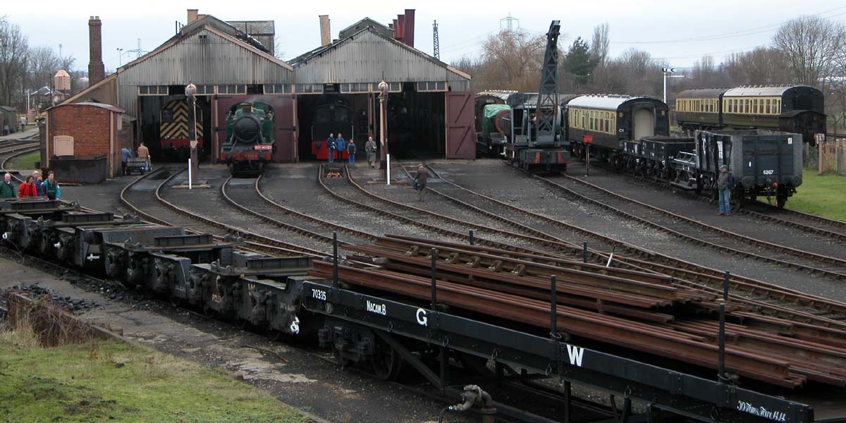


Why visit Didcot
Townapedia lists 8 museums and landmarks, 17 parks and trails, 53 places to eat, 1 place to stay and 8 attractions in and around town.
Highlights include Appleford Railway Bridge, Clifton Hampden Bridge, Didcot Railway Centre and Blewburton Hill.
Weather in Didcot
Forecast from MET Norway (CC BY 4.0). Full forecast
About Didcot
Didcot ( DID-kot, -kət) is a railway town and civil parish in South Oxfordshire, England, located 15 miles (24 km) south of Oxford, 10 miles (16 km) east of Wantage and 15 miles (24 km) north west of Reading. Historically part of Berkshire, the town is noted for its railway heritage, Didcot station opening as a junction station on the Great Western Main Line in 1844.
From the Wikipedia article Didcot (this version), under CC BY-SA 4.0.
Travel tips from other travellers: Didcot on Wikivoyage (CC BY-SA 4.0).
Things to do8


Clifton Hampden Bridge
Bridge · 3.4 mi
Bridge in Clifton Hampden, South Oxfordshire, England, UK


Day's Lock
Bridge · 3.4 mi
Lock in Oxfordshire, South East England, England, UK
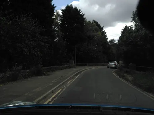
Sutton Bridge
Bridge · 3.0 mi
Grade II listed bridge in Oxfordshire, England, UK


Museums and landmarks8

Didcot Railway Centre
Museum
Railway museum in Didcot, Oxfordshire, United Kingdom

Blewburton Hill
Monument and historic site · 2.9 mi
Hillfort in Oxfordshire, England, UK

Pendon Museum
Museum · 2.2 mi
Museum in Oxfordshire, England, United Kingdom


Parks, trails and playgrounds17


Caterpillar park
Park · 1.3 mi
Park with trees and benches and grass, inside is a playground


5 more on the map.
Restaurants and cafes53
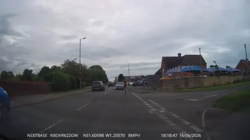
The Mulberry
Bar and pub · 0.4 mi
237 Broadway, Didcot
Mo-Th 12:00-23:00; Fr-Sa 11:00-24:00; Su 12:00-22:00


Bizzy Bees Cafe & Bistro
Cafe · Breakfast, Cake, Coffee Shop, Tea · 1.3 mi
Greenwood Way
Mo-Sa 09:30-16:30

Lusso
Restaurant · Pizza
39 Orchard Street, Didcot
Mo-Th 12:00-20:30; Fr 12:00-21:30; Sa 11:00-21:30; Su 11:00-20:30
The Royal Oak
Bar and pub · 0.9 mi
118 Park Road, Didcot
Mo-Th 12:00-23:00; Fr,Sa 12:00-24:00; Su 12:00-22:00
Starbucks
Cafe · Coffee Shop
59 Orchard Street, Didcot
Mo, Fr 06:30-17:30; Su 08:30-16:30; Sa 07:30-17:30; Tu-Th 06:00-17:30
Costa
Cafe · Coffee Shop
33 Orchard Street, Didcot
Mo-Sa 07:30-18:00; Su 09:00-17:00
41 more on the map.
History
The area around present-day Didcot has been inhabited for at least 9,000 years. A large archaeological dig between 2010 and 2013 produced finds from the Mesolithic, Neolithic, Iron Age and Bronze Age. In the Roman era the inhabitants of the area tried to drain the marshland by digging ditches through what is now the Ladygrove area north of the town near Long Wittenham, evidence of which was found during surveying in 1994. A hoard of 126 gold Roman coins dating from about 160 was found just outside the village in 1995 by an enthusiast with a metal detector. It is now displayed at the Ashmolean Museum on loan from the British Museum.
The Domesday Book of 1086 does not record Didcot. In 13th-century records the toponym appears as Dudecota, Dudecote, Doudecote, Dudcote or Dudecothe. Some of these spellings continued into later centuries, and were joined by Dodecote from the 14th century onward, Dudcott from the 16th century onward and Didcott from the 17th century onward. It is derived from Old English, meaning the house or shelter of Dudda's people. The name is believed to be derived from that of Dida, a 7th-century Mercian sub-king who ruled the area around Oxford and was the father of Saint Frithuswith or Frideswide, now the patron saint of both Oxford and Oxford University.
Read more of the history
Didcot was then a rural Berkshire village, and it remained so for centuries, only occasionally appearing in records. If Didcot existed at the time of the Domesday Book in 1086, it will have been much smaller than several surrounding villages, including Harwell and Long Wittenham, that modern Didcot now dwarfs. The nearest settlement recorded in the Domesday Book was Wibalditone, with 21 inhabitants and a church, whose name possibly survives in Willington's Farm on the edge of Didcot's present-day Ladygrove Estate. The oldest parts of the Church of England parish church of All Saints go back to the 12th century. They include the walls of the nave and east wall of the chancel, which were built about 1160. The church is a Grade II* listed building.
Parts of the original village survive in the Lydalls Road area around All Saints' church. In the 16th-century Didcot was a small village of landowners, tenants and tradespeople with a population of about 120. The oldest surviving house in Didcot is White Cottage, a 16th-century timber-framed building in Manor Road that has a wood shingle roof. It is a Grade II listed building. At that time the village centre consisted of a group of cottages and surrounding farms around Manor, Foxhall and Lydalls Roads. Those still surviving include The Nook, Thorney Down Cottage and Manor Cottage, which were all built in the early to mid-17th century. Didcot village was on the route between London and Wantage (now Wantage Road), which in 1752 was made a toll road. Didcot had three toll gates that collected revenue for the turnpike trust until 1879, when the trust was dissolved due to the growing use of the railway.
The Great Western Railway, engineered by Isambard Kingdom Brunel, reached Didcot in 1839. In 1844 the Brunel-designed Didcot station was opened. The original station burnt down in the late 19th century. Although longer, a cheaper-to-build line to Bristol would have been through Abingdon farther north but the landowner, the first Lord Wantage, is reputed to have prevented that alignment. The railway and its junction to Oxford assisted the growth of Didcot. The station's name helped to standardise the spelling "Didcot".
Didcot's junction of the routes to London, Bristol, Oxford and to Southampton via the Didcot, Newbury and Southampton Railway (DN&S) made the town militarily important, especially during the First World War campaign on the Western Front and the Second World War preparations for D-Day. The DN&S line has since closed, and the large Army and Royal Air Force ordnance depots have disappeared beneath the power station and Milton Park Business Park; however the 11 Explosive Ordnance Disposal and Search Regiment RLC is still based at the Vauxhall Barracks in the town.
Remains of the DN&S railway survive in the eastern part of town. This line, designed to provide a direct link to the south coast from the Midlands and the North avoiding the indirect and congested route via Reading and Basingstoke, was built in 1879–82 after previous proposals had failed. It was designed as a main line and was engineered by John Fowler and built by contractors TH Falkiner and Sir Thomas Tancred, who together also constructed the Forth Railway Bridge. It was a very costly line to build due to the heavy engineering challenges of crossing the Berkshire and Hampshire Downs with a 1 in 106 gradient to allow for higher mainline speeds, and this initial cost and the initially lower than expected traffic volumes caused the company financial problems. It never independently reached Southampton, but instead joined the main London and South Western Railway line at Shawford, south of Winchester.
In the Second World War there was so much military traffic to the port of Southampton that the line was upgraded. The northern section between Didcot and Newbury was made double track. It was closed for 5 months in 1942–43 for this to be done. Several of the bridges in the area of Didcot and the Hagbournes were also strengthened and rebuilt. Although passenger trains between Didcot and Newbury were withdrawn in 1962, the line continued to be used by freight trains for a further four years, and there was regular oil traffic to the north from the refinery at Fawley near Southampton. But in 1966 this traffic was also withdrawn, and then the line was dismantled. The last passenger train was a re-routed Pines Express in May 1964, diverted due to a derailment at Reading West. A section of the abandoned embankment towards Upton, now designated as a Sustrans route, has views across the town and countryside.
From the History section of Didcot on Wikipedia, under CC BY-SA 4.0.
More about Didcot
Economy
Didcot A Power Station (between Didcot and Sutton Courtenay), which was commissioned in 1968, ceased generating electricity for the National Grid in March 2013. Country Life once voted the power station the third worst eyesore in Britain. The power station cooling towers were visible from up to 30 miles (48 km) away because of their location, but were designed with visual impact in mind (six towers in two separated groups 0.5 miles (800 m) apart rather than a monolithic 3×2 block), much in the style of what is sometimes called Didcot's 'sister' station – Fiddlers Ferry Power Station – at Widnes, Cheshire, constructed slightly earlier. The power station had also proved a popular man-made object for local photographers.
Arts and culture
Cornerstone, a 278-seater multi-purpose arts centre, was opened on 29 August 2008.
Didcot Choral Society, founded in 1958, performs three concerts a year in various venues around the town as well as an annual tour (Paris in 2008, Belgium in 2009).
Didcot Concert Orchestra, founded in 2017, performs concerts every February, May and October at Cornerstone arts centre in Didcot.
In November 2018, Rebellion Developments began setting up a new studio on the edge of Didcot, valued at $100 million, using the existing former Daily Mail printing works on Milton Road. The studio is planned to be used for film and TV series based on 2000 AD comic series characters, including Judge Dredd: Mega City One.
Local news and television programmes are provided by BBC South and ITV Meridian. Television signals are received from the Oxford TV transmitter.
Didcot's local radio stations are BBC Radio Oxford on 95.2 FM, Heart South on 102.6 FM and Greatest Hits Radio on 106.4 FM.
Local newspapers are the Didcot Herald and Oxfordshire Guardian.
Education
Didcot is served by seven primary schools: All Saints' C of E, Aureus, Ladygrove Park, Manor, Northbourne C of E, Stephen Freeman and Willowcroft. Along with these seven schools based in Didcot, a further six local village schools form the Didcot Primary Partnership: Blewbury Endowed C of E, Cholsey, Hagbourne, Harwell Community, Long Wittenham C of E and South Moreton County. Didcot Primary Academy, opened in 2016 in the Great Western Park area, falls under Harwell Parish.
Two of Didcot's state secondary schools; St Birinus School and Didcot Girls' School are single-sex schools that join at sixth form to host Didcot Sixth Form. There are two other secondary schools in Didcot which have opened alongside the construction of the Great Western Park estate; UTC Oxfordshire (ages 14–19), in 2015, and Aureus School (ages 11–16), in 2017.
From the Wikipedia article Didcot, under CC BY-SA 4.0.
Notable people from Didcot
 Edgar AndrewsEnglish physicist and engineerPhoto: Eddy Maatkamp, CC BY-SA 4.0
 Matt RichardsonBritish comedian and television presenterPhoto: glastocabaret, CC BY 2.0
- Maurice EvansEnglish footballer (1936–2000)
- Jerry WilliamsEnglish footballer (born 1960)
- Ken LesterBritish rower
Born in Didcot, according to Wikidata (CC0). Each name links to its Wikipedia article.
Where to stay1
Churches and places of worship9
Foxhall Gospel Hall (Plymouth Brethren Christian Church)
Church · Plymouth Brethren · 0.4 mi
Shopping20
Gas and EV charging2
Schools, colleges and libraries15
Healthcare7
Map of Didcot
140 places. The map loads OpenStreetMap tiles when you open it.
Getting there and nearby towns
RAF Benson (BEX) is the nearest airport with scheduled flights listed in OpenStreetMap, 6 miles away.
- Wallingford 5 mi east, about 8 min by car
- Wantage 8 mi west, about 13 min by car
- Oxford 10 mi north, about 16 min by car
- Thatcham 14 mi south, about 23 min by car
- Kidlington 15 mi north, about 24 min by car
- Thame 15 mi northeast, about 24 min by car
- Reading 16 mi southeast, about 25 min by car
- Witney 16 mi northwest, about 26 min by car
- Henley-on-Thames 16 mi east, about 25 min by car
- Tadley 19 mi south, about 30 min by car
Drive times are estimates from straight-line distance, not routes.
Towns near Didcot


Keep exploring
Local news
Headlines from INDB.
Reviews, tips and questions
Loading what members have shared...
Sources and licences
- GeoNames (CC BY 4.0): population, coordinates, regions and time zone
- Mapillary (see each image): photos
- OpenStreetMap contributors (ODbL 1.0): places, airports, map data
- Wikidata (CC0 1.0): elevation, founding date, time zone, website, landmarks and historic places
- Wikimedia Commons (see each image): photos
- Wikipedia (CC BY-SA 4.0): overview and history text
Photo credits
- 2008-05 Appleford Rail Bridge (2), Nancy, CC BY-SA 3.0
- Clifton Hampden Bridge (4) (Nancy), Nancy, CC BY-SA 3.0
- Didcot Railway Centre, Taken January 2005 by William M. Connolley with a nikon 5700, CC BY-SA 3.0
- Pendon's Madderport, William Grimes at English Wikipedia, Public domain
- Sutton Courtney Church from south, Rob Stallard, CC BY-SA 3.0
- St Birinus School, Didcot, Sionk, CC BY-SA 4.0
- Didcot AllSaints SSE, Motacilla, CC BY-SA 4.0
- Northbourne StPeter southwest, Motacilla, CC BY-SA 4.0
- Little Wittenham Bridge, Day's Lock, Motmit, CC BY-SA 3.0
- Old Culham Bridge (North Side), MrBalintore, CC BY-SA 4.0
- Blewburton Hill 12, Simon Burchell, CC BY-SA 4.0
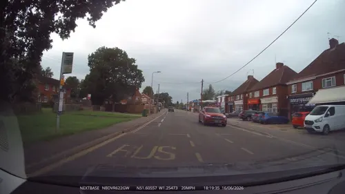
- Street-level photo, swinetown, CC BY-SA 4.0
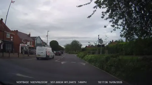
- Street-level photo, swinetown, CC BY-SA 4.0
- Street-level photo, swinetown, CC BY-SA 4.0
- Street-level photo, swinetown, CC BY-SA 4.0
- Street-level photo, swinetown, CC BY-SA 4.0
- Street-level photo, southglos, CC BY-SA 4.0
- Street-level photo, swinetown, CC BY-SA 4.0
- Street-level photo, ebel, CC BY-SA 4.0
- Street-level photo, swinetown, CC BY-SA 4.0
- Street-level photo, lamaar639, CC BY-SA 4.0
- Street-level photo, lamaar639, CC BY-SA 4.0
- Street-level photo, zymurgic, CC BY-SA 4.0
- Street-level photo, swinetown, CC BY-SA 4.0
- Street-level photo, swinetown, CC BY-SA 4.0
- Street-level photo, swinetown, CC BY-SA 4.0
- Street-level photo, swinetown, CC BY-SA 4.0
- Street-level photo, swinetown, CC BY-SA 4.0


Page built November 10, 2026. Spotted a mistake? Tell us or suggest a place.