


Black Notley, United Kingdom
Black Notley is a town of 1,988 people in England, United Kingdom.
Why visit Black Notley
Townapedia lists 4 museums and landmarks, 12 parks and trails, 27 places to eat, 1 place to stay and 1 attraction in and around town.
Highlights include Cineworld, Cressing Temple, Warner Textile Archive and Bocking Blackwater.
Weather in Black Notley
Forecast from MET Norway (CC BY 4.0). Full forecast
About Black Notley
Black Notley is a village and civil parish in Essex, England. It is located approximately 1+1⁄2 miles (2.4 km) south of Braintree and is 9 miles (14 km) north-northeast from the county town of Chelmsford. As well as the village itself, the parish also includes rural areas including the hamlets of Row Green and Young's End. At the 2021 census the Black Notley built up area had a population of 1,952 and the parish had a population of 2,589.
From the Wikipedia article Black Notley (this version), under CC BY-SA 4.0.
Things to do1

Museums and landmarks4

Cressing Temple
Museum · 2.1 mi
Ancient monument situated between Witham and Braintree in Essex, England, UK

Warner Textile Archive
Museum · 1.7 mi
Textile archive in Braintree, Essex, United Kingdom

Parks, trails and playgrounds12


Phyllis Currie Nature Reserve
Park · 3.2 mi
Essex Wildlife Trust Nature reserve

Sandylay and Moat Woods
Park · 2.9 mi
Essex Wildlife Trust Nature reserve


Restaurants and cafes27
Mulberry Tree
Bar and pub · British · 1.2 mi
Braintree Bypass, Braintree
Mo-Fr 06:30-10:30,11:30-23:00; Sa 07:00-11:00,11:30-23:00; Su...
Cookies & Cones
Ice cream · 1.2 mi
Charter Way, Braintree
Mo-Fr 11:00-17:00; Sa 10:00-18:00; Su 10:00-17:00
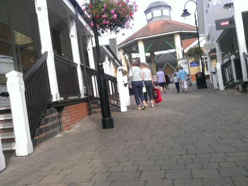
The Cornish Bakery
Bakery · 1.2 mi
Charter Way, Braintree
Mo-Fr 10:00-18:00; Sa 09:00-19:00; Su 10:00-17:00
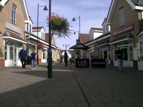
Costa
Cafe · Coffee Shop · 1.2 mi
Charter Way, Braintree
Mo-Fr 10:00-18:00; Sa 09:00-19:00; Su 10:00-17:00

Wildwood
Restaurant · Grill, Pasta, Pizza · 1.1 mi
Charter Way, Braintree
Mo-Th 12:00-21:30; Fr-Sa 12:00-10:30; Su 12:00-21:00
15 more on the map.
History
The place-name 'Notley' is first attested in a Saxon charter of 998 as Hnutlea, and appears as 'Nutlea' in the Domesday Book of 1086. The name means 'nut wood'. 'Black Notley' is first attested in 1240.
The parish church is dedicated to both St. Peter and St. Paul, and has walls of flint and pebble. The nave was constructed in the 12th century and the chancel was rebuilt around the 16th century when also the south porch and bell-turret were added. Around 100 yards to the south of the church is the 15th-century Grade II-listed Black Notley Hall.
From the History section of Black Notley on Wikipedia, under CC BY-SA 4.0.
More about Black Notley
Geography
The village is in the district of Braintree, but as of 2010, forms part of the parliamentary constituency of Witham. It has its own parish council, and is part of the wider Cressing, Black Notley, White Notley and Faulkbourne parish cluster.
It is close to the River Brain. In 2002, work was completed on the new estate, built in place of the old hospital giving 350 new houses to the area.
From the Wikipedia article Black Notley, under CC BY-SA 4.0.
Notable people from Black Notley
 John RayBritish botanist (1627–1705)Photo: anonymous, Public domain
 William BedellIrish bishop and bible translatorPhoto: Sarah777 at English Wikipedia ...., Public domain
- Richard SymondsEnglish royalist and antiquary
Born in Black Notley, according to Wikidata (CC0). Each name links to its Wikipedia article.
Where to stay1
Churches and places of worship7
Chapel Of The Immaculate Conception, Franciscan Convent
Church · 2.6 mi
Shopping14
Gas and EV charging3
Schools, colleges and libraries5
Map of Black Notley
74 places. The map loads OpenStreetMap tiles when you open it.
Getting there and nearby towns
London Stansted Airport (STN) is the nearest airport with scheduled flights listed in OpenStreetMap, 14 miles away.
- Rayne 1 mi northeast, about 2 min by car
- Braintree 2 mi north, about 3 min by car
- Witham 5 mi southeast, about 8 min by car
- Gosfield 6 mi north, about 9 min by car
- Halstead 7 mi northeast, about 11 min by car
- Chelmsford 9 mi southwest, about 15 min by car
- Great Bardfield 9 mi northwest, about 14 min by car
- Maldon 10 mi southeast, about 15 min by car
- Castle Hedingham 10 mi north, about 15 min by car
- Tolleshunt Knights 10 mi southeast, about 16 min by car
Drive times are estimates from straight-line distance, not routes.
Towns near Black Notley


Keep exploring
Local news
Headlines from INDB.
Reviews, tips and questions
Loading what members have shared...
Sources and licences
- GeoNames (CC BY 4.0): population, coordinates, regions and time zone
- Mapillary (see each image): photos
- OpenStreetMap contributors (ODbL 1.0): places, airports, map data
- Wikidata (CC0 1.0): elevation, founding date, time zone, website, landmarks and historic places
- Wikimedia Commons (see each image): photos
- Wikipedia (CC BY-SA 4.0): overview and history text
Photo credits
- CressingTemple, User:JohnArmagh, Public domain
- Bocking Blackwater 10, Dudley Miles, CC BY-SA 4.0
- Cuckoo Wood 1, Dudley Miles, CC BY-SA 4.0
- Hoppit Mead 2, Dudley Miles, CC BY-SA 4.0
- BraintreeFranciscanChapelFront, CalderUK, CC BY-SA 4.0
- Phyllis Currie Nature Reserve (31821521404), Jason Boldero from UK, CC BY 2.0
- Street-level photo, petermead, CC BY-SA 4.0
- Street-level photo, petermead, CC BY-SA 4.0
- Street-level photo, chris_debian, CC BY-SA 4.0
- Street-level photo, petermead, CC BY-SA 4.0
- Street-level photo, petermead, CC BY-SA 4.0
- Street-level photo, IpswichEdits, CC BY-SA 4.0
- Street-level photo, petermead, CC BY-SA 4.0
- Street-level photo, petermead, CC BY-SA 4.0
- Street-level photo, petermead, CC BY-SA 4.0
- Street-level photo, petermead, CC BY-SA 4.0
- Street-level photo, petermead, CC BY-SA 4.0
- Street-level photo, petermead, CC BY-SA 4.0
- Street-level photo, petermead, CC BY-SA 4.0
- Street-level photo, petermead, CC BY-SA 4.0
- Street-level photo, IpswichEdits, CC BY-SA 4.0
- Street-level photo, chris_debian, CC BY-SA 4.0
- Street-level photo, petermead, CC BY-SA 4.0
- Street-level photo, TobyDS, CC BY-SA 4.0
- Street-level photo, IpswichEdits, CC BY-SA 4.0
- Street-level photo, petermead, CC BY-SA 4.0
- Street-level photo, IpswichEdits, CC BY-SA 4.0
- Street-level photo, petermead, CC BY-SA 4.0
- Street-level photo, IpswichEdits, CC BY-SA 4.0
Page built November 10, 2026. Spotted a mistake? Tell us or suggest a place.