


Caernarfon, United Kingdom
Caernarfon is a town of 9,730 people in Wales, United Kingdom.
Why visit Caernarfon
Townapedia lists 16 museums and landmarks, 5 parks and trails, 60 places to eat, 15 places to stay and 5 attractions in and around town.
Highlights include Aber Swing Bridge, Galeri, Caernarfon Castle and Royal Welch Fusiliers Museum.
Weather in Caernarfon
Forecast from MET Norway (CC BY 4.0). Full forecast
About Caernarfon
Caernarfon ( ; Welsh: [kaɨrˈnarvɔn] ) is a royal town, community and port, in Gwynedd, Wales. The community (which includes Caeathro) has a population of 9,852. It lies along the A4871 road, on the eastern shore of the Menai Strait, opposite the island of Anglesey. Bangor is 9 miles (14 km) to the north-east, Porthmadog is 20 miles (32 km) southeast and Holyhead is 29 miles (47 km) northwest, via the Britannia Bridge.
From the Wikipedia article Caernarfon (this version), under CC BY-SA 4.0.
Travel tips from other travellers: Caernarfon on Wikivoyage (CC BY-SA 4.0).
Things to do5


Museums and landmarks16

Caernarfon Castle
Monument and historic site
Castle in Caernarfon, North Wales

Bryn Gwyn stones
Monument and historic site · 2.8 mi
Two remaining stones of an original circle of eight stones


Caernarfon Mithraeum
Monument and historic site
Mithraeum in the United Kingdom

4 more on the map.
Parks, trails and playgrounds5


Anglesey Sea Zoo
Park · 1.6 mi
British aquarium and marine research centre



Restaurants and cafes60

The Black Boy Inn
Bar and pub
Stryd Pedwar a Chwech, Caernarfon
Mo-Th 11:00-23:00; Fr-Sa 11:00-23:30; Su 12:00-22:30
Caernarfon Tandoori
Restaurant · Indian
Penrallt Isaf, Caernarfon
Tu-Su 17:00-22:00

The Palace Vaults
Bar and pub
22 Stryd y Plas, Caernarfon
Su-Th 12:00-23:00, Fr,Sa 12:00-01:00
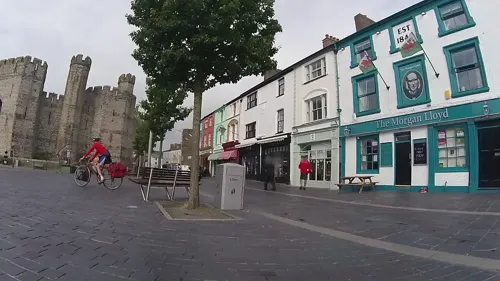
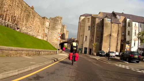


48 more on the map.
History
Caernarfon contains a Roman fort, Segontium, and a Norman motte-and-bailey castle was built at the mouth of the River Seiont.
In 1283, King Edward I completed his conquest of Wales which he secured by a chain of castles and walled towns. The construction of a new stone Caernarfon Castle seems to have started as soon as the campaign had finished. Edward's architect, James of St. George, may well have modelled the castle on the walls of Constantinople, possibly being aware of the town's legendary associations. Edward's fourth son, Edward of Caernarfon, later Edward II of England, was born at the castle in April 1284 and made Prince of Wales in 1301. A story recorded in the 16th century suggests that the new prince was offered to the native Welsh on the premise "that [he] was borne in Wales and could speake never a word of English", however, there is no contemporary evidence to support this.
Caernarfon was constituted a borough in 1284 by a charter of Edward I. The charter, which was confirmed on a number of occasions, appointed the mayor of the borough Constable of the Castle ex officio.
Read more of the history
In 1911, David Lloyd George, then Member of Parliament (MP) for Caernarfon boroughs, which included various towns from Llŷn to Conwy, agreed to the British royal family's idea of holding the investiture of the Prince of Wales at Caernarfon Castle. The ceremony took place on 13 July, with the royal family visiting Wales, and the future Edward VIII was duly invested.
In 1955, Caernarfon was in the running for the title of Capital of Wales on historical grounds but the town's campaign was heavily defeated in a ballot of Welsh local authorities, with 11 votes compared to Cardiff's 136. Cardiff therefore became the Welsh capital.
On 1 July 1969, the investiture ceremony for Charles, Prince of Wales was again held at Caernarfon Castle. The ceremony went ahead without incident despite terrorist threats and protests, which culminated in the death of two members of Mudiad Amddiffyn Cymru (Welsh Defence Movement), Alwyn Jones and George Taylor, who were killed when their bomb – intended for the railway line at Abergele in order to stop the British Royal Train – exploded prematurely. The bombing campaign (one in Abergele, two in Caernarfon and finally one on Llandudno Pier) was organised by the movement's leader, John Jenkins. He was later arrested after a tip-off and was sentenced to ten years imprisonment.
In July 2019, Caernarfon hosted a rally for Welsh independence. The event, organised by AUOB (All Under One Banner) Cymru, included a march through the town centre. Organisers estimated that roughly 8,000 people joined the march on the town square; local authorities confirmed at least 5,000 attendees. The event featured a number of speakers including Hardeep Singh Kohli, Evra Rose, Dafydd Iwan, Lleuwen Steffan, Siôn Jobbins, Beth Angell, Gwion Hallam, Meleri Davies and Elfed Wyn Jones. Talks covered criticism of Brexit and Westminster with advocating Welsh Independence.
The history of Caernarfon, as an example where the rise and fall of different civilizations can be seen from one hilltop, is discussed in John Michael Greer's book The Long Descent. He writes of Caernarfon: Spread out below us in an unexpected glory of sunlight was the whole recorded history of that little corner of the world. The ground beneath us still rippled with earthworks from the Celtic hill fort that guarded the Menai Strait more than two and a half millennia ago. The Roman fort that replaced it was now the dim brown mark of an old archaeological site on low hills off to the left. Edward I's great grey castle rose up in the middle foreground, and the high contrails of RAF jets on a training exercise out over the Irish Sea showed that the town's current overlords still maintained the old watch. Houses and shops from more than half a dozen centuries spread eastward as they rose through the waters of time, from the cramped medieval buildings of the old castle town straight ahead to the gaudy sign and sprawling parking lot of the supermarket back behind us.
From the History section of Caernarfon on Wikipedia, under CC BY-SA 4.0.
More about Caernarfon
Geography
Caernarfon is situated on the southern bank of the Menai Strait facing the Isle of Anglesey. It is situated 9 miles (14 km) south-west of Bangor, 20 miles (32 km) north of Porthmadog and approximately 8 miles (13 km) west of Llanberis and Snowdonia National Park. The mouth of the River Seiont is in the town, creating a natural harbour where it flows into the Menai Strait. Caernarfon Castle stands at the mouth of the river. The A487 passes directly through Caernarfon, with Bangor to the north and Porthmadog to the south.
Economy
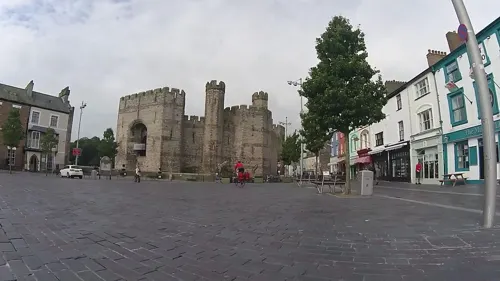
Caernarfon's historical prominence and landmarks have made it a major tourist centre. As a result, many of the local businesses cater for the tourist trade. Caernarfon has numerous guest houses, inns and pubs, hotels, restaurants and shops. The majority of shops in the town are located either in the centre of town around Pool Street and Castle Square (Y Maes), on Doc Fictoria (Victoria Dock) or in Cei Llechi (Slate Quay). A number of shops are also located within the Town Walls.
The majority of the retail and residential section of Doc Fictoria was opened in 2008. The retail and residential section of Doc Fictoria is built directly beside a Blue Flag beach marina. It contains numerous homes, bars and bistros, cafés and restaurants, an award-winning arts centre, a maritime museum and a range of shops and stores.
Arts and culture
Caernarfon hosted the National Eisteddfod in 1862, 1894, 1906, 1921, 1935, 1959 and 1979. Unofficial National Eisteddfod events were also held there in 1877 and 1880. Caernarfon also hosted the 30th annual Celtic Media Festival in March 2009. Cultural destinations include Galeri and Oriel Pendeitsh. Galeri, which opened in 2004, is a creative enterprise centre that houses a gallery, a concert hall, a cinema, a number of companies, and a range of other creative and cultural spaces. Oriel Pendeitsh is a ground-floor exhibition space adjoining the Tourist Information Centre opposite Caernarfon Castle. The gallery has a varied and changing programme of exhibitions throughout the year.
Education
There are four primary schools in Caernarfon, Ysgol yr Hendre being the largest. The others are Ysgol y Gelli, Ysgol Santes Helen and Ysgol Maesincla. Ysgol Syr Hugh Owen is the single secondary school serving Caernarfon and the surrounding areas and currently has between 900 and 1000 pupils from ages 11 to 18. Ysgol Pendalar is a school for children with special needs. Coleg Menai is a further education college for adult learners.
From the Wikipedia article Caernarfon, under CC BY-SA 4.0.
Notable people from Caernarfon
 Barry HughesWelsh footballer and manager (1937-2019)Photo: Rob Croes / Anefo, CC0
 John EvansWelsh explorer who produced an early map of the Missouri RiverPhoto: James Mackay (1759-1822) with the..., Public domain
- Anna LeonowensBritish educator and writer (1831-1915)
- William Henry PreeceBritish scientist (1834–1913)
- Owen MorrisWelsh record producer
- Wyn DaviesWelsh footballer (1942–2025)
- Lewis Jonesone of the founders of the Welsh settlement in Patagonia
- Jamie JonesDJ, producer
- Ray MielczarekWelsh footballer (1946-2013)
- Lionel ReesWelsh Royal Air Force officer (1884–1955); recipient of the Victoria Cross
- Tom WalleyWelsh professional footballer and coach (born 1945)
- Trevor RobertsEnglish footballer (1942-1972)
Born in Caernarfon, according to Wikidata (CC0). Each name links to its Wikipedia article.
Where to stay15
Townhouse within Castle's Town Walls
Motel and hotel
12 Stryd y Farchnad, Caernarfon
Churches and places of worship11
Shopping12
Gas and EV charging2
Schools, colleges and libraries7
Healthcare2
Map of Caernarfon
135 places. The map loads OpenStreetMap tiles when you open it.
Getting there and nearby towns
RAF Valley - Anglesey Airport (VLY) is the nearest airport with scheduled flights listed in OpenStreetMap, 13 miles away.
- Gaerwen 6 mi north, about 9 min by car
- Llanfairpwllgwyngyll 6 mi northeast, about 10 min by car
- Penygroes 6 mi south, about 10 min by car
- Llanberis 6 mi east, about 10 min by car
- Menai Bridge 7 mi northeast, about 12 min by car
- Bangor 8 mi northeast, about 13 min by car
- Llangefni 8 mi north, about 13 min by car
- Tregarth 8 mi northeast, about 13 min by car
- Rhosneigr 12 mi northwest, about 19 min by car
- Llanfairfechan 15 mi northeast, about 24 min by car
Drive times are estimates from straight-line distance, not routes.
Towns near Caernarfon


Keep exploring
Local news
Headlines from INDB.
Reviews, tips and questions
Loading what members have shared...
Sources and licences
- GeoNames (CC BY 4.0): population, coordinates, regions and time zone
- Mapillary (see each image): photos
- OpenStreetMap contributors (ODbL 1.0): places, airports, map data
- Wikidata (CC0 1.0): elevation, founding date, time zone, website, landmarks and historic places
- Wikimedia Commons (see each image): photos
- Wikipedia (CC BY-SA 4.0): overview and history text
Photo credits
- Afon Seiont in Caernarfon (7492), Nilfanion, CC BY-SA 4.0
- Twthill laundrette, Caernarfon (1580775), Geoff Charles, CC BY-SA 4.0
- A487, Caernarfon, Ian S, CC BY-SA 2.0
- Castell Caernarfon yn y cyfnos yn 2023 - Castell Caernarfon, Gwynedd, Wales at Dusk - 2023 10, Llywelyn2000, CC BY-SA 4.0
- Bryn Gwyn slab stone with small adult 11102009, Richard Keatinge, CC BY-SA 3.0
- Llanidan Old Church, Bencherlite, CC BY-SA 3.0
- Eglwys Sant Baglan (Llanfaglan), Caernarfon, Gwynedd - Church of St Baglan A Grade I Listed Building in Bontnewydd, Gwynedd, Wales 55, Llywelyn2000, CC BY-SA 4.0
- St Mary, Llanfair yn y Cwmwd, Bill Nicholls, CC BY-SA 2.0
- Segontium, No machine-readable author provided. Rhion assumed (based on copyright claims)., Public domain
- The Oval (Caernarfon), MadSproute ( talk ), Public domain
- Santes Fair, Eglwys, Caernarfon St Mary's Church, Caernarfon, Gwynedd 02, Llywelyn2000, CC BY-SA 4.0
- 3832 Palace Vaults, Castle Ditch, Palace Street Caernarfon 20240529 0088 DxO, Tilman2007, CC BY-SA 4.0
- 3831 Craft Cymru, 8 Castle Ditch, 17 Castle Street Caernarfon 20240529 0096 DxO, Tilman2007, CC BY-SA 4.0
- Capel Ebeneser, Caernarfon (2), Alex Liivet from Chester, United Kingdom, CC BY 2.0
- Celtic Royal Hotel (Gwesty'r Celt), Caernarfon, Dawnswraig, CC BY-SA 4.0
- Salem Welsh Independent Chapel (1), GeraintTudur2, CC BY-SA 3.0
- The Black Boy Inn, Caernarfon, Gwynedd, Eric Jones, CC BY-SA 2.0
- Street-level photo, gness, CC BY-SA 4.0
- Street-level photo, gness, CC BY-SA 4.0
- Street-level photo, ligfietser, CC BY-SA 4.0
- Street-level photo, ligfietser, CC BY-SA 4.0
- Street-level photo, ligfietser, CC BY-SA 4.0
- Street-level photo, ligfietser, CC BY-SA 4.0
- Street-level photo, ligfietser, CC BY-SA 4.0
- Street-level photo, ligfietser, CC BY-SA 4.0
- Street-level photo, ligfietser, CC BY-SA 4.0
- Street-level photo, ligfietser, CC BY-SA 4.0
- Street-level photo, ligfietser, CC BY-SA 4.0
- Street-level photo, trigpoint, CC BY-SA 4.0
- Street-level photo, trigpoint, CC BY-SA 4.0
- Street-level photo, ligfietser, CC BY-SA 4.0
- Street-level photo, gness, CC BY-SA 4.0
- Street-level photo, ligfietser, CC BY-SA 4.0
- Street-level photo, ligfietser, CC BY-SA 4.0
- Street-level photo, ligfietser, CC BY-SA 4.0
- Street-level photo, ligfietser, CC BY-SA 4.0
- Street-level photo, gness, CC BY-SA 4.0


Page built November 10, 2026. Spotted a mistake? Tell us or suggest a place.