


Why visit Blean
Townapedia lists 21 museums and landmarks, 27 parks and trails, 57 places to eat, 20 places to stay and 5 attractions in and around town.
Highlights include Marlowe Theatre, Gulbenkian Cinema, Sidney Cooper Gallery and Kent Museum of Freemasonry.
Weather in Blean
Forecast from MET Norway (CC BY 4.0). Full forecast
About Blean
Blean is a village and civil parish in the Canterbury district of Kent, England. The civil parish is large and is mostly woodland, much of which is ancient woodland. The developed village within the parish is scattered along the road between Canterbury and Whitstable, in the middle of the Forest of Blean. Blean is part of the electoral ward of Blean Forest.
From the Wikipedia article Blean (this version), under CC BY-SA 4.0.
Photos of Blean


Things to do5

Marlowe Theatre
Cinema and theater · 2.4 mi
Theatre in Canterbury, England (third of that name)



Museums and landmarks21

Sidney Cooper Gallery
Museum · 2.3 mi
22-23 St. Peter's Street, Canterbury
Tu-Fr 10:30-17:00, Sa 11:30-17:00

Kent Museum of Freemasonry
Museum · 2.3 mi
Local history and masonic museum in Canterbury, Kent, United Kingdom
Mo-Sa 10:00-16:00

Canterbury Roman Museum
Museum · 2.5 mi
Museum in Canterbury, Kent, England, UK

Dane John Mound
Monument and historic site · 2.7 mi
Roman cemetery in Canterbury, England

Durovernum Cantiacorum
Monument and historic site · 2.6 mi
Roman city at present-day Canterbury, United Kingdom

Greyfriars
Monument and historic site · 2.4 mi
Former Franciscan convent in Kent

Harris Memorial Garden
Monument and historic site · 2.6 mi
War memorial in Canterbury, England

St Augustine's Abbey
Monument and historic site · 2.8 mi
Monastery in Canterbury, Kent, England, UK

The Beaney
Museum · 2.5 mi
Museum, library and art gallery in Canterbury, Kent, United Kingdom


Whitstable Museum and Gallery
Museum · 3.5 mi
Museum in Kent, United Kingdom
9 more on the map.
Parks, trails and playgrounds27


Tyler Hill Meadow
Park · 1.0 mi
Local Nature Preserve in Hackington, Kent, England


Chequer's Wood and Old Park
Park · 3.5 mi
Park in Kent, United Kingdom
Mount Ephraim Gardens
Park · 3.6 mi
Historic house and gardens, near Faversham, in Hernhill, Swale, Kent, England, UK
15 more on the map.
Restaurants and cafes57
Chapman's
Restaurant · Seafood · 2.2 mi
89-90 St. Dunstan's Street, Canterbury
We-Sa 12:00-14:30, Tu-Sa 17:00-21:30
The Bishop's Finger
Bar and pub · 2.2 mi
13 St. Dunstan's Street, Canterbury
Su-Th 12:00-00:00; Fr 12:00-01:00; Sa 11:00-01:00
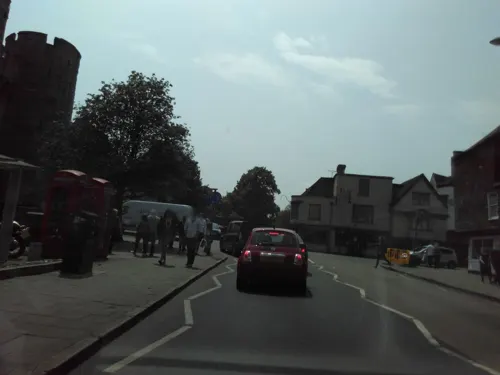
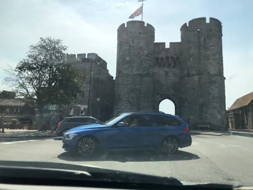
The West Gate Inn
Bar and pub · 2.2 mi
1-3 North Lane, Canterbury
Mo-Th 08:00-00:00;Fr 08:00-00:00;Sa 00:00-01:00,08:00-00:00;Su...
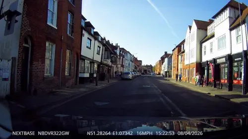

Ye Olde Beverlie
Bar and pub · 1.9 mi
6 St. Stephen's Green, Canterbury
Mo-Sa 12:00-23:00; Su 12:00-22:30

Ancient Raj
Restaurant · Indian · 2.2 mi
25-26 North Lane, Canterbury
Mo-Th 12:00-14:00, 18:00-00:00; Fr 18:00-00:00; Sa 12:00-14:00,...

45 more on the map.
History
The name Blean is the dative form of the Old English word blea which means rough ground. Therefore the full name of the parish meant "the church of Saints Cosmas and Damian in the rough ground."
In 2020, an iron age enclosure was excavated at Blean Church Field. 13 pottery fragments were found dating from 50 BC to 50 AD in a linear feature that measured around 1.20 metres deep to 4 metres wide. The ancient woodland in Blean were once larger, going out to Boughton-Under-Blean and near to the Canterbury Walls. Though small portions were granted Christ Church Canterbury in 791.
Blean was mentioned in the Doomsday Book as a settlement in the hundred of Whitstable. There were 12 households of villagers. The Lord and Tenant-in-chief in 1086 was Hamo Dapifer. He held the manor until his death. King Henry II sent a letter in July 1174 to St Gregory's Priory, Canterbury, giving permission for a daily horse load worth of wood cut from Blean Woods to be used for priory and its surrounding houses in Canterbury. In the period 1271-1379, the main grain harvested in the village was oats, at 15 acres in 1291. Other crops included vetch at 11 acres, and barley and rye with smaller plots of 6 and 3 acres respectively.
Read more of the history
During the reign of Richard I, the manor was possessed by Hamo de Crevequer, a descendant of Hamo Dapifer. In the time of his grandson Robert de Crevequer, it was seized and put in the hands of the crown. Later, the manor was granted to Bartholomew de Badlesmere, who was subsequently beheaded for high treason at the gallows of Blean on 14 April 1322. The manor was co-inherited by his four daughters: Margery, Maud, Elizabeth and Margaret. In partition of inheritance, the full share of the manor of Blean went to Margaret. She held the manor for the rest of her life. The manor was then granted to Thomas de Wolton and Robert de Denton During the reign of Henry VI, boar were hunted for sport in Blean Woods, with the king holding sylvan rights over the woods. A keeper of these boars was appointed by royal patent.
In 1835, the Blean Union Workhouse, designed by William Edmunds, was built on four acres south of Herne Common. The design was based on Sir Francis Bond Head's Plan of a Rural Workhouse for 500 Persons, a publication of the Poor Law Commission. To keep costs down, no outside drains were added, and the building was windowless. At that time, the lord of the manor and principal landowner was Earl Sondes. The workhouse was completed the following year, with room for around 298 inmates. In 1875, a small hospital was built with beds for up to 68 patients. Discipline at the workhouse was severe. A nine-year-old girl was once punished for a small offence by being forced to remain overnight in the mortuary with a corpse; the Master and Matron were dismissed as a result. By 1901, there were around 146 workhouse inmates and 17 officers.
On 1 April 2019, the parish of St Cosmus and St Damian in the Blean was renamed to "Blean".
From the History section of Blean on Wikipedia, under CC BY-SA 4.0.
More about Blean
Economy
Blean's economy is closely tied to Canterbury and to a lesser extent, Whitstable. In television entertainment Smallfilms operates here the production company that created the animated series Ivor the Engine, Bagpuss and the Clangers, at Peter Firmin's barn on the Blean farm. The bay window of Firmin's house was featured in the opening sequence of Bagpuss.
Education
Blean Primary School, previously known as Blean School, was built in 1929 The school opened on 12 November the same year. It is a mixed gender school for ages 3 to 11. It is currently rated outstanding by Ofsted. During World War 2, the school was equipped with air raid shelters. Teachers carried torches, as the power was often cut off. Along the school walls, there were posters to identify allied and enemy planes as the action was often visible from below. In 1941, there was a small fundraiser run by six of the students for the National Savings Schemes to help with the war effort. The group raised £123 in total. Proposals for building modernisation and maintenance were approved in 2024. The combined costs were estimated at £1,440,000, with most the cost coming from proposed tendering costs.
From the Wikipedia article Blean, under CC BY-SA 4.0.
Notable people from Blean
- Gabrielle Bluntactress (1919-2014)
- Peta Taylorcricketer (1914-1989)
- Gordon Herbert VasseRAF Commandant (1899–1965)
- John Clayton CowellArmy Officer (1832-1894)
- Edward BoysEnglish theologian
- Brian YoungRoyal Naval captain
- Frank MapleAustralian rules footballer
Born in Blean, according to Wikidata (CC0). Each name links to its Wikipedia article.
Where to stay20
Churches and places of worship20
Church of St. Gabriel
Church · Anglican · 1.0 mi
56 Rough Common Road, Canterbury
Shopping3
Gas and EV charging1
Schools, colleges and libraries21
University of Kent – School of Sport & Exercise Sciences
School · 1.3 mi
Healthcare6
Map of Blean
181 places. The map loads OpenStreetMap tiles when you open it.
Getting there and nearby towns
Manston Airport (MSE) is the nearest airport with scheduled flights listed in OpenStreetMap, 13 miles away.
- Canterbury 2 mi southeast, about 4 min by car
- Whitstable 4 mi north, about 6 min by car
- Herne Bay 6 mi northeast, about 9 min by car
- Bridge 6 mi southeast, about 9 min by car
- Littlebourne 6 mi southeast, about 9 min by car
- Faversham 7 mi west, about 11 min by car
- Wingham 8 mi east, about 13 min by car
- Eastchurch 11 mi northwest, about 17 min by car
- Ashford 13 mi southwest, about 21 min by car
- Sittingbourne 14 mi west, about 22 min by car
Drive times are estimates from straight-line distance, not routes.
Towns near Blean


Keep exploring
Local news
Headlines from INDB.
Reviews, tips and questions
Loading what members have shared...
Sources and licences
- GeoNames (CC BY 4.0): population, coordinates, regions and time zone
- Mapillary (see each image): photos
- OpenStreetMap contributors (ODbL 1.0): places, airports, map data
- Wikidata (CC0 1.0): elevation, founding date, time zone, website, landmarks and historic places
- Wikimedia Commons (see each image): photos
- Wikipedia (CC BY-SA 4.0): overview and history text
Photo credits
- Shops in Blean, Kent, UK, Nick Smith, CC BY-SA 2.0
- Rare Heath Fritillary at RSPB Blean Woods, Jchigham, CC BY-SA 4.0
- Marlowe Theatre Canterbury, Adam Bishop, CC BY-SA 3.0
- Kent Museum of Freemasonry Entrance, Pre36sunbeam, CC BY-SA 3.0
- Roman Museum 002a, Linda Spashett ( Storye book ), CC BY 3.0
- Dane John Mound (1), Richard Nevell, CC BY-SA 3.0
- Watling Street route, w:en:User:Neddyseagoon, CC BY-SA 3.0
- Canterbury - Greyfriars Chapel, Pam Fray, CC BY-SA 2.0
- 1085027 II PUBLIC LIBRARY AND MUSEUM AT BEANEY INSTITUTE, HIGH STREET Canterbury 20260607 0005, Tilman2007, CC BY-SA 4.0
- South Blean 2, Dudley Miles, CC BY-SA 4.0
- Tyler Hill Meadow 1, Dudley Miles, CC BY-SA 4.0
- Church of St Mildred Canterbury 1085039 20230812 0042, Tilman2007, CC BY-SA 4.0
- 1241661 II Star Former Church of the Holy Cross Canterbury 20250823 0001, Tilman2007, CC BY-SA 4.0
- St Michael And All Angels Harbledown 20190915 12 2251, Joe Simons, CC BY-SA 4.0
- St Thomas of Canterbury Church, Canterbury (01), Quartettgeschwister, CC BY-SA 3.0
- School of Arts - UKC, St BC ( talk ), CC BY-SA 3.0
- St Edmund's School Canterbury, main entrance, Brakspear at English Wikipedia, Public domain
- Canterbury High School aerial, John Fielding, CC BY 2.0
- Bigbury Camp hillfort 01, Simon Burchell, CC BY-SA 3.0
- Kent College, UK, Roger May, CC BY-SA 2.0
- 1260281 II Star HOUSE OF AGNES HOTEL Canterbury 20250823 0002, Tilman2007, CC BY-SA 4.0
- Sidney Cooper Museum, Peter Glyn, CC BY-SA 3.0
- A Long Way from the Arctic - Flickr - Charlie From Bristol, Charlie Marshall from Bristol UK, United Kingdom, CC BY 2.0
- Slope at the Northeast Area of Bigbury Camp (01), Doyle of London, CC BY-SA 4.0
- County of Kent memorial cross, Canterbury Cathedral, August 2022, No Swan So Fine, CC BY-SA 4.0
- Succisa pratensis premorse, E Wusk, CC BY-SA 4.0
- St. Augustine's Abbey Spring 2016, Mball93, CC BY-SA 4.0
- Street-level photo, tallguy, CC BY-SA 4.0
- Street-level photo, tallguy, CC BY-SA 4.0
- Street-level photo, tallguy, CC BY-SA 4.0
- Street-level photo, jjhaslanded, CC BY-SA 4.0
- Street-level photo, jjhaslanded, CC BY-SA 4.0
- Street-level photo, gregorywilliams, CC BY-SA 4.0
- Street-level photo, tallguy, CC BY-SA 4.0
- Street-level photo, tallguy, CC BY-SA 4.0
- Street-level photo, tallguy, CC BY-SA 4.0
- Street-level photo, jjhaslanded, CC BY-SA 4.0
- Street-level photo, gregorywilliams, CC BY-SA 4.0
- Street-level photo, jjhaslanded, CC BY-SA 4.0
- Street-level photo, jjhaslanded, CC BY-SA 4.0
- Street-level photo, jjhaslanded, CC BY-SA 4.0
- Street-level photo, paulbiv, CC BY-SA 4.0


Page built November 10, 2026. Spotted a mistake? Tell us or suggest a place.