


Bloxwich, United Kingdom
Bloxwich is a town of 40,000 people in England, United Kingdom.
Why visit Bloxwich
Townapedia lists 11 museums and landmarks, 46 parks and trails, 129 places to eat, 1 place to stay and 2 attractions in and around town.
Highlights include School Farm Shop, Sikh Regiment Memorial, The New Art Gallery Walsall and Walsall Arboretum.
Weather in Bloxwich
Forecast from MET Norway (CC BY 4.0). Full forecast
About Bloxwich
Bloxwich is a market town in the Metropolitan Borough of Walsall, West Midlands, England. It is located between the towns of Walsall, Cannock, Willenhall and Brownhills.
From the Wikipedia article Bloxwich (this version), under CC BY-SA 4.0.
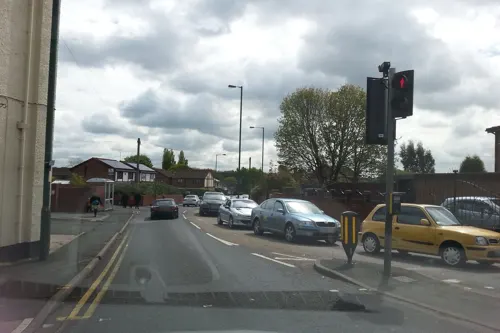
Photos of Bloxwich


Things to do2


Museums and landmarks11

Sikh Regiment Memorial
Monument and historic site · 3.6 mi
2021 statue in Wolverhampton, England

The New Art Gallery Walsall
Museum · 2.4 mi
Modern and contemporary art gallery in Walsall, England, United Kingdom

Walsall Leather Museum
Museum · 2.2 mi
Municipal museum in Walsall, England, United Kingdom

Locksmith's House
Museum · 3.3 mi
Museum in Willenhall, Staffordshire, England, United Kingdom

Walsall Castle
Monument and historic site · 2.4 mi
Manor house in Walsall, West Midlands, England

Parks, trails and playgrounds46

Walsall Arboretum
Park · 2.6 mi
Victorian public park located close to Walsall town centre in the West Midlands of England

Wryley & Essington Canal Local Nature Reserve
Hiking and trails · 2.0 mi


Pelsall North Common Local Nature Reserve
Hiking and trails · 1.8 mi
Site of Importance for Nature Conservation
The Jane Lane History & Sensory Garden
Park · 2.0 mi
Garden and trail reflecting Jane Lane’s flight as she aided the escape of Charles II in the 1640′s. Totem poles have terracotta plaques...

34 more on the map.
Restaurants and cafes129
The Bridge Tavern
Bar and pub · 1.7 mi
1 Bentley Lane, Willenhall
Mo-Th 16:00-23:00; Fr 16:00-00:30; Sa 12:00-00:30; Su 12:00-23:00



Harvester George Stephenson
Diner · American · 1.4 mi
Mo-Su "please add opening times"
The Alma
Bar and pub · 1.8 mi
Bentley Lane, Walsall
Mo-Su "please add opening times"

Village Bakery
Bakery · 1.7 mi
55 High Street, Walsall
Mo-Fr 09:00-16:30; Sa 08:30-15:00; Su,PH off

117 more on the map.
Notable people from Bloxwich
 Harold ParryBritish soldier and poet (1896-1917)Photo: Arthur St. John Adcock, Public domain
- Charlie AthersmithEnglish footballer (1872-1910)
- Harry AstonProfessional footballer born 1855
- Neil DavisEnglish footballer (born 1973)
- Bobby DownesEnglish professional football player, coach and manager (born 1949)
- Simon Greencricketer (born 1970)
- Fred Davis(1929-1996)
- David MiddletonEnglish cricketer (born 1965)
- Derek PaceEnglish footballer (1932-1989)
- Arthur Stantonfootballer (1892-?)
- Kenny MowerEnglish footballer (born 1960)
- Syd HomerEnglish footballer (1903-1983)
Born in Bloxwich, according to Wikidata (CC0). Each name links to its Wikipedia article.
Where to stay1
Churches and places of worship52
Shopping16
Gas and EV charging7
Schools, colleges and libraries55
St Alban's Church of England Primary Academy
School · Anglican · 2.0 mi
St. Albans Close, Wolverhampton
St Thomas of Canterbury Catholic Primary School
School · Roman Catholic · 1.5 mi
Dartmouth Avenue, Walsall
Healthcare18
Walsall Child Development Centre
Clinic and pharmacy · 2.1 mi
Coalheath Lane, Walsall
Map of Bloxwich
250 places. The map loads OpenStreetMap tiles when you open it.
Getting there and nearby towns
Birmingham Airport (BHX) is the nearest airport with scheduled flights listed in OpenStreetMap, 16 miles away.
- Pelsall 2 mi northeast, about 3 min by car
- Walsall 2 mi south, about 4 min by car
- Willenhall 3 mi southwest, about 5 min by car
- Great Wyrley 3 mi north, about 5 min by car
- Brownhills 3 mi east, about 5 min by car
- Wednesfield 4 mi southwest, about 6 min by car
- Aldridge 4 mi east, about 6 min by car
- Featherstone 4 mi northwest, about 7 min by car
- Wednesbury 5 mi south, about 8 min by car
- Cannock 5 mi north, about 8 min by car
Drive times are estimates from straight-line distance, not routes.
Towns near Bloxwich


Keep exploring
Local news
Headlines from INDB.
Reviews, tips and questions
Loading what members have shared...
Sources and licences
- GeoNames (CC BY 4.0): population, coordinates, regions and time zone
- Mapillary (see each image): photos
- OpenStreetMap contributors (ODbL 1.0): places, airports, map data
- Wikidata (CC0 1.0): elevation, founding date, time zone, website, landmarks and historic places
- Wikimedia Commons (see each image): photos
- Wikipedia (CC BY-SA 4.0): overview and history text
Photo credits
- Monument All Saints Bloxwich, Martin Neylon, CC BY-SA 4.0
- Saragarhi Memorial, Wednesfield (53259285121), Elliott Brown from Birmingham, United Kingdom, CC BY-SA 2.0
- Walsall Leather Museum, Brianboru100, CC BY-SA 3.0
- StMichaelsPelsall, ChrisTheDude ( talk ), CC BY-SA 2.0
- All Saints Bloxwich, Martin Neylon, CC BY-SA 4.0
- SneydWharfWyrleyCanal, Edward Hunt, CC BY-SA 2.0
- Holbrook ,Walsall Arboretum - panoramio, shakestd, CC BY 3.0
- Turf Tavern, Martin Neylon, CC BY-SA 4.0
- Romping Cat, Martin Neylon, CC BY-SA 4.0
- Former Royal Exchange Brewhouse, Martin Neylon, CC BY-SA 4.0
- New Art Gallery Walsall - interior 11 - barrier tape, Andy Mabbett, CC BY-SA 3.0
- Street-level photo, techie2000, CC BY-SA 4.0
- Street-level photo, southglos, CC BY-SA 4.0
- Street-level photo, adam2, CC BY-SA 4.0
- Street-level photo, adam2, CC BY-SA 4.0
- Street-level photo, adam2, CC BY-SA 4.0
- Street-level photo, edloach, CC BY-SA 4.0
- Street-level photo, southglos, CC BY-SA 4.0
- Street-level photo, edloach, CC BY-SA 4.0
Page built November 10, 2026. Spotted a mistake? Tell us or suggest a place.