


Why visit Cannock
Townapedia lists 5 museums and landmarks, 9 parks and trails, 78 places to eat, 6 places to stay and 2 attractions in and around town.
Highlights include Hednesford Park and Shoal Hill Common.
Weather in Cannock
Forecast from MET Norway (CC BY 4.0). Full forecast
About Cannock
Cannock () is a town in the Cannock Chase district in the county Staffordshire, England. It had a population of 29,018. Cannock is not far from the towns Walsall, Burntwood, Stafford and Telford. The cities Lichfield and Wolverhampton are also nearby.
From the Wikipedia article Cannock (this version), under CC BY-SA 4.0.
Travel tips from other travellers: Cannock on Wikivoyage (CC BY-SA 4.0).
Photos of Cannock


Things to do2

Museums and landmarks5

Staffordshire & Worcestershire Canal (Hatherton Branch)
Monument and historic site · 1.1 mi
Parks, trails and playgrounds9


Shoal Hill Common
Park · 1.1 mi
Nature reserve in Staffordshire, England, UK

Hednesford Town Football Club
Sports field and stadium · 1.8 mi
Keys Park Road, Hednesford

Restaurants and cafes78
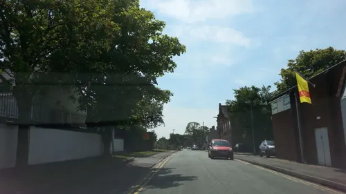
The Hedgeford Lodge
Bar and pub · 1.8 mi
Anglesey Street, Hednesford
Mo,Tu,We,Th,Su 08:00-24:00; Fr,Sa 08:00-25:00
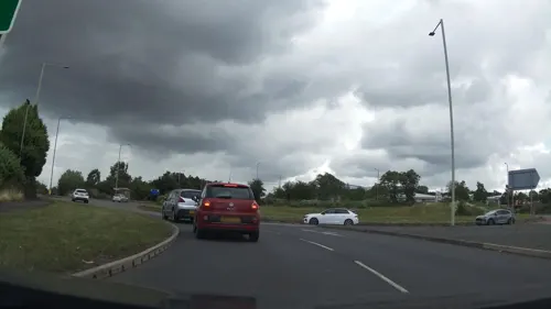
Brewers Fayre - Orbital
Bar and pub · British · 1.2 mi
Eastern Way, Cannock
Mo-Fr 06:30-23:00, Sa 07:00-23:00, Su 07:00-22:30
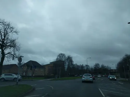


Hawkins Sports & Social Club
Bar and pub · 1.6 mi
Coppice Lane, Cheslyn Hay
Mo-Fr 19:00-23:00, Sa 12:00-23:30, Su 12:00-23:00
66 more on the map.
History
Cannock was in the Domesday Book of 1086. It was called Chnoc c.1130, Cnot in 1156, Canot in 1157, and Canoc in 1198. Cannock is probably Old English cnocc meaning 'hillock', modified by Norman pronunciation by the insertion of a vowel to Canoc. The name may refer to Shoal Hill, north-west of the town.
Cannock was a small rural community until mining increased heavily during the mid-to-late 19th century. The area then continued to grow rapidly with many industries coming to the area because of its proximity to the Black Country and its coal reserves. Cannock's population continued to increase steadily in the 20th century and its slight fall since the 1981 census has been more than compensated for by house-building in the adjoining village of Heath Hayes. The last colliery to close in the town was Mid Cannock in 1967, and the last remaining colliery to close in the Cannock Chase area was Littleton (in Huntington) in 1993.
The total population of the built-up area defined in 2011 was 86,121, making it the second largest in Staffordshire if Swadlincote in Derbyshire is excluded from the Burton upon Trent Built-up Area (BUA). There is some green belt, particularly between the Cannock BUA and the much larger West Midlands BUA to the south. As well as the Lichfield, Stafford, East Staffordshire, and South Staffordshire Districts.
Read more of the history
A house known as The Green, which dated from the 1730s and which was the home of Sir Robert Fisher, 4th Baronet, became the headquarters of Cannock Urban District Council in 1927. It was converted into offices in the 1980s, initially for Cannock Chase Technical College but, in 2016, it was refurbished for private use.
Cannock Chase German war cemetery is located nearby containing 4,885 German military dead from the First and Second World Wars. It is managed by the Commonwealth War Graves Commission.
From the History section of Cannock on Wikipedia, under CC BY-SA 4.0.
More about Cannock
Geography
Cannock is on a south-west facing slope, falling from the highest point on Cannock Chase (244 m) at Castle Ring, to about 148 m in the town centre and 111 m near Wedges Mills. The soil is light with a gravel and clay subsoil, and there are extensive coal measures.
Cannock has a moderate, temperate climate. See Penkridge weather station for details of average temperature and rainfall figures taken between 1981 and 2010 at the Met Office weather station in Penkridge (around 5 miles (8 km) north-west of Cannock).
Cannock is about 20 miles (30 km) by road north-north-west of Birmingham, 80 miles (130 km) south-south-east of Manchester and 130 miles (210 km) north-west of London. It is 9 to 10 miles (14 to 16 km) by road from many of the nearest towns and cities (Aldridge, Lichfield, Stafford, Walsall, Willenhall and Wolverhampton), but Hednesford (2 miles (3 km)), Burntwood and Penkridge (5 miles (8 km)), Bloxwich and Brownhills (6 miles (10 km)) and Rugeley (7 miles (11 km)) are nearer.
Education
Cannock Chase High School is a non-denominational mixed comprehensive with just over 1000 pupils aged 11–18.
Cardinal Griffin Catholic College is a voluntary aided Roman Catholic secondary school with around 950 pupils aged 11–18.
Chase Grammar School (called Lyncroft House School 1980–1996 then Chase Academy until January 2013) was an independent co-educational boarding school with a day nursery that operated up until September 2025.
South Staffordshire College closed its Cannock Campus in July 2017, but reopened it the following summer as the new Cannock Chase Skills and Innovation Hub with courses starting there from September 2018.
From the Wikipedia article Cannock, under CC BY-SA 4.0.
Notable people from Cannock
 Glenn HughesBritish bassist and singerPhoto: Paul Hasselblatt, CC BY-SA 4.0
 Elgar HowarthEnglish conductor, composer and trumpeter (1935–2025)Photo: Tom Yates at English Wikipedia, CC BY-SA 3.0
 Steve JamesEnglish snooker playerPhoto: Unknown author Unknown author, Public domain
 Andy BishopEnglish association football player and managerPhoto: https://www.flickr.com/photos/ingythewingy/, CC BY-SA 2.0
 Riley ParsonsEnglish snooker playerPhoto: Gustavo Matlock, CC BY-SA 4.0
 Jim Rhodesprofessional golfer (1946–2015)Photo: Pvt pauline, CC BY-SA 3.0
- Mel GalleyBritish guitarist (1948–2008)
- Lewis AskeyBritish cyclist
- Chris OvertonEnglish actor and filmmaker
- Carole AshbyBritish actress
- Gordon LeeEnglish football player and manager
- Dave NortonEnglish footballer and manager (born 1965)
Born in Cannock, according to Wikidata (CC0). Each name links to its Wikipedia article.
Where to stay6
Churches and places of worship24
Shopping20
Gas and EV charging6
Schools, colleges and libraries31
Healthcare3
Map of Cannock
184 places. The map loads OpenStreetMap tiles when you open it.
Getting there and nearby towns
Birmingham Airport (BHX) is the nearest airport with scheduled flights listed in OpenStreetMap, 21 miles away.
- Great Wyrley 2 mi southeast, about 3 min by car
- Featherstone 4 mi southwest, about 7 min by car
- Burntwood 4 mi east, about 7 min by car
- Pelsall 5 mi southeast, about 8 min by car
- Brownhills 6 mi southeast, about 9 min by car
- Rugeley 6 mi northeast, about 10 min by car
- Wednesfield 7 mi south, about 11 min by car
- Willenhall 7 mi south, about 12 min by car
- Walsall 8 mi south, about 12 min by car
- Wolverhampton 8 mi southwest, about 13 min by car
Drive times are estimates from straight-line distance, not routes.
Towns near Cannock


Keep exploring
Local news
Headlines from INDB.
Reviews, tips and questions
Loading what members have shared...
Sources and licences
- GeoNames (CC BY 4.0): population, coordinates, regions and time zone
- Mapillary (see each image): photos
- OpenStreetMap contributors (ODbL 1.0): places, airports, map data
- Wikidata (CC0 1.0): elevation, founding date, time zone, website, landmarks and historic places
- Wikimedia Commons (see each image): photos
- Wikipedia (CC BY-SA 4.0): overview and history text
Photo credits
- Chaserider B5WER at Cannock Bus Station, KD Ramsey, CC BY-SA 4.0
- Council House, Cannock, John M, CC BY-SA 2.0
- Congregational Chapel, Cannock, Geoff Pick, CC BY-SA 2.0
- Conduit Head, Cannock, John M, CC BY-SA 2.0
- Cannock War Memorial - Market Place, Cannock (41546548932), Elliott Brown from Birmingham, United Kingdom, CC BY-SA 2.0
- Cannock War Memorial - Market Place, Cannock (41587182601), Elliott Brown from Birmingham, United Kingdom, CC BY-SA 2.0
- Cannock War Memorial - Market Place, Cannock (41587173141), Elliott Brown from Birmingham, United Kingdom, CC BY-SA 2.0
- The Sower - Cannock Library - Manor Avenue, Cannock (41546980052), Elliott Brown from Birmingham, United Kingdom, CC BY-SA 2.0
- Church of Our Lady of Lourdes, Hednesford, JThomas, CC BY-SA 2.0
- Mill Street and St Luke's Church in Cannock, Staffordshire, John M, CC BY-SA 2.0
- Cardinal Griffin College, Cannock, Pjposullivan, CC BY-SA 2.0
- Hednesford Park from Victoria Street, Asheiou, CC BY-SA 4.0
- Street-level photo, adam2, CC BY-SA 4.0
- Street-level photo, adam2, CC BY-SA 4.0
- Street-level photo, adam2, CC BY-SA 4.0
- Street-level photo, adam2, CC BY-SA 4.0
- Street-level photo, tallguy, CC BY-SA 4.0
- Street-level photo, adam2, CC BY-SA 4.0
- Street-level photo, adam2, CC BY-SA 4.0
- Street-level photo, adam2, CC BY-SA 4.0
- Street-level photo, adam2, CC BY-SA 4.0
- Street-level photo, edloach, CC BY-SA 4.0
- Street-level photo, edloach, CC BY-SA 4.0
- Street-level photo, adam2, CC BY-SA 4.0
- Street-level photo, adam2, CC BY-SA 4.0
- Street-level photo, southglos, CC BY-SA 4.0
- Street-level photo, southglos, CC BY-SA 4.0
- Street-level photo, adam2, CC BY-SA 4.0
- Street-level photo, edloach, CC BY-SA 4.0
- Street-level photo, adam2, CC BY-SA 4.0
- Street-level photo, adam2, CC BY-SA 4.0


Page built November 10, 2026. Spotted a mistake? Tell us or suggest a place.