


Great Wyrley, United Kingdom
Great Wyrley is a town of 19,193 people in England, United Kingdom.
Why visit Great Wyrley
Townapedia lists 6 museums and landmarks, 4 parks and trails, 40 places to eat and 2 places to stay in and around town.
Highlights include Hednesford Park and Shoal Hill Common.
Weather in Great Wyrley
Forecast from MET Norway (CC BY 4.0). Full forecast
About Great Wyrley
Great Wyrley is a village and civil parish in the South Staffordshire district of Staffordshire, England. It forms a built-up area with nearby Cheslyn Hay, Churchbridge, Landywood and Little Wyrley. It lies 6 miles (9.7 km) north of Walsall and a similar distance from Wolverhampton. Cannock is directly north of the village.
From the Wikipedia article Great Wyrley (this version), under CC BY-SA 4.0.
Museums and landmarks6

Staffordshire & Worcestershire Canal (Hatherton Branch)
Monument and historic site · 1.1 mi
Parks, trails and playgrounds4


Shoal Hill Common
Park · 3.1 mi
Nature reserve in Staffordshire, England, UK
Restaurants and cafes40
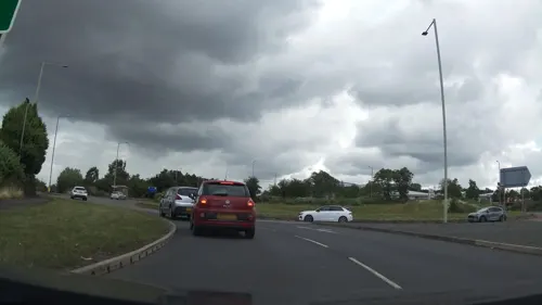
Brewers Fayre - Orbital
Bar and pub · British · 0.9 mi
Eastern Way, Cannock
Mo-Fr 06:30-23:00, Sa 07:00-23:00, Su 07:00-22:30
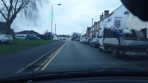
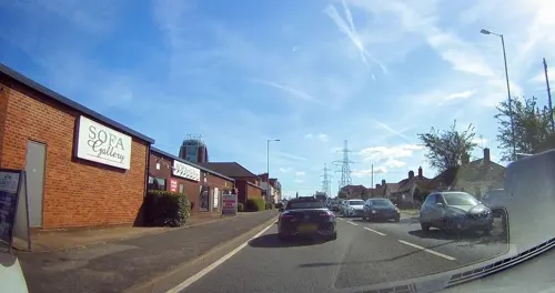


Hawkins Sports & Social Club
Bar and pub · 0.9 mi
Coppice Lane, Cheslyn Hay
Mo-Fr 19:00-23:00, Sa 12:00-23:30, Su 12:00-23:00

28 more on the map.
Where to stay2

History
The word "Wyrley" derives from two Old English words: wir and leah. Wir meant "bog myrtle" and leah meant "woodland clearing", suggesting that Great Wyrley began as sparse woodland or marshland. "Great" refers to its dominant size over Little Wyrley.
Great Wyrley is mentioned in the Domesday Book under the name of Wereleia, and as early as 1086 is said to have been indirectly owned by the Bishop of Chester St John's as part of the "somewhat scattered holdings" of the Church of Saint Chad in Lichfield. Some 480 acres (190 ha) of farming land were, assumingly, evenly distributed between Wyrley and nearby Norton Canes. However, all six dependencies of Saint Chad had been labelled as "wasta", which meant they had been abandoned by the time the Domesday Book was made.
In former times the village was a mining village – The Great Wyrley Colliery – with metalworking (such as for nails, agricultural implements and horseshoes) in outlying areas. The Wyrley and Essington Canal passes nearby.
In 1848 Samuel Lewis included the settlement in his gazetteer and stated it had:
799 inhabitants and 1,600 acres (650 ha), of which the Duke of Sutherland owned part;
The road from Walsall to Cannock passing through the village, long, and consisting of detached houses;
In 1844, Great Wyrley formed with Cheslyn Hay a new ecclesiastical district, having a population of 1,753;
Read more of the history
St. Mark's Church, a highly finished structure in the early English style, built 1845, at a cost of £2,430, of which sum £1,200 was given by the Rev. William Gresley, prebendary of Lichfield; the remainder was raised by subscription, aided by £333 from the Diocesan, and £250 from the Incorporated Society;
A perpetual curacy; patrons, the Dean and Chapter of Lichfield;
A school, purchased from the Independents (Nonconformists), was opened in 1843 which cross-references the gazetteer entry Cannock.
In 1876 Shapurji Edalji was appointed Vicar of Great Wyrley; he served until his death forty-two years later. A Parsi convert to Christianity from Bombay, he may well have been the first South Asian to become the incumbent of an English parish.
In 1903, the village was the scene of the Great Wyrley Outrages, a series of slashings of horses, cows and sheep. In October, a local solicitor and son of the parson, George Edalji, was tried and convicted for the eighth attack, on a pit pony, and sentenced to seven years with hard labour. Edalji's family had been the victims of a long-running campaign of untraceable abusive letters and anonymous harassment in 1888 and 1892–1895. Further letters, in 1903, alleged he was partially responsible for the outrages and caused the police suspicion to focus on him.
Edalji was released in 1906 after the Chief Justice of the Bahamas and others had pleaded his case but he was not pardoned, and the police kept him under surveillance. Sir Arthur Conan Doyle of Sherlock Holmes fame was persuaded to "turn detective" to prove the man's innocence. This he achieved after eight months of work. Edalji was exonerated by a Home Office committee of enquiry, although no compensation was awarded.
Local myth remembers the Outrages to have been enacted by "The Wyrley Gang", although Doyle believed that they were the work of a single person, a local butcher's boy and sometime sailor called Royden Sharp. Ironically, Doyle's suspicion was based on circumstantial evidence. It was an over-reliance on this type of evidence in the first place which had resulted in Edalji's flawed conviction.
Poison pen letters in the name of the "Wyrley Gang" continued for another twenty-five years, but these were subsequently discovered to have been posted from outside the town by Enoch Knowles of Wednesbury, who was arrested and convicted in 1934.
Doyle's The Story of Mr. George Edalji (1907, expanded re-issue in 1985).
1972 BBC anthology series The Edwardians: Arthur Conan Doyle (one episode) centres on his involvement in the Edalji case. Written by Jeremy Paul and directed by Brian Farnham, it stars Nigel Davenport as Doyle, Sam Dastor as George Edalji, and Renu Setna as the Reverend Edalji.
Arthur & George by Julian Barnes (2005), nominated that year for the Man Booker Prize. In 2010, Arthur & George was adapted for the theatre by David Edgar and, in 2015, for a three-part British television drama of the same title.
A comprehensive non-fictional account Conan Doyle and the Parson's Son: The George Edalji Case by Gordon Weaver (2006).
In Roger Oldfield's book Outrage: The Edalji Five and the Shadow of Sherlock Holmes, Vanguard Press (2010), the case is set within the context of the wider experiences of the Edalji family as a whole. Oldfield taught history at Great Wyrley High School.
From the History section of Great Wyrley on Wikipedia, under CC BY-SA 4.0.
Notable people from Great Wyrley
- Maurice HerriottBritish athlete
- John WalkerEnglish footballer, born 1900
- Paul ArnoldEnglish video game composer
Born in Great Wyrley, according to Wikidata (CC0). Each name links to its Wikipedia article.
Churches and places of worship14
Shopping7
Gas and EV charging1
Schools, colleges and libraries9
Healthcare1
Map of Great Wyrley
84 places. The map loads OpenStreetMap tiles when you open it.
Getting there and nearby towns
Birmingham Airport (BHX) is the nearest airport with scheduled flights listed in OpenStreetMap, 18 miles away.
- Pelsall 3 mi southeast, about 5 min by car
- Walsall 5 mi south, about 9 min by car
- Wolverhampton 7 mi southwest, about 11 min by car
- Rugeley 7 mi northeast, about 12 min by car
- Wednesbury 8 mi south, about 12 min by car
- Streetly 8 mi southeast, about 12 min by car
- West Bromwich 10 mi south, about 16 min by car
- Sutton Coldfield 11 mi southeast, about 17 min by car
- Dudley 12 mi south, about 19 min by car
- Birmingham 13 mi south, about 22 min by car
Drive times are estimates from straight-line distance, not routes.
Towns near Great Wyrley


Keep exploring
Local news
Headlines from INDB.
Reviews, tips and questions
Loading what members have shared...
Sources and licences
- GeoNames (CC BY 4.0): population, coordinates, regions and time zone
- Mapillary (see each image): photos
- OpenStreetMap contributors (ODbL 1.0): places, airports, map data
- Wikidata (CC0 1.0): elevation, founding date, time zone, website, landmarks and historic places
- Wikimedia Commons (see each image): photos
- Wikipedia (CC BY-SA 4.0): overview and history text
Photo credits
- All Saints Bloxwich, Martin Neylon, CC BY-SA 4.0
- Church of Our Lady of Lourdes, Hednesford, JThomas, CC BY-SA 2.0
- Mill Street and St Luke's Church in Cannock, Staffordshire, John M, CC BY-SA 2.0
- StMichaelsPelsall, ChrisTheDude ( talk ), CC BY-SA 2.0
- Hednesford Park from Victoria Street, Asheiou, CC BY-SA 4.0
- Street-level photo, tallguy, CC BY-SA 4.0
- Street-level photo, edloach, CC BY-SA 4.0
- Street-level photo, adam2, CC BY-SA 4.0
- Street-level photo, edloach, CC BY-SA 4.0
- Street-level photo, edloach, CC BY-SA 4.0
- Street-level photo, southglos, CC BY-SA 4.0
- Street-level photo, southglos, CC BY-SA 4.0
- Street-level photo, adam2, CC BY-SA 4.0
- Street-level photo, edloach, CC BY-SA 4.0
- Street-level photo, edloach, CC BY-SA 4.0
- Street-level photo, tallguy, CC BY-SA 4.0
Page built November 10, 2026. Spotted a mistake? Tell us or suggest a place.