


Bramhall, United Kingdom
Bramhall is a town of 17,195 people in England, United Kingdom.
Why visit Bramhall
Townapedia lists 19 museums and landmarks, 47 parks and trails, 196 places to eat, 6 places to stay and 5 attractions in and around town.
Highlights include Garrick Theatre, Brookdale Club and Theatre, Avro Heritage Museum and Bramall Hall.
Weather in Bramhall
Forecast from MET Norway (CC BY 4.0). Full forecast
About Bramhall
Bramhall is a large village in the Metropolitan Borough of Stockport, Greater Manchester, England. It was formerly a civil parish in Cheshire. At the 2021 census, the built-up area, as defined by the Office for National Statistics, had a population of 17,195.
From the Wikipedia article Bramhall (this version), under CC BY-SA 4.0.
Things to do5

Garrick Theatre
Cinema and theater · 3.5 mi
Theatre in Stockport, England

Museums and landmarks19


Bramall Hall
Monument and historic site · 1.1 mi
Tudor manor house in Bramhall, Stockport, Greater Manchester, England, UK

Adlington Hall
Museum · 2.7 mi
Country house in Cheshire, England, UK

Anson Engine Museum
Museum · 3.2 mi
Museum based in Poynton, England, United Kingdom

Hat Works
Museum · 3.5 mi
Museum and former cotton mill Greater Manchester, England

Staircase House
Museum · 3.8 mi
Grade II* listed medieval building and museum in Stockport, England

War Memorial Art Gallery
Museum · 3.2 mi
Grade II* listed art gallery in Stockport, Greater Manchester, England, UK

Brookside Miniature Railway
Monument and historic site · 2.2 mi
London Road North, Poynton
Th-Su 10:30-16:00; PH 10:30-16:00

Stockport Air Raid Shelters
Museum · 3.6 mi
Underground air-raid shelters dug under Stockport in England
Stockport Castle
Monument and historic site · 3.7 mi
Former motte-and-bailey castle in Stockport, Cheshire
Wolfgang Webster Gallery
Museum · 1.1 mi
4 Gillbent Road, Cheadle
7 more on the map.
Parks, trails and playgrounds47






35 more on the map.
Restaurants and cafes196
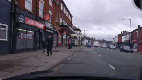
TAPTU
Restaurant · Mediterranean, Tapas · 2.4 mi
229 London Road
Su-Mo, We-Th 12:00-21:00; Fr-Sa 12:00-22:00
The Chiverton Tap
Bar and pub · Local · 1.5 mi
8 Mellor Road
Mo-Th 16:00-22:30; Fr-Sa 12:00-23:00; Su 10:00-22:30
Frurt
Ice cream · Frozen Yogurt
10a Ack Lane East, Stockport
Mo-Th 11:00-22:45; Fr 11:00-23:45; Sa 10:00-23:45; Su 10:00-22:45
The Bubble Room
Bar and pub
2, 4 Ack Lane East, Stockport
Mo 11:00-23:30; Tu off; We-Fr 11:00-23:30; Sa-Su 10:00-23:30
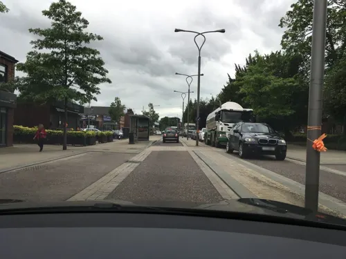


184 more on the map.
History
In 1066, the Anglo-Saxon manor of Bramall was held as separate estates by two freemen, Brun and Hakon. In 1070, William the Conqueror subdued the north-west of England and divided the land among his followers. The manor was given to Hamon de Massey, who eventually became the first Baron of Dunham Massey. The earliest reference to Bramall was recorded in the Domesday Book as "Bramale", a name derived from the Old English words brom meaning broom, both indigenous to the area, and halh meaning nook or secret place, probably by water. De Massey received the manor as wasteland, since it had been devastated in the Harrying of the North. By the time of the Domesday survey, the land was recovering and cultivated again.
From the History section of Bramhall on Wikipedia, under CC BY-SA 4.0.
Notable people from Bramhall
- Sacha DhawanBritish actor
- Peter ButterworthEnglish actor (1915-1979)
- Mike BullenEnglish TV screenwriter
- Peter HigsonEnglish cricketer (1905-1986)
- Peter Ranellscricketer (born 1954)
- Simon ThompsonBritish investment banker
- Derek GrangerBritish producer and screenwriter (1921–2022)
Born in Bramhall, according to Wikidata (CC0). Each name links to its Wikipedia article.
Where to stay6
Churches and places of worship46
Shopping28
Gas and EV charging8
Schools, colleges and libraries50
Healthcare17
Map of Bramhall
250 places. The map loads OpenStreetMap tiles when you open it.
Getting there and nearby towns
Manchester Airport (MAN) is the nearest airport with scheduled flights listed in OpenStreetMap, 5 miles away.
- Cheadle Hulme 2 mi northwest, about 3 min by car
- Poynton 2 mi east, about 3 min by car
- Hazel Grove 3 mi northeast, about 4 min by car
- Wilmslow 3 mi southwest, about 6 min by car
- Stockport 4 mi north, about 6 min by car
- Bredbury 5 mi northeast, about 7 min by car
- Marple 5 mi northeast, about 8 min by car
- New Mills 7 mi east, about 11 min by car
- Denton 7 mi north, about 11 min by car
- Manchester 9 mi north, about 14 min by car
Drive times are estimates from straight-line distance, not routes.
Towns near Bramhall


Keep exploring
Local news
Headlines from INDB.
Reviews, tips and questions
Loading what members have shared...
Sources and licences
- GeoNames (CC BY 4.0): population, coordinates, regions and time zone
- Mapillary (see each image): photos
- OpenStreetMap contributors (ODbL 1.0): places, airports, map data
- Wikidata (CC0 1.0): elevation, founding date, time zone, website, landmarks and historic places
- Wikimedia Commons (see each image): photos
- Wikipedia (CC BY-SA 4.0): overview and history text
Photo credits
- Bramall Hall SE view, 2005, Stockport Council from England, UK, CC BY 2.0
- Garrick Theatre, Stockport (1), Rept0n1x, CC BY-SA 3.0
- Avro Heritage Museum Rear, Trevor Harris, CC BY-SA 2.0
- Bramall Hall from west, 2011, David Dixon, CC BY-SA 2.0
- Courtyard from the south-west, John Swallow, CC BY-SA 3.0
- Anson engine museum 6246, Photograph by Clem Rutter, Rochester, Kent. ( www.clemrutter.net )., CC BY-SA 3.0
- Hat Works, Zzztriple2000 at en.wikipedia, Public domain
- Staircasehouse, Polishname, Public domain
- Stockport Art Gallery, Jaggery, CC BY-SA 2.0
- Dean Row Unitarian Chapel, Wilmslow, Mike in Macc, CC BY-SA 3.0
- Wilmslow Church, David Wilmot from Wimbledon, United Kingdom, CC BY 2.0
- St. George's Church, Stockport 22 April 2009, This media: Zzztriple2000 ; Original work: Hubert Austin (31 March 1841 – 1915); Subject work of original work :, CC BY 3.0
- St George's Church, Poynton, David Dixon, CC BY-SA 2.0
- St Mary's Church, Cheadle, Alexander P Kapp, CC BY-SA 2.0
- St Mary's under reconstruction, Zzztriple2000, CC BY 3.0
- St Peter's Church, Stockport, Zzztriple2000, CC BY 3.0
- St. Thomas' Church, Stockport 04, Zzztriple2000, CC BY 3.0
- CHHS 2018, Aiken drum, CC BY-SA 4.0
- Cheadle Hulme School, Main Building, Front, Timhudsonchs, CC BY-SA 3.0
- SGS Emblem, Aklongson1, CC BY-SA 3.0
- Lindow Common in Wilmslow - panoramio, Dai O'Nysius, CC BY-SA 3.0
- Stockport Museum In Vernon Park, Dave.Dunford, CC BY-SA 4.0
- Street-level photo, julianlb, CC BY-SA 4.0
- Street-level photo, julianlb, CC BY-SA 4.0
- Street-level photo, julianlb, CC BY-SA 4.0
- Street-level photo, julianlb, CC BY-SA 4.0
- Street-level photo, julianlb, CC BY-SA 4.0
- Street-level photo, julianlb, CC BY-SA 4.0
- Street-level photo, southglos, CC BY-SA 4.0
- Street-level photo, julianlb, CC BY-SA 4.0
- Street-level photo, julianlb, CC BY-SA 4.0
- Street-level photo, julianlb, CC BY-SA 4.0
- Street-level photo, julianlb, CC BY-SA 4.0
- Street-level photo, julianlb, CC BY-SA 4.0
- Street-level photo, julianlb, CC BY-SA 4.0
- Street-level photo, southglos, CC BY-SA 4.0
- Street-level photo, southglos, CC BY-SA 4.0
- Street-level photo, julianlb, CC BY-SA 4.0
- Street-level photo, julianlb, CC BY-SA 4.0
- Street-level photo, julianlb, CC BY-SA 4.0
- Street-level photo, julianlb, CC BY-SA 4.0
- Street-level photo, JSouter1st, CC BY-SA 4.0
- Street-level photo, julianlb, CC BY-SA 4.0
- Street-level photo, julianlb, CC BY-SA 4.0
- Street-level photo, southglos, CC BY-SA 4.0
- Street-level photo, sscsjone, CC BY-SA 4.0
- Street-level photo, julianlb, CC BY-SA 4.0


Page built November 10, 2026. Spotted a mistake? Tell us or suggest a place.