


Hazel Grove, United Kingdom
Hazel Grove is a town of 20,170 people in England, United Kingdom.
Why visit Hazel Grove
Townapedia lists 8 museums and landmarks, 17 parks and trails, 79 places to eat, 2 places to stay and 1 attraction in and around town.
Highlights include Garrick Theatre, Anson Engine Museum, Bramall Hall and Brabyns Park.
Weather in Hazel Grove
Forecast from MET Norway (CC BY 4.0). Full forecast
About Hazel Grove
Hazel Grove is a village in the Metropolitan Borough of Stockport, Greater Manchester, England. It lies within the historic county boundaries of Cheshire and became part of Greater Manchester in 1974. The built-up area, as defined by the Office for National Statistics, had a population of 20,170 at the 2021 census.
From the Wikipedia article Hazel Grove (this version), under CC BY-SA 4.0.
Things to do1

Garrick Theatre
Cinema and theater · 2.5 mi
Theatre in Stockport, England
Museums and landmarks8

Anson Engine Museum
Museum · 2.7 mi
Museum based in Poynton, England, United Kingdom

Bramall Hall
Museum · 2.2 mi
Tudor manor house in Bramhall, Stockport, Greater Manchester, England, UK

Hat Works
Museum · 2.6 mi
Museum and former cotton mill Greater Manchester, England

Staircase House
Museum · 2.5 mi
Grade II* listed medieval building and museum in Stockport, England

War Memorial Art Gallery
Museum · 2.3 mi
Grade II* listed art gallery in Stockport, Greater Manchester, England, UK

Brookside Miniature Railway
Monument and historic site · 1.3 mi
London Road North, Poynton
Th-Su 10:30-16:00; PH 10:30-16:00

Stockport Air Raid Shelters
Museum · 2.6 mi
Underground air-raid shelters dug under Stockport in England
Stockport Castle
Monument and historic site · 2.5 mi
Former motte-and-bailey castle in Stockport, Cheshire
Parks, trails and playgrounds17






5 more on the map.
Restaurants and cafes79
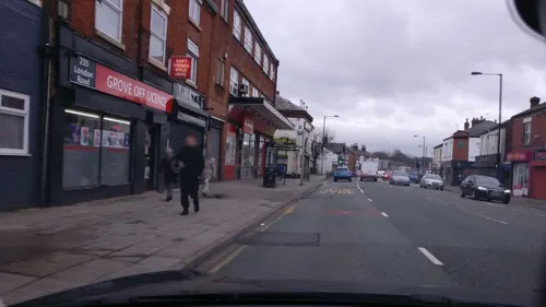
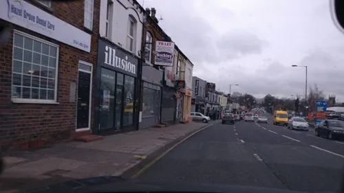
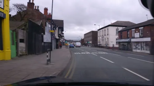
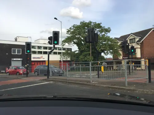
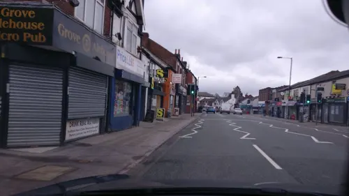

Grove Alehouse
Bar and pub
145 London Road
We-Th 15:00-21:00; Fr 15:00-23:00; Sa 14:00-23:00; Su 14:00-21:00
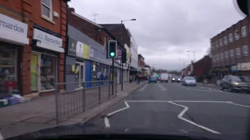

67 more on the map.
History
Until the 16th century, there was very little development at Hazel Grove. The area straddled the boundaries of four townships or manors: Bosden, Bramhall, Norbury and Torkington. Norbury was mentioned in the Domesday Survey in 1086 (as Nordberie).
In 1560, a blacksmith called Richard Bullock built a smithy on the corner of what is now Torkington Park. This building later became the Bullock Smithy Inn. It stood on the main road from Manchester and Stockport to Buxton and London, later numbered as the A6 road. A village known as Bullock Smithy gradually grew up along the road. The name Hazel Grove, referring to a grove of hazel trees, was also sometimes used for the area, appearing on a 1749 map as 'Hessel-grave'. In 1836, the villagers of Bullock Smithy held a public meeting and resolved to formally adopt the name Hazel Grove for the village.
A tram line from Stockport to Hazel Grove opened in 1890, running along London Road to a terminus near the Rising Sun public house at the corner of Buxton Road and Macclesfield Road. The line was initially run by a private company, but became part of Stockport Corporation Tramways in 1905. Through services into Manchester via the connected Manchester Corporation Tramways network operated from 1908. The tram route closed in 1950.
Read more of the history
A Mechanics' Institute was built in 1871 at the corner of London Road and Hatherlow Lane, serving as the village's main public events venue. The charity that originally ran the building transferred ownership to the Hazel Grove and Bramhall Urban District Council in 1952, who later renamed it the Civic Hall.
There were no churches in the area until the end of the 16th century. By the early 17th century, a chapel had been built in Norbury township. It stood in fields to the east of Macclesfield Road, opposite Norbury Hall Farm, nearly a mile south of Hazel Grove. The chapel was known for being served by Nonconformist ministers in the late 17th century. After the Restoration, a law was passed in 1662 forbidding ministers to preach without the Book of Common Prayer. The minister of Norbury Chapel, John Jollie, went there to preach, but found that the door was locked. He and his followers broke down the door and he preached as usual. Subsequently, he was tried for nonconformity, but it was decided that Norbury Chapel was not a consecrated place.
In 1788, John Wesley preached in Bullock Smithy. In his journal he described the village as "... one of the most famous villages in the county for all manner of wickedness."
In the 1830s, it was decided to build a new church, both to serve the growing village and to replace the increasingly ruinous Norbury Chapel. The site chosen was on the southern edge of the village, and was also in Norbury township. The church, dedicated to St Thomas, was completed in 1834. The site of Norbury Chapel then reverted to fields. In 1842 an ecclesiastical parish called 'St Thomas, Norbury' was created, which initially just covered the Norbury township. The ecclesiastical parish was enlarged in 1878 to take in Bosden and parts of Bramhall and Torkington townships, such that it then covered the whole of Hazel Grove village.
The legal name of the ecclesiastical parish covering Hazel Grove remains 'St Thomas, Norbury'. The church is now known both as 'Norbury Church' and 'St Thomas, Hazel Grove'.
From the History section of Hazel Grove on Wikipedia, under CC BY-SA 4.0.
More about Hazel Grove
Economy
Most residents work outside the village. Hazel Grove was also home to the UK Adidas headquarters, who had their main warehouse on the edge of the village, and the nearby Stepping Hill Hospital which is the main maternity and A&E hospital serving the Stockport and south Manchester areas.
Mirlees, Bickerton and Day established a factory in October 1908, where diesel engines were manufactured for many years.
Education
The area has four state primary schools: Hazel Grove, Torkington, Norbury Hall and Moorfield. In addition, there are two Catholic primary schools: St Simon's and St Peter's.
Hazel Grove High School provides secondary education for the area's 11–18 year olds.
From the Wikipedia article Hazel Grove, under CC BY-SA 4.0.
Notable people from Hazel Grove
 William WraggBritish politician (born 1987)Photo: UK PARLIAMENT, CC BY 3.0
- James HorsfieldEnglish association football player (born 1995)
- Johnny JohnsonEnglish footballer (1921-2003)
- Benny PhillipsEnglish football player and manager
- Tim ScottBritish musician
- Peter BowkerBritish playwright and screenwriter
- Carolyn HanssonBritish metallurgical scientist
- Helena Littleactress
Born in Hazel Grove, according to Wikidata (CC0). Each name links to its Wikipedia article.
Where to stay2
Churches and places of worship20
Shopping8
Gas and EV charging6
Schools, colleges and libraries20
Aquinas College
School · Roman Catholic · 1.4 mi
Nangreave Road, Stockport
Healthcare10
Map of Hazel Grove
171 places. The map loads OpenStreetMap tiles when you open it.
Getting there and nearby towns
Manchester Airport (MAN) is the nearest airport with scheduled flights listed in OpenStreetMap, 7 miles away.
- Stockport 2 mi northwest, about 4 min by car
- Poynton 2 mi south, about 4 min by car
- Marple 2 mi east, about 4 min by car
- New Mills 5 mi east, about 8 min by car
- Wilmslow 6 mi southwest, about 10 min by car
- Stalybridge 7 mi north, about 12 min by car
- Manchester 8 mi northwest, about 13 min by car
- Timperley 9 mi west, about 14 min by car
- Salford 10 mi northwest, about 16 min by car
- Oldham 11 mi north, about 17 min by car
Drive times are estimates from straight-line distance, not routes.
Towns near Hazel Grove


Keep exploring
Local news
Headlines from INDB.
Reviews, tips and questions
Loading what members have shared...
Sources and licences
- GeoNames (CC BY 4.0): population, coordinates, regions and time zone
- Mapillary (see each image): photos
- OpenStreetMap contributors (ODbL 1.0): places, airports, map data
- Wikidata (CC0 1.0): elevation, founding date, time zone, website, landmarks and historic places
- Wikimedia Commons (see each image): photos
- Wikipedia (CC BY-SA 4.0): overview and history text
Photo credits
- Hazel Grove 2, Iamali84 at English Wikipedia, Public domain
- London Road - Hazel Grove c.1910 (3), Unknown author Unknown author, Public domain
- Garrick Theatre, Stockport (1), Rept0n1x, CC BY-SA 3.0
- Anson engine museum 6246, Photograph by Clem Rutter, Rochester, Kent. ( www.clemrutter.net )., CC BY-SA 3.0
- Bramall Hall from west, 2011, David Dixon, CC BY-SA 2.0
- Hat Works, Zzztriple2000 at en.wikipedia, Public domain
- Staircasehouse, Polishname, Public domain
- Stockport Art Gallery, Jaggery, CC BY-SA 2.0
- All saints church, Marple, Greater Manchester, Zzztriple2000, CC BY 3.0
- Romiley - Chadkirk Chapel, Skinsmoke, CC BY 3.0
- St Martin's Church, Brabyns Brow, Marple (NHLE Code 1241823) (March 2015) (1), User:Hassocks5489, CC0
- St. George's Church, Stockport 22 April 2009, This media: Zzztriple2000 ; Original work: Hubert Austin (31 March 1841 – 1915); Subject work of original work :, CC BY 3.0
- St George's Church, Poynton, David Dixon, CC BY-SA 2.0
- St Mary's under reconstruction, Zzztriple2000, CC BY 3.0
- St Peter's Church, Stockport, Zzztriple2000, CC BY 3.0
- St. Thomas' Church, Stockport 04, Zzztriple2000, CC BY 3.0
- Aquinas College, Stockport, Bill Boaden, CC BY-SA 2.0
- SGS Emblem, Aklongson1, CC BY-SA 3.0
- St Thomas' Church, Norbury, Gerald England, CC BY-SA 2.0
- Iron Bridge, Brabyns Park, Neil Theasby, CC BY-SA 2.0
- Stockport Museum In Vernon Park, Dave.Dunford, CC BY-SA 4.0
- Street-level photo, julianlb, CC BY-SA 4.0
- Street-level photo, julianlb, CC BY-SA 4.0
- Street-level photo, julianlb, CC BY-SA 4.0
- Street-level photo, julianlb, CC BY-SA 4.0
- Street-level photo, julianlb, CC BY-SA 4.0
- Street-level photo, julianlb, CC BY-SA 4.0
- Street-level photo, julianlb, CC BY-SA 4.0
- Street-level photo, julianlb, CC BY-SA 4.0
- Street-level photo, southglos, CC BY-SA 4.0
- Street-level photo, julianlb, CC BY-SA 4.0
- Street-level photo, julianlb, CC BY-SA 4.0
- Street-level photo, julianlb, CC BY-SA 4.0
- Street-level photo, julianlb, CC BY-SA 4.0
- Street-level photo, julianlb, CC BY-SA 4.0
- Street-level photo, julianlb, CC BY-SA 4.0
- Street-level photo, julianlb, CC BY-SA 4.0
- Street-level photo, julianlb, CC BY-SA 4.0
- Street-level photo, julianlb, CC BY-SA 4.0
- Street-level photo, julianlb, CC BY-SA 4.0
- Street-level photo, julianlb, CC BY-SA 4.0
- Street-level photo, julianlb, CC BY-SA 4.0
- Street-level photo, julianlb, CC BY-SA 4.0
- Street-level photo, julianlb, CC BY-SA 4.0
- Street-level photo, julianlb, CC BY-SA 4.0
- Street-level photo, julianlb, CC BY-SA 4.0
- Street-level photo, julianlb, CC BY-SA 4.0


Page built November 10, 2026. Spotted a mistake? Tell us or suggest a place.