


Why visit Denton
Townapedia lists 5 museums and landmarks, 19 parks and trails, 92 places to eat, 2 places to stay and 3 attractions in and around town.
Highlights include Alhambra Theatre, Tameside Hippodrome, Ashton Under Lyne War Memorial and Peacock Mausoleum.
Weather in Denton
Forecast from MET Norway (CC BY 4.0). Full forecast
About Denton
Denton is a town in Tameside, Greater Manchester, England. It lies east to Gorton in the City of Manchester and 5 miles (8 km) east of Manchester city centre. Historically part of Lancashire, it had a population of 36,591 at the 2011 Census.
From the Wikipedia article Denton, Greater Manchester (this version), under CC BY-SA 4.0.
Photos of Denton


Things to do3
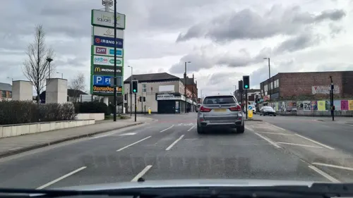
Alhambra Theatre
Cinema and theater · 2.2 mi
Former theatre and cinema in Openshaw, Manchester, England, later a bingo hall and sports venue
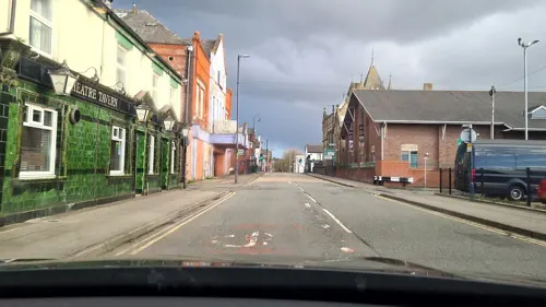
Tameside Hippodrome
Cinema and theater · 2.3 mi
Theatre and former cinema in Ashton-under-Lyne, Greater Manchester, England, UK

Theatre Royal
Cinema and theater · 1.6 mi
Former theatre and cinema in Hyde, Greater Manchester, England, UK
Museums and landmarks5

Ashton Under Lyne War Memorial
Monument and historic site · 2.5 mi
War memorial in Tameside, Greater Manchester, England, UK

Peacock Mausoleum
Monument and historic site · 2.1 mi
Mausoleum in Gorton, Manchester

Staircase House
Museum · 3.4 mi
Grade II* listed medieval building and museum in Stockport, England

Stalybridge War Memorial
Monument and historic site · 3.1 mi
War memorial in Stalybridge, Greater Manchester, England, UK

Parks, trails and playgrounds19

Belle Vue Zoological Gardens
Park · 2.9 mi
Former zoo, amusement park, exhibition hall complex and speedway in Manchester, England


Highfield Country Park
Park · 2.7 mi
Local Nature Reserve in Manchester, England



Clayton Vale
Park · 3.4 mi
Valley in Clayton, Manchester, England, UK


7 more on the map.
Restaurants and cafes92
Plaza
Restaurant · Indian · 1.3 mi
90 Audenshaw Road, Manchester
Mo-Th 16:00-23:00, Fr 16:00-00:00, Sa 13:00-24:00; Su 13:00-22:00

Costa
Cafe · Coffee Shop · 1.5 mi
Snipe Way, Ashton-under-Lyne
Mo-Sa 07:00-20:00; Su 07:00-19:00



Pausa
Cafe · Coffee Shop · 1.6 mi
16 Snipe Way, Ashton-under-Lyne
Mo-Fr 09:00-20:00; Sa 09:00-19:00; Su 10:30-16:30

Globe Canteen & Coffee
Cafe · 1.2 mi
Globe Square, Dukinfield
Mo-Fr 08:00-14:00; Sa,Su 09:00-13:00
Guide Bridge Con Club
Bar and pub · 1.4 mi
253-255 Stockport Road, Ashton-under-Lyne
Fr-Su 19:00-23:00
80 more on the map.
History
Denton probably derives its name from Dane-town, an etymology supported by other place names in the area such as Danehead-bank and Daneditch-bourne. The word 'Dane' is itself derived from Anglo-Saxon denu, dene, daenland, meaning a valley. So literally Denton means valley town.
A Byzantine coin was discovered in Danesheadbank, dating from the sixth or seventh century, as part of the Denton coin hoard. The early medieval linear earthwork Nico Ditch passes through Denton; it was probably used as an administrative boundary and dates from the 8th or 9th centuries. A 300 m stretch is still visible on Denton golf course, about 4 m wide and 1.5 m deep.
In the early 13th century, it lay within the Manor of Withington; this was a feudal estate which also encompassed the townships of Withington, Didsbury, Chorlton-cum-Hardy, Moss Side, Rusholme, Burnage and Haughton, ruled by the Hathersage, Longford, Mosley and Tatton families.
Read more of the history
Felt hatting was recorded in Denton as early as 1702 and the town gained supremacy in the hatting industry towards the end of the 19th century. The increasing importance of Denton and Haughton as centres of felt hat production is demonstrated by the increase of manufacturers in the area. In 1800, there were 4 hatting firms in Denton and Haughton but, by 1825, there were 25 manufacturers, making it the third largest hat making centre in the North West. By 1840, 24,000 felt hats were produced in Denton a week. The prosperity of the hatting industry is reflected in the growth of the town from 2,501 in 1801 to 6,759 in 1841.
During the 1840s, the felt hat industry went into depression; the recession affected Denton, with wages in the area falling by 35% and only 12 hat manufacturers remaining in Denton. The depression was partially due to changes in fashion away from felt towards silk hats. The revitalisation of the felt hat industry came in the 1850s, once again on a whim of fashion but also the increased use of machinery led to reduced production costs. The resurgence was demonstrated by the doubling of the number of hat manufacturers in the town between 1861 and 1872. At its peak in the Edwardian period, Denton's felt hat industry was the largest felt hat manufacturing centre in Britain. There were 36 firms directly involved in the felt hat making industry. In 1907, the majority of the 16,428,000 felt hats made in England (worth £2,068,000) were made in Denton and Stockport. In 1921, the working population of Denton was 9,653 with about 41% of those people in occupations related to the hatting industry. The last hat factory in Denton closed in 1980.
Although the felt hat industry in Denton and Haughton was prosperous and an integral part of the town, working conditions in the factories were not risk free. One of the problems workers faced was mercury poisoning; mercury was used to separate the fur from the rabbit hide and workers were in regular contact with fur impregnated with mercury or exposed to mercury vapour. Inadequate ventilation in some parts of the hat making process led to other sorts of dangers; solvents were also used and on 14 January 1901 there was an explosion at the factory of Joseph Wilson & Sons in Denton, killing 13 people and injuring many more. The explosion was of vapour from methylated spirits used in the dying process.
Throughout the 19th century and well into the 20th century, a wide range of hats was manufactured to suit all tastes and purses. The names used by the competing manufacturers to describe their products was bewildering and some of these were; felt hats, silk hats, fur hats, wear fur hats, soft hats, stiff hats, velour hats, wool hats, straw hats and, of course, the ubiquitous cloth cap. In the 1930s the 'Attaboy' trilby hat was introduced by the Denton Hat Company. This brand quickly became famous and it was in production for many years. Ladies' hats were not forgotten either and at least one works specialised in making these and the hat master's wife designed them at home. Hats were made for home consumption and for export. The well-known slogan "If you want to get ahead, get a hat" arose in Denton and, needless to say, anyone attending for a job interview not wearing a hat was quickly shown the door. Similarly, until the early 20th century, anyone entering a Denton shop without a hat would receive much cursing. The term, "mad as a hatter" also arose in Denton because the mercury used in the felting process led to mercury poisoning.
In 2003, the prominent Wilson's Hat Factory on Wilton Street, together with the adjacent mill-workers' houses, other factories, Wilton Street Chapel and Mainstream Studios was demolished to make way for a new retail shopping park Crown Point North.
Denton is on the Lancashire coalfield and once had a number of collieries. These included the Ellis Colliery (which became Denton Colliery), Top Pit, Hard Mine Pit and, further south and near to the River Tame, Hulmes Pit. Much of the coal that they produced was consumed by local industry, there being an abundance of steam powered mills in the area.
Denton Colliery was the largest of these mines and eventually absorbed the other local pits, often using their shafts for ventilation or, in the case of Hulmes Pit, as a pumping station to drain water from the main workings. Denton Colliery was connected to the London & North Western Railway's line from Guide Bridge to Stockport by a standard gauge tramway. The tramway was worked by steam power, rather than horses, as evidenced by a photograph held in the Tameside Local History Library archives.
In 1926, miners at Denton Colliery joined the national strike against reduced wages and longer working hours. This dispute led to the General Strike (3–12 May 1926). When the General Strike was called off, coal miners stayed out for several more months.
From the History section of Denton, Greater Manchester on Wikipedia, under CC BY-SA 4.0.
Notable people from Denton
 Jimmy ArmfieldEnglish footballer (1935-2018)Photo: Angstpristine, CC BY-SA 3.0
 Mick HucknallEnglish singer, songwriter and lead singer of Simply Red (born 1960)Photo: payayita, CC BY-SA 2.0
 Tony AudenshawBritish actorPhoto: Schooleydoo, CC BY 3.0
 James TunnicliffeFootballer (born 1989)Photo: https://www.flickr.com/photos/bluewhe..., CC BY-SA 2.0
- Zach CloughEnglish association football player (born 1995)
- Robert Milson ApplebyBritish paleontologist
- Robert ArrowsmithEnglish cricketer (born 1952)
- Carl Alfordassociation football player
- Charlie HurstEnglish footballer (1919-1999)
- Steve MasseyFootballer (born 1958)
- Scott KayFootballer (born 1989)
- Harry RutherfordEnglish artist (1903–1985)
Born in Denton, according to Wikidata (CC0). Each name links to its Wikipedia article.
Where to stay2
Churches and places of worship32
Shopping19
Gas and EV charging2
Schools, colleges and libraries24
Healthcare4
Map of Denton
202 places. The map loads OpenStreetMap tiles when you open it.
Getting there and nearby towns
Manchester Airport (MAN) is the nearest airport with scheduled flights listed in OpenStreetMap, 10 miles away.
- Dukinfield 2 mi northeast, about 3 min by car
- Droylsden 2 mi northwest, about 3 min by car
- Stalybridge 3 mi northeast, about 5 min by car
- Stockport 4 mi southwest, about 6 min by car
- Hollinwood 4 mi north, about 7 min by car
- Manchester 5 mi west, about 8 min by car
- Marple 5 mi southeast, about 8 min by car
- Hazel Grove 5 mi south, about 8 min by car
- Oldham 6 mi north, about 9 min by car
- Lees 6 mi north, about 10 min by car
Drive times are estimates from straight-line distance, not routes.
Towns near Denton


Keep exploring
Local news
Headlines from INDB.
Reviews, tips and questions
Loading what members have shared...
Sources and licences
- GeoNames (CC BY 4.0): population, coordinates, regions and time zone
- Mapillary (see each image): photos
- OpenStreetMap contributors (ODbL 1.0): places, airports, map data
- Wikidata (CC0 1.0): elevation, founding date, time zone, website, landmarks and historic places
- Wikimedia Commons (see each image): photos
- Wikipedia (CC BY-SA 4.0): overview and history text
Photo credits
- Denton greater manchester from the air, Parrot of Doom, CC BY-SA 4.0
- Theatre Royal, Hyde, Izzak, CC BY-SA 3.0
- Ashton-under-Lyne War Memorial (1), Rept0n1x, CC BY-SA 3.0
- Peacock Family Memorial, Brookfield Unitarian Church, Gorton, A. Carty ( talk ), CC BY-SA 3.0
- Staircasehouse, Polishname, Public domain
- Stalybridge war memorial (6), Rept0n1x, CC BY-SA 3.0
- Belle-Vue-guide-circa-late-1800s, Unknown Unknown, Public domain
- Highfield Country Park pond, Kurt Adkins, CC BY-SA 3.0
- Stamford Park, Tameside (5), Rept0n1x, CC BY-SA 3.0
- Albion United Reformed Church, Ashton under Lyne, A. Carty ( talk ), CC BY-SA 3.0
- Gorton Monastery, Gorton, Mikey, CC BY 2.0
- Wright Robinson Sports College 2697980, David Dixon, CC BY-SA 2.0
- Front college blue sky, Wrcollege, CC BY-SA 4.0
- 2000 BMW Alpina B12 6.0 V12 (31804238183), Kieran White from Manchester, England, CC BY 2.0
- Arden Hall, Bredbury 1855, Lawrence Walker, Public domain
- Stannybrook road on daisy nook, Marc A Gibbs, CC BY-SA 4.0
- Stockport Museum In Vernon Park, Dave.Dunford, CC BY-SA 4.0
- Street-level photo, mappo2, CC BY-SA 4.0
- Street-level photo, lukemb, CC BY-SA 4.0
- Street-level photo, mappo2, CC BY-SA 4.0
- Street-level photo, mappo2, CC BY-SA 4.0
- Street-level photo, mappo2, CC BY-SA 4.0
- Street-level photo, mappo2, CC BY-SA 4.0
- Street-level photo, mappo2, CC BY-SA 4.0
- Street-level photo, lukemb, CC BY-SA 4.0
- Street-level photo, mappo2, CC BY-SA 4.0
- Street-level photo, mappo2, CC BY-SA 4.0
- Street-level photo, adam2, CC BY-SA 4.0
- Street-level photo, mappo2, CC BY-SA 4.0
- Street-level photo, mappo2, CC BY-SA 4.0
- Street-level photo, mappo2, CC BY-SA 4.0
- Street-level photo, mappo2, CC BY-SA 4.0
- Street-level photo, mappo2, CC BY-SA 4.0
- Street-level photo, adam2, CC BY-SA 4.0
- Street-level photo, adam2, CC BY-SA 4.0
- Street-level photo, mappo2, CC BY-SA 4.0
- Street-level photo, mappo2, CC BY-SA 4.0
- Street-level photo, mappo2, CC BY-SA 4.0
- Street-level photo, mappo2, CC BY-SA 4.0
- Street-level photo, mappo2, CC BY-SA 4.0


Page built November 10, 2026. Spotted a mistake? Tell us or suggest a place.