


Why visit Brewood
Townapedia lists 5 museums and landmarks, 1 park or trail and 10 places to eat in and around town.
Highlights include Boscobel House and Chillington Hall.
Weather in Brewood
Forecast from MET Norway (CC BY 4.0). Full forecast
About Brewood
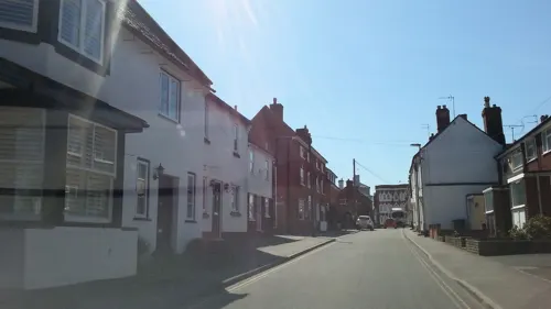
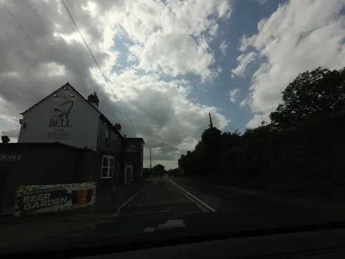
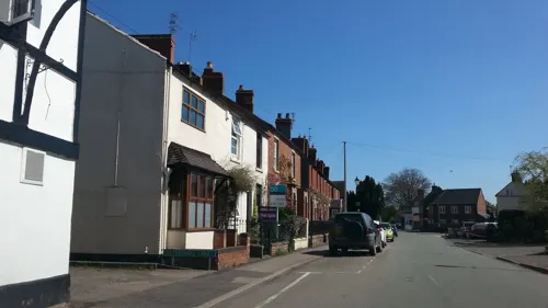
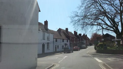
Brewood is an ancient market town in the civil parish of Brewood and Coven, in the South Staffordshire district, in the county of Staffordshire, England. Brewood lies near the River Penk, 8 miles (13 km) north of Wolverhampton and 11 miles (18 km) south of Stafford. Brewood is about 3 miles (4.8 km) east of the county border with Shropshire.
From the Wikipedia article Brewood (this version), under CC BY-SA 4.0.
Museums and landmarks5

Boscobel House
Museum · 2.9 mi
Historic house museum in Shropshire, England, UK

Chillington Hall
Museum · 1.8 mi
Grade I listed historic house museum in South Staffordshire, England, UK
Pennocrucium
Monument and historic site · 1.7 mi
Archaeological site in Penkridge, South Staffordshire, England, UK
Parks, trails and playgrounds1

Restaurants and cafes10


Churches and places of worship7

Church of St Mary and St Chad
Church
Church in South Staffordshire, England, UK

Roman Catholic Church of St Mary
Church
Church building in Brewood and Coven, South Staffordshire, England, UK

St Nicholas' Church, Codsall
Church · 3.2 mi
Church in Codsall, South Staffordshire, England, UK

St John's Church, Stretton
Church · 1.8 mi
Church in Stretton, South Staffordshire, England, UK
St Paul's Church, Coven
Church · 2.2 mi
Church in Coven, South Staffordshire, England, UK
History
The old Roman road, Watling Street, stretching from Londinium across the Roman Province of Britannia Superior to Wroxeter and later Chester, runs one mile to the north of the village as the A5. There were small Roman stations along this route and the most important settlement locally was Pennocrucium, which had an outlying fort. The name Pennocrucium is clearly associated with Penkridge, the town and parish north of Brewood, which is separated from it by the line of Watling Street, and these important remains do lie just outside the parish boundary. However, the remains of a small Roman villa have been found about 500m south of Watling Street, close to Engleton, and so within Brewood parish. Clearly there was a small population in the Brewood area in Roman times, and quite possibly earlier. However, there is no evidence of continuity at any of the main settlements in present-day Brewood. The history of Brewood really begins with the Anglo-Saxon settlement, when it emerged as a village within Mercia. The place name suggests that it came into existence during the earlier part of the Anglo-Saxon period, when there were still people in the area of Celtic language and culture. However, the first real documentation comes after the Norman Conquest of England.
Read more of the history
In the Domesday Book of 1086, Brewood fell within the Cuttlestone Hundred of Staffordshire. The survey records that it was held by the Bishop of Chester and that it had been a church property before 1066. However, the landholder of the manor of Brewood in the Middle Ages is generally stated to be the Diocese of Lichfield. This is not a contradiction, but reflects the shifts in the seat of the diocese. In 1075, Peter, bishop of Lichfield, had transferred his see to Chester, and there it remained until 1102, when it moved to Coventry. From 1228, the official title was the Diocese of Coventry and Lichfield.
Brewood was assessed for tax purposes as 5 hides, the hide being notionally an area of 120 acres, although at this time it had become simply a unit of tax liability, irrespective of actual area. Domesday also records Brewood as consisting of enough land for 20 ploughs. The bishop had twenty slaves cultivating his land in the village. The rest of the population consisted of 24 villagers, 18 smallholders and a priest. There were two mills, presumably on the River Penk. There was also a substantial area of woodland, tending to confirm the accepted etymology. However Domesday records that the value of the village was £10 in 1066, and had halved in the twenty years since. Hence we can be sure that it had prospered in the late Anglo-Saxon period but had suffered a check to its growth during, and perhaps because of, Norman rule.
Norman rule brought Forest Law to the area, and it was not until 1204, in the reign of King John, that Brewood Forest was abolished. A forest was a royal hunting reserve, which meant that it was not necessarily wooded. The area of the parish to the east of the Penk was not part of Brewood Forest, but it belonged to the Forest of Cank or Cannock Chase. It was not deforested until about a century later.
In 1221, a charter for a Friday market at Brewood was granted to the Bishop of Coventry and Lichfield by King Henry III, suggesting considerable growth and increased prosperity since the Domesday survey. However, the charter was valid only until the seniority of the king, who was a child at the time. The market continued, nevertheless, and the king recognised a Monday market too, in 1259, as well as granting the right to hold an annual fair over the feast of the Nativity of Mary, on 7–9 September, although it was transferred to 19 September after the adoption of the Gregorian Calendar in the 18th century. In 1382, the burgesses of Stafford tried to get Brewood's markets suppressed, claiming that they had been unlicensed for twenty years and injured their trade. However, Stafford lost to Brewood and both market and fair were confirmed some time around 1390, in the reign of Richard II. The market petered out during the 18th century, and competition from Wolverhampton killed off an attempted revival in the following century. Although a general fair, the most important trade at the annual event was in horses. It continued until after World War I.
Around the same time that the market was established, building of the large sandstone church of St Mary and St Chad was commenced, probably replacing a less impressive earlier church. It has undergone numerous alterations and restorations, but it was clearly a large and impressive structure from the outset. Around 1176, the bishop had conferred the church on the deanery of Lichfield Cathedral. The deans kept advowson, the right to nominate the priest until 1868. In medieval England, the local priest, in this case titled the vicar from 1275, was not a salaried official but a feudatory, dependent on a benefice designed to support him in office and owing service to his patron, the dean, in return. The vicar was to receive the altar dues and various other revenues, including mortuary dues and tithes on wool – with the notable exception of wool from the dean's flock, of course. In return, he was to pay the dean a pension of 10 marks.
From the History section of Brewood on Wikipedia, under CC BY-SA 4.0.
Notable people from Brewood
 William CarelessRoyalist officer and companion of King Charles IIPhoto: Isaac Fuller, Public domain
- James FletcherEnglish footballer (1926-2014)
Born in Brewood, according to Wikidata (CC0). Each name links to its Wikipedia article.
Shopping3
Gas and EV charging1
Schools, colleges and libraries4
Map of Brewood
31 places. The map loads OpenStreetMap tiles when you open it.
Getting there and nearby towns
Birmingham Airport (BHX) is the nearest airport with scheduled flights listed in OpenStreetMap, 24 miles away.
- Wheaton Aston 3 mi northwest, about 5 min by car
- Codsall 3 mi south, about 6 min by car
- Featherstone 4 mi southeast, about 7 min by car
- Cannock 6 mi east, about 10 min by car
- Wolverhampton 7 mi south, about 11 min by car
- Wednesfield 7 mi southeast, about 11 min by car
- Great Wyrley 7 mi east, about 11 min by car
- Willenhall 8 mi southeast, about 13 min by car
- Bloxwich 8 mi southeast, about 13 min by car
- Stafford 9 mi north, about 15 min by car
Drive times are estimates from straight-line distance, not routes.
Towns near Brewood


Keep exploring
Local news
Headlines from INDB.
Reviews, tips and questions
Loading what members have shared...
Sources and licences
- GeoNames (CC BY 4.0): population, coordinates, regions and time zone
- Mapillary (see each image): photos
- OpenStreetMap contributors (ODbL 1.0): places, airports, map data
- Wikidata (CC0 1.0): elevation, founding date, time zone, website, landmarks and historic places
- Wikimedia Commons (see each image): photos
- Wikipedia (CC BY-SA 4.0): overview and history text
Photo credits
- Brewood, Oosoom at English Wikipedia, CC BY-SA 3.0
- Stafford Street, Brewood, Roger Kidd, CC BY-SA 2.0
- Brewood Market Place 01, Sjwells53, CC BY-SA 3.0
- Brewood Thomas Anrew Walker birthplace, Sjwells53, CC BY-SA 3.0
- 2 School Road, Brewood, Jo Turner, CC BY-SA 2.0
- Altar of Brewood Church, MagicRubberDuck, CC BY-SA 4.0
- Chillington Hall (2), Philip Halling, CC BY-SA 2.0
- Brewood and Coven - Roman Catholic Church of St Mary - 20230826095407, Rodw, CC BY-SA 4.0
- Brewood CE Church, Original uploader was Oosoom at en.wikipedia, CC BY-SA 3.0
- Boscobel House, Oosoom at English Wikipedia, CC BY-SA 3.0
- St Nicholas' Church, Codsall, Stephen McKay, CC BY-SA 2.0
- Street-level photo, tallguy, CC BY-SA 4.0
- Street-level photo, tallguy, CC BY-SA 4.0
- Street-level photo, adam2, CC BY-SA 4.0
- Street-level photo, adam2, CC BY-SA 4.0
- Street-level photo, tallguy, CC BY-SA 4.0
- Street-level photo, adam2, CC BY-SA 4.0
- Street-level photo, adam2, CC BY-SA 4.0
- Street-level photo, adam2, CC BY-SA 4.0
- Street-level photo, adam2, CC BY-SA 4.0
- Street-level photo, tallguy, CC BY-SA 4.0
- Street-level photo, adam2, CC BY-SA 4.0
- Street-level photo, adam2, CC BY-SA 4.0
- Street-level photo, adam2, CC BY-SA 4.0
- Street-level photo, adam2, CC BY-SA 4.0
- Street-level photo, tallguy, CC BY-SA 4.0
- Street-level photo, tallguy, CC BY-SA 4.0
Page built November 10, 2026. Spotted a mistake? Tell us or suggest a place.