


Stafford, United Kingdom
Stafford is a town of 70,145 people in England, United Kingdom, founded in 700.
Why visit Stafford
Townapedia lists 94 museums and landmarks, 127 parks and trails, 393 places to eat, 28 places to stay and 30 attractions in and around town.
Highlights include Borough Hall, Garden bridge, Watling Street and Shugborough Hall.
Weather in Stafford
Forecast from MET Norway (CC BY 4.0). Full forecast
About Stafford
Stafford () is a market town and the county town of Staffordshire, England. It is located about 15 miles (24 km) south of Stoke-on-Trent, 15 miles (24 km) north of Wolverhampton and 24 miles (39 km) north-west of Birmingham. The town had a population of 71,673 at the 2021 census, and is the main settlement within the larger Borough of Stafford, which had a population of 136,837 in 2021.
From the Wikipedia article Stafford (this version), under CC BY-SA 4.0.
Travel tips from other travellers: Stafford on Wikivoyage (CC BY-SA 4.0).
Photos of Stafford


Things to do30

Borough Hall
Cinema and theater
Grade II civic building, now theatre, in Stafford, Staffordshire, England, UK

Garden bridge
Bridge · 4.3 mi
Grade I listed bridge at Shugborough Hall, Staffordshire, England

Gentleshaw Wildlife Centre
Zoo and aquarium · 6.3 mi
Stone Road, Stafford
Mo-Tu off; We-Sa 11:00-16:30; Su 11:00-16:00



18 more on the map.
Museums and landmarks94
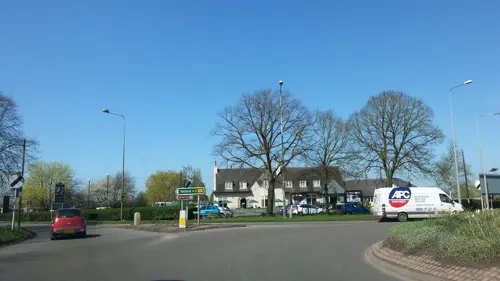

Shugborough Hall
Monument and historic site · 4.3 mi
Grade I listed historic house museum in Colwich, Stafford, Staffordshire, England, UK


Ancient High House
Museum
Historic house in Stafford, England, United Kingdom

Izaak Walton's Cottage
Museum · 4.7 mi
Cottage in Chebsey, Stafford, Staffordshire, England, UK


Stafford Castle
Museum · 1.4 mi
Castle and museum in Staffordshire, England, United Kingdom

Boscobel House
Museum · 10.6 mi
Historic house museum in Shropshire, England, UK

Chillington Hall
Museum · 10.8 mi
Grade I listed historic house museum in South Staffordshire, England, UK

County Buildings and Judges House
Museum
Buildings in Stafford, United Kingdom

82 more on the map.
Parks, trails and playgrounds127



Astonfields Balancing Lakes
Park · 1.1 mi
Nature reserve in Staffordshire, UK
Shoal Hill Common
Park · 7.8 mi
Nature reserve in Staffordshire, England, UK
Barlaston and Rough Close Common
Park · 10.3 mi
Nature reserve in Staffordshire, UK
Jackon's Coppice and Marsh
Park · 9.3 mi
Nature reserve in Staffordshire, UK
115 more on the map.
Restaurants and cafes393
Starbucks
Cafe · Coffee Shop · 2.0 mi
Spitfire Close, Stafford
Mo-Fr 06:30-22:00, Sa 06:30-21:00, Su 07:00-21:00
The Hedgeford Lodge
Bar and pub · 8.2 mi
Anglesey Street, Hednesford
Mo,Tu,We,Th,Su 08:00-24:00; Fr,Sa 08:00-25:00

Grounds Café Birches Valley
Cafe · Ice Cream, Burger, Sandwich, Coffee Shop · 7.0 mi
Birches Valley, Rugeley
Mo-Fr 09:30-16:00, Sa-Su 09:00-17:00


381 more on the map.
History
Prehistoric finds suggest scattered settlements in the area, whilst 2.5 miles (4.0 km) south-west of the town lies an Iron Age hill fort at Berry Ring. There is also evidence of Roman activity in the area, with finds around Clark and Eastgate Street. However it is thought that the Romans reclaimed the marsh for agriculture rather than settlement.
Stafford means "ford" by a staithe (landing place). The original settlement was on a near island, on a gravelly lowland bounded by loop of the River Sow to the south and west (a tributary of the River Trent). The eastern boundary was formed by Sandyford brook, with a marshy area to the north. Despite many drains being constructed in the 19th century, the area is still prone to flooding.
Stafford has been identified as the island of Bethney, or Bethnei where St Bertelin is said to have founded a hermitage about AD 700, before moving to a more remote area.
Read more of the history
Others then settled in the area and named it Stafford. There may have been a settlement near the river crossing in 913, when Æthelflæd, Lady of Mercia founded a burh (fortified settlement) at Stafford; one of many founded across Mercia as part of her campaign against the Danes (Vikings). A mint was founded at Stafford by King Æthelstan (924-39) which continued in operation until the reign of Henry II (1154–89). Stafford also provided an industrial area for centralised production of Roman-style pottery (Stafford Ware), which was supplied to a chain of West Midlands burhs.
The county of Staffordshire was formed at about this time, with Stafford as its county town. Stafford lay within the Pirehill hundred.
In the autumn of 1069, a rebellion led by Eadric the Wild against the Norman Conquest culminated in the Battle of Stafford, during which the Anglo-Welsh rebel army was decisively defeated by Norman forces led by Brian of Brittany and William I. Two years later another rebellion, led by Edwin, Earl of Mercia, ended in Edwin's assassination and distribution of his lands among the followers of William the Conqueror, who granted Robert de Tosny (later known as Robert de Stafford) the manor of Bradley and one third of the king's rents in Stafford. The estate became the seat of the powerful Stafford family.
Following the Battle of Stafford, and the subsequent Harrying of the North, Stafford underwent an extensive period of depopulation and urban decay. Archaeological evidence has revealed that much of the town had been abandoned following the battle, and when the Doomsday Book was completed in 1086, seventeen years after the battle, the town was declared to still be "partially waste" with almost a third of the messuages uninhabited.
Stafford Castle, was first built by Robert de Stafford on a nearby hilltop to the west in the wake of the Norman Invasion, where the motte, moat and baily remain visible to this day. It was first made of wood and later rebuilt in stone around 1348. It has been rebuilt since. A wooden castle had been built in 1070 much closer to the town centre, however this had fallen into ruin by the recording of the Doomsday Book and its precise location remains unknown.
Stafford was a walled town by 1086. The town walls were probably wooden originally, but later rebuilt in stone. There were four gates on the roads into the town from the north, south, east and west. By around 1670 the walls were in ruin, and their remnants were gradually demolished.
Stafford became an important market town during the Middle Ages, which had a particular focus of trading cloth and wool. By the 1280s there were various trades such as tanning, glove making and shoe making being practised in the town. A guild of shoemakers was founded in 1476.
Medieval Stafford was served by two churches: St Chad's, which is the oldest building in Stafford, dating from the mid-12th century, and St Mary's which dates from the early-13th century.
King Richard II was paraded through the town's streets as a prisoner in 1399, by troops loyal to Henry Bolingbroke (the future Henry IV).
In 1521, Stafford was described as 'a proper and fair town', although it went into decline during the Tudor period, and in 1540, many of the houses were described as being in a state of disrepair. Elizabeth I visited Stafford in 1575, at this time the town was still in a state of decay.
The Ancient High House, believed to be the largest timber-framed town house in England, was built in 1595 for John Dorrington; it was extensively restored during 1976-86.
When James I visited Stafford in 1617, he was said to be so impressed by the Shire Hall and other buildings that he called it "Little London".
During the English Civil War, Stafford was initially held by the Royalists; King Charles I visited Stafford shortly after the outbreak of the war in September 1642, staying for three days at the Ancient High House. The town resisted two assaults by the Parliamentarians in February 1643, but was later taken by them in May 1643, when a force led by Sir William Brereton captured the town by stealth. Stafford then became the seat of the parliamentary county committee. Stafford Castle was defended by a garrison led by Lady Isabel Stafford, but the Parliamentarians finally won control in 1643. A few months later an order was given for the demolition of the castle. However, Stafford's famous son Izaak Walton, author of The Compleat Angler, was a staunch Royalist.
In 1658, Stafford elected John Bradshaw, who had been judge at the trial of King Charles I, to represent the town in Parliament. During the reign of Charles II, William Howard, 1st Viscount Stafford became implicated in the Popish Plot, in which Titus Oates whipped up anti-Catholic feeling with claims of a plot to have the king killed. Lord Stafford was among those accused; he was unfortunate to be the first to be tried and was beheaded in 1680. The charge was false and on 4 June 1685, the bill of attainder against him was reversed.
From the History section of Stafford on Wikipedia, under CC BY-SA 4.0.
More about Stafford
Economy
Stafford has a history of shoemaking as far back as 1476, when it was a cottage industry, but a manufacturing process was introduced in the 1700s. William Horton founded a business in 1767 that became the largest shoe company in Stafford, selling worldwide. He had several government contracts through the town's Member of Parliament (MP), the playwright Richard Brinsley Sheridan. The shoe industry gradually died out in the late 20th century, with Lotus Shoes the last manufacturer. Its factory in Sandon Road was demolished in 2001 and replaced by housing.
A locomotive firm, W. G. Bagnall, was set up in 1875 to manufacture steam engines for the London, Midland and Scottish Railway and the Great Western Railway. Between 1875 and 1962, the Castle Engine Works in Castle Town produced 1,869 locomotives, including steam, diesel and electric. It was taken over in 1961 by English Electric, which also bought the Stafford-based engine manufacturer W.H. Dorman & Co. This had merged with Bagnall's by then. Amerton Railway, based on the outskirts of Stafford is a heritage railway originally constructed to display and operate a W. G. Bagnall steam locomotive.
Arts and culture
Stafford Gatehouse Theatre is the town's main entertainment and cultural venue. Its Met Studio is a dedicated to stand-up comedy and alternative live music. There is an art gallery in the Shire Hall.
Victoria Park hosts the annual LGBTQ+ Pride Festival started in 2024 by 2 local business owners attracting over 8000 people throughout the town centre during the festival.
Staffordshire County Showground, just outside the town, holds many national and local events. The annual Shakespeare Festival at Stafford Castle has attracted many notable people, including Frank Sidebottom and Ann Widdecombe.
Victoria Park, opened in 1908, is a 13-acre (53 ha) Edwardian riverside park with a play park, bowling green, bird cages and greenhouses. It has a children's play area, a sand-and-water-jet area replacing an open-air paddling pool, and a bmx/skateboard area. Stafford also has a 9-hole golf course near the town centre.
Recent developments on Riverside allowed for an expansion of the town, notably with a new Odeon cinema to replace the ageing one at the end of the high street. Stafford Film Theatre is based at the Gatehouse Theatre and shows independent and alternative films. There is a tenpin bowling alley at Greyfriars Place. The new Stafford Leisure Centre opened in 2008 on Lammascote Road.
Education
Stafford College is a large college of further education. It also provides some higher education courses on behalf of Staffordshire University, focusing on computing and engineering.
South Staffordshire College has a base in the village of Rodbaston on the edge of Stafford. It is largely an agricultural college.
The University of Staffordshire had a large campus in the east of the town which focused heavily on computing, engineering and media technologies (film, music and computer games). It also ran teacher-training courses. The university had two halls of residence opposite the campus, the smaller Yarlet with 51 rooms and the larger Stafford Court with 554 Rooms. Stafford Court was divided into 13 "houses" named after local villages. This part of the campus closed in 2016, with the majority of facilities relocating to its new campus in Stoke-on-Trent. The University retains a significant presence at its Blackheath Lane campus to cater for Health related courses, such as Nursing and Paramedics.
From the Wikipedia article Stafford, under CC BY-SA 4.0.
Notable people from Stafford
 Morgan Gibbs-WhiteEnglish association football player (born 2000)Photo: Sebalston, CC0
 Izaak WaltonEnglish author and biographer (1593-1683)Photo: Jacob Huysmans, Public domain
 Patrick McLoughlinBritish Conservative Party politician (born 1957)Photo: ©House of Lords / photography by Roger Harris, CC BY 3.0
 Fran HealyScottish singer and songwriterPhoto: Malopez 21, CC BY-SA 4.0
 Dominic MafhamBritish actorPhoto: Geezeroo, CC BY-SA 4.0
 Kieron GillenBritish journalist and comics writerPhoto: Nightscream, CC BY 3.0
- Chris BirchallTrinidad and Tobago footballer
- Anthony GardnerEnglish association football player (born 1980)
- Humphrey Stafford, 1st Duke of BuckinghamBritish noble (1402-1460)
- Greg GibsonOlympic wrestler
- Joe HulmeBritish footballer and football manager (1904-1991)
- Maurice Henry DormanBritish colonial administrator (1912-1993)
Born in Stafford, according to Wikidata (CC0). Each name links to its Wikipedia article.
Where to stay28
Churches and places of worship143
Shopping72
Gas and EV charging23
Schools, colleges and libraries123
Healthcare25
Map of Stafford
250 places. The map loads OpenStreetMap tiles when you open it.
Getting there and nearby towns
Birmingham Airport (BHX) is the nearest airport with scheduled flights listed in OpenStreetMap, 29 miles away.
- Stone 7 mi north, about 11 min by car
- Rugeley 8 mi southeast, about 13 min by car
- Great Wyrley 11 mi southeast, about 17 min by car
- Featherstone 11 mi south, about 18 min by car
- Newport 11 mi west, about 18 min by car
- Burntwood 12 mi southeast, about 19 min by car
- Longton 12 mi north, about 20 min by car
- Uttoxeter 12 mi northeast, about 20 min by car
- Stoke-on-Trent 14 mi north, about 23 min by car
- Newcastle under Lyme 14 mi north, about 23 min by car
Drive times are estimates from straight-line distance, not routes.
Towns near Stafford


Keep exploring
Local news
Headlines from INDB.
Reviews, tips and questions
Loading what members have shared...
Sources and licences
- GeoNames (CC BY 4.0): population, coordinates, regions and time zone
- Mapillary (see each image): photos
- OpenStreetMap contributors (ODbL 1.0): places, airports, map data
- Wikidata (CC0 1.0): elevation, founding date, time zone, website, landmarks and historic places
- Wikimedia Commons (see each image): photos
- Wikipedia (CC BY-SA 4.0): overview and history text
Photo credits
- Richard Brinsley Sheridan plaque at Stafford Post Office 01, Andy Mabbett, CC BY-SA 3.0
- Richard Brinsley Sheridan plaque at Stafford Post Office 02, Andy Mabbett, CC BY-SA 3.0
- Former Post Office, Stafford, Alan Murray-Rust, CC BY-SA 2.0
- 37-40 Greengate Street, Stafford, Alan Murray-Rust, CC BY-SA 2.0
- Greengate Street, Stafford, looking south, Jan 2022, TheFrog001, CC0
- Post Office, Stafford, Frontage with railings, Guy Cockin, CC BY-SA 4.0
- Post Office, Stafford, Guy Cockin, CC BY-SA 4.0
- Greengate Street, Stafford, looking north, Jan 2022 01, TheFrog001, CC0
- Greengate Street, Stafford, looking north, Jan 2022 02, TheFrog001, CC0
- 21 and 22 Greengate Street, Stafford, Alan Murray-Rust, CC BY-SA 2.0
- Stafford-ancient-high-house, Stocksy, Public domain
- The Borough Hall, Eastgate Street, Stafford (cropped), Alan Murray-Rust, CC BY-SA 2.0
- Chinese Bridge, Shugborough Hall, Stephen Craven, CC BY-SA 2.0
- Shugborough Hall 01, Mandy Moore, CC BY-SA 2.0
- Izaak Walton's Cottage 01, Martinevans123, CC0
- Ranton abbey, Peter morrell, Public domain
- Stafford Castle (September 2020), Nashetty, CC0
- Chillington Hall (2), Philip Halling, CC BY-SA 2.0
- County Buildings Stafford Guy Cockin, Guy Cockin, CC BY-SA 4.0
- Doxey Marshes 2, Pete Hanley at en.wikipedia, CC BY-SA 3.0
- Crown Meadow, Staffordshire 2, AtticTapestry, CC BY-SA 4.0
- Rugeley (33266782403), Alex Liivet from Chester, United Kingdom, CC0
- StLawrenceGnosall, User:SirronTheMighty, Public domain
- Collégiale Sainte Marie de Stafford 03, User:Otourly, CC BY-SA 3.0
- St. Augustine's Church Rugeley, Geoff Pick, CC BY-SA 2.0
- Kerr, Stuart & Co. Locomotives Diana and Lorna Doone Side, Kris Douglas, CC BY-SA 4.0
- Cardinal Griffin College, Cannock, Pjposullivan, CC BY-SA 2.0
- Stafford Hospital Overview, No machine-readable author provided. Bookishferret assumed (based on copyright claims)., CC BY-SA 4.0
- Dunston church, Peter morrell, Public domain
- Church Lane Evangelical Church, Stafford, Alan Murray-Rust, CC BY-SA 2.0
- Hednesford Park from Victoria Street, Asheiou, CC BY-SA 4.0
- St Thomas Church, Walton-on-the-hill, Unknown author Unknown author, Public domain
- Flickr - ronsaunders47 - CORGI SCOOTER. 98 cc TWO STROKE., Ronald Saunders from Warrington, UK, CC BY-SA 2.0
- Flickr - ronsaunders47 - SCOTT FLYING SQUIRREL . UK 1937., Ronald Saunders from Warrington, UK, CC BY-SA 2.0
- Boscobel House, Oosoom at English Wikipedia, CC BY-SA 3.0
- Street-level photo, adam2, CC BY-SA 4.0
- Street-level photo, adam2, CC BY-SA 4.0
- Street-level photo, adam2, CC BY-SA 4.0
- Street-level photo, edloach, CC BY-SA 4.0
- Street-level photo, adam2, CC BY-SA 4.0
- Street-level photo, adam2, CC BY-SA 4.0
- Street-level photo, adam2, CC BY-SA 4.0
- Street-level photo, adam2, CC BY-SA 4.0
- Street-level photo, adam2, CC BY-SA 4.0
- Street-level photo, adam2, CC BY-SA 4.0
- Street-level photo, adam2, CC BY-SA 4.0
- Street-level photo, mfk, CC BY-SA 4.0
- Street-level photo, southglos, CC BY-SA 4.0
- Street-level photo, edloach, CC BY-SA 4.0
- Street-level photo, adam2, CC BY-SA 4.0
- Street-level photo, southglos, CC BY-SA 4.0
- Street-level photo, tallguy, CC BY-SA 4.0
- Street-level photo, adam2, CC BY-SA 4.0
- Street-level photo, tallguy, CC BY-SA 4.0
- Street-level photo, adam2, CC BY-SA 4.0
- Street-level photo, adam2, CC BY-SA 4.0


Page built November 10, 2026. Spotted a mistake? Tell us or suggest a place.