


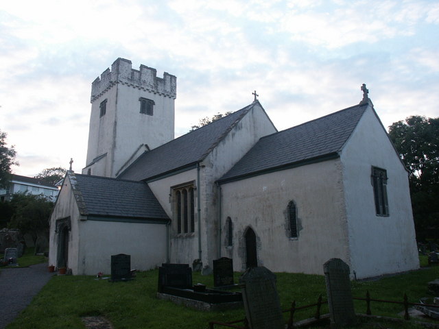

Why visit Bridgend
Townapedia lists 13 museums and landmarks, 7 parks and trails, 96 places to eat, 6 places to stay and 2 attractions in and around town.
Highlights include Old Bridge, Brackla Hill, Coity Castle and Ewenni Priory.
Weather in Bridgend
Forecast from MET Norway (CC BY 4.0). Full forecast
About Bridgend
Bridgend (English: ; Welsh: Pen-y-bont ar Ogwr or just Pen-y-bont, meaning "the end of the bridge on the Ogmore") is a town in the Bridgend County Borough of Wales, 20 miles (32 km) west of Cardiff and 20 miles (32 km) east of Swansea. The town is named after the medieval bridge over the River Ogmore. The River Ewenny also flows through the town. The population was 49,597 in 2021.
From the Wikipedia article Bridgend (this version), under CC BY-SA 4.0.
Travel tips from other travellers: Bridgend on Wikivoyage (CC BY-SA 4.0).
Things to do2

Old Bridge
Bridge
Grade II* listed building in Bridgend County Borough. Bridge in Bridgend, south Wales

Museums and landmarks13




1 more on the map.
Parks, trails and playgrounds7

Bryngarw Country Park
Park · 3.4 mi
Park in Bridgend County Borough, United Kingdom


Compost Cwtch
Park · 0.8 mi
Community Garden on the site of the former Garages. Consists of a number of raised bed plantings & a polytunnel.

Restaurants and cafes96
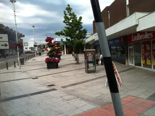
The Kings Head
Bar and pub
44 Nolton Street, Bridgend
Mo-Th 11:00-23:00; Fr-Sa 11:00-26:00; Su 11:00-23:00
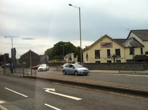
The Little Bar On The Bridge
Bar and pub
3 Old Bridge, Bridgend
Mo Off; Tu Off; We-Sa 14:00-22:00; Su 14:00-21:00
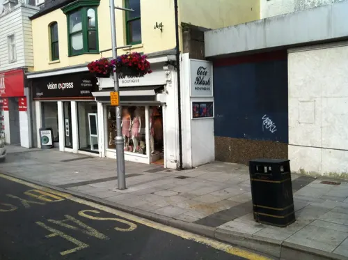
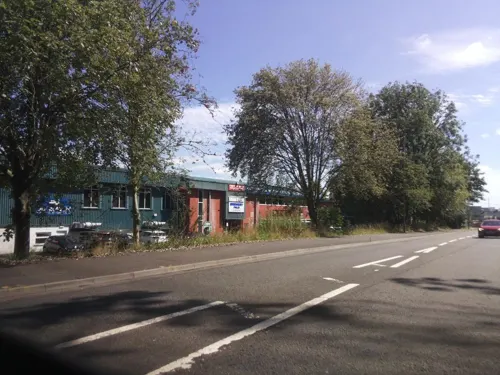


The Railway
Bar and pub
Derwen Road, Bridgend
Mo-We 11:00-21:45; Th-Sa 11:00-26:00; Su 11:00-26:30
The Wyndham Arms
Bar and pub
Wetherspoons Pub with Hotel above.
Dunraven Place, Bridgend
Mo-Th 07:00-24:00; Fr-Sa 07:00-25:00; Su 07:00-24:00

Zia Nina
Restaurant · Italian
28 Dunraven Place, Bridgend
Mo-Tu 16:00-22:00; We 12:00-22:00; Th 12:00-23:00; Fr 12:00-25:00;...
84 more on the map.
History
Several prehistoric burial mounds have been found in the vicinity of Bridgend, suggesting that the area was settled before Roman times. The A48 between Bridgend and Cowbridge has a portion, known locally as "Crack Hill", of Roman road and the 'Golden Mile' where it is believed Roman soldiers were lined up to be paid. The Vale of Glamorgan would have been a natural low-level route west to the Roman fort and harbour at Neath (Nidum) from settlements in the east like Cardiff and Caerleon (Isca).
In the decades after the Norman Conquest of Anglo-Saxon England in 1066, the Normans looked westwards to create new seats for lords loyal to William the Conqueror. Groups of Norman barons arrived in Wales, and in the south and east created what would later become the Welsh Marches, while the north and west remained largely unconquered.
At Coity, the local Welsh chieftain Morgan Gam already had a stronghold. Sometime in the 11th century, Norman Lord Payn de Turberville approached Morgan to turn over control of Coity Castle to Turberville. Morgan Gam agreed, on condition that Turberville either fought Morgan for the land, or took Gam's daughter Sybil's hand in marriage. Turberville married Sybil and became Lord of Coity, and rebuilt the castle.
Read more of the history
Newcastle Castle (on Newcastle Hill, overlooking the town centre, 1106) and Ogmore Castle (1116) were built by Robert Fitzhamon and William de Londres, respectively. About 2 miles (3 km) north-east of Ogmore Castle, Maurice de Londres founded the fortified Benedictine Ewenny Priory in 1141.
These three castles provided a "defensive triangle" for the area – a quadrilateral if Ewenny Priory is included.
Bridgend developed at a ford on the River Ogmore, which was on the main route between east and west Wales. Just north of the town is the confluence of three rivers, the Ogmore, the Llynfi, and the Garw. South of Bridgend, the River Ewenny merges with the River Ogmore and flows into the Bristol Channel. In the 15th century, a stone bridge was built as a permanent connection between the two sides of the Ogmore (and was later rebuilt). Originally, this bridge had four arches, but in the 18th century, a massive flood washed two of them away. The rest of the bridge still stands and remains a focal point of the town: aesthetic restoration took place in 2006.
Bridgend grew rapidly into an agricultural town. It became an important market town, a status it retained until the late 20th century.
The discovery of coal in the South Wales Valleys north of Bridgend had a massive impact on the town. The first coal mining operations opened north of Bridgend in the 17th century; the Llynfi Valley was the first to be industrialised. Bridgend itself never had coal deposits and remained a market town for some time, but the valleys of the three rivers grew into an important part of the South Wales coalfields. Ironworks and brickworks (notably at Tondu) were also established in the same period by John Bedford, although the ironworks faltered after his death and ceased operating entirely in 1836.
The Great Western Railway arrived and Bridgend was at the junction between the main London to Fishguard line and the branch to the three valleys. Frequent coal trains took coal down the valleys; and when the Vale of Glamorgan railway opened, coal could be sent directly to port at Barry or via other branch lines to Porthcawl.
Several quarries opened in and around Bridgend town centre; some remnants of these can still be seen today near Brackla. An engine works was opened in the town and a larger farmers' market also opened in the town centre, where it remained until the 1970s.
In 1801, the population of what is now Bridgend County was around 6000. By the beginning of the 20th century this had risen to 61,000. By this time Bridgend was a bustling market town with prosperous valleys to the north, a thriving community and good links to other towns and cities.
In the Second World War, Bridgend had a prisoner of war (POW) camp at Island Farm and a large munitions factory (ROF Bridgend – known as the "Admiralty") at Waterton, as well as a large underground munitions storage base at Brackla (known as the 8Xs). This was an overspill of the Royal Arsenal, Woolwich.
At its peak, the arsenal had 40,000 workers, many of them women. Large numbers of them were transported by bus from the Rhondda and the valleys.
The factory complex had three sites in Bridgend, all linked together by a large network of railways. Many reminders of the factory sites remain to this day.
In March 1945, 87 POWs from Island Farm escaped through a tunnel, but all were recaptured. While Bridgend was as important during the war as any other part of Wales, and although it was photographed by the Luftwaffe, it was never blitzed, although the area immediately around Bridgend did suffer bombing raids.
The admiralty ceased full-scale production in December 1945 after five years. Two of the munitions-storage magazines in the Brackla ROF site were converted to a regional government headquarters during the Cold War as part of the UK continuity of government plans. It is now in the hands of a private company.
Bridgend remained a solid market town after the war. In 1948, Newbridge Fields (a short distance from the town centre) hosted the 1948 National Eisteddfod.
In 1960, the River Ogmore burst its banks and flooded the town centre. Subsequent floods and extreme weather led the Welsh Water Authority to develop concrete flood defence walls along the banks of the River Ogmore in the town centre. The town centre has not been flooded since. During this time, Bridgend was chosen to become the headquarters for South Wales Police. This action was ideal as geographically, Bridgend stands equidistant to Swansea to the west and Cardiff to the east.
The Beeching cuts of the 1960s had the loss of passenger rail links in the Vale of Glamorgan and to the northern valleys. The Vale of Glamorgan link to Barry via Rhoose was reinstated in June 2005.
From the History section of Bridgend on Wikipedia, under CC BY-SA 4.0.
More about Bridgend
Economy
Bridgend's travel to work area has expanded since 1991 and the 2001-based area now incorporates the western part of the Vale of Glamorgan.
Bridgend recovered quickly from the decline of traditional industries, particularly coal-mining due to other alternative forms of employment. Wages are generally higher here than in other parts of the South Wales valleys. There are large industrial estates at Bridgend and Waterton (formerly Waterton Admiralty) which host a number of small-scale and multi-national companies, mainly manufacturing.
Ford's engine plant near Waterton used to employ around 2,000 workers and was one of the area's largest employers, working on range of low carbon "EcoBoost" engines. The plant won praise from Peter Mandelson in January 2009 who described it as "a top-of-the-class, world-beating engine production plant." Ford invested £315 million in the Bridgend plant between 2004 and 2009. The Ford plant closed in September 2020.
IT Consultancy Group CGI have an office in Bridgend, and Lidl has also set up its Welsh headquarters and distribution site at Waterton. Zoobiotic, a company specialising in maggot therapy, has its facility near Bridgend town centre. Also, since 1983, the dart board producer Winmau has based its global headquarters in Bridgend.
Arts and culture
Several pubs, restaurants and a nightclub are located within the town centre.
In December 2008, Bridgend Council introduced its first alcohol-free zone, restricting the consumption of alcohol to pubs, clubs, and other licensed premises in the town centre to help address alcohol-related issues. CCTV is in operation throughout the town centre, and usually police have a presence of some form. Since July 2007, the streets of Bridgend are also patrolled on Friday and Saturday evenings by Street Pastors, an inter-denominational church response to urban problems, engaging with people on the streets.
Funeral for a Friend and Jayce Lewis have both received mainstream and commercial recognition, while rock/metal act Bullet for My Valentine contributed to the meteoric uprising in the mid-2000s metal music industry. Along with Those Damn Crows, they have all received national and international chart success. Several smaller venues in and around the town centre, including The New Angel Inn, The Railway Inn, Barracudas and Sapphires, host a number of open-mic nights. Bryan Adams played to a 15,000 crowd at Brewery Field stadium in the town in 2006. The Recreation Centre has hosted acts such as Fall Out Boy and Bring Me the Horizon.
Bridgend hosted the National Eisteddfod in 1948. Bridgend County hosted the Urdd Gobaith Cymru National Eisteddfod in 2017.
Education
Bridgend town has four comprehensive schools: Coleg Cymunedol Y Dderwen Archbishop McGrath Catholic Comprehensive, Brynteg Comprehensive School, Bryntirion Comprehensive School, and pencoed comprehensive school. Brynteg generally serves the area east of the River Ogmore, while Bryntirion serves the areas west of the river.
Brynteg is renowned for its rugby alumni, including J. P. R. Williams, Rob Howley, Gavin Henson, Mike Hall and Dafydd James; many talented athletes at other local schools join Brynteg to play for the school in the Welsh School Rugby Union leagues. The school has produced several Welsh rugby union internationals, and prominent athletes in other sports have also attended, including female cyclist Nicole Cooke. Bryntirion has also produced sporting talent, including Gareth Llewellyn and triathlete Marc Jenkins. Archbishop McGrath School covers the whole of the county, and moved to a new campus at Brackla in 2011.
At least nine primary, junior schools, and infant schools are in the town, though several of the junior and infant schools have merged to form single primary schools in recent years.
From the Wikipedia article Bridgend, under CC BY-SA 4.0.
Notable people from Bridgend
 Matthew TuckWelsh singer and guitarist (born 1980)Photo: Sven Mandel, CC BY-SA 4.0
 Aneurin BarnardWelsh actor (born 1987)Photo: GabboT, CC BY-SA 2.0
 Huw EdwardsWelsh journalist and newsreader (born 1961)Photo: The National Churches Trust, CC BY 2.0
 Amanda LeveteBritish architectPhoto: Seriousarchfan at English Wikipedia, CC BY-SA 3.0
 Laura McAllisterWelsh footballer & politics academic (born 1964)Photo: National Assembly for Wales from Wales, CC BY 2.0
 William MorganWelsh physician, physicist, statistician and actuaryPhoto: Thomas Lawrence, Public domain
 Gavin HensonWelsh rugby union playerPhoto: Chris P Jobling, CC BY 2.0
 Wayne DavidWelsh politician and MP (born 1957)Photo: Richard Townshend, CC BY 3.0
 Gerald BattrickBritish tennis player (1947–1998)Photo: W. Punt for Anefo, CC0
 J. J. WilliamsWelsh rugby union player (1948–2020)Photo: Stefano Delfrate, CC BY-SA 2.0
- Michael PagetBritish musician
- Ruth JonesWelsh actress, script-writer and producer
Born in Bridgend, according to Wikidata (CC0). Each name links to its Wikipedia article.
Where to stay6
Churches and places of worship24
The Church of Jesus Christ of Latter-day Saints
Church · Latter Day Saints · 1.1 mi
Celestial Way, Bridgend
Shopping18
Gas and EV charging5
Schools, colleges and libraries18
Healthcare9
Map of Bridgend
198 places. The map loads OpenStreetMap tiles when you open it.
Getting there and nearby towns
Cardiff Airport (CWL) is the nearest airport with scheduled flights listed in OpenStreetMap, 12 miles away.
- Coity 1 mi northeast, about 2 min by car
- Pyle 5 mi west, about 9 min by car
- Porthcawl 6 mi west, about 9 min by car
- Llantwit Major 8 mi southeast, about 12 min by car
- Maesteg 8 mi northwest, about 13 min by car
- Llantrisant 9 mi east, about 15 min by car
- Rhondda 12 mi northeast, about 19 min by car
- Pontypridd 12 mi northeast, about 19 min by car
- Neath 15 mi northwest, about 24 min by car
- Cardiff 17 mi east, about 28 min by car
Drive times are estimates from straight-line distance, not routes.
Towns near Bridgend


Keep exploring
Local news
Headlines from INDB.
Reviews, tips and questions
Loading what members have shared...
Sources and licences
- GeoNames (CC BY 4.0): population, coordinates, regions and time zone
- Mapillary (see each image): photos
- OpenStreetMap contributors (ODbL 1.0): places, airports, map data
- Wikidata (CC0 1.0): elevation, founding date, time zone, website, landmarks and historic places
- Wikimedia Commons (see each image): photos
- Wikipedia (CC BY-SA 4.0): overview and history text
Photo credits
- The old bridge, two towers and walkway, Bridgend 1915596 6bc31f25, Mick Lobb, CC BY-SA 2.0
- 31-35 Caroline Street, Bridgend, FruitMonkey, CC BY-SA 4.0
- Old Bridge (Yr Hen Bont) Bridgend 2948762 b59f41b8, Chris Andrews, CC BY-SA 2.0
- Bryngarw Country Park, Cafe 2011, Fillius, CC BY-SA 3.0
- Colwinston5, jeff goodwin, CC BY-SA 2.0
- Coity Castle, kenneth rees, CC BY-SA 2.0
- Brewery Field Castle View, Sionk, CC BY 4.0
- Archbishop-school, ShaneSealey66, CC BY-SA 4.0
- Ewenny Priory interior 062415, Wilson44691, CC0
- St Illtyd's Church, Bridgend, FruitMonkey, CC BY-SA 3.0
- Hope Baptist Chapel, Bridgend, FruitMonkey, CC BY-SA 4.0
- Newcastle Castle Bridgend, MRNasher, Public domain
- Street-level photo, miguel_andrade, CC BY-SA 4.0
- Street-level photo, miguel_andrade, CC BY-SA 4.0
- Street-level photo, miguel_andrade, CC BY-SA 4.0
- Street-level photo, miguel_andrade, CC BY-SA 4.0
- Street-level photo, southglos, CC BY-SA 4.0
- Street-level photo, southglos, CC BY-SA 4.0
- Street-level photo, southglos, CC BY-SA 4.0
- Street-level photo, southglos, CC BY-SA 4.0
- Street-level photo, miguel_andrade, CC BY-SA 4.0
- Street-level photo, southglos, CC BY-SA 4.0
- Street-level photo, southglos, CC BY-SA 4.0


Page built November 10, 2026. Spotted a mistake? Tell us or suggest a place.