


Porthcawl, United Kingdom
Porthcawl is a town of 15,672 people in Wales, United Kingdom.
Why visit Porthcawl
Townapedia lists 4 museums and landmarks, 8 parks and trails, 67 places to eat, 6 places to stay and 3 attractions in and around town.
Highlights include Coney Beach Pleasure Park, Grand Pavilion, Porthcawl, Coney Beach Funfair and Kenfig Castle.
Weather in Porthcawl
Forecast from MET Norway (CC BY 4.0). Full forecast
About Porthcawl
Porthcawl ([pɔrθˈkaul] ) is a town and community in the Bridgend County Borough of Wales. It is located on the south coast, 25 miles (40 km) west of Cardiff and 19 miles (31 km) south-east of Swansea.
From the Wikipedia article Porthcawl (this version), under CC BY-SA 4.0.
Travel tips from other travellers: Porthcawl on Wikivoyage (CC BY-SA 4.0).
Things to do3

Coney Beach Pleasure Park
Monument and historic site
Amusement park in Mid Glamorgan, Wales

Grand Pavilion, Porthcawl
Cinema and theater
Theatre and music venue in Porthcawl, Wales

Porthcawl Lighthouse
Lighthouse · 0.4 mi
Lighthouse in Bridgend County Borough, Wales
Museums and landmarks4
Coney Beach Funfair
Monument and historic site
Permantly closed
closed

Kenfig Castle
Monument and historic site · 3.6 mi
Ruins of castle in Wales, UK

Porthcawl Museum
Museum
John Street, Porthcawl
Mo Off; Tu Off; We 11:00-15:00; Th Off; Fr 11:00-15:00; Sa...

Parks, trails and playgrounds8

Griffin Park
Park
Eastern Promenade, Porthcawl
Jan-Mar Mo-Su 09:00-17:00; Apr-Jun Mo-Su 09:00-19:00; Jul-Sep...



Restaurants and cafes67

The Jolly Sailor
Bar and pub · 1.2 mi
1 Church Street, Newton
Mo 16:00-23:00; Tu-We 12:00-23:00; Th 12:00-00:00; Fr 12:00-23:00;...
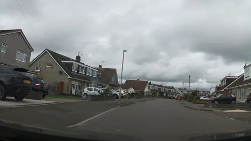
The Seagull
Bar and pub · 0.8 mi
Sandpiper Road, Porthcawl
Mo-Th 12:00-23:00; Fr-Sa 12:00-00:00; Su 12:00-22:00
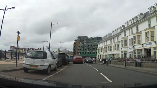
Cosy Corner
Restaurant · Korean, Spanish, Deli
33 Esplanade, Porthcawl
Mo Off; Tu Off; We Off; Th 12:00-23:00; Fr 12:00-24:00; Sa...
Prince of Wales
Bar and pub
10 New Road, Porthcawl
Mo-Su 11:00-24:00
The Royal Oak
Bar and pub
1-3 South Road, Porthcawl
Mo-Th 12:00-24:00; Fr-Sa 12:00-25:00; Su 12:00-22:30

Rock Inn
Bar and pub
98 John Street, Porthcawl
Mo Off; Tu-Th 11:30-23:00; Fr-Sa 11:30-24:00; Su 12:00-23:00
The Ancient Briton
Bar and pub · 1.1 mi
Clevis Hill, Porthcawl
Mo-Th 12:00-23:00; Fr 12:00-00:00; Sa 00:00-01:00,12:00-00:00; Su...
The Seahorse
Bar and pub
17 South Road, Porthcawl
Mo-Th 13:00-23:00; Fr 13:00-24:00; Sa 12:00-24:00; Su 12:00-22:30

Isabella's
Restaurant · Spanish
9-10 Well Street, Porthcawl
Mo Off; Tu-Sa 12:00-14:00,18:00-21:00; Su Off
Porthcawl Tandoori
Restaurant · Indian
1 Eastern Promenade, Porthcawl
Mo-Th 17:30-23:15; Fr-Sa 17:30-24:00; Su 17:30-23:15
Sandpiper Inn
Bar and pub
52 New Road, Porthcawl
Mo-Sa 11:00-24:00; Su 11:00-23:00

55 more on the map.
More about Porthcawl
Education
There are six English medium schools in Porthcawl: four primary schools, one comprehensive school and one private school.
Porthcawl Comprehensive School, on the western side of the town, has 1,500 pupils (aged 11–18) and 80 teaching staff.
As at 2011, it was the only school to have received a new Band 1 assessment in the Bridgend County from the Welsh Government.
St Clare's School was a co-educational independent school, located in the village of Newton (an eastern part of Porthcawl), in Bridgend County Borough. The school provides preparatory, secondary and tertiary education leading to GCSE and A-level qualifications. Originally a Roman Catholic girls' school, the school was owned and operated by the Cognita Group.
In 2026, Clare House Independent School Trust acquired the site from Cognita School. This led to the formation of Clare House School Porthcawl, which is owned and governed by the Trust.
This is a state school which provides education for ages 3–11 and is participating in the Foundation Phase. It is a large primary school, with approximately 500 pupils, surrounded by extensive grounds. It has a conservation area and is in the process of building a pond. It has a large outdoor play area and a sensory garden. There is an outdoor classroom which is used for a range of activities.
From the Wikipedia article Porthcawl, under CC BY-SA 4.0.
Notable people from Porthcawl
 Simon RichardsonWelsh racing cyclistPhoto: James Mitchell, CC BY-SA 2.0
 Tom PrydieWelsh rugby union playerPhoto: Stefano Delfrate, CC BY-SA 2.0
- Jason HughesWelsh actor
- Helen MorganWelsh field hockey player (1966-2020)
- Matthew Gravelleactor
- Gareth MorganOrganizational theorist
- Robert WilfortBritish actor
- Robert EastBritish actor
- Brian Huggettprofessional golfer
- Clive WilliamsWelsh rugby union footballer
- Jack LewisWelsh footballer (born 1912)
- Jan AndersonBritish actress
Born in Porthcawl, according to Wikidata (CC0). Each name links to its Wikipedia article.
Where to stay6
Churches and places of worship19
Shopping19
Gas and EV charging1
Schools, colleges and libraries7
Healthcare4
Map of Porthcawl
138 places. The map loads OpenStreetMap tiles when you open it.
Getting there and nearby towns
Cardiff Airport (CWL) is the nearest airport with scheduled flights listed in OpenStreetMap, 17 miles away.
- Pyle 3 mi north, about 4 min by car
- Swansea 14 mi northwest, about 23 min by car
- Rhondda 17 mi northeast, about 27 min by car
- Ystalyfera 20 mi north, about 32 min by car
- Whitchurch 21 mi east, about 34 min by car
- Minehead 21 mi southeast, about 34 min by car
- Treharris 21 mi northeast, about 34 min by car
- Cardiff 23 mi east, about 36 min by car
- Ilfracombe 26 mi southwest, about 41 min by car
- Risca 27 mi east, about 44 min by car
Drive times are estimates from straight-line distance, not routes.
Towns near Porthcawl


Keep exploring
Local news
Headlines from INDB.
Reviews, tips and questions
Loading what members have shared...
Sources and licences
- GeoNames (CC BY 4.0): population, coordinates, regions and time zone
- Mapillary (see each image): photos
- OpenStreetMap contributors (ODbL 1.0): places, airports, map data
- Wikidata (CC0 1.0): elevation, founding date, time zone, website, landmarks and historic places
- Wikimedia Commons (see each image): photos
- Wikipedia (CC BY-SA 4.0): overview and history text
Photo credits
- GrandPavilion, Photographed by Mark Phillips Summer 2004, CC BY-SA 3.0
- Porthcawlwave2013, Ben Salter from Wales, CC BY 2.0
- Coneybeach, WillMcC at English Wikipedia, CC BY-SA 3.0
- Seabank Hotel front, Moogan, CC BY 2.0
- Jolly Sailor pub, Porthcawl, Wales, cowbridgeguide.co.uk, CC BY 3.0
- Kenfig Castle ruins, Mick Lobb, CC BY-SA 2.0
- Street-level photo, southglos, CC BY-SA 4.0
- Street-level photo, southglos, CC BY-SA 4.0
- Street-level photo, southglos, CC BY-SA 4.0
- Street-level photo, southglos, CC BY-SA 4.0
- Street-level photo, southglos, CC BY-SA 4.0
- Street-level photo, southglos, CC BY-SA 4.0
- Street-level photo, southglos, CC BY-SA 4.0
- Street-level photo, southglos, CC BY-SA 4.0
- Street-level photo, southglos, CC BY-SA 4.0
- Street-level photo, southglos, CC BY-SA 4.0
- Street-level photo, southglos, CC BY-SA 4.0
Page built November 10, 2026. Spotted a mistake? Tell us or suggest a place.