


Brixton Hill, United Kingdom
Brixton Hill is a town of 12,458 people in England, United Kingdom.
Why visit Brixton Hill
Townapedia lists 52 museums and landmarks, 70 parks and trails, 203 places to eat, 10 places to stay and 28 attractions in and around town.
Highlights include O2 Academy Brixton, Streatham Hill Theatre, Studio Voltaire and 575 Wandsworth Road.
Weather in Brixton Hill
Forecast from MET Norway (CC BY 4.0). Full forecast
About Brixton Hill
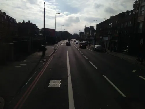
Brixton Hill is the name given to a two-thirds of a mile (1 km) section of road between Brixton and Streatham Hill in south London, England. The name also refers to the surrounding residential neighbourhood and former electoral ward in the London Borough of Lambeth.
From the Wikipedia article Brixton Hill (this version), under CC BY-SA 4.0.
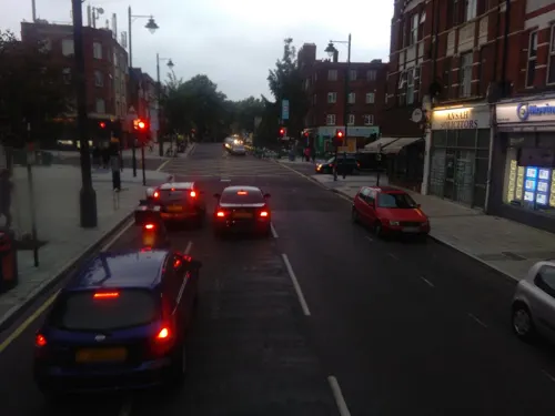
Photos of Brixton Hill

Things to do28

O2 Academy Brixton
Cinema and theater · 1.0 mi
Music venue in London, a former cinema
211 Stockwell Road, London

Streatham Hill Theatre
Cinema and theater · 0.8 mi
Former grand theatre, now mostly disused.
110 Streatham Hill, London


Albert Bridge
Bridge · 2.8 mi
Road bridge over the River Thames in West London

Apollo Victoria Theatre
Cinema and theater · 3.1 mi
Theatre in London, England, UK

Battersea Arts Centre
Cinema and theater · 1.8 mi
Performance space in the London Borough of Wandsworth, England, the former Battersea Town Hall

Battersea Bridge
Bridge · 2.9 mi
Arch bridge with cast-iron girders and granite piers crossing the River Thames in London

Battersea Railway Bridge
Bridge · 2.9 mi
Bridge across the River Thames in London

Canterbury Music Hall
Cinema and theater · 3.3 mi
Former music hall and theatre in Lambeth, London, England

Chelsea Bridge
Bridge · 2.5 mi
Bridge over the River Thames in west London

16 more on the map.
Museums and landmarks52


575 Wandsworth Road
Museum · 1.4 mi
Georgian terraced house in London, England
575 Wandsworth Road, London

198 Contemporary Arts and Learning
Museum · 0.8 mi
Arts gallery/organisation in London

24th Division War Memorial
Monument and historic site · 2.4 mi
War memorial in Battersea Park, London

African and Caribbean War Memorial
Monument and historic site · 0.7 mi
War memorial in London

Cherry Groce Memorial Pavilion
Monument and historic site · 0.7 mi
Memorial to Cherry Groce in Brixton, London SW9

Dulwich Picture Gallery
Museum · 1.6 mi
Art gallery in Dulwich, South London, United Kingdom

National Army Museum
Museum · 2.8 mi
Museum in London, England, United Kingdom

Pump House Gallery
Museum · 2.3 mi
Art gallery in Battersea Park, London

Saatchi Gallery
Museum · 3.1 mi
Physical and online contemporary art gallery in Chelsea, London

Carlyle's House
Museum · 3.0 mi
Historic house museum in London, England, UK
Mica Gallery
Museum · 3.2 mi
Art gallery located near the Cadogan Gardens intersection on Pavilion Road, Knightsbridge, London
40 more on the map.
Parks, trails and playgrounds70

Brockwell Lido
Sports field and stadium · 0.7 mi
Brockwell Lido has an open air swimming pool, gym facilities, health suite including physiotherapy treatment rooms and the Lido Cafe
Dulwich Road, London
Mo-Th 06:30-20:00;Fr 06:30-19:00;Sa-Su 07:00-18:00;PH 06:30-19:00


Battersea Park
Park · 2.4 mi
Park in the Borough of Wandsworth, London, England, UK

Burton’s Court
Park · 3.0 mi
Park in Royal Borough of Kensington and Chelsea, United Kingdom
58 more on the map.
Restaurants and cafes203

Knowles of Norwood
Bar and pub · 1.4 mi
294-296 Norwood Road, London
Mo-Th 11:00-23:00; Fr, Sa 11:00-00:00; Su 12:00-22:30 || Mo-Sa...
2210 By NattyCanCook
Restaurant · Caribbean, Fine Dining · 1.0 mi
75-79 Norwood Road, London
Mo-Tu off; We-Th 17:00-23:00; Fr 17:00-24:00; Sa 12:00-24:00; Su...
500 Degrees
Restaurant · Italian · 0.9 mi
153 Dulwich Road, London
Mo-Th 16:00-22:00; Fr-Sa 12:00-23:00; Su 12:00-22:00
Booma
Restaurant · Indian · 1.4 mi
244 Brixton Road, London
Mo off; Tu-Fr 17:30-23:00; Sa 13:00-23:00; Su 13:00-21:00
Brixton Cake Shop
Bakery · 1.0 mi
The Craft is baker's confections, aka flour confections.
53-59 Norwood Road, London
Mo-Fr 10:00-18:00; Sa 10:00-17:00
Clarkshaws Brewery
Brewery and winery · 1.3 mi
As a small independent microbrewery.
Ridgway Road, London
Th-Su 12:00-20:00
Coffee Wake Cup
Cafe · Coffee Shop · 0.9 mi
14 Clapham Park Road
Mo-Th 07:30-17:00; Fr-Sa 07:30-18:00; Su 08:00-18:00


Badger Badger
Bar and pub · Japanese · 1.5 mi
543 Norwood Road, London
Mo-Tu off; We-Th 12:00-23:00; Fr-Sa 12:00-00:00; Su 12:00-22:00

CafePod Coffee
Cafe · 0.8 mi
After 14 years of helping people make amazing coffee at home, we’ve created a space where you can taste great coffee & pick up...
27 Abbeville Road, London
Mo-Fr 09:00-18:00
191 more on the map.
History
Prior to the late 19th century, the road was known as Brixton (or Bristow) Causeway. On the eastern side of the road, a series of tree-lined open spaces and front gardens make up Rush Common — an area of former common land that, although it is subject to a prohibition on 'erections above the surface of the earth' under an Act of Parliament of 1806, has seen some incursions for building.
The name Brixton Hill has subsequently been given to the residential areas on both sides of the road, and from 2002 to 2022, it was also the name of an electoral ward of the London Borough of Lambeth.
From 1891 until the 1950s Brixton Hill was served by a regular London tram service; it was cable-drawn until 1904 when it was replaced by a conventional electric tram. The tram depot at Streatham Hill, opposite Telford Avenue, housed the tram cars, horses and the steam-powered winding gear for the cable. It is now a bus depot.
Another surviving tram shed, which can still be seen near the junction of Brixton Hill with Christchurch Road, was designed by London County Council Tramways' architect G. Topham Forest, and had a capacity of 30 trams.
From the History section of Brixton Hill on Wikipedia, under CC BY-SA 4.0.
Notable people from Brixton Hill
 Bertie JoyceRoyal Air Force pilotPhoto: TheUltimateGenealogy, CC0
- Philip LeviAustralian settler (1822-1898)
Born in Brixton Hill, according to Wikidata (CC0). Each name links to its Wikipedia article.
Where to stay10
Churches and places of worship82
Shopping98
Gas and EV charging12
Schools, colleges and libraries50
Christ Church, Streatham Church of England Primary School
School · Anglican · 0.5 mi
Cotherstone Road, London
Healthcare35
Map of Brixton Hill
250 places. The map loads OpenStreetMap tiles when you open it.
Getting there and nearby towns
London City Airport (LCY) is the nearest airport with scheduled flights listed in OpenStreetMap, 9 miles away.
- Balham 1 mi west, about 2 min by car
- City of Westminster 3 mi north, about 5 min by car
- Wimbledon Park 3 mi west, about 6 min by car
- London 4 mi north, about 6 min by car
- Thornton Heath 4 mi south, about 6 min by car
- Croydon 5 mi south, about 8 min by car
- Holborn 5 mi north, about 7 min by car
- Shadwell 5 mi northeast, about 8 min by car
- King's Cross 5 mi north, about 9 min by car
- Islington 6 mi north, about 9 min by car
Drive times are estimates from straight-line distance, not routes.
Towns near Brixton Hill


Keep exploring
Local news
Headlines from INDB.
Reviews, tips and questions
Loading what members have shared...
Sources and licences
- GeoNames (CC BY 4.0): population, coordinates, regions and time zone
- Mapillary (see each image): photos
- OpenStreetMap contributors (ODbL 1.0): places, airports, map data
- Wikidata (CC0 1.0): elevation, founding date, time zone, website, landmarks and historic places
- Wikimedia Commons (see each image): photos
- Wikipedia (CC BY-SA 4.0): overview and history text
Photo credits
- Brixton Academy, Brixton, SW9 (3380443064), Ewan Munro from London, UK, CC BY-SA 2.0
- Albert Bridge from the South, Peter Cooper, CC BY-SA 4.0
- Battersea Arts Centre, Lavender Hill, SW11 (3324322940), Ewan Munro from London, UK, CC BY-SA 2.0
- Battersea Railway Bridge, London 04, Edwardx, CC BY-SA 3.0
- Canterbury Hall circa 1856, Unknown author Unknown author, Public domain
- Chelsea Bridge, London, Tom Graham, CC BY-SA 2.0
- Entrance to 575 Wandsworth Road, JRennocks, CC BY-SA 4.0
- External view of 198 Contemporary Arts and Learning, 2010, Barby Asante, CC BY-SA 4.0
- War Memorial, Battersea Park 02, Edwardx, CC BY-SA 3.0
- African and Caribbean Memorial, 31 July 2017 02 (cropped), Kelly Foster, CC BY-SA 4.0
- At Brixton 2026 03, Photograph by Mike Peel ( www.mikepeel.net )., CC BY-SA 4.0
- National Army Museum - Joy of Museums, Joyofmuseums, CC BY-SA 4.0
- Pump House Gallery, Battersea Park, Garry Knight, CC BY-SA 2.0
- SaatchiGallery, Jack Gavigan, CC BY-SA 3.0
- BrockwellParkHut, Richard Irons, CC BY-SA 3.0
- Clapham Common 360 Panorama - July 2007, Diliff, CC BY 3.0
- Bandstand, Ruskin Park, Lambeth, London-24March2012, James Petts from London, England, CC BY-SA 2.0
- Peace Pagoda Battersea Park, Gordon Joly, CC BY 2.5
- All-saints-dulwich, Le Deluge, CC BY-SA 3.0
- Brockwell Lido, Unknown author, CC BY 2.0
- LaetitiaSadierVoltaire150717-15, Raph_PH, CC BY 2.0
- Brockwell Hall, Tommy20000, CC BY-SA 3.0
- 320, Brixton Road Sw9, Jwslubbock, CC BY-SA 3.0
- Carnegie Library Herne Hill, Tom Betts, Public domain
- Saint Mary & Saint John The Divine (view from street entrance), KyotoWatanabe, CC BY-SA 4.0
- Front profile of Herne Hill Baptist Church, No Swan So Fine, CC BY-SA 4.0
- Former Playhouse Theatre (9176302961), Reading Tom from Reading, UK, CC BY 2.0
- St. James Clapham 01, Tillmann Lenz, CC BY-SA 4.0
- Picturehouse Clapham, Tero Koistinen, CC BY-SA 4.0
- Max Roach Park, London Borough of Lambeth, SW9 (3379992935), Ewan Munro from London, UK, CC BY-SA 2.0
- Larkhall Park, London Borough of Lambeth, SW8 (2130909988), Ewan Munro from London, UK, CC BY-SA 2.0
- Lambeth Hospital main entrance (2026), Mornholt, CC BY-SA 4.0
- Carnegie Library, Herne Hill, Celsoazevedo, CC BY 4.0
- At Brixton, London 2025 012, Photograph by Mike Peel ( www.mikepeel.net )., CC BY-SA 4.0
- London - Apollo Victoria Theatre, Fred Romero from Paris, France, CC BY 2.0
- Battersea Bridge at sunset - panoramio, lizericson, CC BY-SA 3.0
- Dulwich Picture Gallery, June 2018 (3), No Swan So Fine, CC BY-SA 4.0
- Street-level photo, ris, CC BY-SA 4.0
- Street-level photo, ris, CC BY-SA 4.0
- Street-level photo, ris, CC BY-SA 4.0
- Street-level photo, ris, CC BY-SA 4.0
- Street-level photo, ris, CC BY-SA 4.0
- Street-level photo, gness, CC BY-SA 4.0
- Street-level photo, ris, CC BY-SA 4.0
- Street-level photo, ris, CC BY-SA 4.0
- Street-level photo, ecatmur, CC BY-SA 4.0
- Street-level photo, ris, CC BY-SA 4.0
- Street-level photo, ris, CC BY-SA 4.0
- Street-level photo, ris, CC BY-SA 4.0
- Street-level photo, ecatmur, CC BY-SA 4.0
- Street-level photo, damianb, CC BY-SA 4.0
- Street-level photo, matth81, CC BY-SA 4.0
- Street-level photo, matth81, CC BY-SA 4.0
- Street-level photo, matth81, CC BY-SA 4.0
- Street-level photo, tomchance, CC BY-SA 4.0
- Street-level photo, matth81, CC BY-SA 4.0
- Street-level photo, Opspin, CC BY-SA 4.0
- Street-level photo, IpswichEdits, CC BY-SA 4.0
- Street-level photo, ris, CC BY-SA 4.0
- Street-level photo, ris, CC BY-SA 4.0
- Street-level photo, ris, CC BY-SA 4.0
- Street-level photo, ris, CC BY-SA 4.0
- Street-level photo, ris, CC BY-SA 4.0
- Street-level photo, ris, CC BY-SA 4.0


Page built November 10, 2026. Spotted a mistake? Tell us or suggest a place.