


Why visit Holborn
Townapedia lists 150 museums and landmarks, 60 parks and trails, 120 places to eat, 30 places to stay and 72 attractions in and around town.
Highlights include Bloomsbury Theatre, His Majesty's Theatre, British Museum and Buckingham Palace.
Weather in Holborn
Forecast from MET Norway (CC BY 4.0). Full forecast
About Holborn
Holborn ( HOH-bərn or HOHL-bərn[a]) is an area in central London, that covers the southeastern part of the London Borough of Camden and a part (St Andrew Holborn Below the Bars) of the Ward of Farringdon Without in the City of London.
From the Wikipedia article Holborn (this version), under CC BY-SA 4.0.
Travel tips from other travellers: Holborn on Wikivoyage (CC BY-SA 4.0).
Photos of Holborn


Things to do72


60 more on the map.
Museums and landmarks150


Dr Johnson's House
Museum · 0.6 mi
17 Gough Square, London
Oct-Apr: Mo-Sa 11:00-17:00; May-Sep: Mo-Sa 11:00-17:30

Royal Academy of Arts
Museum · 1.0 mi
The Royal Academy of Arts is one of Britain's foremost cultural institutions and a major attraction located in the heart of Piccadilly....
Piccadilly, London


Banqueting House
Monument and historic site · 0.9 mi
Tu-Th, Sa-Su 10:00-17:00; Mo 10:00-13:00; Fr 10:00-16:00


The Museum of Philatelic History
Museum · 1.3 mi
The Museum of Philatelic History at the Royal Philatelic Society London holds a collection of internationally significant objects. The...
41 Devonshire Place, London
Mo-Fr 09:30-16:30
ARTE DELUX
Museum · 1.4 mi
Private art gallery, by appointment
Laurence Pountney Hill, London
Mo-Fr 09:00-18:00
138 more on the map.
Parks, trails and playgrounds60


St. James's Park
Park · 1.2 mi
Royal Park in central London
Mo-Su 05:00-00:00

Victoria Embankment Gardens
Park · 0.6 mi
Victoria Embankment, London
Jan 01-Feb 15 08:30-16:30,Feb 16-Feb 29 08:30-17:30,Mar 01-Mar...


St Anne's Churchyard
Park · 0.6 mi
week 1-13 Mo-Su 10:00-16:00; week 14-43 10:00-18:00; week 44-52 10:00-16:00



48 more on the map.
Restaurants and cafes120


The Blackfriar
Bar and pub · 0.8 mi
174 Queen Victoria Street, London
Mo-Tu, Sa 11:00-23:00; We-Fr 11:00-23:30; Su 12:00-22:30

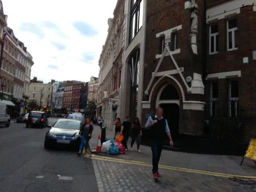

The Old Bank of England
Bar and pub · 0.5 mi
194 Fleet Street, London
Mo-We 11:30-22:00; Th-Fr 11:30-23:00; Sa 11:30-22:00; Su 12:00-20:00

Eat Tokyo
Restaurant · Japanese
50 Red Lion Street, London
Mo-Fr 12:00-15:00, 18:00-22:30; Sa 12:00-15:30, 17:30-22:30; Su...

Green Man
Bar and pub · Fish And Chips · 0.7 mi
57 Berwick Street, London
Mo-We 11:00-23:30; Th-Sa 10:00-01:00; Su 10:00-22:30

Indian YMCA
Restaurant · Indian · 0.9 mi
41 Fitzroy Street, London
Mo-Fr 07:30-09:15, 12:00-15:00; Sa-Su 07:30-09:15, 12:00-14:00


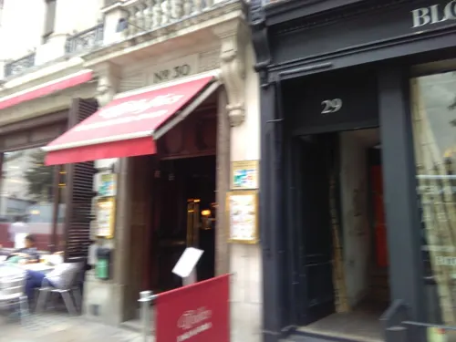

Galvin at Windows
Restaurant · French, Fine Dining · 1.5 mi
22 Park Lane, London
Mo-We 12:00-14:30,17:30-22:00; Th-Fr 12:00-14:30,17:30-22:30; Sa...
108 more on the map.
More about Holborn
Geography
The district can best be described in reference to the ancient parish and the sub-divisions that succeeded it, however the area is not an administrative unit so contemporary perceptions of its extent can be vague and highly variable. In particular there are overlapping perceptions of the extent of the districts of Holborn, Bloomsbury and St Giles. One of the many factors in this, is a tendency to conflate the Holborn and High Holborn roads with the district.
The now buried River Fleet formed the historic eastern boundary of the ancient parish of Holborn, a course now marked by Farringdon Street, Farringdon Road and other streets. The northern boundary with St Pancras was formed by a tributary of the Fleet later known as Lamb's Conduit. The curving alignment of Roger Street follows part of the course of that lost brook, and marked the northern boundary of the parish and later borough.
The area extends west from Farringdon Street, for three-quarters of a mile, roughly as far as Southampton Row and Holborn tube station. The station was originally named Holborn (Kingsway) as it was on the junction of those two roads. Most of the area lies north of the eponymous road, rather than to the south.
The nearest London Underground stations are Chancery Lane and Holborn. The closest mainline railway station is City Thameslink.
Economy
In the early 21st century, Holborn has become the site of new offices and hotels. For example, the old neoclassical Pearl Assurance building near the junction with Kingsway was converted into a hotel in 1999.
There has been attempts by some commercial organisations to rebrand the southern parts of the London Borough of Camden (Holborn, Bloomsbury and St Giles; the former Metropolitan Borough of Holborn) as "Midtown". This area, is notionally in the very middle of London, being situated between the Westminster and the City, but this Americanisation has been widely criticised and not accepted or used by Londoners.
From the Wikipedia article Holborn, under CC BY-SA 4.0.
Notable people from Holborn
 Elizabeth SiddalPre-Raphaelite model, artist, and poet (1829-1862)Photo: Unknown author Unknown author, Public domain
 Susan KramerBritish politician, Member of Parliament for Richmond ParkPhoto: Roger Harris, CC BY 3.0
 Georgina Fanny CheffinsEnglish political activistPhoto: Unknown author Unknown author, Public domain
- Ann RadcliffeEnglish author and pioneer of the Gothic novel (1764–1823)
- Eric MorleyEnglish businessman (1918–2000)
- Alfred MarksBritish actor and comedian (1921-1996)
- Rupert FarleyBritish actor
- John VertueBishop of Portsmouth (1826–1900)
- Wyndham GuiseBritish actor (1859-1934)
- Clement Kinloch-CookeBritish politician (1854-1944)
- Narcissus LuttrellEnglish historian, diarist, and bibliographer
- William Waltoncricketer born in 1799
Born in Holborn, according to Wikidata (CC0). Each name links to its Wikipedia article.
Where to stay30
Churches and places of worship59
Shopping60
Gas and EV charging19
Schools, colleges and libraries33
Healthcare27
MSI Reproductive Choices Local Treatment Centre
Clinic and pharmacy · 0.8 mi
108 Whitfield Street, London
Map of Holborn
250 places. The map loads OpenStreetMap tiles when you open it.
Getting there and nearby towns
London City Airport (LCY) is the nearest airport with scheduled flights listed in OpenStreetMap, 7 miles away.
- London 1 mi south, about 1 min by car
- Islington 1 mi northeast, about 2 min by car
- City of Westminster 2 mi southwest, about 2 min by car
- Archway 3 mi north, about 6 min by car
- Stepney 3 mi east, about 5 min by car
- Hornsey 5 mi north, about 8 min by car
- Wood Green 6 mi north, about 9 min by car
- Tottenham 6 mi north, about 10 min by car
- Leyton 6 mi northeast, about 9 min by car
- Walthamstow 7 mi northeast, about 11 min by car
Drive times are estimates from straight-line distance, not routes.
Towns near Holborn


Keep exploring
Local news
Headlines from INDB.
Reviews, tips and questions
Loading what members have shared...
Sources and licences
- GeoNames (CC BY 4.0): population, coordinates, regions and time zone
- Mapillary (see each image): photos
- OpenStreetMap contributors (ODbL 1.0): places, airports, map data
- Wikidata (CC0 1.0): elevation, founding date, time zone, website, landmarks and historic places
- Wikimedia Commons (see each image): photos
- Wikipedia (CC BY-SA 4.0): overview and history text
Photo credits
- 142 Holborn Bars, London, The original uploader was MarkS at English Wikipedia ., CC BY-SA 3.0
- Holborn Underground Station - Early Morning - September 2025, Celsoazevedo, CC BY 4.0
- Box junction in Holborn tube station, Matt Brown from London, England, CC BY 2.0
- THOMAS EARNSHAW - 119 High Holborn Holborn London WC1V 6RD, Spudgun67, CC BY-SA 4.0
- HOLBORN-7 080613 CPS (11609696934), Chris Sampson, CC BY 2.0
- HOLBORN-3 080613 CPS (11609358175), Chris Sampson, CC BY 2.0
- Flood door at Holborn station, Matt Brown, CC BY 2.0
- HOLBORN-1 230612 CPS (7567940900), Chris Sampson, CC BY 2.0
- Black History Month display at Holborn station, Rhagfyr, CC0
- Big Ben Parketik - panoramio, Ugo Cuesta, CC BY-SA 3.0
- Westminster-Abbey, Σπάρτακος, CC BY-SA 3.0
- British Museum from NE 2 (cropped), Ham, CC BY-SA 3.0
- British Library + St Pancras 7527-31hug, Patche99z, CC BY-SA 3.0
- Buckingham Palace, London - April 2009, Diliff, CC BY-SA 3.0
- Marx Memorial Library 37a Clerkenwell Green, Unknown author, CC BY-SA 2.0
- St Pauls aerial (cropped), Mark Fosh, CC BY 2.0
- Bank of England Building, London, UK - Diliff, Diliff, CC BY-SA 3.0
- Burlington House, Photograph by Mike Peel ( www.mikepeel.net )., CC BY-SA 4.0
- Church of St Dunstan in the West 20130414 016, Elisa.rolle, CC BY-SA 3.0
- 2008 Haymarket Theatre, Kbthompson at English Wikipedia, CC BY-SA 3.0
- Somerset House, Strand, Stephen Richards, CC BY-SA 2.0
- Langham london, The Langham, London, CC BY-SA 3.0
- Grosvenor Square nord, CVB, CC BY-SA 4.0
- St.thomas.hospital.arp.750pix, Photographer and original uploader was Adrian Pingstone at en.wikipedia, Public domain
- Royal Academy of Music, London W1, Philafrenzy, CC BY 2.0
- His Majesty’s Theatre London August 2023, AirshipJungleman29, CC BY-SA 4.0
- Finsbury Circus Gardens City of London 2025 Image Credit Realm, User07963, CC BY-SA 4.0
- Waldorf Hotel 2, No machine-readable author provided. Edward assumed (based on copyright claims)., Public domain
- Temple Church, Temple, London EC4, John Salmon, CC BY-SA 2.0
- The Ritz (6902790412), Tony Hisgett from Birmingham, UK, CC BY 2.0
- Aldwych Theatre 3, No machine-readable author provided. Edward assumed (based on copyright claims)., Public domain
- Lambeth, London, UK - panoramio (124), joinai, CC BY 3.0
- Michael Peacock Atrium, Unknown author, No restrictions
- Liberty of London, habitatgirl, CC BY 2.0
- LyricLondon, KF, Public domain
- NHNN and ION, Montano336, CC BY-SA 3.0
- University College Hospital - New Building - London - 020504, Tagishsimon ( talk ) ( Uploads ), CC BY-SA 3.0
- Bankside Gallery (2), the wub, CC BY-SA 3.0
- Palace Theatre - London, Matt May uploaded and derivative work: MrPanyGoff, CC BY 2.0
- Apollo Theatre, February 2022, Magic Goes Wrong, Richard Nevell, CC BY-SA 4.0
- Benjamin Franklin House, 36 Craven Street, London, Ridiculopathy, CC0
- UCL Bloomsbury Theatre, Frankieroberto at English Wikipedia, Public domain
- Camley Street Natural Park, Unknown author, CC BY-SA 2.5
- Cross Bones, Southwark, London, September 2014, Matt Brown, CC BY 2.0
- Dr. Johnson's House, Jim Linwood, CC BY 2.0
- Duchess Theatre 1, User:Edward, Public domain
- Gays the Word, Ross Burgess, CC BY-SA 3.0
- Frontage of L'Escargot Restaurant Soho London - 2024, 40Dover, CC BY 4.0
- Park Lane Hotel, Piccadilly - DSC04267, Rept0n1x, CC BY-SA 3.0
- Quo Vadis, Soho, W1 (2588280146), Ewan Munro from London, UK, CC BY-SA 2.0
- Simpson 40418, gillfoto, CC BY-SA 4.0
- St Pancras Railway Station 2012-06-23, Colin, CC BY-SA 3.0
- Victoria Embankment Gardens, Alexrk2, CC BY-SA 3.0
- Wesley's Chapel, London, The wub, CC BY-SA 4.0
- Lima, Fitzrovia, W1, Ewan Munro, CC BY-SA 2.0
- The Black Friar (16634557733), It's No Game, CC BY 2.0
- Weymouth Street Hospital 09, Edward, CC BY-SA 4.0
- John Bell & Croyden Skincare, Cheryl Goddard, CC BY-SA 4.0
- House on Cockspur Street London, Ricardalovesmonuments, CC BY-SA 4.0
- 1192681 II THE OLD BANK OF ENGLAND London 20250615 0001, Tilman2007, CC BY-SA 4.0
- 50, Red Lion Street, Jwslubbock, CC BY-SA 4.0
- 1 Colville Place, Fitzrovia, August 2023, No Swan So Fine, CC BY-SA 4.0
- Flying Horse Public House, Jwslubbock, CC BY-SA 4.0
- Green Man, Soho, W1 (2534865794), Ewan Munro from London, UK, CC BY-SA 2.0
- Crowne Plaza hotel, Blackfriars House, New Bridge St, London 03, Paul the Archivist, CC BY-SA 4.0
- Waterstones Bookshop - Facade, Stefan Wolmarans, CC BY-SA 4.0
- Picturehouse Central, Piccadilly Circus, W1 (18234385723), Ewan Munro from London, UK, CC BY-SA 2.0
- At London 2025 975, Photograph by Mike Peel ( www.mikepeel.net )., CC BY-SA 4.0
- Foyles, Charing Cross Road (April 2015) (cropped), Chris Sampson, CC BY 2.0
- Collinge & Clark storefront, CJJ2501, CC0
- Altea Gallery, St George Street, Mayfair, January 2016, Basher Eyre, CC BY-SA 2.0
- Green Park, London - April 2007, Diliff, CC BY 2.5
- St Mary le Bow, Bellminsterboy, CC BY-SA 4.0
- St Bartholomew-the-Great, 2025-02-28 (cropped), Matt Brown, CC BY 2.0
- Charles Dickens Museum London, Dickens Museum, CC BY-SA 4.0
- Lyceum Theatre 1, The Lud, Public domain
- St Mary Abchurch towards organ, London, UK - Diliff, Diliff, CC BY-SA 3.0
- Covent Garden, Corpus Christi Catholic Church, chancel, AndyScott, CC BY-SA 4.0
- St Peter's church 2020, GrindtXX, CC BY-SA 4.0
- The Gielgud Theatre (5152149396), Tony Hisgett from Birmingham, UK, CC BY 2.0
- Novello Theatre - Aldwych, London - Crazy For You (6447453625), Elliott Brown from Birmingham, United Kingdom, CC BY 2.0
- Banqueting House 01, The wub, CC BY-SA 3.0
- Archbishop's Park 3, Mx. Granger, CC0
- St Anne's churchyard fence, Wardour Street, London, Mark Ahsmann, CC BY-SA 3.0
- Indian YMCA London (2), Philafrenzy, CC BY-SA 4.0
- Street-level photo, ris, CC BY-SA 4.0
- Street-level photo, ris, CC BY-SA 4.0
- Street-level photo, erias, CC BY-SA 4.0
- Street-level photo, erias, CC BY-SA 4.0
- Street-level photo, laye, CC BY-SA 4.0
- Street-level photo, sk53bis, CC BY-SA 4.0
- Street-level photo, kieran, CC BY-SA 4.0
- Street-level photo, asturksever, CC BY-SA 4.0
- Street-level photo, asturksever, CC BY-SA 4.0
- Street-level photo, gness, CC BY-SA 4.0
- Street-level photo, cyclestreets, CC BY-SA 4.0
- Street-level photo, tommorris, CC BY-SA 4.0
- Street-level photo, smsm1, CC BY-SA 4.0
- Street-level photo, laye, CC BY-SA 4.0
- Street-level photo, ris, CC BY-SA 4.0
- Street-level photo, erias, CC BY-SA 4.0
- Street-level photo, erias, CC BY-SA 4.0
- Street-level photo, tommorris, CC BY-SA 4.0
- Street-level photo, sk53, CC BY-SA 4.0
- Street-level photo, NatchaponJ, CC BY-SA 4.0
- Street-level photo, kieran, CC BY-SA 4.0
- Street-level photo, NatchaponJ, CC BY-SA 4.0
- Street-level photo, cyclestreets, CC BY-SA 4.0


Page built November 10, 2026. Spotted a mistake? Tell us or suggest a place.