


Why visit Broadway
Townapedia lists 29 museums and landmarks, 12 parks and trails, 25 places to eat, 19 places to stay and 6 attractions in and around town.
Highlights include Wayside Farm Shop, Broadway Hill, Broadway Tower and Broadway War Memorial.
Weather in Broadway
Forecast from MET Norway (CC BY 4.0). Full forecast
About Broadway
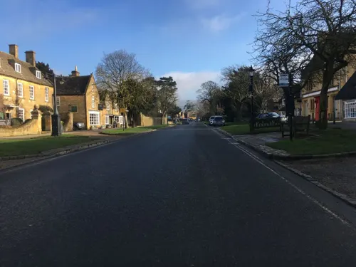
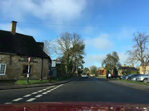
Broadway is a large village and civil parish in the Cotswolds, England, with a population of 3,478 at the 2021 census. It is in the far southeast of Worcestershire, close to the Gloucestershire border, midway between Evesham and Moreton-in-Marsh.
From the Wikipedia article Broadway, Worcestershire (this version), under CC BY-SA 4.0.
Travel tips from other travellers: Broadway on Wikivoyage (CC BY-SA 4.0).
Photos of Broadway

Things to do6


Museums and landmarks29


Broadway War Memorial
Monument and historic site
War memorial in Broadway, Worcestershire, England, UK


Snowshill Manor
Monument and historic site · 2.4 mi
Historic house museum in Gloucestershire, England, UK

Stanway House
Museum · 4.0 mi
Grade I listed historic house museum in Stanway, Tewkesbury, Gloucestershire, England, UK
Stanway War Memorial
Monument and historic site · 4.1 mi
War memorial in Stanway, Tewkesbury, Gloucestershire, England, UK

Cotswold Lavender (Hill Barn Farm Cottage)
Monument and historic site · 2.4 mi
Snowshill Road
Mo-Su 10:00-17:00
Snowshill Manor and Garden
Monument and historic site · 2.4 mi
17 more on the map.
Parks, trails and playgrounds12

Cutsdean Quarry
Park · 3.9 mi
Nature reserve in Gloucestershire, England



Restaurants and cafes25



13 more on the map.
History
Broadway is an ancient settlement whose origins are uncertain. There is documentary evidence of activity in the area as far back as Mesolithic times. In 2004, the Council for British Archaeology's Worcestershire Young Archaeologists' Club found evidence of early occupation. Their fieldwork uncovered a large amount of Roman and medieval domestic waste and, most importantly, a large amount of worked Mesolithic flints, raising the possibility that the site might have been a stopping point for hunter-gatherers. This work makes the known history of the village to be over 5,000 years and so may be evidence of one of the first partially settled sites in the United Kingdom. Broadway has also seen the settlement of the ancient Beaker people (1900 BCE), and later, the Roman occupation. It gained the name Bradsetena Gamere (Broad Village) around the 9th century and underwent a number of changes until the modern spelling 'Broadway' became common usage in the 16th century.
Read more of the history
Broadway was a domain of the Mercian kings and was vested in the Crown in the person of King Edgar in 967. The first existing documentary evidence of importance is embodied in a charter that King Edgar granted to the Benedictine Monastery of Pershore in 972. In this Anglo-Saxon text, Broadway is called Bradanwege and its boundaries are described in great detail. The complete copy of the charter may be seen in the British Museum (Facsimile Volume III 30).
By the 11th century the village was already well established and apparently thriving. It is listed in the Domesday Book in Great Domesday folio 175 for Worcestershire as part of the land holdings of the Church of St Mary of Pershore: "The church itself holds Bradeweia. There are 30 hides paying geld. In demesne are 3 ploughs; and a priest and 42 villeins with 20 ploughs. There are 8 slaves. The whole in the time of Edward was worth £12 10s 0d; now £14 10s 0d."
It continued to prosper, becoming a borough by the 13th century. For Broadway this marked a considerable departure from the entirely peasant community that had existed in former times, though the following two centuries saw it decline in the wake of the Black Death. Its fortunes were revived during the late 16th century after the dissolution of the monasteries relieved Pershore Abbey of ownership in 1539. The Crown sold the Manor of Broadway in 1558. There followed three centuries of almost unbroken growth, during which the population increased to about five times its Elizabethan level. As in other Cotswold towns, wealth was based on the wool and cloth trade. In the first half the 19th century Broadway was part of a short-lived Cotswolds silk industry, centred on Blockley, with a water-powered silk mill.
By around 1600 the village had become a busy stagecoach stop on the route from Worcester to London. The village provided all the services that might be needed, including grooms, places of refreshment and extra horses for the steep haul up Fish Hill, a former quarry. As a result, there were once as many as 33 public houses in Broadway compared to the three which exist today.
The road between Evesham and the summit of Fish Hill became a toll road as a result of legislation dated 1728. Tolls were collected at Turnpike House, which can be found (now renamed Pike Cottage) in the Upper High Street. However, the introduction of the railways in Britain in the mid-19th century reduced the passing trade on which Broadway relied. Travel by stagecoach stopped almost immediately with the opening of the railway in Evesham in 1852.
Stripped of its role of staging post, Broadway became a backwater; a haven of peace and tranquillity. Victorian artists and writers were drawn to the village's calm and the famous Arts and Crafts movement made its home in the area. The artists and writers to whom Broadway became home included Edwin Austin Abbey, Mary Anderson, J. M. Barrie, Arthur Blomfield, Elgar, Francis Davis Millet, William Morris, John Singer Sargent and Vaughan Williams.
Blomfield lived at Springfield House and is buried in Broadway.
Millet died in the sinking of the Titanic aged 65 and is commemorated by a memorial at St Eadburgha's Churchyard, Broadway. In 1932 Millet's son Jack donated £120 to St Eadburgha's Church for the construction of lychgates in his father's memory at the churchyard on Snowshill Road.
Broadway is thought (by Sir Steven Runciman (1903–2000), a Cambridge historian who knew Benson well) to have been the model for a fictional Elizabethan village in the Cotswolds, Riseholme, the home of Lucia in the novels of E. F. Benson, before she moved to Tilling (based on Rye in East Sussex).
The arrival of the motor-car at the turn of the 20th century, and the advent of popular tourism, restored Broadway's vitality, placing it now among the most frequently visited of all Cotswold villages. In 1934 J. B. Priestley published his book English Journey, a travelogue in which he re-visits areas of the Cotswolds, including Broadway. He described the Cotswolds as "the most English and the least spoiled of all our countrysides. The truth is that it has no colour that can be described. Even when the sun is obscured and the light is cold, these walls are still faintly warm and luminous, as if they knew the trick of keeping the lost sunlight of centuries glimmering about them."
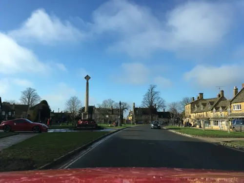
The war memorial on the village green, dating from 1920, marks the deaths of local individuals who died fighting in World War I and World War II.
From the History section of Broadway, Worcestershire on Wikipedia, under CC BY-SA 4.0.
Where to stay19
Old Station House Bed & Breakfast
Motel and hotel · 0.6 mi
Station Road, Broadway
Churches and places of worship12
Shopping31
Gas and EV charging3
Schools, colleges and libraries5
Healthcare1
Map of Broadway
143 places. The map loads OpenStreetMap tiles when you open it.
Getting there and nearby towns
Gloucestershire Airport (GLO) is the nearest airport with scheduled flights listed in OpenStreetMap, 17 miles away.
- Chipping Campden 4 mi east, about 6 min by car
- Honeybourne 4 mi north, about 7 min by car
- Evesham 5 mi northwest, about 9 min by car
- Blockley 5 mi southeast, about 7 min by car
- South Littleton 5 mi north, about 9 min by car
- Moreton in Marsh 8 mi southeast, about 12 min by car
- Harvington 8 mi north, about 12 min by car
- Stow on the Wold 9 mi southeast, about 15 min by car
- Bishops Cleeve 11 mi southwest, about 17 min by car
- Cheltenham 13 mi southwest, about 21 min by car
Drive times are estimates from straight-line distance, not routes.
Towns near Broadway


Keep exploring
Local news
Headlines from INDB.
Reviews, tips and questions
Loading what members have shared...
Sources and licences
- GeoNames (CC BY 4.0): population, coordinates, regions and time zone
- Mapillary (see each image): photos
- OpenStreetMap contributors (ODbL 1.0): places, airports, map data
- Wikidata (CC0 1.0): elevation, founding date, time zone, website, landmarks and historic places
- Wikimedia Commons (see each image): photos
- Wikipedia (CC BY-SA 4.0): overview and history text
Photo credits
- Broadway-02, Mrfinch, CC BY-SA 3.0
- The Gordon Russell Museum Broadway - panoramio, cowbridgeguide.co.uk, CC BY 3.0
- Broadway Banner, Michael Dibb, CC BY-SA 2.0
- Snowshill Manor exterior, Celuici, CC0
- StanwayHouse(PhilipHalling)Jun2006, Philip Halling, CC BY-SA 2.0
- East Banqueting StJames Chipping Campden, Saffron Blaze, CC BY-SA 3.0
- Broadway tower edit, The author is Newton2 (cropped by Yummifruitbat ), CC BY 2.5
- St-Eadburgha Church Broadway, Saffron Blaze, CC BY-SA 3.0
- Lygon Arms Broadway (6026089611), Tony Hisgett from Birmingham, UK, CC BY 2.0
- Church of St. Mary the Virgin, Childswickham 38, Simon Burchell, CC BY-SA 4.0
- The Bell Inn, Willersey, DeFacto, CC BY-SA 4.0
- Big shop - panoramio, cowbridgeguide.co.uk, CC BY 3.0
- Broadway War Memorial, Worcestershire, Mertbiol, CC0
- Street-level photo, southglos, CC BY-SA 4.0
- Street-level photo, southglos, CC BY-SA 4.0
- Street-level photo, southglos, CC BY-SA 4.0
- Street-level photo, southglos, CC BY-SA 4.0
- Street-level photo, southglos, CC BY-SA 4.0
- Street-level photo, southglos, CC BY-SA 4.0
- Street-level photo, southglos, CC BY-SA 4.0
- Street-level photo, southglos, CC BY-SA 4.0
- Street-level photo, southglos, CC BY-SA 4.0
- Street-level photo, southglos, CC BY-SA 4.0
- Street-level photo, southglos, CC BY-SA 4.0
- Street-level photo, southglos, CC BY-SA 4.0
- Street-level photo, trigpoint, CC BY-SA 4.0
- Street-level photo, southglos, CC BY-SA 4.0
- Street-level photo, southglos, CC BY-SA 4.0
- Street-level photo, southglos, CC BY-SA 4.0
- Street-level photo, southglos, CC BY-SA 4.0


Page built November 10, 2026. Spotted a mistake? Tell us or suggest a place.