


Why visit Brora
Townapedia lists 10 museums and landmarks, 1 park or trail, 6 places to eat, 3 places to stay and 1 attraction in and around town.
Highlights include Carn Liath.
Weather in Brora
Forecast from MET Norway (CC BY 4.0). Full forecast
About Brora
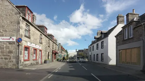
Brora ( ; Scottish Gaelic: Brùra) is a village in the east of Sutherland, in the Highland area of Scotland.
From the Wikipedia article Brora (this version), under CC BY-SA 4.0.
Things to do1

Museums and landmarks10

Carn Liath
Monument and historic site · 2.7 mi
Tower in Highland, Scotland, UK

Parks, trails and playgrounds1

Restaurants and cafes6


History
Brora is a small industrial village, having at one time a coal pit, boat building, salt pans, fish curing, lemonade factory, the new Clynelish Distillery (as well as the old Clynelish distillery which is now called the Brora distillery
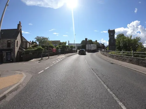
), wool mill, bricks and a stone quarry. The white sandstone in the Clynelish quarry belongs to the Brora Formation, of the Callovian and Oxfordian stages (formerly Middle Oolite) of the Mid-Late Jurassic. Stone from the quarry was used in the construction of London Bridge, Liverpool Cathedral and Dunrobin Castle. When in operation, the coalmine was the most northerly coalmine in the UK. A comparison of the first and second edition Six-inch Ordnance Survey maps gives an interesting picture of Brora's industrial development. Brora was the first place in the north of Scotland to have electricity thanks to its wool industry. This distinction gave rise to the local nickname of "Electric City" at the time. Brora also houses a baronial style clock tower which is a war memorial.
Like many of the smaller fishing ports, Brora's involvement with fishing declined in the years before the First World War. In the 1906 report by the Fishery Board we read that Brora was "becoming yearly more popular as a summer resort and declining as a fishing port. A considerable number of the fishermen find employment ashore as labourers during the greater part of the year".
From the History section of Brora on Wikipedia, under CC BY-SA 4.0.
More about Brora
Education
An education is available for primary school children in Brora Primary School in Johnstone Place. The building was formerly Brora High School, that included the primary department. Although the school opened in 1962, the secondary department closed in 1985. It includes a playgroup, nursery and Primaries 1 to 7. Older children are taken by school transportation to the nearby Golspie High School.
From the Wikipedia article Brora, under CC BY-SA 4.0.
Notable people from Brora
- Donald Mackayfur trader
- Alisdair Sutherlandassociation football player
- Isabella Mackay(1777/8–1850), UK philanthropist and religious activist
Born in Brora, according to Wikidata (CC0). Each name links to its Wikipedia article.
Where to stay3
Churches and places of worship4
Shopping3
Gas and EV charging2
Schools, colleges and libraries2
Map of Brora
32 places. The map loads OpenStreetMap tiles when you open it.
Getting there and nearby towns
RAF Lossiemouth (LMO) is the nearest airport with scheduled flights listed in OpenStreetMap, 29 miles away.
- Golspie 5 mi southwest, about 9 min by car
- Dornoch 11 mi southwest, about 18 min by car
- Nairn 30 mi south, about 48 min by car
- Evanton 30 mi southwest, about 48 min by car
- Fortrose 31 mi south, about 51 min by car
- Elgin 32 mi southeast, about 51 min by car
- North Kessock 38 mi southwest, about 1 h by car
- Inverness 39 mi south, about 1 h by car
- Fochabers 39 mi southeast, about 1 h by car
- Strathpeffer 39 mi southwest, about 1 h by car
Drive times are estimates from straight-line distance, not routes.
Towns near Brora


Keep exploring
Local news
Headlines from INDB.
Reviews, tips and questions
Loading what members have shared...
Sources and licences
- GeoNames (CC BY 4.0): population, coordinates, regions and time zone
- Mapillary (see each image): photos
- OpenStreetMap contributors (ODbL 1.0): places, airports, map data
- Wikidata (CC0 1.0): elevation, founding date, time zone, website, landmarks and historic places
- Wikimedia Commons (see each image): photos
- Wikipedia (CC BY-SA 4.0): overview and history text
Photo credits
- Broch Carn Liath 02, Bubobubo2, CC BY-SA 3.0
- Clynelish Distillery. - panoramio, Alan Jamieson, CC BY-SA 3.0
- Brora Distillery - panoramio (1), Alan Jamieson, CC BY-SA 3.0
- Street-level photo, rudolfmayer, CC BY-SA 4.0
- Street-level photo, toho, CC BY-SA 4.0
- Street-level photo, hobgoblin, CC BY-SA 4.0
- Street-level photo, hobgoblin, CC BY-SA 4.0
- Street-level photo, tallguy, CC BY-SA 4.0
- Street-level photo, rudolfmayer, CC BY-SA 4.0
- Street-level photo, joostjakob, CC BY-SA 4.0
- Street-level photo, hobgoblin, CC BY-SA 4.0
- Street-level photo, rudolfmayer, CC BY-SA 4.0
- Street-level photo, rudolfmayer, CC BY-SA 4.0
- Street-level photo, rudolfmayer, CC BY-SA 4.0
- Street-level photo, hobgoblin, CC BY-SA 4.0
Page built November 10, 2026. Spotted a mistake? Tell us or suggest a place.