


Burngreave, United Kingdom
Burngreave is a town of 27,481 people in England, United Kingdom.
Why visit Burngreave
Townapedia lists 96 museums and landmarks, 77 parks and trails, 179 places to eat, 25 places to stay and 20 attractions in and around town.
Highlights include Showroom Cinema, Sheffield City Hall, Kelham Island Museum and National Emergency Services Museum.
Weather in Burngreave
Forecast from MET Norway (CC BY 4.0). Full forecast
About Burngreave
Burngreave is an inner city district of Sheffield, South Yorkshire, England lying north of the city centre. The population of the ward taken at the 2011 census was 27,481. It started to develop in the second half of the 19th century. Prior to this, this area was mostly covered by Burnt Greave wood.
From the Wikipedia article Burngreave (this version), under CC BY-SA 4.0.
Things to do20

Showroom Cinema
Cinema and theater · 1.1 mi
Mo,Th 10:00-21:00; Tu,We,Fr,Su 11:30-21:00; Sa 10:30-21:00


Crucible Theatre
Cinema and theater · 0.9 mi
Theatre and event venue in Sheffield, England

Lady's Bridge
Bridge · 0.6 mi
Grade II listed bridge in Sheffield, South Yorkshire, England, UK

Lantern Theatre
Cinema and theater · 2.2 mi
Theatre in Sheffield, England

Lyceum Theatre
Cinema and theater · 0.9 mi
Theatre in Sheffield, England

Sheffield Theatres
Cinema and theater · 0.9 mi
Theatre complex in Sheffield, South Yorkshire, England

The Crucible
Cinema and theater · 0.9 mi
55 Norfolk Street, Sheffield


Tanya Moiseiwitsch Playhouse
Cinema and theater · 0.9 mi
55 Norfolk Street, Sheffield
8 more on the map.
Museums and landmarks96

Kelham Island Museum
Museum · 0.7 mi
Museum in Sheffield, England
Alma Street, Sheffield
Tu-Sa 10:00-16:00; Su 11:00-16:00

National Emergency Services Museum
Museum · 0.7 mi
Museum in Sheffield, England
101-109 West Bar, Sheffield
We-Su 10:00-16:00; Mo,Tu off

Site Gallery
Museum · 1.2 mi
Art gallery in Sheffield, England
1 Brown Street, Sheffield
Tu-Sa 11:00-17:00; Su 11:00-16:00; Mo off

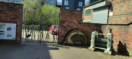
Ken Hawley Collection
Museum · 0.7 mi
Alma Street, Sheffield
Tu-Sa 10:00-16:00; Su 11:00-16:00; Mo off

Millennium Gallery
Museum · 1.0 mi
Art gallery and museum in the centre of Sheffield, England
Tu-Sa 10:00-17:00; Su 11:00-16:00



Sheffield War Memorial
Monument and historic site · 1.1 mi
War memorial in Sheffield, South Yorkshire, England, UK
"Mi Amigo" memorial
Monument and historic site · 2.6 mi
War memorial in Sheffield, England marking the World War II crash site of the USAAF B-17 Flying Fortress "Mi Amigo"

84 more on the map.
Parks, trails and playgrounds77


Winter Garden
Park · 1.0 mi
Surrey Street
Mo-Sa 08:00-20:00; Su,PH 10:00-17:00



Bingham Park and Whiteley Woods
Park · 3.2 mi
Park and woods in South Yorkshire, England
Blackburn Meadows
Park · 3.0 mi
Area of land inside the Sheffield city at Tinsley
Chelsea Park
Park · 3.0 mi
Park in Nether Edge & Sharrow, United Kingdom
Cholera Monument Grounds and Clay Wood
Park · 1.2 mi
Park in Sheffield, South Yorkshire, England, UK
65 more on the map.
Restaurants and cafes179



The Bankers Draft
Bar and pub · 0.8 mi
1,3 Market Place, Sheffield
Mo-Th,Su 07:00-00:00; Fr-Sa 07:00-01:00
Butler's Balti House
Restaurant · Indian · 1.0 mi
44-46 Broad Lane, Sheffield
Su-Th 16:30-23:30, Fr,Sa 16:30-00:30
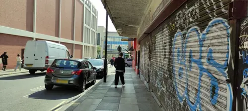
China Red
Restaurant · Chinese · 1.3 mi
3 Rockingham Gate, Sheffield
Su-Th 12:00-21:30; Fr-Sa 12:00-22:00


Caffè Nero
Cafe · Coffee Shop · 0.9 mi
2 High Street, Sheffield
Mo-Fr 06:30-18:30; Sa 07:30-18:30; Su 08:00-18:00
The Cabin
Cafe · Pancake, Waffle, Breakfast, Brunch, Coffee Shop · 1.4 mi
Pancake, waffle and coffee house.
10-12 Fitzwilliam Gate, Sheffield
Mo,We-Su 09:00-16:00; Tu off


Cosy Club
Restaurant · British · 1.1 mi
1 Holly Street, Sheffield
Mo-Th 12:00-22:00; Fr 12:00-23:00; Sa 11:00-23:30; Su 11:00-22:00
Grand Kerala
Restaurant · Indian · 1.1 mi
33 Carver Street, Sheffield
Mo-Fr 17:00-22:00; Sa,Su 13:00-22:00
167 more on the map.
History
Although there is not much physical evidence of early settlement in Burngreave, we do know that an Iron Age fort was discovered in Roe Woods. The people who built this may have been from a Celtic tribe, the Brigantes. In the early 20th century you could still see the circular banks of the fort they had built. In 1922, however, it was destroyed to build a sports ground (now owned by Sheffield United FC).
There is very little evidence of the Roman presence in Burngreave. A hoard of 13 coins was found in Pitsmoor in 1906.
Around the mid 9th century the north of England fell under Danish control. Several local place names suggest Viking settlement in the area. Osgathorpe (an old Danish name) means the farm belonging to Osga and Grimesthorpe means Grims outlying farm. From this we can imagine that the area was occupied by a farming community at a time when Sheffield was still a small, insignificant place. The name of Roe Wood may possibly be derived from the old Norse word ra meaning rowan tree.
In the 12th century, a local lord of the manor founded a hospital in the area, called St Leonards. Although there is no trace of it remaining, the name has been passed on to streets in the vicinity, called Spital Hill and Spital Lane (as in hospital).
In the 13th century, a Norman family called De Mounteney were prominent in the area and owned land around Shirecliffe and Grimesthorpe.
Read more of the history
In the 15th century and 16th century, Burngreave was an area of open countryside with scattered farms, fields and woodland. The name Burngreave was first recorded in 1440 as Byron Greve, meaning Bryons Wood. This is shown in early maps on the site currently occupied by Burngreave Cemetery and along Burngreave Road. During the Tudor period Sheffield began to grow but Burngreave remained on the outskirts. Looking back from the top of Pitsmoor at that time, you would have seen rolling hills and farmland leading down to Lady's Bridge where a cluster of shops and houses had developed around the market place next to Sheffield Castle.
During the 18th century and 19th century the area remained still largely rural but industry was beginning to have an impact. In the 1820s the town of Sheffield stopped at the Wicker, below Spital Hill. Pitsmoor was just a hamlet through which the main turnpike road ran from Sheffield to Barnsley and Wakefield. Industry in the area was mostly in the form of small workshops, attached to farm buildings, producing knives and tools for a local market. There were no factories as yet. Maps from the 1830s and 40s show farmsteads, fields, some woodland and a few scattered mansions that belonged to the wealthy elite of Sheffield. At this time Burngreave was considered a highly desirable place for rich families to build new homes in. Mansions such as Osgathorpe House and Firs Hill (both now demolished) were built during this period.
By 1870 a dramatic transformation had taken place. The arrival of heavy steel and engineering industries, concentrated in the Don Valley, created jobs for migrant workers from all over England and as far away as Ireland. Development of the railways and roads also contributed to the expansion of Sheffield as a centre for craftsmanship and industry.
Between 1820 and 1860 the population of Sheffield tripled from just over 65,000 to 185,000. In Burngreave many new houses including a group of cottages built by William Pass and occupied by miners called Pass-houses (now this location is called Passhouses Road), to accommodate the workforce of nearby industries. These were often terraced or constructed around courts and changed the character of the area completely. Neighbourhoods such as Ellesmere and Woodside became established. In the 1870s the writer Alfred Gatty described the view from Osgathorpe down into the Don Valley: “….there stands, as it were, Dante's city of Dis…masses of buildings, from the tops of which issue fire, and smoke, and steam, which cloud the whole scene, however bright the sunshine.” A drawing from 1879 of John Sorbys Spital Hill steel works captures this atmosphere completely.
Despite this grim picture of development, the higher part of Burngreave was far enough away from the noise and pollution to remain popular with Sheffield's industrialists and professional classes. Abbeyfield House was built during the late 19th century by William Pass as his own residence. Originally called Pitsmoor Abbey, it first belonged to William Pass, the owner of a local colliery, then the house was bought by a solicitor, Bernard Wake, who turned it into the family home. He altered the house greatly, adding a sundial, conservatory, greenhouses, a tennis court and outhouses. The gardens were redesigned and a boating lake created around 1883. In the early 20th century Abbeyfield House was occupied by the Greenwood family and then into the possession of the Sheffield Parks Department Training Centre.
By the late 19th century much of the former countryside of Burngreave was covered in houses. Along with these were created the Vestry Hall in 1864 to administer civic functions. Schools, churches, pubs and allotments were also created in the 19th century. The first school, Pitsmoor Village School, was opened in 1836. In 1861 Burngreave cemetery was laid out to accommodate the overflow from local church yards as these were full. A cinema and public baths were built in the early 20th century. By this time, Burngreave was a suburb of Sheffield, still prosperous and considered a pleasant place to live. It did, however, have an interesting mix of wealthy and working class residents. Occasional declines in the fortunes of the cutlery trade resulted in periods of unemployment and great hardship for many poorer families in the area. A cartoon from a newspaper in 1879 shows a soup kitchen operating from the Vestry Hall, turning away barefoot and hungry children.
From the History section of Burngreave on Wikipedia, under CC BY-SA 4.0.
Where to stay25
Miller & Carter Sheffield by Innkeeper's Collection
Motel and hotel · 1.0 mi
55 Surrey Street, Sheffield
Premier Inn Sheffield City Centre (St Mary's Gate)
Motel and hotel · 1.5 mi
7 Young Street, Sheffield
Earl Marshall Guest House
Motel and hotel · 1.2 mi
949 Grimesthorpe Road, Sheffield
Churches and places of worship70
Baitul Afiyat Mosque
Place of worship · Ahmadiyya · 0.5 mi
60 Sussex Street, Sheffield
Shopping84
Gas and EV charging7
Schools, colleges and libraries42
Emmaus Catholic and CofE Primary School
School · Anglican, Roman Catholic · 1.4 mi
Southend Road, Sheffield
Healthcare30
Map of Burngreave
250 places. The map loads OpenStreetMap tiles when you open it.
Getting there and nearby towns
Leeds Bradford Airport (LBA) is the nearest airport with scheduled flights listed in OpenStreetMap, 34 miles away.
- Sheffield 1 mi southwest, about 1 min by car
- Rotherham 5 mi northeast, about 8 min by car
- Fulwood 5 mi southwest, about 8 min by car
- Chapeltown 5 mi north, about 8 min by car
- Dronfield 6 mi south, about 10 min by car
- Rawmarsh 7 mi northeast, about 11 min by car
- Beighton 7 mi southeast, about 11 min by car
- Hoyland Nether 7 mi north, about 12 min by car
- Stocksbridge 8 mi northwest, about 13 min by car
- Wath upon Dearne 9 mi northeast, about 14 min by car
Drive times are estimates from straight-line distance, not routes.
Towns near Burngreave


Keep exploring
Local news
Headlines from INDB.
Reviews, tips and questions
Loading what members have shared...
Sources and licences
- GeoNames (CC BY 4.0): population, coordinates, regions and time zone
- Mapillary (see each image): photos
- OpenStreetMap contributors (ODbL 1.0): places, airports, map data
- Wikidata (CC0 1.0): elevation, founding date, time zone, website, landmarks and historic places
- Wikimedia Commons (see each image): photos
- Wikipedia (CC BY-SA 4.0): overview and history text
Photo credits
- Sheffield Lyceum 18-12-06, Gregory Deryckère, CC BY 2.5
- Kelham Island Museum, Steel Ladle, Mick Knapton, CC BY-SA 4.0
- FireMuseumS3 8PT, Chemical Engineer, Public domain
- Site Gallery, Simon Cobb, CC0
- TurnerMuseum02, Chemical Engineer, Public domain
- Millennium Galleries, Warofdreams, CC BY-SA 3.0
- Bishops House 2011, Chemical Engineer, CC BY-SA 3.0
- Weston Park, Simon Cobb, CC0
- Crookes Valley Park 1, Mick Knapton, CC BY-SA 3.0
- Endcliffe Park, Sheffield, Shanerounce, CC BY-SA 4.0
- Upper Chapel Sheffield, Warofdreams, CC BY-SA 3.0
- All Saints Church, Sheffield, Graham Hogg, CC BY-SA 2.0
- Attercliffe Chapel, Warofdreams, CC BY-SA 4.0
- Banner Cross Methodists, Mick Knapton, CC BY-SA 3.0
- ST Marks Church Sheffield UK 2009, Wikityke, CC BY-SA 1.0
- St Silas Church Sheffield 2017, DrStrauss, CC BY-SA 4.0
- Sheffield - Former Glossop Road Baptist Church - 2, This illustration was made by Peter Potrowl . Please credit this with : © Peter Potrowl in the immediate vicinity of the image. A link to my website sitemai.eu would be much appreciated but isn't..., CC BY-SA 4.0
- Sheffield Crucible theatre, St BC at English Wikipedia, CC BY-SA 3.0
- Showroom and Workstation, Sheffield, Warofdreams, CC BY-SA 3.0
- Sheffield city hall 3, St BC at English Wikipedia, CC BY-SA 3.0
- Sheffield skyline at night, June 2013., Benedict Hunjan, CC BY-SA 3.0
- Bankers Draft, Warofdreams, CC BY-SA 3.0
- 2-12, Division Street, Simon Cobb, CC0
- 2 and 3 East Parade, Sheffield, Warofdreams, CC BY-SA 3.0
- National Videogame Museum, Frombowen, CC BY-SA 4.0
- Sheffield Theatres, BCDS, CC BY-SA 4.0
- Atkinsons Department Store Sheffield, EffectiveWiki, CC0
- Lantern Theatre, Warofdreams, CC BY-SA 3.0
- Pound's Park, Sheffield, Mick Knapton, CC BY 4.0
- Sheffield - Lady's Bridge, Dave Bevis, CC BY-SA 2.0
- Tinsley viaduct at sunset, Liz Jones from Sheffield, UK, CC BY 2.0
- IceSheffield, BCDS, CC BY-SA 4.0
- Street-level photo, skifans, CC BY-SA 4.0
- Street-level photo, jethro10, CC BY-SA 4.0
- Street-level photo, jethro10, CC BY-SA 4.0
- Street-level photo, jethro10, CC BY-SA 4.0
- Street-level photo, sk53_quint, CC BY-SA 4.0
- Street-level photo, jethro10, CC BY-SA 4.0
- Street-level photo, wasd42, CC BY-SA 4.0
- Street-level photo, skifans, CC BY-SA 4.0
- Street-level photo, skifans, CC BY-SA 4.0
- Street-level photo, jethro10, CC BY-SA 4.0
- Street-level photo, wasd42, CC BY-SA 4.0
- Street-level photo, jethro10, CC BY-SA 4.0
- Street-level photo, ars22cc, CC BY-SA 4.0
- Street-level photo, skifans, CC BY-SA 4.0
- Street-level photo, adam2, CC BY-SA 4.0
- Street-level photo, jethro10, CC BY-SA 4.0
- Street-level photo, sk53_quint, CC BY-SA 4.0
- Street-level photo, sk53_quint, CC BY-SA 4.0
- Street-level photo, jethro10, CC BY-SA 4.0
- Street-level photo, jethro10, CC BY-SA 4.0
- Street-level photo, skifans, CC BY-SA 4.0


Page built November 10, 2026. Spotted a mistake? Tell us or suggest a place.