


Chapeltown, United Kingdom
Chapeltown is a town of 23,056 people in England, United Kingdom.
Why visit Chapeltown
Townapedia lists 3 museums and landmarks, 13 parks and trails, 51 places to eat and 2 places to stay in and around town.
Highlights include Elsecar Heritage Centre, Chapeltown War Memorial, Longley Park and Concord Park.
Weather in Chapeltown
Forecast from MET Norway (CC BY 4.0). Full forecast
About Chapeltown
Chapeltown is a small town in South Yorkshire, England. It lies half way between Barnsley and Sheffield approximately 7 miles from both. It is part of the civil parish of Ecclesfield. Chapeltown is historically within the West Riding of Yorkshire.
From the Wikipedia article Chapeltown, South Yorkshire (this version), under CC BY-SA 4.0.
Museums and landmarks3

Elsecar Heritage Centre
Museum · 2.9 mi
Living history museum in Elsecar, England

Parks, trails and playgrounds13


Greno Woods
Park · 1.5 mi
Woodland in Ecclesfield, South Yorkshire, England


1 more on the map.
Restaurants and cafes51



39 more on the map.
Where to stay2


History
Until industrial expansion, Chapeltown was a hamlet that originated at the intersection of the roads between Sheffield and Barnsley and between Rotherham and Wortley. In the late 16th century a blast furnace was installed there which initially used charcoal, and from 1780 was fired with coke. Chapeltown was part of the ecclesiastical parish of Ecclesfield and had a population of 4063 persons around 1870. Coal mining was one of the main occupations of the inhabitants.
The works of Newton, Chambers & Company were first established in Chapeltown in 1793. Initially they were an iron works specialising in cast iron products, but over time the company expanded into related mining industries and products from the fractional distillation of coal, including the Izal disinfectant range. In the Second World War they produced Churchill tanks. The company's site is now Thorncliffe Industrial Estate, where most of the industry in Chapeltown is located.
In 2025, Sheffield City Council released a shortlist of Green belt land that was to be released for development, which included Chapeltown as the location for 549 homes. After the announcement was made, the campaign group Save Chapeltown, Ecclesfield and Grenoside Greenbelt was formed and has accumulated over 5000 followers on facebook.
Read more of the history
The council will receive a final report, which includes public responses, and are set to decide on the plan before the conclusion of the process in July.
From the History section of Chapeltown, South Yorkshire on Wikipedia, under CC BY-SA 4.0.
More about Chapeltown
Geography
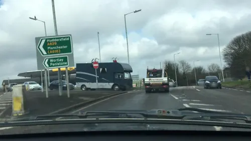
Chapeltown is located 7 miles (11 km) south of the centre of Barnsley and approximately 7 miles (11 km) north of the centre of the city of Sheffield, it lies on the railway between Barnsley and Sheffield. Chapeltown railway station is served by the Penistone Line and Hallam Line. Two junctions of the M1 motorway also serve the area. The A6135 road passes through the town from north to south and is joined near the town centre by the A629 road from the south-east and the B6546 road from the west.
Although near the M1 motorway, there is a large amount of greenspace in and around Chapeltown. The town centre has a cricket ground and a wooded park on either side of it. Between Chapeltown and Ecclesfield the land is used for residential purposes on one side of the main road and agricultural on the other. There is also a brownfield site above the park.
From the Wikipedia article Chapeltown, South Yorkshire, under CC BY-SA 4.0.
Notable people from Chapeltown
- Angela PleasenceBritish actress
- Andy BrownriggEnglish footballer (born 1976)
- Alfred BrownEnglish footballer (1898-1989)
- Dave WiggettEnglish footballer (1957-1978)
- Ted DransfieldEnglish football player (1906-1986)
- Jeff SmithEnglish former professional footballer (born 1935)
- Tony GreenfieldBritish statistical consultant (1931–2019)
- Bernard BilcliffEnglish footballer
- Harold KayEnglish footballer
- Ernest MyersEnglish footballer
Born in Chapeltown, according to Wikidata (CC0). Each name links to its Wikipedia article.
Churches and places of worship14
The Methodist Church, Chapeltown
Church · Methodist
1 Nether Ley Avenue, Sheffield
Shopping6
Gas and EV charging3
Schools, colleges and libraries12
Healthcare3
Map of Chapeltown
107 places. The map loads OpenStreetMap tiles when you open it.
Getting there and nearby towns
Leeds Bradford Airport (LBA) is the nearest airport with scheduled flights listed in OpenStreetMap, 29 miles away.
- Hoyland Nether 3 mi north, about 4 min by car
- Rotherham 5 mi southeast, about 9 min by car
- Wombwell 5 mi northeast, about 8 min by car
- Stocksbridge 5 mi west, about 8 min by car
- Rawmarsh 5 mi east, about 8 min by car
- Sheffield 6 mi south, about 9 min by car
- Wath upon Dearne 6 mi northeast, about 9 min by car
- Mexborough 8 mi east, about 12 min by car
- Cudworth 8 mi north, about 12 min by car
- Penistone 8 mi northwest, about 12 min by car
Drive times are estimates from straight-line distance, not routes.
Towns near Chapeltown


Keep exploring
Local news
Headlines from INDB.
Reviews, tips and questions
Loading what members have shared...
Sources and licences
- GeoNames (CC BY 4.0): population, coordinates, regions and time zone
- Mapillary (see each image): photos
- OpenStreetMap contributors (ODbL 1.0): places, airports, map data
- Wikidata (CC0 1.0): elevation, founding date, time zone, website, landmarks and historic places
- Wikimedia Commons (see each image): photos
- Wikipedia (CC BY-SA 4.0): overview and history text
Photo credits
- Chapeltown - St John's Church, Dave Bevis, CC BY-SA 2.0
- StMarksGrenoside, Chemical Engineer, Public domain
- St Pauls, Wordsworth Avenue, Mick Knapton, CC BY-SA 3.0
- Ecclesfield Church, Mick Knapton ( talk ), CC BY-SA 3.0
- Whitley Hall, Sheffield, Mick Knapton, CC BY-SA 3.0
- Longley Park main entrance, Mick Knapton, CC BY-SA 3.0
- Elsecar Heritage Centre Sentinel Elizabeth locomotive - November 2017, Neil Turner, CC BY-SA 2.0
- Street-level photo, lvl5, CC BY-SA 4.0
- Street-level photo, lvl5, CC BY-SA 4.0
Page built November 10, 2026. Spotted a mistake? Tell us or suggest a place.