


Burnham-on-Sea, United Kingdom
Burnham-on-Sea is a town of 23,325 people in England, United Kingdom.
Why visit Burnham-on-Sea
Townapedia lists 7 parks and trails, 18 places to eat, 4 places to stay and 4 attractions in and around town.
Highlights include Burnham-on-Sea High Lighthouse, Burnham-on-Sea Low Lighthouse and Apex Leisure and Wildlife Park.
Weather in Burnham-on-Sea
Forecast from MET Norway (CC BY 4.0). Full forecast
About Burnham-on-Sea
Burnham-on-Sea is a seaside town in Somerset, England, at the mouth of the River Parrett, on Bridgwater Bay. Burnham was a small fishing village until the late 18th century when it began to grow because of its popularity as a seaside resort.
From the Wikipedia article Burnham-on-Sea (this version), under CC BY-SA 4.0.
Photos of Burnham-on-Sea


Things to do4

Burnham-on-Sea High Lighthouse
Lighthouse · 0.7 mi
Lighthouse in Burnham-on-Sea and Highbridge, Sedgemoor, Somerset, England, UK
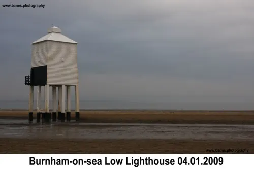
Burnham-on-Sea Low Lighthouse
Lighthouse · 0.8 mi
Lighthouse in Burnham-on-Sea and Highbridge, Sedgemoor, Somerset, England, UK

Burnham-on-Sea Round Tower
Lighthouse
Lighthouse in Somerset, England

Brean Leisure Park
Monument and historic site · 3.3 mi
Amusement park in the coastal resort of Brean, near Burnham-on-Sea, Somerset, England, UK
Parks, trails and playgrounds7

Apex Leisure and Wildlife Park
Park · 1.0 mi
Park and wildlife centre in England, United Kingdom


Restaurants and cafes18
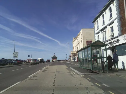
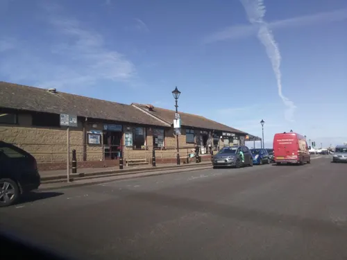
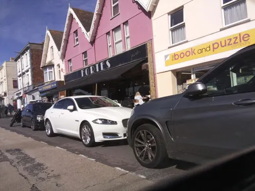
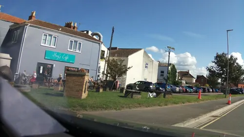



6 more on the map.
Where to stay4
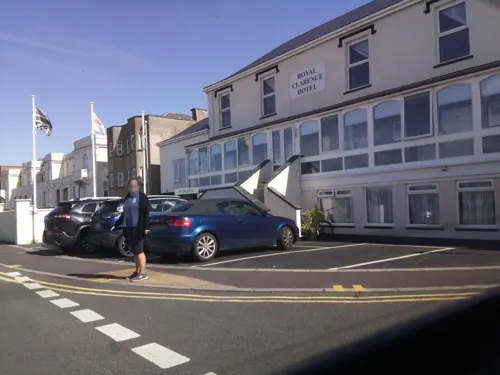

Haven Burnham-on-Sea Holiday Village
Campground · 0.8 mi
Marine Drive, Burnham-on-Sea

History
The name Burnham is derived from Burnhamm, as it was called in the will of King Alfred, made up from the Old English words burna meaning stream and hamm for enclosure. On-Sea was added later as there are several other towns of the same name in England.
The history of Burnham-on-Sea is the history of the reclamation of the Somerset Levels from the River Severn and the Bristol Channel. The Romans were the first peoples to try to reclaim the Somerset levels, and it was their people who were probably the first settlers in the high sand dunes behind the River Parrett. This could have been in part to maintain navigational systems, to aid ships entering the River Parrett and what is now Highbridge. When the Romans left, the system of drainage they installed was not maintained, and the areas reverted to become a tidal salt flat during the Anglo Saxon period.
It is likely that at the time of the Norman Domesday book, settlements existed at Burnham and Huntspill, their common boundary running along what is now the Westhill Rhyne. The church at Burnham and its lands were given to Gloucester Abbey in the 12th century, later transferred to Wells Cathedral along with up to 50 houses surrounding the church.
Read more of the history
One of the earliest recorded incidents to affect the town was the Bristol Channel floods of 1607, since when various flood defences have been installed. In 1911 a concrete wall was built. After the Second World War, further additions to the defences against the sea were added by bringing part of the remains of a Mulberry harbour used for the Normandy Landings, and burying them in the sand. Today the town is defended from flooding by a large curved concrete wall, completed in 1988 following serious flooding in 1981. The wall runs along the Esplanade, and serves as the canvas for a wide variety of graffiti and street art.
USS Aulick was a Clemson-class destroyer in the United States Navy built in 1918 to 1919. In 1940 she was transferred to the British under the agreement with the United Kingdom exchanging American destroyers for bases in the Atlantic. She transferred to the Royal Navy where she served as HMS Burnham (H82) during the Second World War. In 1942, Burnham was formally adopted by Burnham-on-Sea. In 1944, she was used on aircraft training duties in the Western Approaches Command, which allowed a contingent from the ship to visit the town and march through its streets. Burnham was reduced to reserve at Milford Haven, Wales, in November 1944. She was ultimately scrapped at Pembroke Dock, in December 1948.
From the History section of Burnham-on-Sea on Wikipedia, under CC BY-SA 4.0.
More about Burnham-on-Sea
Geography
Burnham-on-Sea is notable for its beach and mudflats, the danger they pose to individuals and shipping, and the efforts to which locals have gone in defending their town and preventing loss of life. Burnham is close to the estuary of the River Parrett where it flows into the Bristol Channel, which has the second highest tidal range in the world. At 11 m (36 ft), it is second only to the Bay of Fundy in Eastern Canada.
Burnham's extensive mud flats are characteristic of Bridgwater Bay and the rest of the Bristol Channel, where the tide can recede for over 1.5 miles (2.4 kilometres). Bridgwater Bay consists of large areas of mudflats, saltmarsh, sandflats and shingle ridges, some of which are vegetated. It has been designated as a Site of Special Scientific Interest since 1989, and is designated as a wetland of international importance under the Ramsar Convention.
Apex Leisure and Wildlife Park, in the south-west corner of Burnham-on-Sea, north of the River Brue, occupies an area of more than 42 acres (17 hectares). The park was created from excavated clay pits, which were flooded, and the lakes are now home to many types of wildlife and leisure activities.
Arts and culture
Burnham and Berrow Golf Course lies at the North of the town and is a 36-hole championship.
Burnham-on-Sea is a noted venue for kitesurfing, as well as other water sports, and has its own sailing club.
Land side many activities cater for either the dominant resident elderly population or the seasonal tourists, including bowls, and there is also a swimming pool and sports academy.
The Burnham-on-Sea rugby union club was formed in 1887. It was wound up after World War 2 and subsequently reformed. After winning the Tribute Somerset Premier in the 2008–09 they were promoted to the Western Counties North rugby union league.
The Burnham-on-Sea cricket club was established in 1861 and has played continuously since then. They currently play in the Somerset Cricket League Premier Div. The ground is in Stoddens Road and boasts fine facilities. The best-known player in the club's history is Sammy Woods, who played Test cricket for England and Australia during the 1890s. The club has also provided a number of players for Somerset in the County Championship competition.
Education
Primary schools in the town providing education for children up to the age of 11 include: Berrow Church of England Primary School, Burnham-on-Sea Community Infants School, St Andrew's Church of England Junior School, St Joseph's Catholic Primary School and Nursery.
The nearest secondary school is The King Alfred School, a coeducational comprehensive school located in Highbridge. The school is a specialist sports college. In 2007, the school celebrated its 50th anniversary. The facilities of the dual-use King Alfred Sports Centre, which is next to the school site, are shared between the school and town.
From the Wikipedia article Burnham-on-Sea, under CC BY-SA 4.0.
Notable people from Burnham-on-Sea
 Charles BrookeBritish naval officer, colonial officer, and second raja of Sarawak (1829–1917)Photo: Alexander Bassano, CC BY 4.0
 Thomas Alan StephensonBritish zoologist (1898-1961)Photo: National Library of Australia from..., No restrictions
- John PopleNobel prize winning British chemist (1925-2004)
- Leslie Beancricketer (1906-1988)
- Paul Bailcricketer (born 1965)
- Dean HorrixEnglish footballer (1961-1990)
- William WigginsBritish politician (1870-1950)
- Arthur Daygolfer (1878-1944)
Born in Burnham-on-Sea, according to Wikidata (CC0). Each name links to its Wikipedia article.
Churches and places of worship13
Shopping4
Gas and EV charging4
Schools, colleges and libraries5
St Joseph's Catholic Primary and Nursery School
School · Roman Catholic · 0.4 mi
Oxford Street, Burnham-on-Sea
Healthcare7
Map of Burnham-on-Sea
66 places. The map loads OpenStreetMap tiles when you open it.
Getting there and nearby towns
Bristol Airport (BRS) is the nearest airport with scheduled flights listed in OpenStreetMap, 16 miles away.
- Yatton 13 mi northeast, about 21 min by car
- Street 14 mi southeast, about 22 min by car
- Clevedon 15 mi northeast, about 25 min by car
- Wells 15 mi east, about 25 min by car
- Nailsea 17 mi northeast, about 27 min by car
- Cardiff 18 mi northwest, about 30 min by car
- Portishead 19 mi northeast, about 31 min by car
- Shepton Mallet 20 mi east, about 32 min by car
- Bristol 23 mi northeast, about 37 min by car
- Newport 24 mi north, about 39 min by car
Drive times are estimates from straight-line distance, not routes.
Towns near Burnham-on-Sea


Keep exploring
Local news
Headlines from INDB.
Reviews, tips and questions
Loading what members have shared...
Sources and licences
- GeoNames (CC BY 4.0): population, coordinates, regions and time zone
- Mapillary (see each image): photos
- OpenStreetMap contributors (ODbL 1.0): places, airports, map data
- Wikidata (CC0 1.0): elevation, founding date, time zone, website, landmarks and historic places
- Wikimedia Commons (see each image): photos
- Wikipedia (CC BY-SA 4.0): overview and history text
Photo credits
- Pier Burnham-on-Sea, Unknown author, CC BY-SA 2.0
- Burnham on Sea - panoramio (17), Tanya Dedyukhina, CC BY 3.0
- Sizzler ride - Brean Leisure Park, Cboomf ( talk ) ( Uploads ), Public domain
- Berrow church, Adrian and Janet Quantock, CC BY-SA 2.0
- West Huntspill church, ChurchCrawler, CC BY-SA 2.0
- Standrewsburnham, Major Slateley Boncass, CC BY-SA 2.0
- King Alfred's School, Highbridge, Rodw, CC0
- Highbridge St Johns, ChurchCrawler, CC BY-SA 2.0
- Bunrham Round Tower1510008 64bb67f5, Ken Grainger, CC BY-SA 2.0
- Burnhan on sea - panoramio, Keithg51, CC BY 3.0
- Close-up of the inscription (OpenBenches 1865), Anonymous Unknown author, CC BY-SA 4.0
- Close-up of the inscription (OpenBenches 1864), Anonymous Unknown author, CC BY-SA 4.0
- Close-up of the inscription (OpenBenches 1866), Anonymous Unknown author, CC BY-SA 4.0
- Street-level photo, southglos, CC BY-SA 4.0
- Street-level photo, colinpeachey, CC BY-SA 4.0
- Street-level photo, southglos, CC BY-SA 4.0
- Street-level photo, southglos, CC BY-SA 4.0
- Street-level photo, southglos, CC BY-SA 4.0
- Street-level photo, southglos, CC BY-SA 4.0
- Street-level photo, southglos, CC BY-SA 4.0
- Street-level photo, ukchris, CC BY-SA 4.0
- Street-level photo, southglos, CC BY-SA 4.0
- Street-level photo, southglos, CC BY-SA 4.0
- Street-level photo, southglos, CC BY-SA 4.0
- Street-level photo, southglos, CC BY-SA 4.0
- Street-level photo, southglos, CC BY-SA 4.0
- Street-level photo, southglos, CC BY-SA 4.0
- Street-level photo, southglos, CC BY-SA 4.0


Page built November 10, 2026. Spotted a mistake? Tell us or suggest a place.