


Why visit Bury
Townapedia lists 56 museums and landmarks, 60 parks and trails, 133 places to eat, 8 places to stay and 5 attractions in and around town.
Highlights include Daisyfield Viaduct, Outwood Viaduct, Bury Transport Museum and Lancashire Fusiliers War Memorial.
Weather in Bury
Forecast from MET Norway (CC BY 4.0). Full forecast
About Bury
Bury (, ) is a market town in the Metropolitan Borough of Bury, Greater Manchester, England. It lies on the river Irwell, 5 miles (8 km) east of Bolton, 6 miles (9.7 km) south-west of Rochdale and 8 miles (12.9 km) north-west of Manchester. The town had a population of 81,101 in 2021, while the wider borough was 193,846.
From the Wikipedia article Bury, Greater Manchester (this version), under CC BY-SA 4.0.
Travel tips from other travellers: Bury on Wikivoyage (CC BY-SA 4.0).
Photos of Bury


Things to do5

Daisyfield Viaduct
Bridge · 0.9 mi
Stone structure crossing the Manchester, Bolton and Bury Canal and River Irwell in Bury, Greater Manchester, England

Outwood Viaduct
Bridge · 3.3 mi
Grade II listed footbridge in Bury, Greater Manchester, England, UK

Ringley Old Bridge
Bridge · 4.6 mi
Grade II* listed bridge in Bolton, Greater Manchester, England, UK


Museums and landmarks56


Lancashire Fusiliers War Memorial
Monument and historic site · 0.5 mi
War memorial in Bury, UK

Peel Memorial
Monument and historic site · 0.4 mi
Statue in Bury, Greater Manchester, England, UK

Radcliffe Cenotaph
Monument and historic site · 2.8 mi
War memorial in Bury, Greater Manchester, England, UK

Radcliffe Tower
Monument and historic site · 2.5 mi
Grade I listed fortified house in Radcliffe, Greater Manchester, England, United Kingdom

Bury Castle
Monument and historic site · 0.4 mi
Castle in Greater Manchester, England, UK

Bury War Memorial
Monument and historic site · 0.4 mi
War memorial in Bury, UK

Peel Monument
Monument and historic site · 3.4 mi
Commemorative monument

Bury Art Museum
Museum · 0.6 mi
Museum, archives, and gallery in Bury, Lancashire, England, United Kingdom

Pilgrims Cross, Holcombe Moor
Monument and historic site · 4.6 mi
Monument marking the site of the ancient Pilgrims Cross on Holcombe Moor
44 more on the map.
Parks, trails and playgrounds60


Clifton Country Park
Park · 4.9 mi
Nature reserve in Greater Manchester, England


Moses Gate Country Park
Park · 4.6 mi
Park in Moses Gate, United Kingdom

Clarence Park
Park · 0.7 mi
Urban park in Bury, Greater Manchester, England

Kirklees Valley Local Nature Reserve
Park · 1.6 mi
Nature Reserve in Tottington, Greater Manchester, UK
48 more on the map.
Restaurants and cafes133
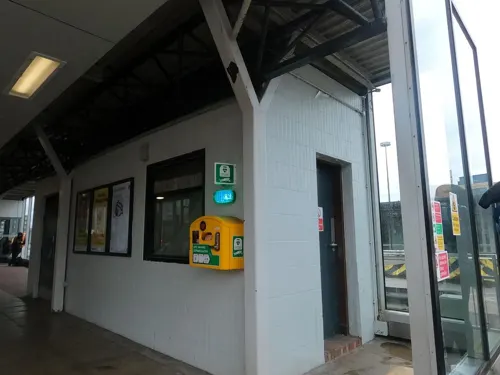
The Art Picture House
Bar and pub · 0.6 mi
36 Haymarket Street, Bury
Mo,Tu,We,Th,Su 08:00-24:00; Fr,Sa 08:00-25:00



Costa
Cafe · Coffee Shop · 0.5 mi
1 St Johns Square, Bury
Mo-Fr 07:30-19:30, Sa 07:30-19:00, Su 08:30-17:30
121 more on the map.
History
The name Bury (also earlier known as Buri and Byri) comes from an Old English word, meaning castle, stronghold or fort, an early form of modern English borough (German burg).
Bury was formed around the ancient market place, but there is evidence of activity dating back to the period of Roman occupation. Bury Museum has a Roman urn containing a number of small bronze coins dated for AD 253–282 which was found north of what is now the town centre. Under Agricola, the road-building programme included a route from the fort at Manchester (Mamucium) to the fort at Ribchester (Bremetennacum) which ran through Radcliffe and Affetside. The modern Watling Street, which serves the Seddons Farm estate on the west side of town, follows the approximate line of the Roman road.
Read more of the history
The most imposing building in the late medieval town would have been Bury Castle. Originally built as a timber framed moated manor house in the late 14th century, it was later rebuilt in stone and fortified, following the granting of a licence to crenellate to Sir Thomas Pilkington in 1469. It sat in a good defensive position on high ground overlooking the Irwell Valley. The Pilkington family suffered badly in the Wars of the Roses when, despite geography, they supported the House of York. When Richard III was killed at the Battle of Bosworth in 1485, Thomas Pilkington was captured and later executed. The outcome of the battle was the Lancastrian Duke of Richmond being crowned Henry VII by Sir William Stanley. As a reward for the support of his family, Thomas Stanley was created Earl of Derby and, amongst other lands, the confiscated Pilkington estate in Bury was presented to him.
The ancestral home of the Earls of Derby is Knowsley Hall on the outskirts of Liverpool. The family maintains a connection with Bury in various ways; Derby High School is named after them. When the school opened in 1959 the 18th Earl of Derby was patron and the school's badge is based on the Earl's coat of arms. The 15th and 16th earls were both supporters of Bury Grammar School, both financially and in terms of land, and one of the school houses is named Derby in their honour. The town is home to the Derby Hall and formerly also the Derby Hotel, opened in February 1850.
The castle remains were buried beneath the streets outside the Castle Armoury until properly excavated for the first time in the 1970s.
Between 1801 and 1830, the population of the town more than doubled from 7,072 to 15,086. This was the time when the factories, mines and foundries, with their spinning machines and steam engines, began to dominate the landscape. In 1822, Bury Savings Bank was opened on Silver Street, which was established under government control and later became Trustee Savings Bank.
Probate evidence from the 17th century and the remains of 18th-century weavers' cottages in Elton, on the west side of Bury, indicate that domestic textile production was an important factor in the local economy at a time when Bury's textile industry was dominated by woollens, and based upon the domestic production of yarn and cloth, as well as water-powered fulling mills.
Development was swift in the late 18th and early 19th centuries. The establishment in 1773 by the family of Sir Robert Peel of Brooksbottom Mill in Summerseat, north of the town, as a calico printing works marked the beginning of the cotton industry in Bury. By the early 19th century, cotton was the predominant textile industry, with the rivers Roch and Irwell providing power for spinning mills and processing water for the finishing trades. Development was further promoted when the town was linked to the national canal network by the Manchester, Bolton & Bury Canal, fully opened in 1808. The canal was provided with water from Elton Reservoir, fed by aqueducts from a weir on the Irwell, north of what is now the Burrs Country Park. The Burrs is also the site of another mill developed by the Peel family, first founded in 1790. The remains are displayed for the public. There were seven cotton mills in Bury by 1818 and the population grew from 9,152 in 1801, to 20,710 in 1841, and then to 58,029 in 1901.
Following this, railways were opened, linking the town from Bury Bolton Street to Manchester, via Prestwich and Radcliffe, to Rawtenstall and to Accrington. From Knowsley Street, there were connections to the neighbouring mill towns of Bolton, Heywood and Rochdale. As well as the many cotton mills, other industries which thrived included paper-making, calico printing and some light engineering. The town expanded to incorporate the former townships of Elton, Walmersley and Heap, and rows of terraced houses encircled the town centre by the turn of the 19th century. Districts such as Freetown, Fishpool and Pimhole were transformed from farmers' fields to rows of terraces beside the factories and mills.
The houses were of the most limited kind, without basic facilities, sewers or proper streets. The result was the rapid spread of disease and high mortality rates in crowded areas. In 1838, out of 1,058 working class houses in Bury investigated by the Manchester Statistical Society, 733 had 3–4 people in each bed, 207 had 4–5, and 76 had 5–6. Social reformers locally and nationally were concerned about such issues, including Edwin Chadwick. One report that prepared the ground for the reform of public health matters, commissioned by the prime minister Sir Robert Peel, asked local doctors for information. King Street was highlighted: it had 10 houses, each with one bedroom, and a population of 69. The average life expectancy in Bury was 13.8 years. Towns like Bury were likened to 'camps' where newcomers sought work in mill, mine or forge. Many, often from Ireland, found shelter in lodging houses. Thirty-eight in Bury were surveyed: 73% had men and women sharing beds indiscriminately, 81% were filthy and the average was 5.5 persons to a bed.
From the History section of Bury, Greater Manchester on Wikipedia, under CC BY-SA 4.0.
More about Bury
Geography
Bury is located on the edge of the western Pennines in North West England, in the northern part of the Greater Manchester Urban Area. Its position on the river Irwell has proved important in its history and development. Flowing from north to south, the river divides the town into two parts on the east and west sides of the valley, respectively. The town centre sits close to, and above, the river on the east side. Bury Bridge is a key bridging point, linking the east side of town and the town centre with the western suburbs and Bolton beyond.
Other bridges across the river are few—there is one at Radcliffe Road to the south and one at Summerseat to the north. There is a bridge at the Burrs, but it serves a cul-de-sac and does not allow full east–west access. To the south, the main tributary (the river Roch, flowing from the east) joins the Irwell close to another significant bridging point, Blackford Bridge. This carries the main A56 road south towards Manchester. Industrialisation of the area in the past dramatically reduced the fauna present in the river, as sewage continues to pollute it today; the Irwell is considered one of the most polluted rivers in the UK.
Arts and culture
The Bury Transport Museum, part of the East Lancashire Railway, holds a collection of vintage vehicles and interactive displays. It is housed in the restored and Grade II-listed 1848 Castlecroft Goods Shed.
Bury Art Museum is home to a fine collection of Victorian and 20th-century art, including works by Turner, Constable and Landseer.
The Fusilier Museum, home to the collection of the Lancashire Fusiliers, commemorates over three hundred years of the regiment's history. The museum occupies the former School of Arts and Crafts on Broad Street.
The 2008 Mercury Music Prize-winning group Elbow, fronted by Guy Garvey, hails from Bury. In 2009, the group was awarded the Freedom of the Borough after their 2008 album The Seldom Seen Kid won several accolades including a Brit Award and the Mercury Prize.
Bury hosts several music festivals yearly, including the Glaston-Bury Festival on the August bank holiday weekend, and Head for the Hills Festival (previously known as Ramsbottom Festival) closing the festival season in mid-September. While Glaston-Bury hosts mainly local/upcoming bands, Head for the Hills hosts a wider range of talent, including bands such as Soul II Soul, The Proclaimers and Maxïmo Park.
Education
Bury College, formed from a merger of Bury Technical College, Peel Sixth Form College and Stand Sixth Form College
Holy Cross College, formerly Bury Convent Grammar School. In 2008, it was named the second-best college in the country, in relation to students' academic performance.
Bury Grammar School (Girls), formerly Bury Girls' High School, opened in 1884.
From the Wikipedia article Bury, Greater Manchester, under CC BY-SA 4.0.
Notable people from Bury
 Gary NevilleEnglish football pundit and former playePhoto: University of Salford Press Office, CC BY 2.0
 Phil NevilleEnglish association football player and manager (born 1977)Photo: James Boyes from UK, CC BY 2.0
 Simon YatesBritish road and track racing cyclistPhoto: filip bossuyt from Kortrijk, Belgium, CC BY 2.0
 Cherie BlairBritish barrister and wife of former British Prime Minister Tony Blair (born 1954)Photo: Chatham House, CC BY 2.0
 Adam YatesBritish racing cyclist (borm 1992)Photo: Connor Mah, CC BY-SA 3.0
 Gemma AtkinsonBritish actress and modelPhoto: Marple Bridge Photography, CC BY-SA 2.0
 Callum StylesHungarian associatiob football player (born 2000)Photo: Timmy96, CC0
- Kieran TrippierEnglish association football player (born 1990)
- Matt HollandIrish footballer
- Andy GoramScottish footballer (1964–2022)
- John KayBritish inventor
- James GuyBritish swimmer
Born in Bury, according to Wikidata (CC0). Each name links to its Wikipedia article.
Where to stay8
Churches and places of worship60
Ainsworth Presbyterian Chapel
Church · Unitarian · 2.6 mi
4 Knowsley Road, Bolton
Shopping31
Gas and EV charging16
Schools, colleges and libraries69
Christ Church Ainsworth Church of England Primary School
School · Anglican · 2.7 mi
Tommy Lane, Bolton
Holly Mount Roman Catholic Primary School, Bury
School · Roman Catholic · 2.6 mi
Holly Mount Lane, Bury
Our Lady & St Paul's Roman Catholic Primary School
School · Roman Catholic · 2.2 mi
Sutherland Road, Heywood
Our Lady of Lourdes Roman Catholic Primary School
School · Roman Catholic · 1.0 mi
Rudgwick Drive, Bury
Radcliffe Hall Church of England Methodist Primary School
School · Anglican, Methodist · 2.4 mi
Bury Street, Manchester
Healthcare13
Manor Pharmacy
Clinic and pharmacy · 2.3 mi
1 Brandlesholme Road, Greenmount, Bury
Map of Bury
250 places. The map loads OpenStreetMap tiles when you open it.
Getting there and nearby towns
Manchester Airport (MAN) is the nearest airport with scheduled flights listed in OpenStreetMap, 17 miles away.
- Radcliffe 3 mi south, about 5 min by car
- Ramsbottom 3 mi north, about 5 min by car
- Whitefield 3 mi south, about 6 min by car
- Little Lever 4 mi southwest, about 7 min by car
- Prestwich 5 mi south, about 7 min by car
- Middleton 5 mi southeast, about 9 min by car
- Farnworth 5 mi southwest, about 9 min by car
- Bolton 6 mi west, about 9 min by car
- Rochdale 6 mi east, about 10 min by car
- Kearsley 6 mi southwest, about 9 min by car
Drive times are estimates from straight-line distance, not routes.
Towns near Bury


Keep exploring
Local news
Headlines from INDB.
Reviews, tips and questions
Loading what members have shared...
Sources and licences
- GeoNames (CC BY 4.0): population, coordinates, regions and time zone
- Mapillary (see each image): photos
- OpenStreetMap contributors (ODbL 1.0): places, airports, map data
- Wikidata (CC0 1.0): elevation, founding date, time zone, website, landmarks and historic places
- Wikimedia Commons (see each image): photos
- Wikipedia (CC BY-SA 4.0): overview and history text
Photo credits
- Bury Town Hall (2), David Ingham from Bury, Greater Manchester, England, CC BY-SA 2.0
- Manchester bolton and bury canal, daisyfield viaduct 2, Parrot of Doom at English Wikipedia, Public domain
- Outwood viaduct from river irwell, Parrot of Doom, CC BY-SA 4.0
- Ringley old bridge, Parrot of Doom, CC BY-SA 3.0
- Lancashire Fusiliers memorial, Gallipoli Garden, Bury (5), Rept0n1x, CC BY-SA 3.0
- Peel Memorial statue - Bury, Christian David, CC BY-SA 4.0
- Radcliffe cenotaph, Ingy the Wingy, CC BY-SA 2.0
- Radcliffe tower hdr, Parrot of Doom, CC BY-SA 3.0
- Bury Castle moat wall, Chemical Engineer, CC BY-SA 4.0
- Bury War Memorial, Peter Broster, CC BY 4.0
- Peel Monument - August 2022 (1), Christian David, CC BY-SA 4.0
- Feeder aqueduct burrs country park, Dennis Turner, CC BY-SA 2.0
- Manchester Town Hall Colonade, Pimlico Badger, CC BY-SA 2.0
- Long curve, Leverhulme park, darcy lever, bolton - panoramio, Mitt Doot, CC BY 3.0
- Moses gate 002, Original uploader was Geotek at en.wikipedia, Public domain
- Christ Church, Walshaw, Alexander P Kapp, CC BY-SA 2.0
- All Saints Church, Whitefield, David Ingham from Bury, Greater Manchester, England, CC BY-SA 2.0
- Bury Parish Church, David Ingham from Bury, Greater Manchester, England, CC BY-SA 2.0
- Christ Church, Ainsworth, Philip Platt, CC BY-SA 2.0
- Bury Transport Museum East Exterior April 2017, Chemical Engineer, CC BY-SA 4.0
- Irwell Sculpture Trail Lookout, Parrot of Doom, Public domain
- Bury Parish Church 08 April 2017, Chemical Engineer, CC BY-SA 4.0
- Bury Grammar Girls 2016, Chemical Engineer, CC BY-SA 4.0
- Bury Transport Museum West Exterior April 2017, Chemical Engineer, CC BY-SA 4.0
- Greenmount Golf Club - panoramio, jolmartyn, CC BY-SA 3.0
- Street-level photo, trigpoint, CC BY-SA 4.0
- Street-level photo, tonys999, CC BY-SA 4.0


Page built November 10, 2026. Spotted a mistake? Tell us or suggest a place.