


Rochdale, United Kingdom
Rochdale is a town of 97,550 people in England, United Kingdom.
Why visit Rochdale
Townapedia lists 10 museums and landmarks, 16 parks and trails, 62 places to eat, 6 places to stay and 2 attractions in and around town.
Highlights include Odeon, Reel Cinema Rochdale, Rochdale Pioneers Museum and Rochdale Cenotaph.
Weather in Rochdale
Forecast from MET Norway (CC BY 4.0). Full forecast
About Rochdale
Rochdale is a town in Greater Manchester, England, and the administrative centre of the Metropolitan Borough of Rochdale. In the 2021 Census, the town had a population of 111,261, compared to 223,773 for the wider borough. Rochdale is in the foothills of the South Pennines and lies in the dale (valley) of the River Roch, 5 miles (8 km) north-west of Oldham and 10 miles (16 km) north-east of Manchester.
From the Wikipedia article Rochdale (this version), under CC BY-SA 4.0.
Travel tips from other travellers: Rochdale on Wikivoyage (CC BY-SA 4.0).
Photos of Rochdale


Things to do2

Museums and landmarks10

Rochdale Pioneers Museum
Museum
Collection (museum), Heritage centre in Toad Lane, Rochdale
31 Toad Lane, Rochdale

Rochdale Cenotaph
Monument and historic site
War memorial in Rochdale, Greater Manchester, England, UK

Tandle Hill
Monument and historic site · 3.1 mi
Hill and country park in Greater Manchester, England
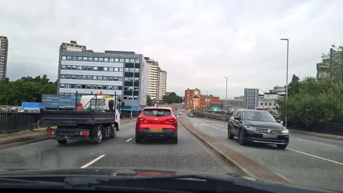
Touchstones Rochdale
Museum
Art gallery, museum and local studies library in Rochdale, Greater Manchester, United Kingdom

Ellenroad Ring Mill Engine
Museum · 2.3 mi
Stationary steam engine and museum in Milnrow, Rochdale, Greater Manchester, England, UK

Parks, trails and playgrounds16
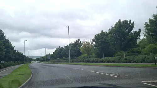



Falinge Park, Rochdale
Park · 0.6 mi
Public park in Rochdale, Greater Manchester, England, UK
Queen's Park, Rochdale
Park · 2.7 mi
Public park in Rochdale, England
Springfield Park, Rochdale
Park · 1.7 mi
Public park in Rochdale, United Kingdom

4 more on the map.
Restaurants and cafes62




50 more on the map.
History
The town is recorded as Recedham in the Domesday Book and Rachetham in 1193. Variations of Rechedham continue into the 13th century when the first element's termination is dropped as Rachedam became Racheham. This change was soon followed with the suffix -ham (homestead) changing to -dale (wide valley).
Rachdale is recorded as a name for the town in 1242, but may have been used earlier as a name for the valley, Hundred and Parish. The Domesday Book's rendering of the name led Eilert Ekwall to suggest a derivation from reced, an obscure Old English element meaning "hall".
Although the name of the river is still pronounced (with a long vowel sound), Rochdale is pronounced (with a shorter o sound).
A Roman road, leading from Mamucium (Manchester) to Eboracum (York), crossed the moors at Blackstone Edge.
Read more of the history
Rochdale was subjected to incursions by the Danes; the castle that Castleton is named after, and of which no trace remains, was one of twelve Saxon forts possibly destroyed in frequent conflicts that occurred between the Saxons and Danes during the 10th and 11th centuries. At the time of the Norman Conquest, the manor was held by a Saxon thegn, Gamel. Rochdale appears in the Domesday Book of 1086 as Recedham and was described as lying within the hundred of Salford and the county of Cheshire. At that time, Rochdale was under the lordship of Roger the Poitevin. Before 1212, Henry II granted the manor to Roger de Lacy, whose family retained it as part of the Honour of Clitheroe until it passed to the Dukes of Lancaster by marriage and then to the Crown by 1399. In medieval times, weekly markets were held from 1250 when Edmund de Lacy obtained a grant for a market and an annual fair.
John Byron bought the manor in 1638 and it was sold by the poet, Lord Byron, to the Deardens in 1823, who hold the title. Rochdale did not have a manor house but the Orchard, built in 1702 and acquired in 1745 by Simon Dearden, was the home of the lords of the manor after 1823. It was described as "a red-brick building of no architectural distinction, on the north side of the river opposite the town hall" and sometimes referred to as the Manor House. It was demolished in 1922.
Rochdale is a product of the Industrial Revolution, though the manufacture of woollen cloth, particularly baize, kerseys and flannels, was locally important as far back as the 1500s. At that time, the textile industry was rooted in the domestic system but, towards the end of the 18th century, mills powered by water started to appear.
Water power was replaced by steam power in the 19th century and local coal became important. The Deardens who were lords of the manor were among the local coal mine owners. By the mid-1800s, the woollen trade was declining and the cotton trade was rapidly growing in importance. Cotton manufacturing took advantage of new technological developments in spinning and weaving. In 1804, the Rochdale Canal opened, providing the first link over the Pennines between Lancashire and Yorkshire.
During the 19th century, Rochdale became one of the world's most prominent cotton processing towns rising to prominence and becoming a major centre for textile manufacture during the Industrial Revolution. It was a boomtown of the Industrial Revolution and was amongst the first ever industrialised towns. By the end of the 19th century, Rochdale had woollen mills, silk manufacturers, bleachers and dyers, though cotton spinning and weaving were the dominant industries in the community. Turner & Newall was founded in Rochdale in 1871 to produce cotton-based mechanical packing, and in 1879 it became the first business in the United Kingdom to weave asbestos cloth with power-driven machinery.
The socioeconomic change brought by the success of Rochdale's textile industry in the 19th century led to its rise to borough status and it became an important regional town based upon this economic success.
The Rochdale Pioneers opened the first Co-operative shop in Toad Lane in 1844. The reformer and Member of Parliament, John Bright (1811–1889), was born in Rochdale and gained a reputation as a leader of political dissent and supporter of the Anti-Corn Law League.
By the middle of the 20th century, Rochdale's economy was in decline, reflecting the broader economic situation in other textile manufacturing towns in North West England. This decline was largely driven by the global availability of cheaper textile product offerings from abroad.
During the 1950s and 1960s, Rochdale's lack of a diverse economic base became very apparent, with the closure of numerous textile manufacturing facilities. Textile manufacturing did remain a major contributor to the local economy, even into the 1970s. Regionally, numerous companies still have some connection to the textile industry.
From the History section of Rochdale on Wikipedia, under CC BY-SA 4.0.
More about Rochdale
Geography
Rochdale is approximately 450 feet (137 m) above sea level, 10 miles (16 km) north-north-east of Manchester city centre, in the valley of the River Roch. Blackstone Edge, Saddleworth Moor and the South Pennines are close to the east; on all other sides, Rochdale is bound by other towns and villages including Whitworth, Littleborough, Milnrow, Royton, Heywood and Shaw and Crompton, with little or no green space between them.
Rochdale's built environment consists of a mixture of infrastructure, housing types and commercial buildings from a number of periods. Its housing stock is mixed, but has a significant amount of stone or red-brick terraced houses from the late 19th and early 20th centuries.
The Town Hall, seven large tower blocks (locally known as the Seven Sisters) and a number of former cotton mills mark the town's skyline. The urban structure of Rochdale is regular when compared to most towns in England; its form is restricted in places by its hilly upland terrain.
Much of Rochdale's built environment is centred around a central business district in the town centre, which is the local centre of both the town and borough.
There are a mixture of high-density urban areas, suburbs, semi-rural and rural locations in Rochdale, but overwhelmingly the land use in the town is urban.
Education
The structure of secondary education in Rochdale has undergone significant change since the late 20th century. During the 1960s and 1970s, pupils typically progressed through the O‑level and A‑level system, with several schools — offering academically selective streams and broad subject provision.
The national replacement of O‑levels with the General Certificate of Secondary Education (GCSE) in 1986 brought a shift toward comprehensive assessment and standardised curricula, a reform that coincided with the decline or closure of several older schools and a gradual reduction in subject specialisation.
By the early 21st century, Rochdale’s post‑16 landscape had consolidated significantly. Most secondary schools in the borough no longer maintain sixth forms, with A‑level provision now centred on Rochdale Sixth Form College, opened in 2010 as the primary provider of advanced courses for the town and wider borough. This restructuring has resulted in fewer local subject offerings than were available under the former grammar‑school and sixth‑form model, reflecting broader national trends toward centralised further‑education provision.
Hopwood Hall College is a further education college with a campus in Rochdale. It offers vocational courses for school leavers and adult learners, with some higher education.
From the Wikipedia article Rochdale, under CC BY-SA 4.0.
Notable people from Rochdale
 Anna FrielBritish actressPhoto: RedCarpetReport, CC BY-SA 2.0
 Lisa StansfieldBritish singerPhoto: Lisa Stansfield By Daniel Åhs..., CC BY-SA 3.0
 Keira WalshEnglish footballer (born 1997)Photo: Katie Chan, CC BY-SA 4.0
 Gracie FieldsBritish actress, singer and comedian (1898–1979)Photo: Allan warren, CC BY-SA 3.0
 Dan AbnettBritish comic book writer, novelistPhoto: Nightscream, CC BY 3.0
 Matt Gilksassociation football playerPhoto: Egghead06 ( talk ), CC BY 3.0
 Dean ButterworthEnglish drummerPhoto: Alfred Nitsch, CC BY-SA 4.0
 Bill OddieBritish actor, writer, composer, musician, comedian, ornithologist, conservationist, television presenterPhoto: Bryan Ledgard from Yorkshire, UK, CC BY 2.0
 Megan TaylorBritish figure skater (1920-1993)Photo: International Newsreel, Public domain
- Sajid JavidBritish politician (born 1969)
- Joe BennettEnglish footballer (born 1990)
- John BrightBritish Radical and Liberal statesman (1811–1889)
Born in Rochdale, according to Wikidata (CC0). Each name links to its Wikipedia article.
Where to stay6
Churches and places of worship41
Shopping17
Gas and EV charging6
Schools, colleges and libraries36
St Mary's Church of England Primary School, Balderstone
School · Anglican · 1.3 mi
Oldham Road, Rochdale
Healthcare9
Map of Rochdale
205 places. The map loads OpenStreetMap tiles when you open it.
Getting there and nearby towns
Manchester Airport (MAN) is the nearest airport with scheduled flights listed in OpenStreetMap, 19 miles away.
- Littleborough 3 mi northeast, about 5 min by car
- Royton 4 mi south, about 6 min by car
- Oldham 6 mi south, about 9 min by car
- Bacup 6 mi north, about 10 min by car
- Lees 6 mi southeast, about 10 min by car
- Ramsbottom 7 mi west, about 11 min by car
- Hollinwood 7 mi south, about 11 min by car
- Todmorden 7 mi north, about 11 min by car
- Whitefield 8 mi southwest, about 12 min by car
- Prestwich 8 mi southwest, about 13 min by car
Drive times are estimates from straight-line distance, not routes.
Towns near Rochdale


Keep exploring
Local news
Headlines from INDB.
Reviews, tips and questions
Loading what members have shared...
Sources and licences
- GeoNames (CC BY 4.0): population, coordinates, regions and time zone
- Mapillary (see each image): photos
- OpenStreetMap contributors (ODbL 1.0): places, airports, map data
- Wikidata (CC0 1.0): elevation, founding date, time zone, website, landmarks and historic places
- Wikimedia Commons (see each image): photos
- Wikipedia (CC BY-SA 4.0): overview and history text
Photo credits
- Rochdale Metrolink Terminus, Smith Street, David Dixon, CC BY-SA 2.0
- 3058 - Rochdale Town Centre (15774439381), Firing up the quattro.... from Manchester, UK, CC BY 2.0
- Rochdale Riverside Arcade, LivinAWestLife, CC0
- Rochdale bus station - First 66928 (MX55FHC), Mikey from Wythenshawe, Manchester, UK, CC BY 2.0
- Rochdale town centre, 1996, Dr Neil Clifton, CC BY-SA 2.0
- Rochdale Pioneers Museum A 29 July 2017, Chemical Engineer, CC BY-SA 4.0
- Tandal Hill Country Park, michael ely, CC BY-SA 2.0
- St Aidan's Church, Rochdale, David Dixon, CC BY-SA 2.0
- St Edmund's Masonic Church, Rochdale, Tim Green, CC BY 2.0
- Hope Chapel, Rochdale, Plucas58, CC BY-SA 4.0
- St Chad's church, Rochdale, Kram4 (Mark Henderson), CC BY-SA 3.0
- Town Hall and Cenotaph, Rochdale, Tim Green, CC BY 2.0
- Spotland2, Boothman at English Wikipedia, CC BY-SA 3.0
- St John the Baptist, Rochdale (4739738254), Tim Green from Bradford, CC BY 2.0
- The Baum pub, Rochdale (1), Rept0n1x, CC BY-SA 3.0
- Norden St Paul's church, David Dixon, CC BY-SA 2.0
- Rochdale War Memorial (4), Rept0n1x, CC BY-SA 3.0
- Rossendale Transport bus (2), Mikey from Wythenshawe, Manchester, UK, CC BY 2.0
- First GM 60448 P547BSS (5065771770), Firing up the quattro.... from Manchester, UK, CC BY 2.0
- First bus (9), Mikey from Wythenshawe, Manchester, UK, CC BY 2.0
- Number One Riverside, under construction, David Dixon, CC BY-SA 2.0
- Balderstone park - panoramio, cingiza, CC BY 3.0
- Street-level photo, mappo2, CC BY-SA 4.0
- Street-level photo, mappo2, CC BY-SA 4.0
- Street-level photo, mappo2, CC BY-SA 4.0
- Street-level photo, mappo2, CC BY-SA 4.0
- Street-level photo, mappo2, CC BY-SA 4.0
- Street-level photo, mappo2, CC BY-SA 4.0
- Street-level photo, mappo2, CC BY-SA 4.0
- Street-level photo, mappo2, CC BY-SA 4.0
- Street-level photo, mappo2, CC BY-SA 4.0
- Street-level photo, mappo2, CC BY-SA 4.0
- Street-level photo, mappo2, CC BY-SA 4.0
- Street-level photo, mappo2, CC BY-SA 4.0
- Street-level photo, mappo2, CC BY-SA 4.0


Page built November 10, 2026. Spotted a mistake? Tell us or suggest a place.