


Why visit Bushey
Townapedia lists 13 museums and landmarks, 26 parks and trails, 40 places to eat, 4 places to stay and 3 attractions in and around town.
Highlights include Watford Palace Theatre, Pump House Theatre and Arts Centre, Bushey Museum and Bushey Museum and Art Gallery.
Weather in Bushey
Forecast from MET Norway (CC BY 4.0). Full forecast
About Bushey
Bushey is a town in the Hertsmere borough of Hertfordshire in the East of England. It had a population of 25,328 in the 2011 census, rising to 28,416 in the 2021 census, an increase of 12.19%. This makes Bushey the second most populated town in Hertsmere. Bushey Heath is a large neighbourhood south east of Bushey on the boundary with the London Borough of Harrow reaching elevations of 165 metres (541 ft) above sea level.
From the Wikipedia article Bushey (this version), under CC BY-SA 4.0.
Photos of Bushey


Things to do3
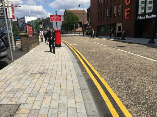
Watford Palace Theatre
Cinema and theater · 1.8 mi
Theatre and cinema in Watford, Hertfordshire, England, UK


Museums and landmarks13

Bushey Museum and Art Gallery
Museum
Museum and gallery in Hertfordshire, England, United Kingdom

Headstone Manor
Museum · 3.4 mi
Grade I listed manor house in the London Borough of Harrow, England,UK

Headstone Manor and Museum
Museum · 3.4 mi
Museum in London Borough of Harrow, United Kingdom

Museum of Watford
Museum · 2.1 mi
Local museum in Hertfordshire, United Kingdom

Watford Peace Memorial
Monument and historic site · 2.2 mi
Memorial in Watford, Hertfordshire, England, UK




1 more on the map.
Parks, trails and playgrounds26

Bentley Priory Nature Reserve
Park · 2.0 mi
Nature reserve in the London Borough of Harrow, England

Cassiobury Park
Park · 2.7 mi
Park in Watford, Hertfordshire, England, UK


Harrow Weald Common
Park · 1.5 mi
Nature reserve in Harrow Weald, Greater London, England

Hilfield Park Reservoir LNR
Park · 1.5 mi
Local Nature Reserve between Bushey and Elstree in Hertfordshire, England


Prestwick Road Meadows
Park · 2.1 mi
Local Nature Reserve in South Oxhey, Hertfordshire, England, UK



Hartsbourne Country Club
Golf course · 1.0 mi
18 hole Par 71 Main Course & 9 hole Par 35 Hunt Course
Hartsbourne Avenue, Bushey
14 more on the map.
Restaurants and cafes40
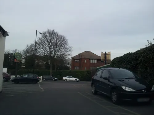
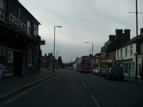


The King Stag
Bar and pub
15 Bournehall Road, Bushey
Mo-Th 12:00-23:00; Fr,Sa 12:00-24:00; Su 12:00-22:30

28 more on the map.
History
The first written record of Bushey is its entry in the Domesday Book of 1086, which describes a small agricultural village named 'Bissei' (which later became 'Biss(h)e' and then 'Bisheye' during the 12th century). However, chance archaeological findings of Stone Age tools provide evidence that the area was inhabited as far back as the Palaeolithic period. The town also has links to the Roman occupation of Britain, with the main road running through it being Roman; sites of possible Roman villas being unearthed in the area; and a Roman tessellated pavement was discovered near Chiltern Avenue.
Bushey Heath's story begins in the Napoleonic Wars during a large food shortage. To help solve the problem, the government awarded the waste land to the east of Bushey to Bushey landowners to be used as farming; the land was more generally known as Bushey Common. Whilst the original aim was to produce food, being close to a railway and up to 500 ft above sea level with beautiful and broad views made the area attractive for housing developers.
Read more of the history
The 19th and 20th centuries marked the time of most change in Bushey, especially between 1860 and 1960. The population rose 28-fold within 200 years, from 856 in 1801, to just under 24,000 today. The expansion was for many reasons, one of the main ones being due to the boom in industry caused by the railway in the early 20th century. A result was that many new jobs were created in and around Watford, and in the early 1920s, Bushey's first council houses were built. More housing was later built for the service families working in defence organisations in Stanmore and Northwood. The expansion eventually died down because much of the land in and around Bushey was protected under the Metropolitan Green Belt after the Second World War.
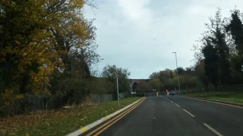
This same Green Belt legislation was also partly responsible for the abandonment of the pre-war Edgware to Bushey Heath extension as part of the Northern Heights programme of the Northern line underground railway. The Metropolitan Green Belt put great restrictions on new development, and the plan had been to use the new railway to stimulate new housing around the new route; without the new housing the route was deemed no longer viable. However, as work was advanced at the onset of war, the depot was completed for use as bomber manufacture, and following the Second World War and Green Belt coming into force, it was converted into the Aldenham bus depot (of Cliff Richard's Summer Holiday fame), which it remained until 1985, when it became derelict. It was redeveloped in 1996 and is now the Centennial Park Industrial Estate (51.639954°N 0.308561°W / 51.639954; -0.308561). Bushey Heath station would have been located at the intersection of Elstree Road and Northwestern Avenue (51.64245°N 0.3200°W / 51.64245; -0.3200). Conceptual plans existed in the 1903 Act of Parliament for an Edgware to Watford railway that would have seen the railway extended at a later date though Bushey village and on to Watford market, but even less came of that than the partially completed Edgware to Bushey Heath stretch. In the 1830s, the London and Birmingham Railway cut through the area between London and Watford though it did not initially serve Bushey. The railway passes to the north west of the town and crosses Bushey Arches Viaduct, an original feature dating from 1837.
The highest point in the historic county of Middlesex was in Bushey Heath on the border between Hertfordshire and Middlesex at the junction of the A4140 and the A409. At 153 m (502 ft) above sea level, the grid reference was TQ 152937.
The lack of farming in Bushey Heath meant that it was a heavily wooded area up to the 18th century; this, added to the lack of street lighting and police, meant that Bushey Heath's history is full of tales of thieves, highwaymen and even murder. According to Grant Longman's Robberies on Bushey Heath, the road from Bushey Heath to Stanmore is said to be where the highwaymen lurked, ready to raid the dozen or so caravans that passed through Bushey Heath daily, carrying money from trade in London. Before venturing through the pass, parties of travellers and merchants would form at the Boot Inn at Edgware and the Three Crowns at Bushey Heath so they did not have to venture through the pass alone. Although one of the highwaymen responsible for the attacks is rumoured to have been the notorious Dick Turpin, evidence suggests that he was in fact more active in the region of Essex.
From the History section of Bushey on Wikipedia, under CC BY-SA 4.0.
Notable people from Bushey
 Simon Le BonBritish singer; lead vocalist of Duran DuranPhoto: Raph_PH, CC BY 2.0
 Divina Galicaracecar driverPhoto: Mike Powell from United States, CC BY-SA 2.0
 Marion BaileyBritish actressPhoto: W!ZARD Radio Media, CC BY 3.0
 Spencer Charles Hilton Barrettevolutionary biologistPhoto: SCH Barrett, CC BY 4.0
 Mark Ramprakashformer English cricketerPhoto: Myself., CC BY 3.0
 Peter CopleyBritish actor (1915-2008)Photo: TV episode screenshot (Guild Films), Public domain
 Alexander BradshawBritish physicist (1944–2024)Photo: Unknown author, CC BY-SA 4.0
 Geoffrey PerkinsComedy writer, producer and actor (1953–2008)Photo: Open Media Ltd, CC BY-SA 3.0
- Michael PortilloBritish journalist, broadcaster, and former politician (born 1953)
- Gilbert TaylorBritish cinematographer (1914—2013)
- Michèle Robertspoet and novelist
- Shirlie HollimanBritish singer
Born in Bushey, according to Wikidata (CC0). Each name links to its Wikipedia article.
Where to stay4
Churches and places of worship16
Shopping7
Gas and EV charging6
Schools, colleges and libraries27
Healthcare6
Map of Bushey
148 places. The map loads OpenStreetMap tiles when you open it.
Getting there and nearby towns
RAF Northolt (NHT) is the nearest airport with scheduled flights listed in OpenStreetMap, 7 miles away.
- Watford 2 mi northwest, about 3 min by car
- Harrow Weald 2 mi southeast, about 4 min by car
- Pinner 4 mi south, about 6 min by car
- Northwood 4 mi southwest, about 6 min by car
- Croxley Green 4 mi west, about 6 min by car
- Harrow 5 mi south, about 7 min by car
- Rickmansworth 5 mi west, about 8 min by car
- Harrow on the Hill 5 mi south, about 8 min by car
- Ruislip 6 mi southwest, about 9 min by car
- Sudbury 6 mi south, about 10 min by car
Drive times are estimates from straight-line distance, not routes.
Towns near Bushey


Keep exploring
Local news
Headlines from INDB.
Reviews, tips and questions
Loading what members have shared...
Sources and licences
- GeoNames (CC BY 4.0): population, coordinates, regions and time zone
- Mapillary (see each image): photos
- OpenStreetMap contributors (ODbL 1.0): places, airports, map data
- Wikidata (CC0 1.0): elevation, founding date, time zone, website, landmarks and historic places
- Wikimedia Commons (see each image): photos
- Wikipedia (CC BY-SA 4.0): overview and history text
Photo credits
- Bushey High Street 2, Dave Allison, Dala0, CC BY-SA 3.0
- Bushey Museum, Rudolph Road, Bushey, Richard Kelly, CC BY-SA 4.0
- Bushey Rose Garden column (33856513622), Peter O'Connor aka anemoneprojectors, CC BY-SA 2.0
- Fountain in Bushey Rose Garden, AnemoneProjectors ( talk ), CC BY-SA 2.0
- GOC Harrow Weald–Bushey 046 Monument fountain in Bushey Rose Garden (34237171555), Peter O'Connor aka anemoneprojectors, CC BY-SA 2.0
- GOC Harrow Weald–Bushey 048 Bushey Rose Garden, Bushey (34196816226), Peter O'Connor aka anemoneprojectors, CC BY-SA 2.0
- GOC Harrow Weald–Bushey 058 Congregational Church, Bushey (34317068535), Peter O'Connor aka anemoneprojectors, CC BY-SA 2.0
- GOC Harrow Weald–Bushey 054 Bushey Rose Garden (34317068025), Peter O'Connor aka anemoneprojectors, CC BY-SA 2.0
- GOC Harrow Weald–Bushey 059 Congregational Church, Bushey (34317069005), Peter O'Connor aka anemoneprojectors, CC BY-SA 2.0
- GOC Harrow Weald–Bushey 052 Bushey Rose Garden, Bushey (34080403092), Peter O'Connor aka anemoneprojectors, CC BY-SA 2.0
- British Legion hall, Bushey (Hertfordshire) 2009, Bazj, CC BY-SA 3.0
- GOC Harrow Weald–Bushey 060 Bushey House, Bushey (34276363996), Peter O'Connor aka anemoneprojectors, CC BY-SA 2.0
- GOC Harrow Weald–Bushey 045 The Horse and Chains, Bushey (34237170935), Peter O'Connor aka anemoneprojectors, CC BY-SA 2.0
- GOC Harrow Weald–Bushey 061 Bushey House, Bushey (34159121982), Peter O'Connor aka anemoneprojectors, CC BY-SA 2.0
- GOC Harrow Weald–Bushey 062 Morris Minor (33977763800), Peter O'Connor aka anemoneprojectors, CC BY-SA 2.0
- GOC Harrow Weald–Bushey 064 Harbourne House, Bushey (33977769860), Peter O'Connor aka anemoneprojectors, CC BY-SA 2.0
- GOC Harrow Weald–Bushey 065 62–68 High Street, Bushey (33977775260), Peter O'Connor aka anemoneprojectors, CC BY-SA 2.0
- GOC Harrow Weald–Bushey 066 56–58 High Street, Bushey (33977779110), Peter O'Connor aka anemoneprojectors, CC BY-SA 2.0
- GOC Harrow Weald–Bushey 070 The Red Lion, Bushey (33977784440), Peter O'Connor aka anemoneprojectors, CC BY-SA 2.0
- Headstone Manor, Bernard Burns, CC BY-SA 3.0
- Harrow Museum Tithe Barn, Bernard Burns, CC BY-SA 3.0
- Watford Town Hall (19716814084), Matt Brown from London, England, CC BY 2.0
- Watford Peace Memorial, Matt Brown from London, England, CC BY 2.0
- Bentley Priory Summerhouse Lake 1, Dudley Miles, CC BY-SA 3.0
- Cassiobury Park 012, Panhard, CC BY 2.5
- Edgware Way Grassland, Dudley Miles, Public domain
- Garston Park Local Nature Reserve 8, Dudley Miles, CC BY-SA 4.0
- Harrow Weald Common path, Dudley Miles, CC BY-SA 3.0
- Hilfield Park Reservoir 14, Dudley Miles, CC BY-SA 4.0
- Oxhey Woods 3, Dudley Miles, CC BY-SA 3.0
- Prestwick Road Meadows 4, Dudley Miles, CC BY-SA 4.0
- St Mary's Church, Watford, Nigel Cox, CC BY-SA 2.0
- Lululaund (postcard c.1900) by Henry Hobson Richardson, Hubert von Herkomer, Unknown author Unknown author, Public domain
- Grims-dyke-main, Jack1956, CC0
- Caldecote Towers from Rose Garden, L.hammerlit, Public domain
- GOC Harrow Weald–Bushey 074 St James's Church, Bushey (33536345244), Peter O'Connor aka anemoneprojectors, CC BY-SA 2.0
- Benskins, Bazj, CC BY-SA 3.0
- GOC Harrow Weald–Bushey 080 Grims Dyke Golf Club (34402553415), Peter O'Connor aka anemoneprojectors, CC BY-SA 2.0
- GOC Harrow Weald–Bushey 034 Stanmore Common, Stanmore (33368006003), Peter O'Connor aka anemoneprojectors, CC BY-SA 2.0
- Street-level photo, adam2, CC BY-SA 4.0
- Street-level photo, adam2, CC BY-SA 4.0
- Street-level photo, mappo2, CC BY-SA 4.0
- Street-level photo, grkaluza, CC BY-SA 4.0
- Street-level photo, rskedgell, CC BY-SA 4.0
- Street-level photo, 4004, CC BY-SA 4.0
- Street-level photo, grkaluza, CC BY-SA 4.0
- Street-level photo, adam2, CC BY-SA 4.0
- Street-level photo, firefishy, CC BY-SA 4.0
- Street-level photo, adam2, CC BY-SA 4.0
- Street-level photo, geomapper69, CC BY-SA 4.0
- Street-level photo, domdomegg, CC BY-SA 4.0
- Street-level photo, rskedgell, CC BY-SA 4.0
- Street-level photo, firefishy, CC BY-SA 4.0
- Street-level photo, grkaluza, CC BY-SA 4.0


Page built November 10, 2026. Spotted a mistake? Tell us or suggest a place.